First significant fall snow in Ontario may bring 15 cm

The first substantial autumnal snowfall in Ontario is en route, with the hardest-hit areas expected to receive 10-15 cm through Sunday morning.
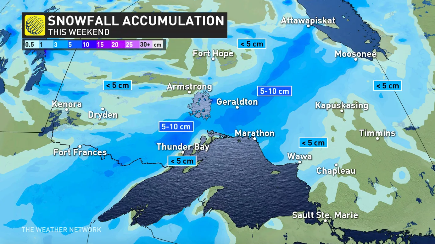
The first real dose of accumulating snow this season will be winding down in northwestern Ontario Sunday as the low-pressure system that produced it gradually exits the province. In the south, people should expect on-and-off showers here and there, and generally cloudy conditions. Beyond, an unsettled week beckons. For a closer look, see below.
WEATHER HIGHLIGHTS
Snow exits northwestern Ontario through Sunday morning and afternoon
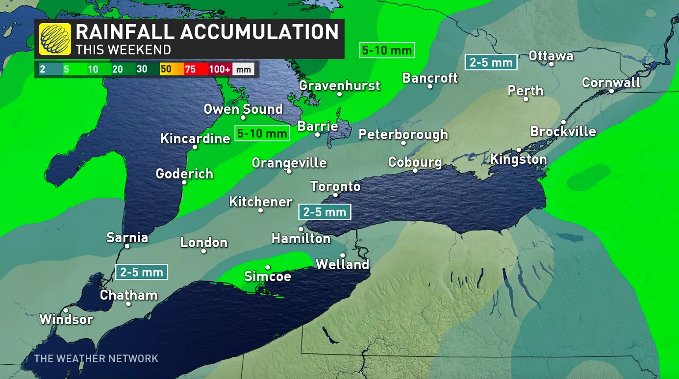
Showers for parts of the south Sunday, widespread cloudy conditions
Cold, active pattern next week with parade of systems
SUNDAY: SNOW ENDS IN THE NORTH, SHOWERS IN THE SOUTH
This first significant snowfall for northern Ontario will be winding down through the morning and early afternoon as the fast-moving Prairie low-pressure system departs the province.
It will leave behind around 5-10 cm of accumulations for areas north of Thunder Bay and northeast of Lake Superior, with up to 5 cm for much of the rest of the region.
Southern Ontario won't be getting any snow this weekend, and in fact, Saturday was largely clear-skied. That will change Sunday, however, as the cold front dips southward beginning in the morning, triggering showers as they go.
This won't be a washout by any means, with around 5-10 mm possible for cottage country and areas near Lake Huron and Georgian Bay, but on-and-off showers will still make for a gloomy day, and even places where rain isn't expected will experience cloudy conditions.
LOOK AHEAD: COLD WEATHER HANGING AROUND, PARADE OF SYSTEMS NEXT WEEK
Beyond the weekend, colder than seasonal temperatures will dominate the next two weeks, lingering at least through to the end of October.
An active pattern will continue next week with a parade of systems tracking across Ontario and Quebec, but the exact tracks are still uncertain.
Mid- and late-week systems have the potential to bring swaths of heavy snow to parts of the north as well.
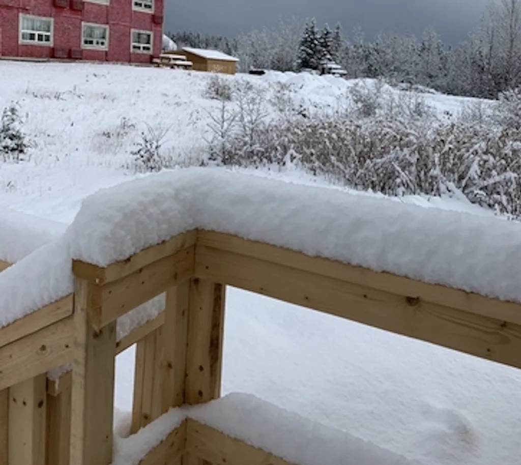
ONTARIO TOWN GETS COVERED WITH SNOW
Thumbnail courtesy of Ryan Matheson/Marathon, Ont., Oct. 16, 2020.
Stay tuned to The Weather Network for the latest updates on the winter-like weather this weekend.