B.C. continues week of relentless rain and heavy winds — timing and details

The rainy, windy, and even snowy week for B.C. continues as two systems come in from the Pacific.
An upper trough that has been responsible for the bouts of heavy rain in B.C. this week is showing no signs of letting up.
Another system is right behind, so showers and rain, and possibly even waterspout activity, could be seen starting Friday and into the weekend.
Details and timing, below.
WEATHER HIGHLIGHTS
Heavy rain, winds for coastal areas, Lower Mainland through Thursday
Brief break from downpours Friday, but another round of soaking rains on the weekend
High-elevation snow continues
WEDNESDAY/THURSDAY: SOAKING RAIN AND STRONG WINDS
B.C. should be waking up to some leftover rain from the overnight downpour. The rain should peter off throughout the day before gaining some energy during evening hours and through Thure=sday.
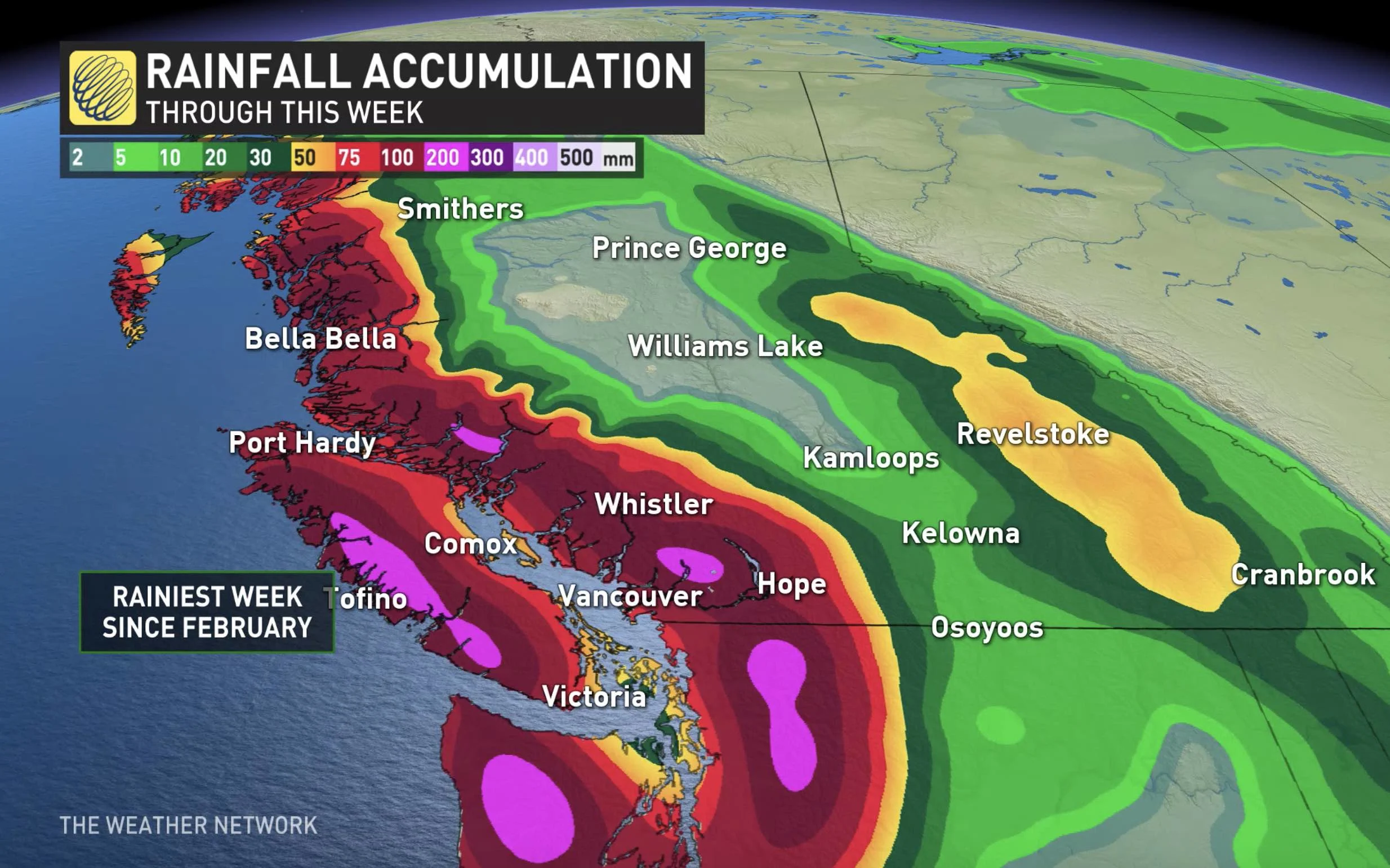
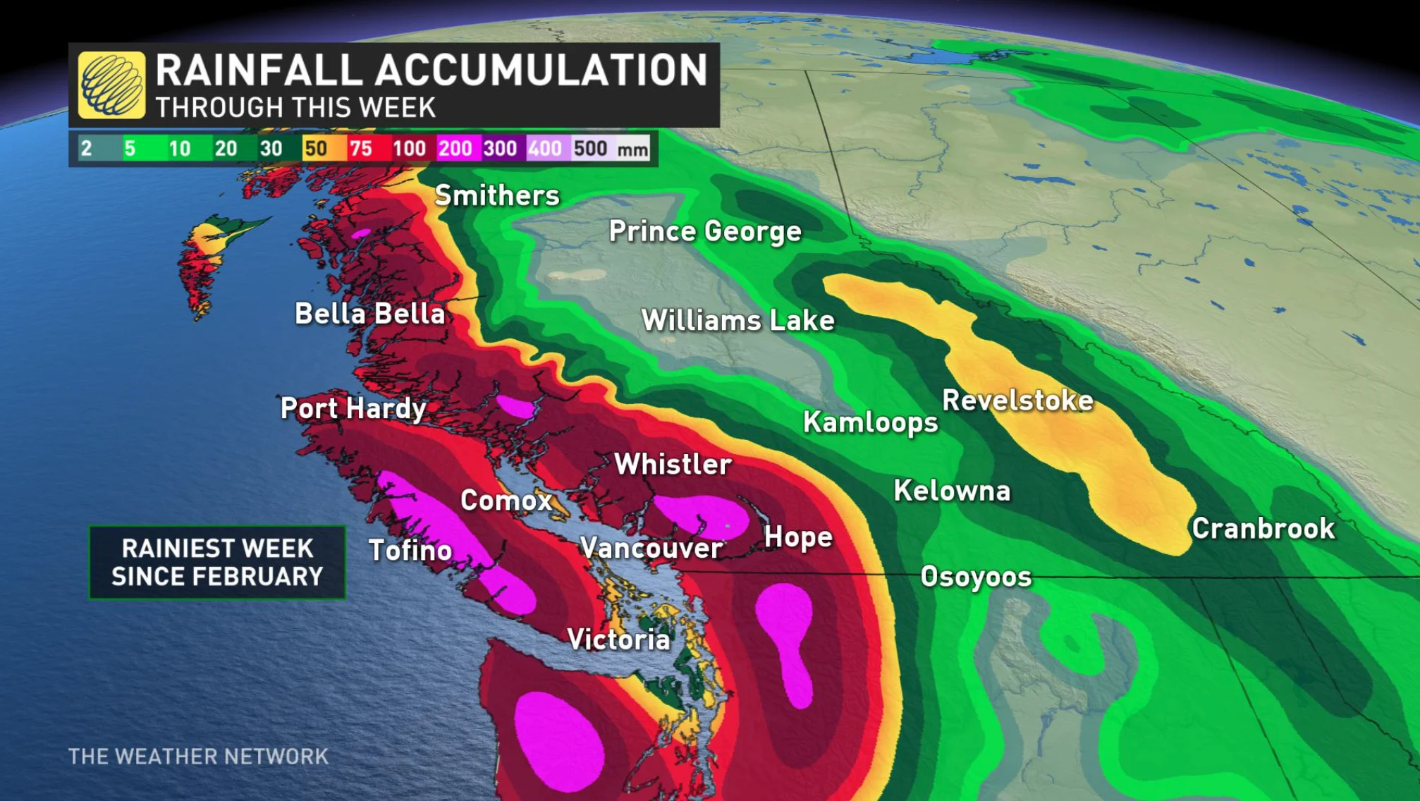
Overall, up to 125 mm of rain is possible for parts of Vancouver Island and the South Coast, with most of Metro Vancouver in line for around 30-50 mm through mid-week.
Winds will also be very strong, again the strongest should be behind us from the overnight, but they could continue into Wednesday morning. Wind speed looks like it can get up to 80 km/h offshore. Wednesday sees southeasterly winds linger through the Strait of Georgia, gusting 50-60 km/h.
BEYOND: MORE ROUNDS OF HEAVY RAIN
There'll not be much relief ahead for the province later in the week, as a 'classic' fall pattern takes hold, with multiple systems.
Through the weekend, around 50-100 mm of rain looks to fall, and as much as 200 mm for western Vancouver Island and the Coastal Mountains.
Weather Network meteorologist Dr. Doug Gillham says there'll be 'substantial' alpine snow for the Coastal Mountains and Rockies this week, as well as substantial rain for Oregon and Washington to help with the wildfire crisis there, though the welcome rainfall will mostly skip California.
"An extended period of much warmer and drier pattern returns next week," Gillham says.