Weekend weather bomb brings heavy snow, blizzard conditions over the East Coast

The second bomb cyclone in a week could bring heavy snow and high winds to Atlantic Canada through Saturday. Here’s what you need to know about the developing storm.
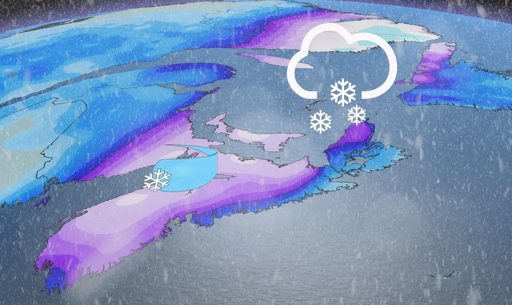
Another winter storm is headed towards Atlantic Canada, a powerful nor’easter that will sweep up the U.S. eastern seaboard and bring significant winter weather to the region heading into this weekend once again. Heavy snow, high winds, and an icy mix are all possible into Saturday morning, along with some dangerous blizzard conditions that could reduced visibilities and make for treacherous travel throughout parts of the region. Widespread special weather statements line the East Coast warning of difficult travel amid heavy snow and ice. There is also the threat for localized flooding, as temperatures stay warmer and heavy rain hits Newfoundland. More on the timing and impacts to watch for, below.
DON'T MISS: Flip the switch: Western Canada warms up as polar vortex shifts east
FRIDAY INTO SATURDAY: WEEKEND WEATHER BOMB THREATENS HEAVY SNOW, POWERFUL WINDS
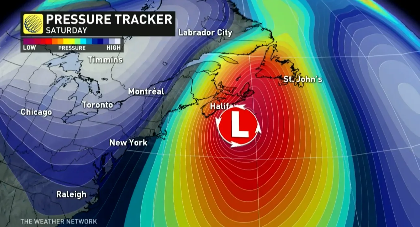
A low-pressure system will rapidly get its act together as it approaches the Maritimes on Friday, possibly meeting the criteria for a ‘weather bomb’ as it sweeps into the area. A weather bomb, or a bomb cyclone, is a centre of low pressure that rapidly strengthens in a short period of time.
MUST SEE: ‘Weather bombs’ are explosive storms that create ferocious conditions
We’ll start to see the effects of the storm in the Maritimes beginning on Friday. The rain, ice, and snow will spread over the area through the day before tapering off from south to north later on Saturday.
Many of the areas that could see impactful winter weather this weekend are still recuperating from the winter wallop they received from last weekend’s blizzard.
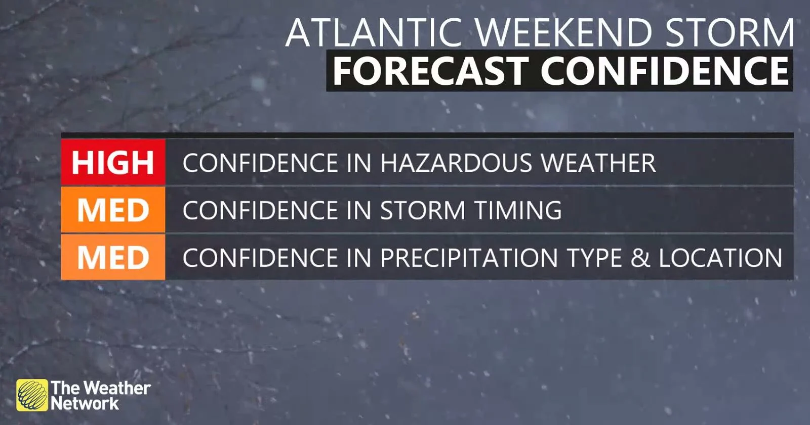
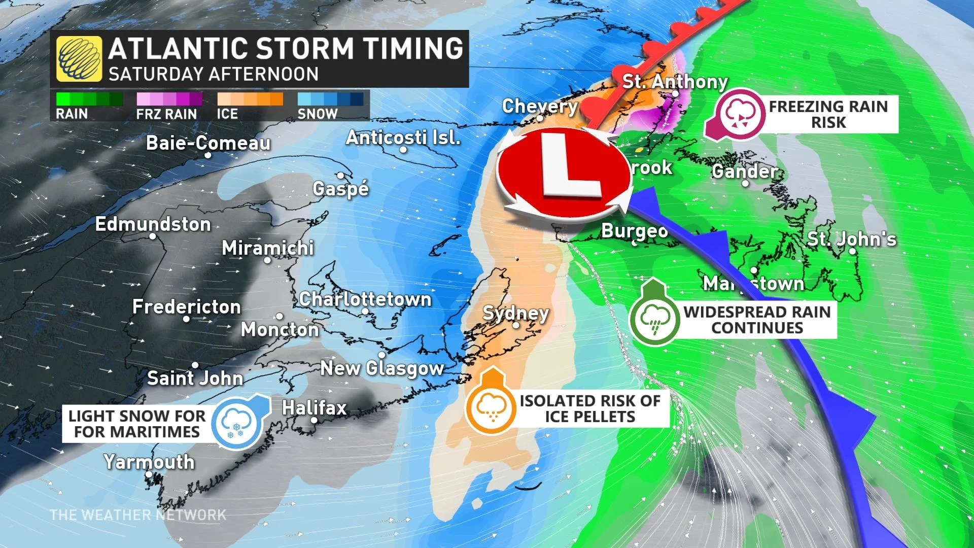
As we see with so many winter storms, the exact track of the system is key in determining who will see snow, ice, or rain, as well as where the heaviest band of snow sets up. Confidence is increasing that widespread gusty winds, combined with heavy snow, could lead to blizzard conditions for some areas for the second time in one week.
"Blizzard conditions are likely for Prince Edward Island and the northern shores of Nova Scotia Friday overnight and into Saturday morning," warns Matt Grinter, a meteorologist at The Weather Network. "Travel is not recommended at these times as visibility, snowpack, drifts, will all make for dangerous travel."
WATCH: WHEN A 'WEATHER BOMB' IS IN THE FORECAST, WHAT EXACTLY DOES THAT MEAN?
Temperatures on Friday will start on the milder side in Nova Scotia, slowly cooling down throughout the day. This warmer air will keep precipitation mostly rain on Friday, delaying the transition to snow until later Friday night. Any standing water will freeze however, and create some icy conditions through the overnight hours and into Saturday morning.
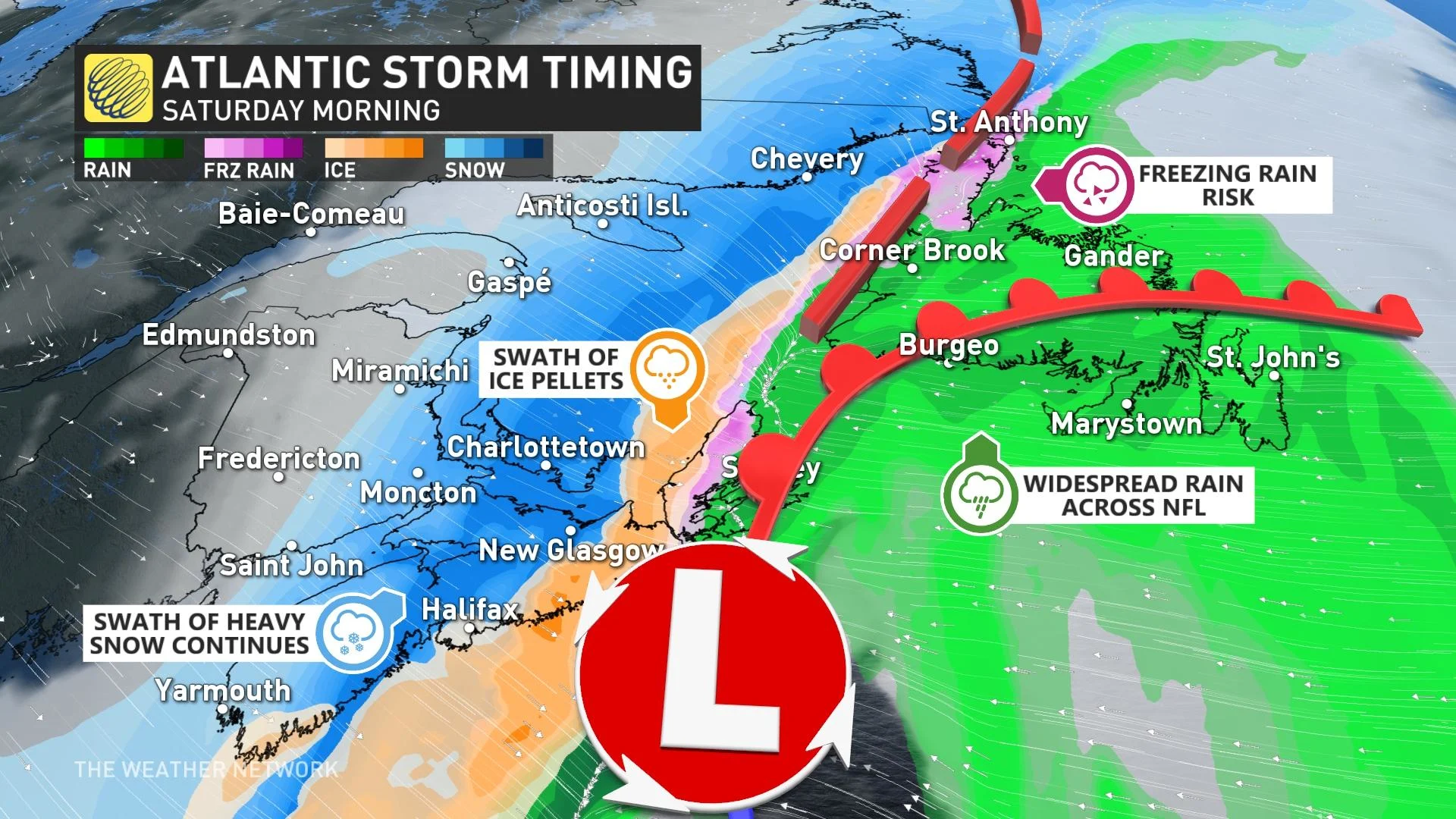
The stretch of eastern Nova Scotia from Halifax to Cape Breton will likely remain around or above freezing for most of the storm, leading to the potential for 30-50 mm of rainfall through Saturday. Heavier snowfall totals are likely in the western and northern sections of the province, where colder air will allow temperatures to remain below freezing for the bulk of the storm.
This is a dicey setup for Halifax, especially, as the city may wind up right on the temperature divide that determines whether precipitation falls as snow, ice, or rain. A tiny shift in the storm’s track could have huge implications in what kind of precipitation falls over the city its surrounding areas. Make sure to check back frequently for the latest forecast updates as we get closer to the event.
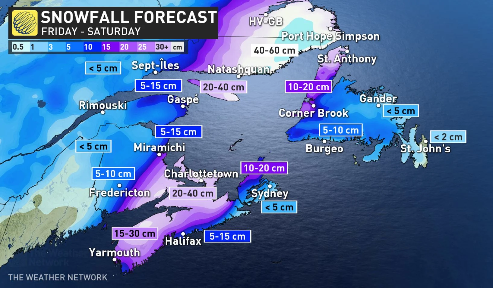
Precipitation will remain as snow across New Brunswick and most of Prince Edward Island, with a band of 15-30+ cm possible in the hardest hit areas through early Saturday.
Newfoundland looks to fall on the warmer side of this nor’easter. Widespread rainfall totals of 20-40 mm are likely across the island through Saturday. A mix of rain and snow is possible at higher elevations. There is also a risk for some freezing rain on Friday for central sections of the province, with that risk for ice and freezing rain pushing into westerns parts of the island, from Corner Brook to St. Anthony, later Friday night.
"Sections of the Trans-Canada and Highway 430 could be slippery as a result of the freezing rain," Grinter warns.
The prospect of a strengthening nor’easter brings the chance for widespread gusty winds as the system moves through the region. Powerful winds will gust between 60-80 km/h for much of the area, with higher cysts of 80-110 km/h possible through much of Nova Scotia and eastern Prince Edward Island, as well as coastal sections of Newfoundland.
The combination of strong winds and milder temperatures with rain in Newfoundland threatens a significant snowmelt. Localized flooding is likely into Saturday.
There will be a brief shot of Arctic air in behind the weekend storm system, before turning much milder early next week. An active storm track next week however, will bring a couple more systems into the region, but it looks like rain will be the dominant precipitation type.
Be sure to check back for the latest updates on the impending winter storm in Atlantic Canada.