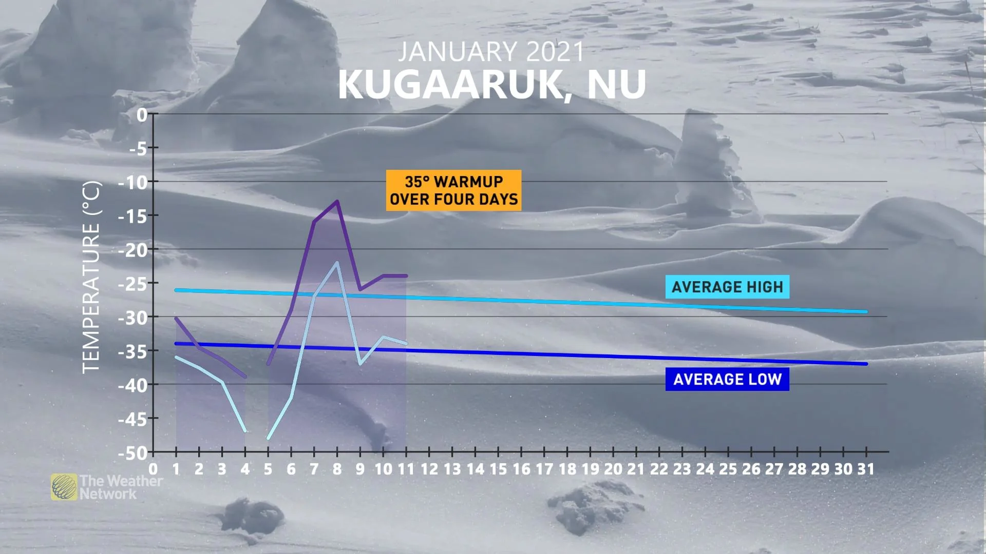
Nunavut set for a 35 degree warm-up after dangerous -60 wind chills

Extreme cold warnings are still in effect for parts of Nunavut, but the decaying polar vortex will allow for a 35 degree warm-up later this week.
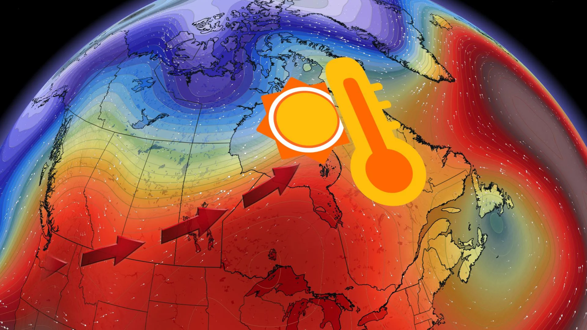
Much of Canada will see a "wintermission" this week as the season takes a nation-wide break from delivering severely cold temperatures or any major blockbuster snow storms. That's as Pacific air continues to flood the country, bringing a very mild pattern through the mid-January mark.
JANUARY OUTLOOK: Canada's mild temperature trend is at a crossroads
Nunavut, however, is excluded from the reprieve for now, as extreme cold warnings remain in effect for parts of the region through Wednesday.
"When a piece of the polar vortex breaks off and moves into any part of the world, it traditionally brings some of the coldest air on the planet," says Weather Network meteorologist Jaclyn Whittal. "This week will be no exception for northern Canada, where we will see record-breaking cold temperatures for some areas, as the rest of the country manages to escape this arctic air."
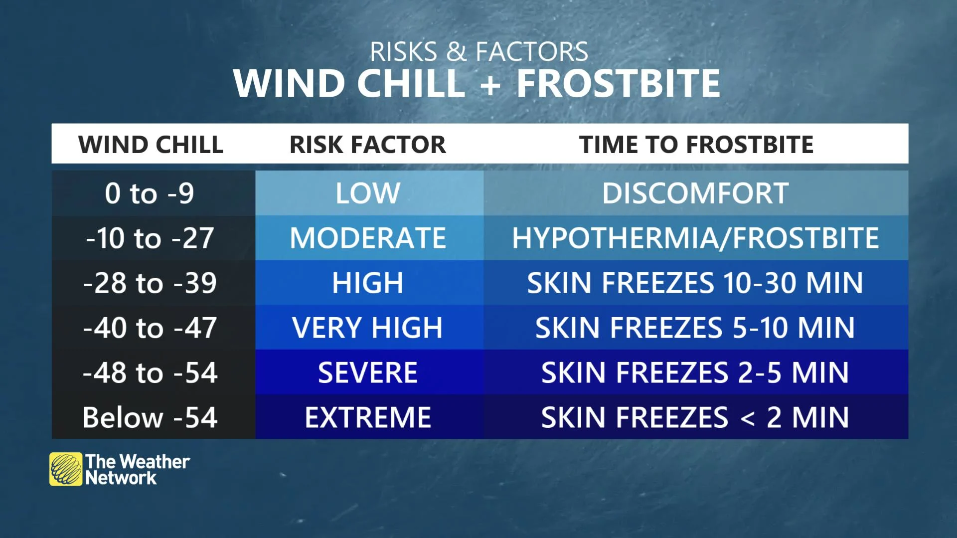
Temperatures near -40°C are expected into Wednesday, with wind chills hitting dangerously low values between -55 and -60 .
On Monday, Taloyoak plunged to -42°C, tying the record low temperature of -42.9°C set back in 1998.
"Cover up," says Environment Canada in the warning, adding that dressing in layers is beneficial so that you can remove if you get too warm. "Frostbite can develop within minutes on exposed skin, especially with wind chill."
The fragment of the polar vortex over northern Canada will continue to dissolve over the next two days. While still cold, regions will go from setting daily low temperature records to a warmup of potentially 35°C by the end of the week.