
Howling winds lash Ontario as powerful storm slams the region

Temperatures surged into the high teens across southern Ontario Saturday morning and early afternoon, but accompanied by gradually intensifying winds that triggered power outages and some property damage, with Quebec next in line for the strongest gusts.
A powerful Colorado low marched through southern Ontario Saturday, bringing heavy showers early in the day and a surge of temperatures well above-seasonal values. But as it departed, strong winds in the 80-100 km/h range lashed the province, with numerous power outages reported. More what remains as we head into Sunday, below.
Visit our Complete Guide to Winter 2022 for an in-depth look at the Winter Forecast, tips to plan for it, and much more!
SATURDAY NIGHT: WINDS BEGIN TO WANE AFTER POWERFUL STORM
Wind warnings were just beginning to drop Saturday evening as the peak gusts of the departing system began to ramp down, but winds will still be blustery for much of the night.
The system's peak gusts were in the 80-100 km/h range across the board, and locally slightly higher, with numerous power outages reported, as well as some storm surge.

"Damage to buildings, such as to roof shingles and windows, may occur. High winds may toss loose objects or cause tree branches to break. Be prepared to adjust your driving with changing road conditions due to high winds," Environment and Climate Change Canada (ECCC) said in the wind warning.
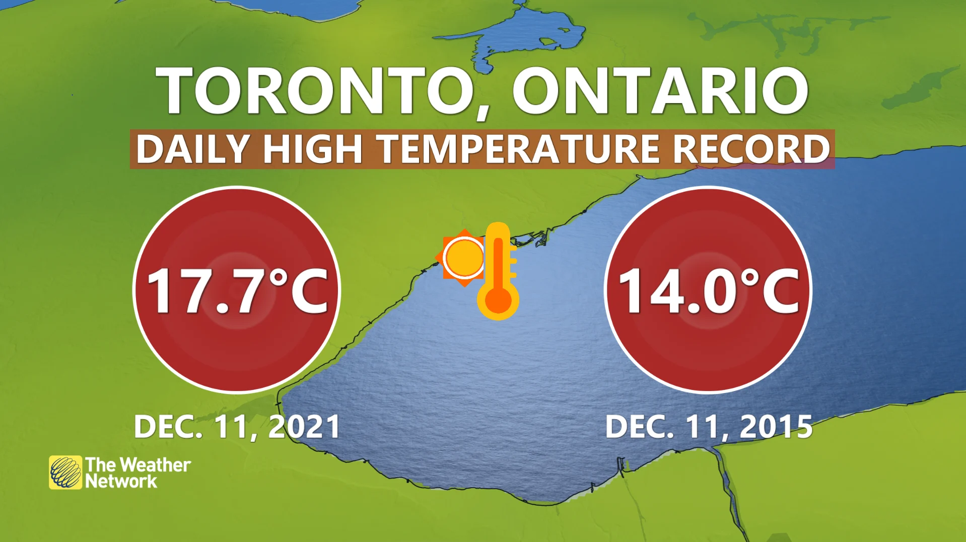
Another remarkable feature of this moisture-laden system was the very warm temperatures accompanying it, thanks to southerly winds. Daytime highs crossed into the teens for much of the region Saturday – sitting very firmly above-seasonal values, sending temperature records tumbling.
SUNDAY: COOLDOWN, BUT STILL ABOVE-SEASONAL
The good news is that a lack of Arctic air behind the system will prevent any significant lake-effect snow for Sunday. In fact, Sunday will be mostly sunny, colder with a gusty wind, but temperatures will still be well above seasonal. The fair and mild conditions will linger into early next week.
Looking ahead further, winds and temperatures will rise Wednesday and Thursday with double-digit highs, and an increasing threat for showers. Temperatures will drop and trend closer to seasonal heading into next weekend. One more warm-up is expected early next week but watching signs of a pattern change towards Christmas. A few dominoes will have to fall correctly for that to happen, otherwise, we will stay mild.
"However, if the pattern unfolds as expected then we will still see a few weeks of cold and stormy winter weather for the final week of 2021 and continuing through early January," says Dr. Doug Gillham, a meteorologist at The Weather Network.
Check back as we continue to update the progress of this significant system.