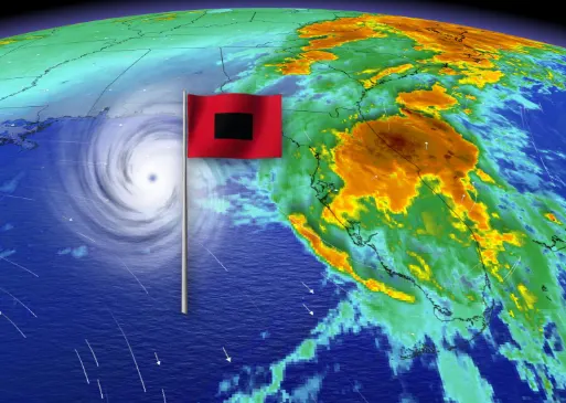
Eta makes landfall near Cedar Key Florida, still producing flooding rains
Eta made its fourth landfall since early November over Florida's west coast Thursday morning.
Eta made landfall in Florida 4 a.m. ET Thursday morning, with sustained wind gusts of 85 km/h, its fourth landfall Caribbean-wide since roaring to life in late October.
Florida Governor Ron DeSantis had already declared a state of emergency in 13 counties as dangerous storm surge, heavy rains and powerful winds swept portions of the Florida Gulf Coast and Northern Peninsula ahead of landfall.
The storm weakened after its passage across the peninsula Thursday, and had exited out to sea by Thursday evening. As of 4 p.m., Eta boasted winds of 65 km/h and was bringing torrential rains to parts of Florida and the U.S. southeast.
"On the forecast track, Eta is expected to accelerate over the western Atlantic and move parallel to, but offshore of the Carolinas tonight and early Friday before heading well east of the Mid-Atlantic coast by late Friday," the U.S. National Hurricane Center says.

Eta could re-intensify as a non-tropical cyclone late Friday or Friday night before becoming absorbed by a larger non-tropical cyclone on Saturday, the NHC adds.
MUST SEE: Theta propels 2020 Atlantic hurricane season into the record books
DANGEROUS STORM SURGE AND FLOODING
Forecasters warn of the potential of flooding and storm surge for parts of the Sunshine State and Southeast U.S.
Between 50-100 mm of rain is forecast over West Florida through Friday, with locally higher accumulations possible. Similar amounts are expected in North Florida with the threat for storm totals to reach up to 500 mm across the South.

"Localized flash and urban flooding will be possible across the Florida Peninsula today, especially across previously inundated areas. Minor river flooding is expected across portions of west Florida lasting into the weekend," the NHC warns.

The combination of dangerous storm surge and tide will also cause normally dry areas near the coast to be flooded by rising waters moving inland.
This latest landfall has made it a fourth for Eta, with its first dating back to November 3 when it barreled inland as a devastating Category 4 hurricane through northeast Nicaragua.
