Overnight storm risk gives way to a sweltering Friday as heat returns

After some overnight storm risk, calmer conditions see out the week, though with strong heat and humidity making it feel close to 40 for many.
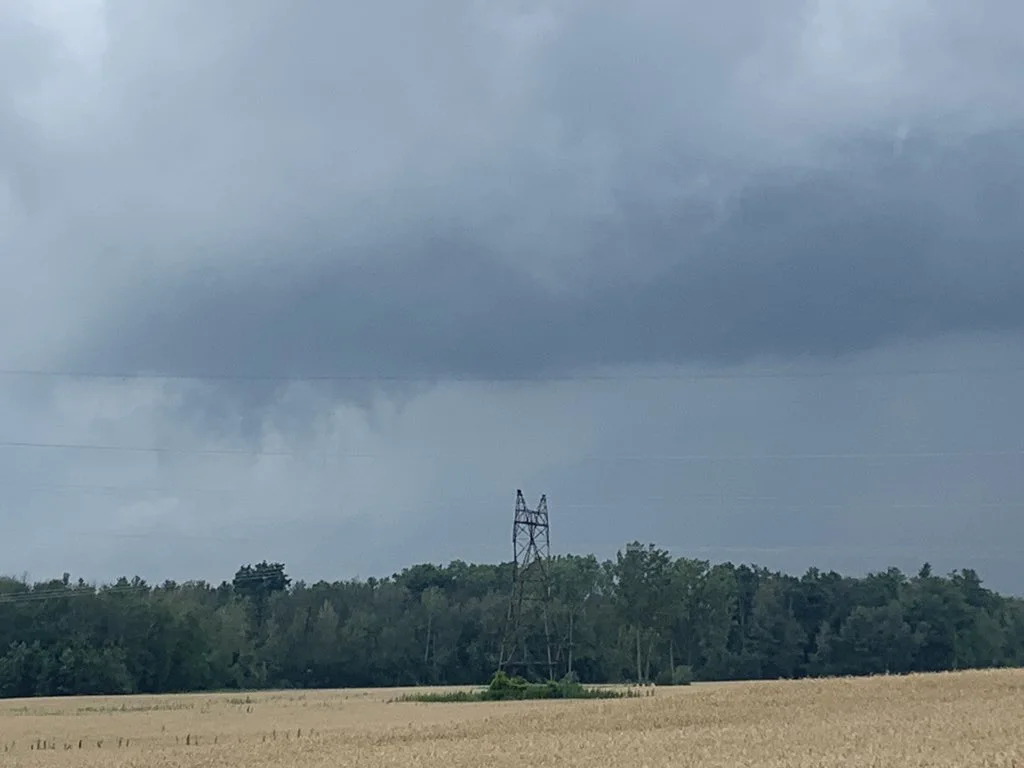
There were some ominous-looking skies above southern Ontario Thursday, with severe thunderstorms bringing local downpours and rotation, with one potential tornado spotted near Brantford. Those storms were set to move on to eastern Ontario through the overnight while, beyond, Friday sees heat and humidity spike to uncomfortable levels ahead of the weekend. More details, below.
Visit our Complete Guide to Summer 2020 for an in-depth look at the Summer Forecast, tips to plan for it and much more
WEATHER HIGHLIGHTS:
Overnight storms likely in eastern Ontario, ending in the early-morning hours
Heat amplifies Friday, peaks on weekend
Temperatures, humidity will relax somewhat early next week
Keep an eye on weather ALERTS in your area
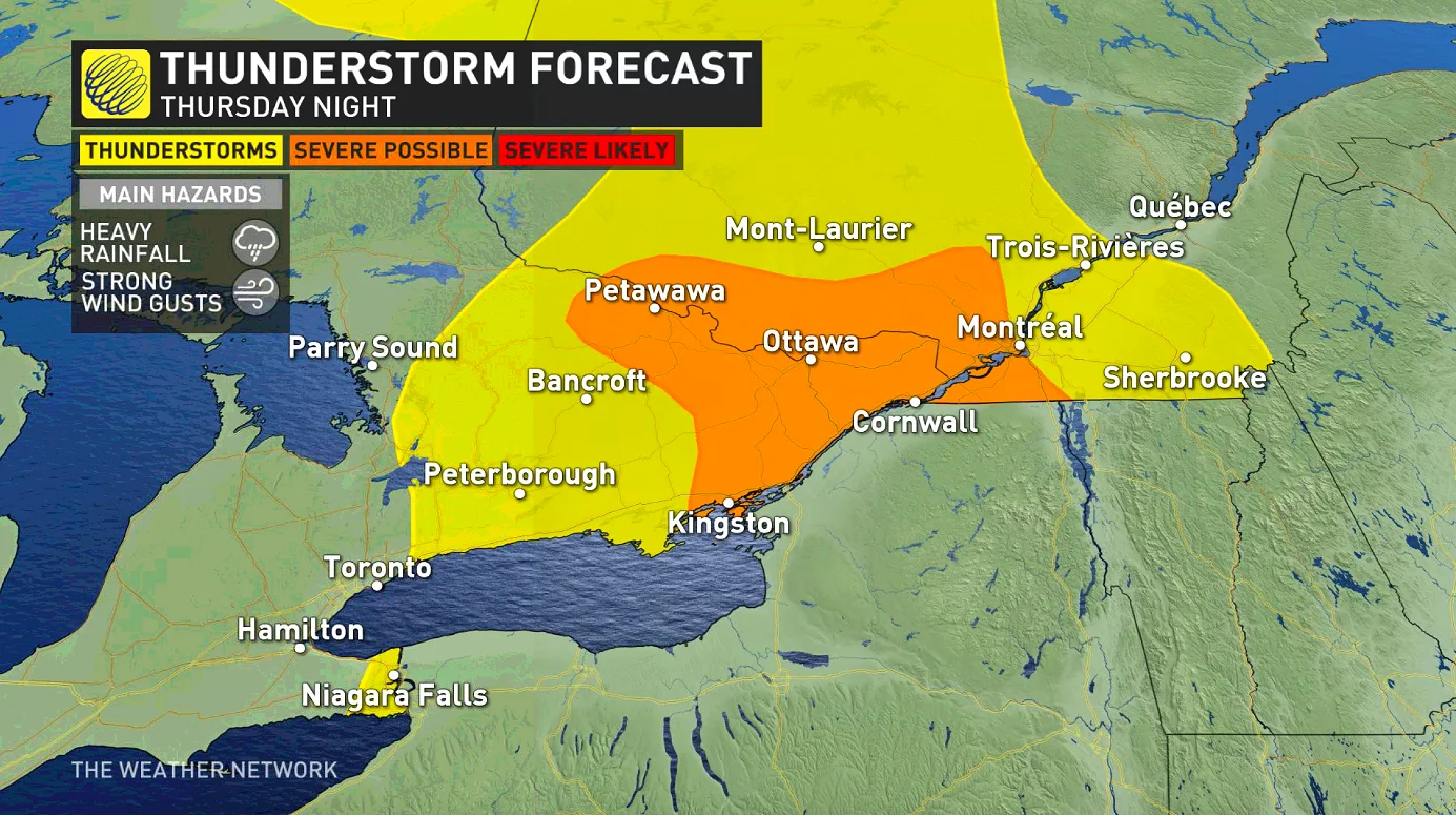
THURSDAY OVERNIGHT: STORM RISK SHIFTS TO EASTERN ONTARIO
Thursday looked to hold a great deal of severe storm risk, including a slight chance of a tornado in the Niagara region. As it happened, the most severe storms stayed south of the border, but Weather Network Storm Hunter Mark Robinson reported spotting a funnel and rotation on one storm near Brantford in the early evening, though it is not completely clear whether any touchdown occurred.
Other storms looked impressive, and were marked by locally heavy downpours.
For the overnight hours, people in eastern Ontario should be mindful, as it is there where the severe potential will shift, lasting into the early morning hours before moving out of the province into Quebec.
Any of these overnight storms that do spark up will be marked by strong winds and heavy downpours.
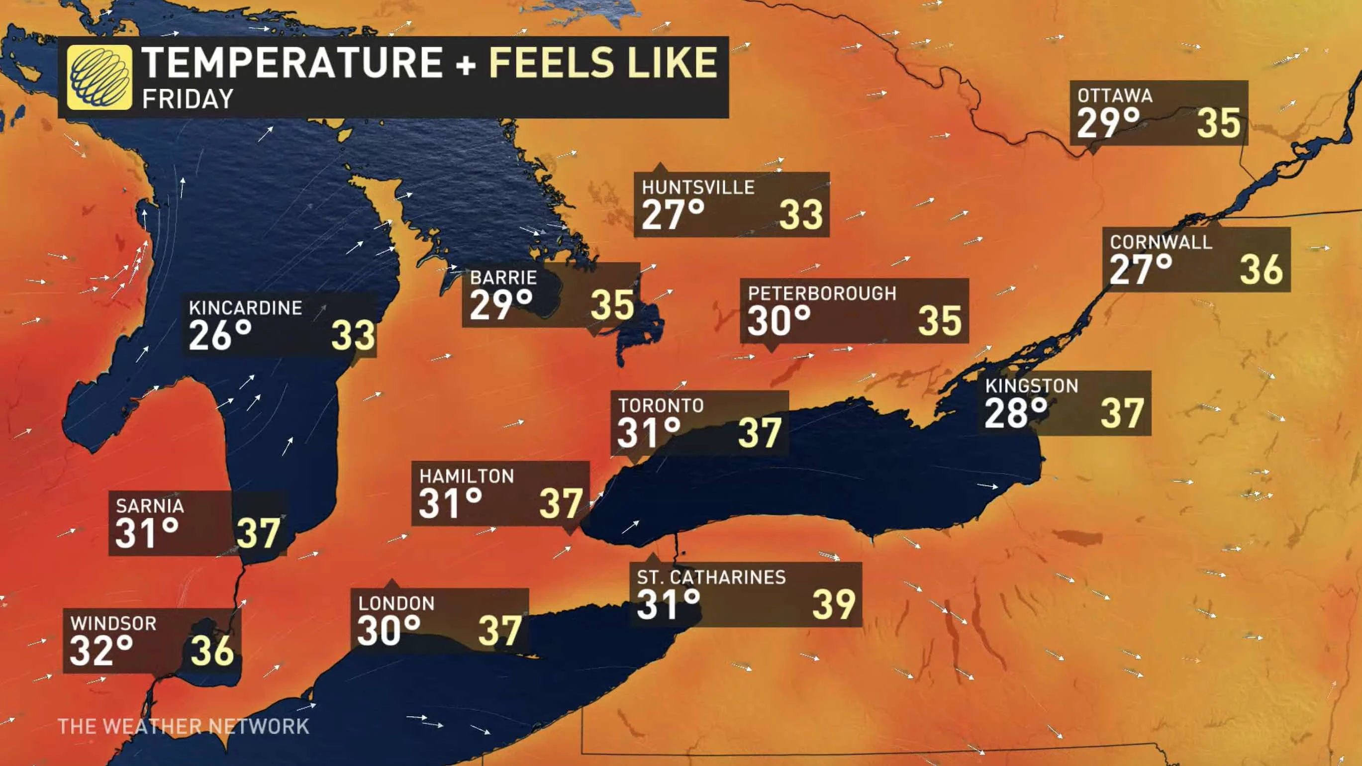
FRIDAY: HEAT RAMPS UP, 30°C TEMPERATURES RETURN
After days of milder temperatures, the heat began building in Thursday, and Friday will see many places inch up past the 30-degree mark once again. With the humidity, daytime highs will feel well hotter than that, and close to 40 for some communities.
The upside: Accompanying the return of the heat Friday will be plenty of sunshine across the south.
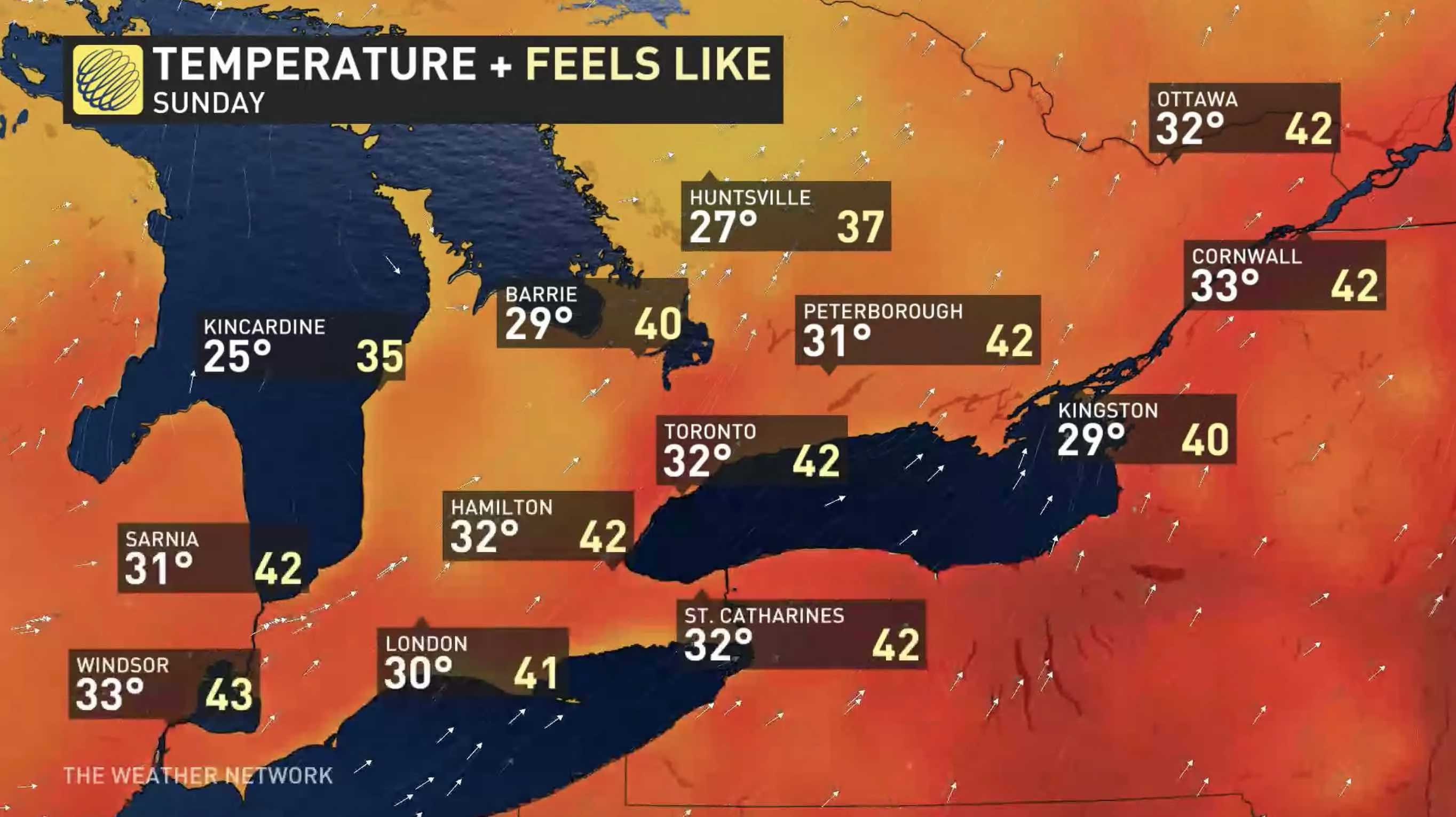
LOOK AHEAD: HEAT, HUMIDITY TO PEAK ON WEEKEND, STORM RISK
Oppressive heat and humidity will peak during the weekend, but temperatures will not be as hot as what we have already seen this summer. The humidex will climb into the lower 40s with tropical humidity on Sunday, accompanied by a threat for thunderstorms, possibly strong to severe, with torrential rain, strong winds and hail.
Beyond, the heat and tropical humidity will ease off a bit early next week, but the humidity will return for the middle of the week. Also watching the potential for a significant system to track into the Great Lakes region mid-week with a period of more widespread rain and thunderstorms possible, confidence is still low at this time.
Stay tuned to The Weather Network as we continue to update the forecast.