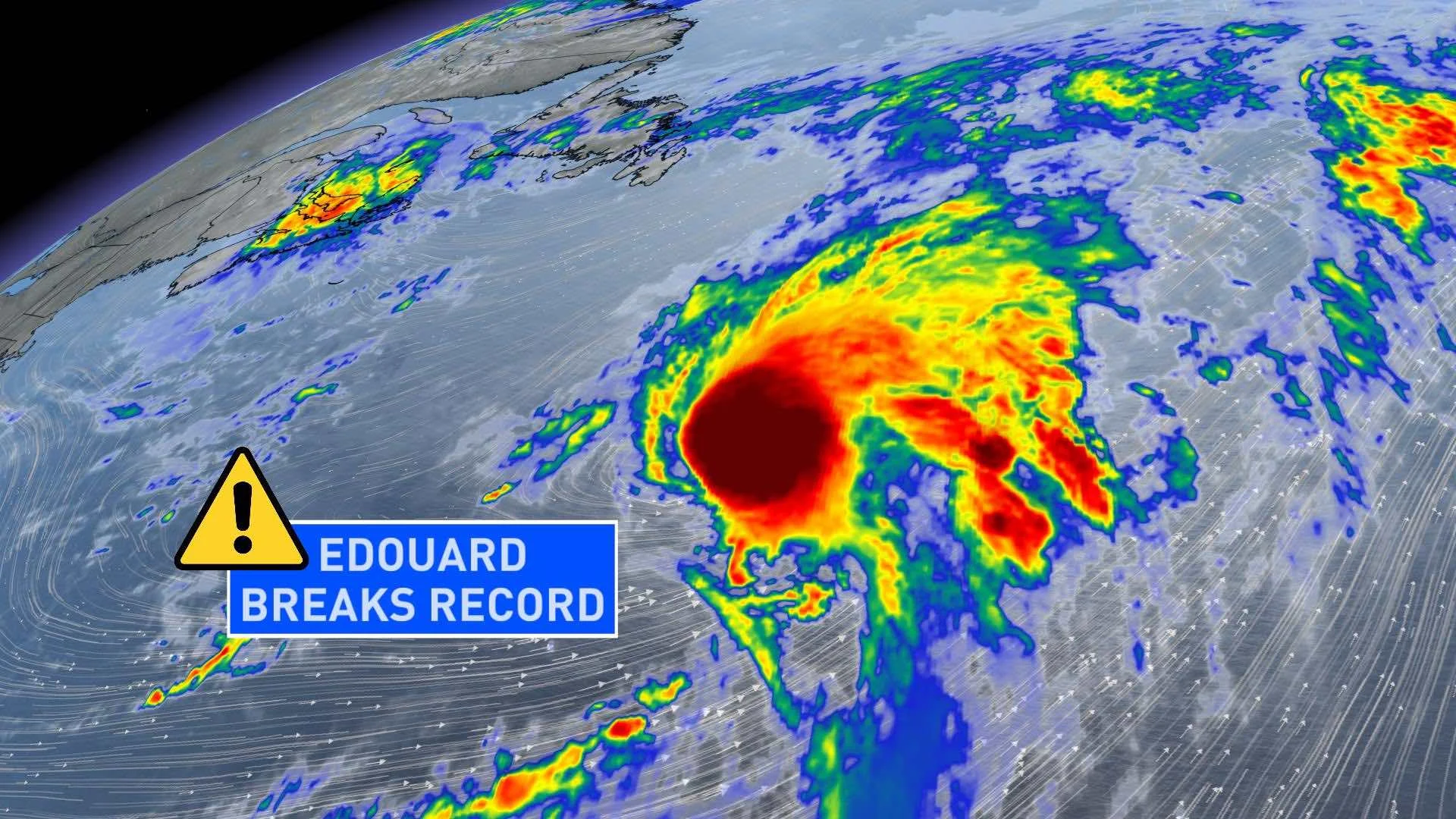
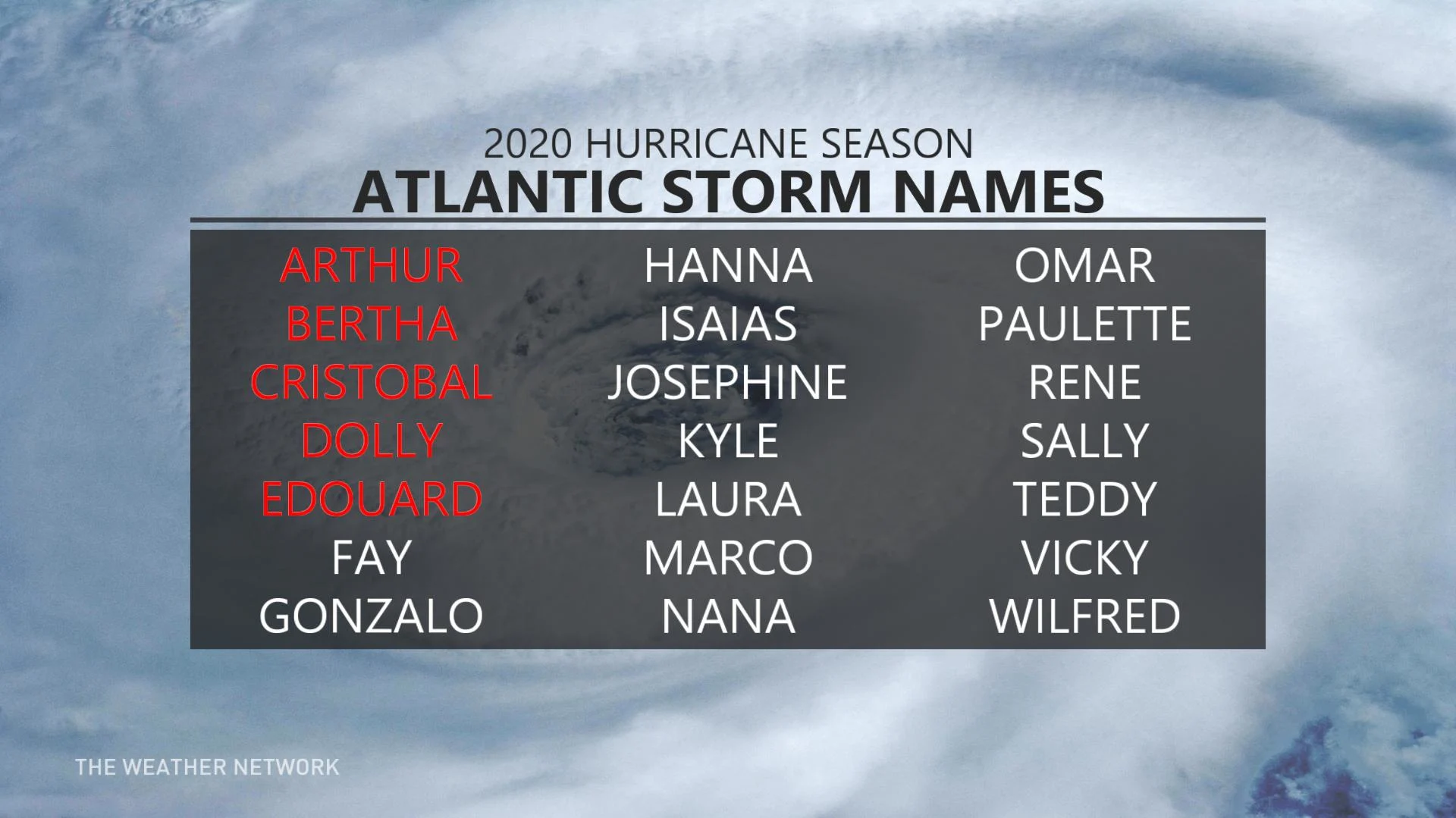
Edouard becomes earliest 5th-named storm on record in the Atlantic

There has been a bit of a lull in the tropics lately, but that all changed on the weekend with the formation of Edouard.
The system, which became a post-tropical cyclone on Monday afternoon, is now the earliest fifth-named storm on record to develop in the Atlantic. The previous record for quickest fifth storm of the season belonged to Emily, which became official on July 12, 2005.
The latest National Hurricane Center (NHC) update has Edouard moving toward the northeast near 61 km/h, which is expected to continue for the next couple of days. Maximum sustained winds are near 75 km/h with higher gusts.
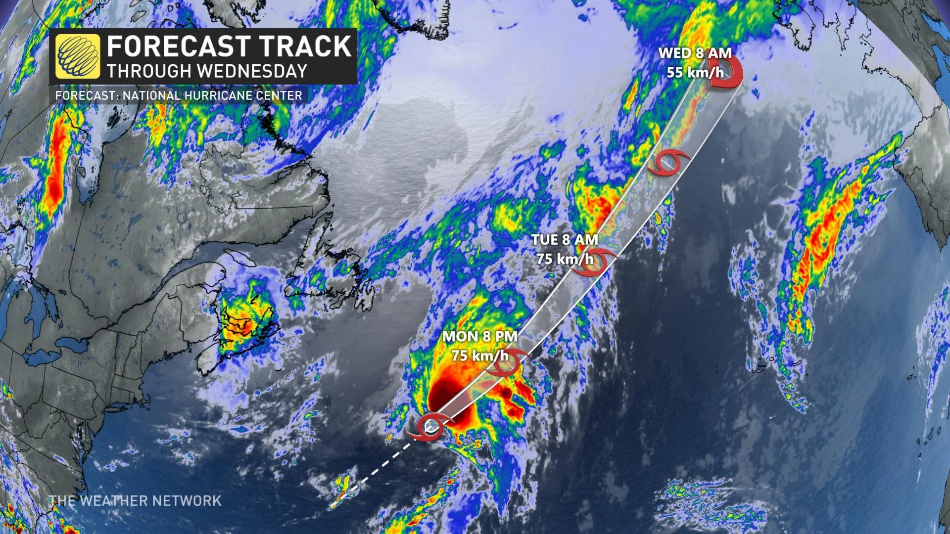
Tropical-storm-force winds extend outward up to 205 km, mainly to the southeast of the centre. There are no coastal warnings or watches in effect.
Forecasters predict an above-average 2020 hurricane season, with some 13-19 named storms, including 6-10 hurricanes.
The season certainly got off to an early start, with three tropical storms forming even before the official June 1 starting date. The last named storm, Dolly, looked initially like it would have some limited Canadian impact, but ultimately did not.
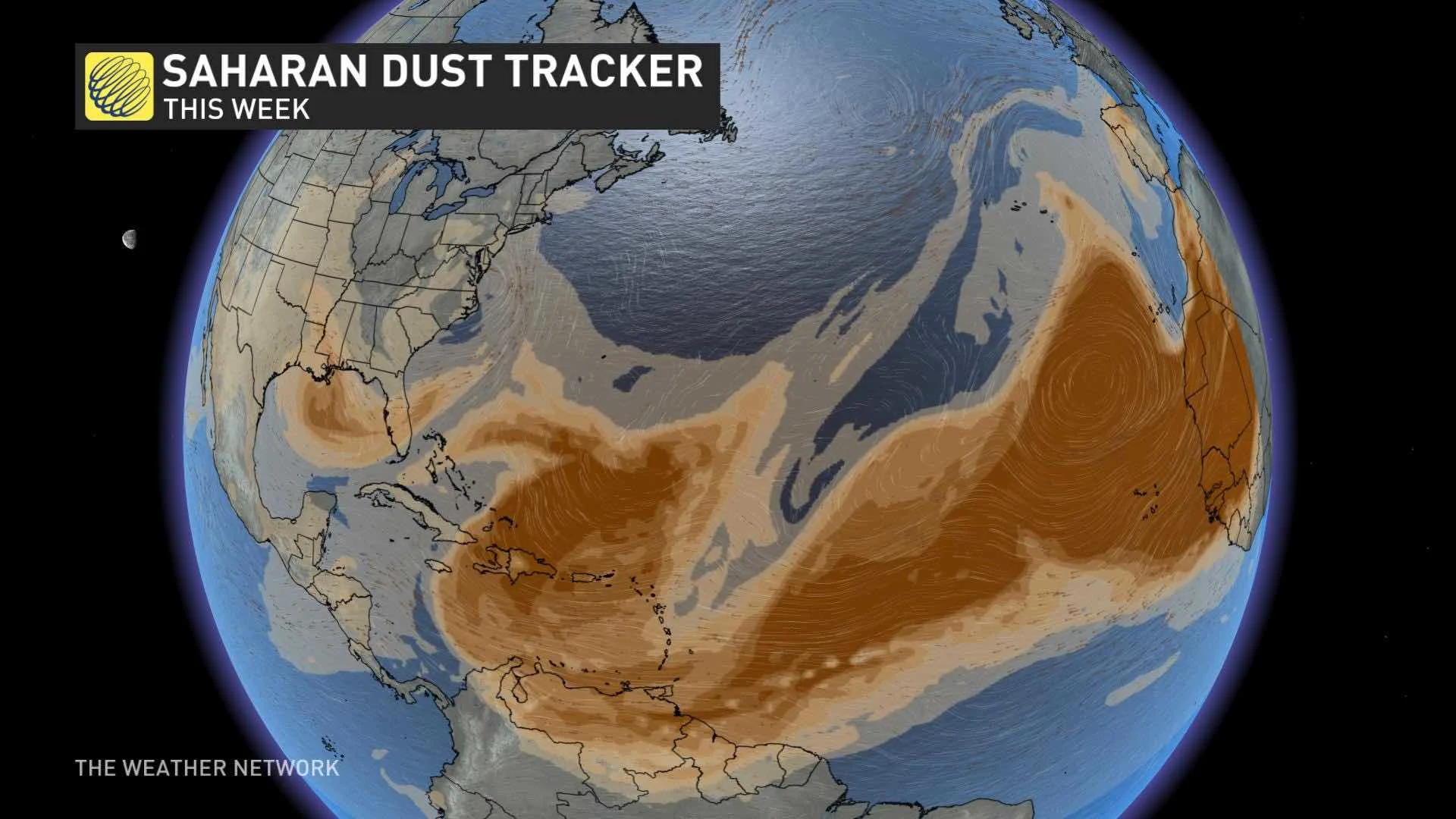
IMPACTS FROM SAHARAN AIR LAYER
While the tropics will remain somewhat quiet as we head through the remainder of July and into August, thanks to the impacts from the Saharan Air Layer (SAL), activity will pick up once again by the late summer.