
Severe storm risk to bubble up again in Quebec Sunday

After Saturday's severe weather in parts of Quebec, the potential for storms will resurface in Quebec Sunday as favourable conditions linger.
The May long weekend got off to a roaring start in Quebec, with severe thunderstorms sweeping through the province as a powerful derecho pushed across. This prompted tornado watches and a warning in eastern areas, but the latter was dropped shortly after. Come Sunday, the risk for severe storms will return -- stretching all the way into New Brunswick, as humidity hangs on for another day. For more on Sunday's storm potential, and what lies beyond for the rest of the long weekend, read below.
SUNDAY:
A system will track into Quebec on Sunday, fuelling the thunderstorm risk for a third and final day before the heat and instability are removed.
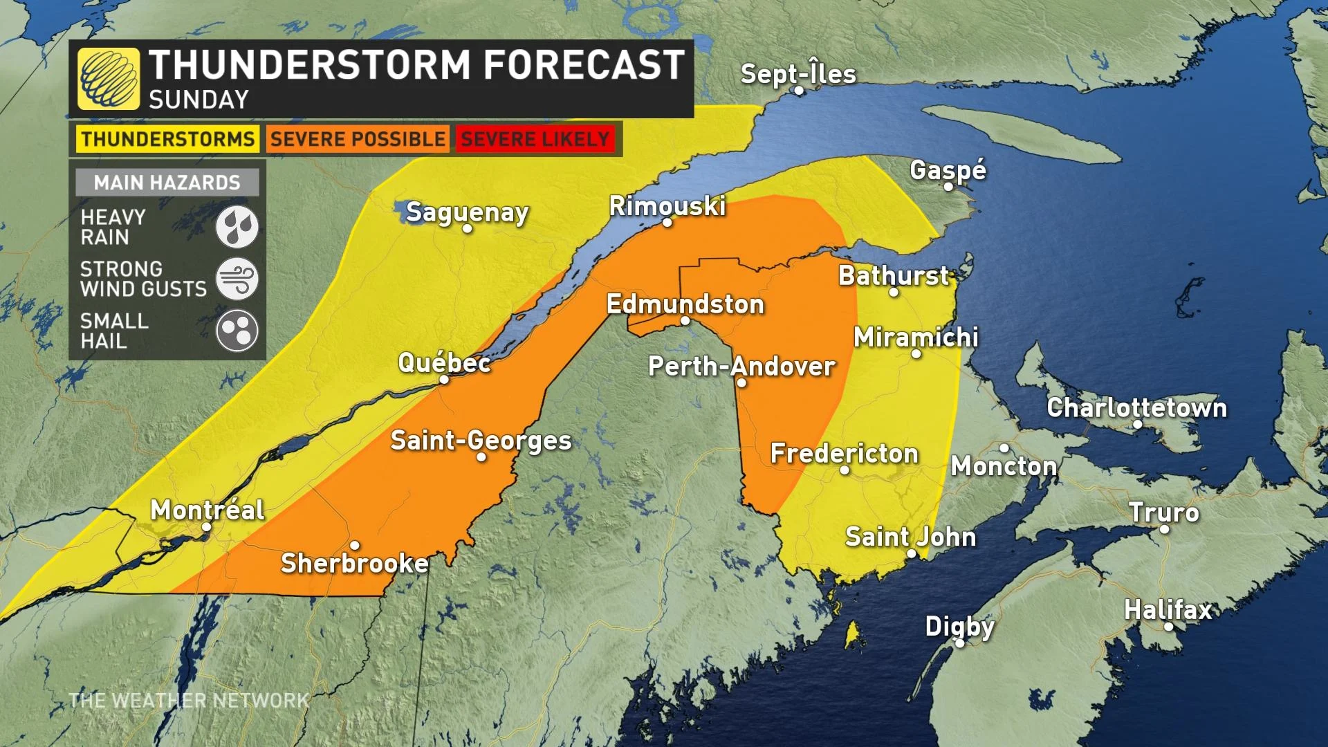
The severe chance returns again, with an area at risk stretching from southern Quebec to western New Brunswick. Possible hazards with any severe storms include heavy rain, strong winds and small hail.
Temperatures will cool somewhat, but the humidity will linger for southern areas before it disappears Monday with another drop in daytime highs.
MONDAY AND BEYOND:
As the thunderstorm risk finally eases, the heat and humidity will also be wiped clean, with dry and seasonably cool conditions left in the wake of the multi-day thunderstorm threat.
Cooler than seasonal temperatures will dominate most of next week. Two low-pressure systems are expected to track into the region from the southern U.S. during the second half, bringing widespread periods of rain late Wednesday through Friday.
Warmer weather is expected for the weekend. A warmer but changeable pattern, and unsettled at times, is expected for the final few days of May and into early June.
Be sure to check back as we continue to fine tune the long weekend storm risks across southern Quebec.