Dynamic atmosphere boosts storm threat across Ontario and Quebec

After Tuesday's damaging storms in Ontario, instability will build once again on Wednesday afternoon the cold front advances across southern Quebec.
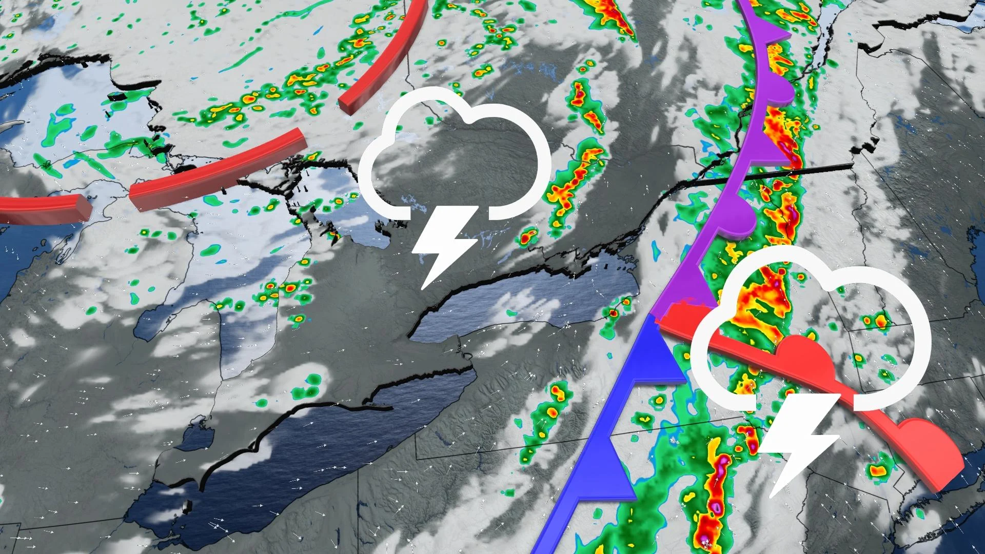
As parts of southern Ontario continue to pick up the pieces from Tuesday's damaging thunderstorms, the system will continue to push eastwards into Quebec, potentially setting off more severe storms through the day on Wednesday. Though the cold front has already cleared the Great Lakes, there's still a threat for some isolated thunderstorms over parts of southern Ontario as well, with heavy rain, small hail and lightning being the main risks with these storms if they develop. More on the timing and impacts, below.
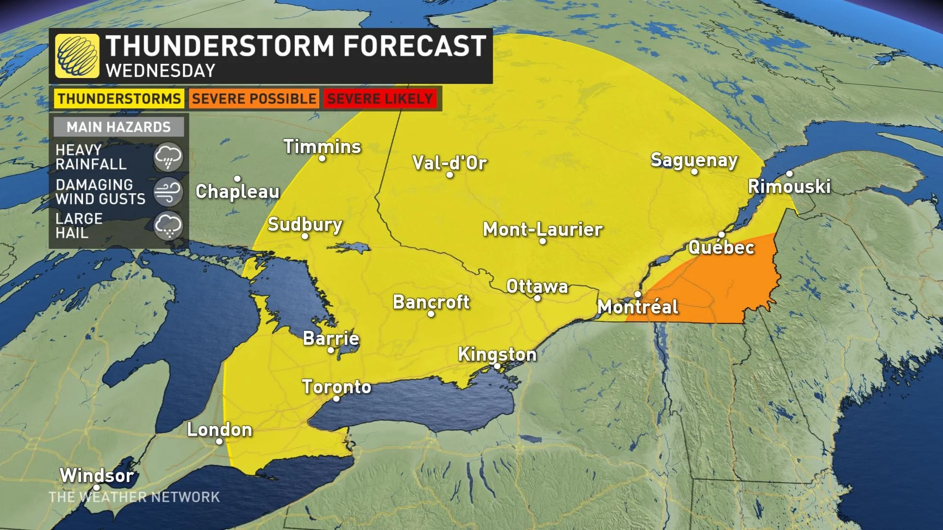
WEDNESDAY: STORM POTENTIAL LINGERS BEHIND COLD FRONT, THREAT FOR SEVERE CONDITIONS IN QUEBEC
Tuesday was quite stormy in southern Ontario, as thunderstorms developed in Michigan and crossed the shorelines of Lake Huron in Ontario in the afternoon. The storms then prompted tornado warnings for the Huron-Perth, Grey-Bruce and Waterloo-Wellington regions. The storms then reached the GTA in the early evening hours, bringing powerful winds, heavy rain, hail and lightning, leaving many without power across the province.
RELATED: Why nocturnal thunderstorms can be particularly dangerous
The same system that brought the damaging squall line through parts of Ontario will continue its track eastwards on Wednesday, threatening areas in southern Quebec with more severe conditions. Instability will build once again through the afternoon as the cold front advances, all while the strong mid-level winds that boosted Tuesday's storms remain in place.
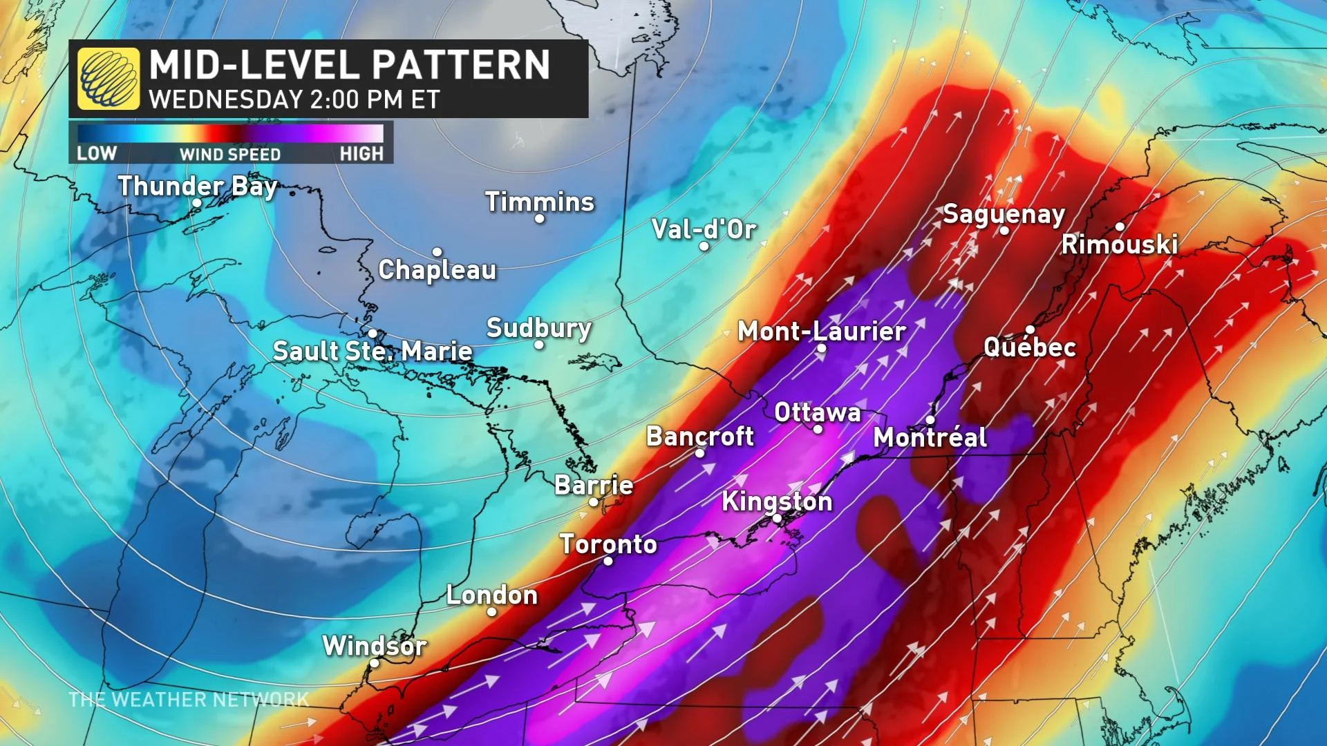
"With this dynamic atmosphere, damaging wind gusts will be a concern for any stronger storms that can tap into that extra momentum, as well as lightning, hail and heavy downpours," says Michal Carter, a meteorologist at The Weather Network.
While the cold front has already cleared the Great Lakes region, there's still a threat for mostly non-severe thunderstorms over a large area in Ontario thanks to cold temperatures aloft.
"Not everyone will be caught by one of these cells today, but those that do could see heavy downpours, small hail, and lightning as the main hazards," Carter adds.
Temperatures won’t drop much in behind the cold front with winds remaining southwesterly. Daytime highs will remain in the mid-20s, accompanied by a bit of humidity, as well. Feels-like values will push close to the 30s or at 30 in many areas.
SEVERE WEATHER STRIKES SOUTHWESTERN ONTARIO TUESDAY, POTENTIAL TORNADO
LOOK AHEAD: TEMPERATURES COOL, BUT POTENTIAL FOR PERIOD OF MID-SEPTEMBER HEAT
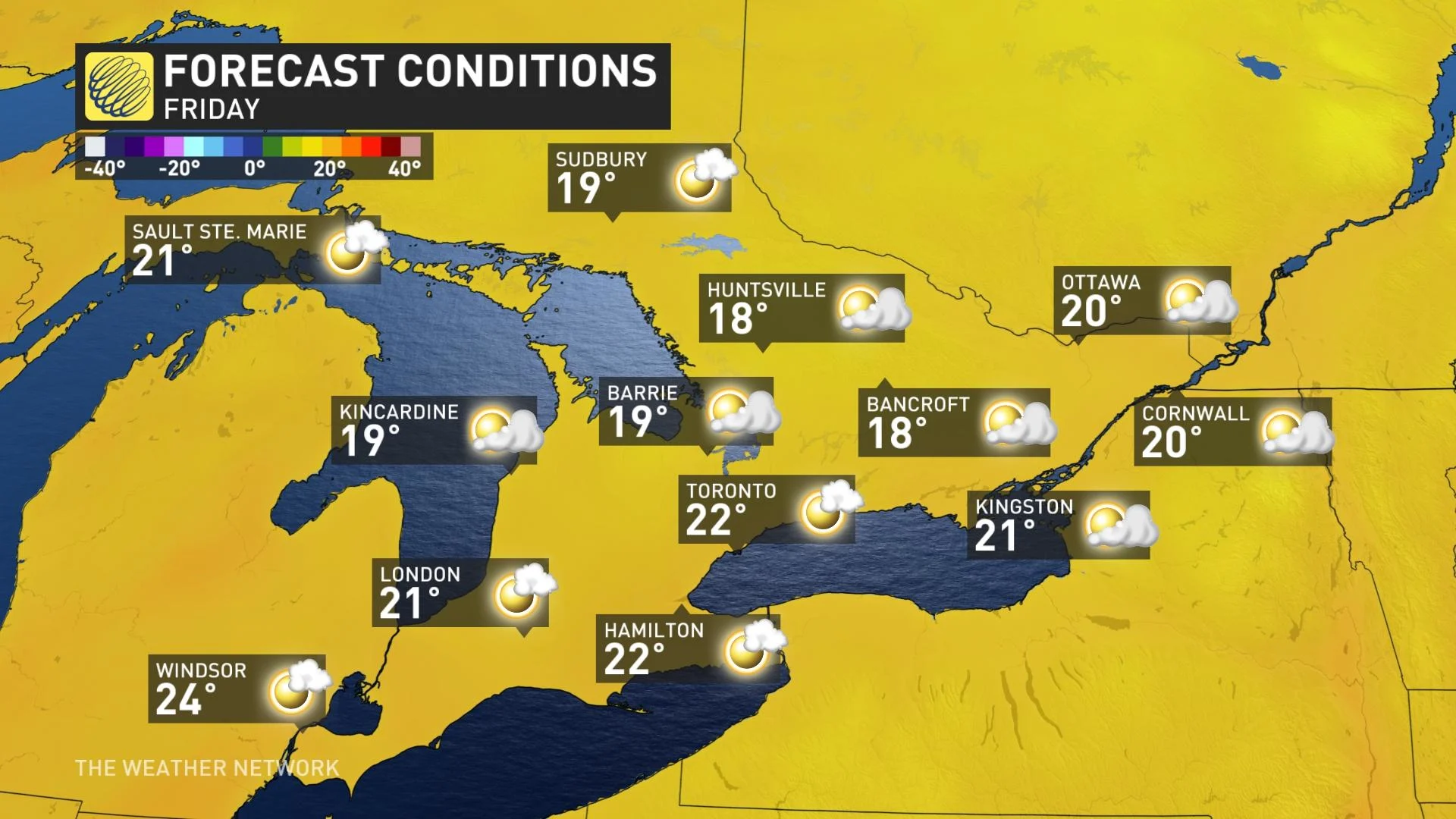
Beyond Wednesday, cool temperatures will move in for Thursday and Friday -- a couple degrees cooler than seasonal -- with a risk for passing showers but mostly staying dry.
Temperatures will be warmer for the weekend, especially for southern Ontario. A period of showers and thunderstorms is expected to track across the region Saturday night into Sunday. Another system is expected to track to the north of the region early next week with the potential for another round of showers and thunderstorms.
The warm sector with this system will extend into southern Ontario. Southwestern sections will reach near the 30-degree mark, while the GTA will see mid-to-upper 20s on Tuesday. Cooler temperatures return mid-week, but potential for warmer weather late week and weekend.
Stay tuned for the latest forecast across Ontario and Quebec.