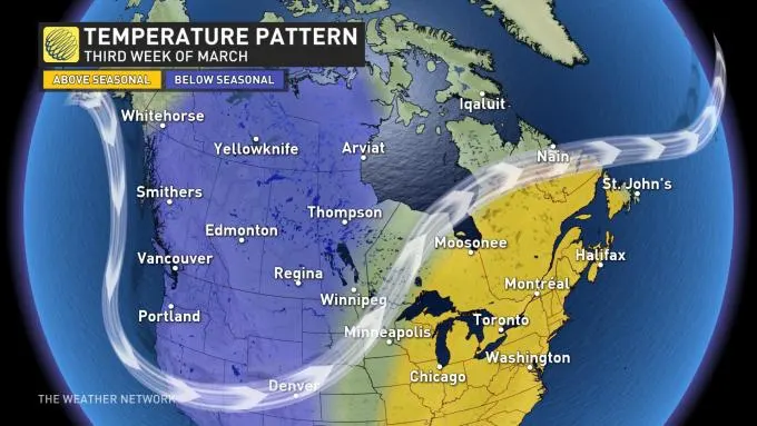
Ontario: Unseasonable warmth to peak Monday before unsettled weather returns

Southern Ontario will get a short-lived glimpse of spring Sunday and Monday, with temperatures jumping into the low or even mid-teens for some areas. The spring-like warmth will come to an end during the afternoon Tuesday, when temperatures quickly plummet following the passage of the next system that moves in Monday evening, bringing rain in the south and snow in the north. By mid-week, there could be more wet snow. For a closer look, see below.
WEATHER HIGHLIGHTS
Temperatures rise significantly Sunday, plenty of sunshine, in the south
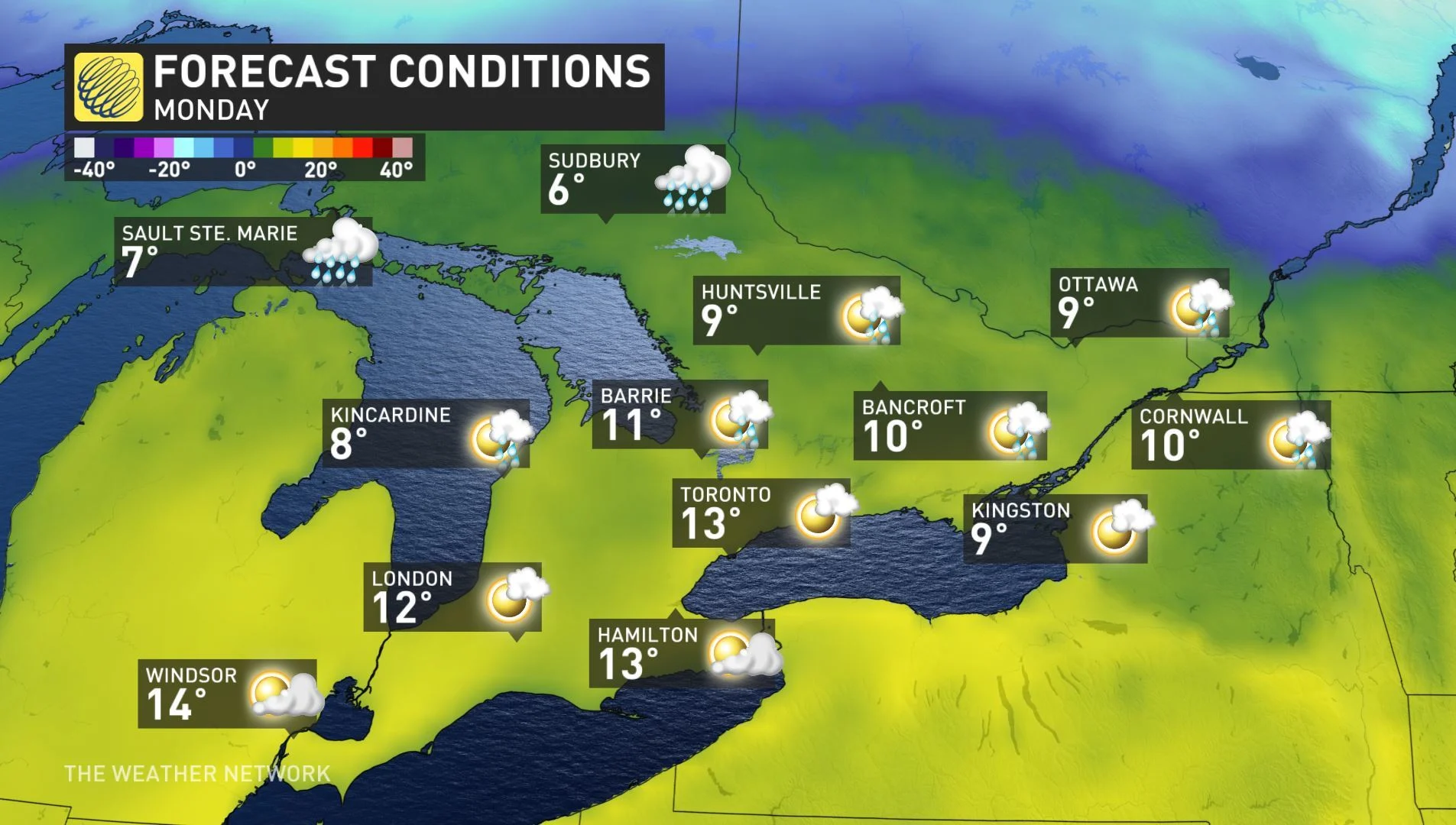
Monday sees warmth peak, with daytime highs in low-to-mid double digits for much of the south
Unsettled pattern returns Monday evening, with rain in the south, snow in north
SUNDAY: TEMPERATURES JUMP, COULD EXCEED 10°C FOR SOME
The end of the weekend will feature plenty of sunshine and daytime highs soaring close to, at or even exceeding 10°C in much of southern, eastern and central Ontario. The spring-like surge in temperatures is courtesy of warm air flowing in from southern regions of the U.S.
The warm temperatures will peak on Monday, when daytime highs will reach or hit the mid-teens in southwestern Ontario and the low teens for much of the south.
However, unsettled weather will return with the next system moving in by Monday evening while a significant cooldown is expected Tuesday afternoon.
MONDAY AND BEYOND: WARM START, BUT UNSETTLED WEATHER, TEMPERATURE DROP EXPECTED
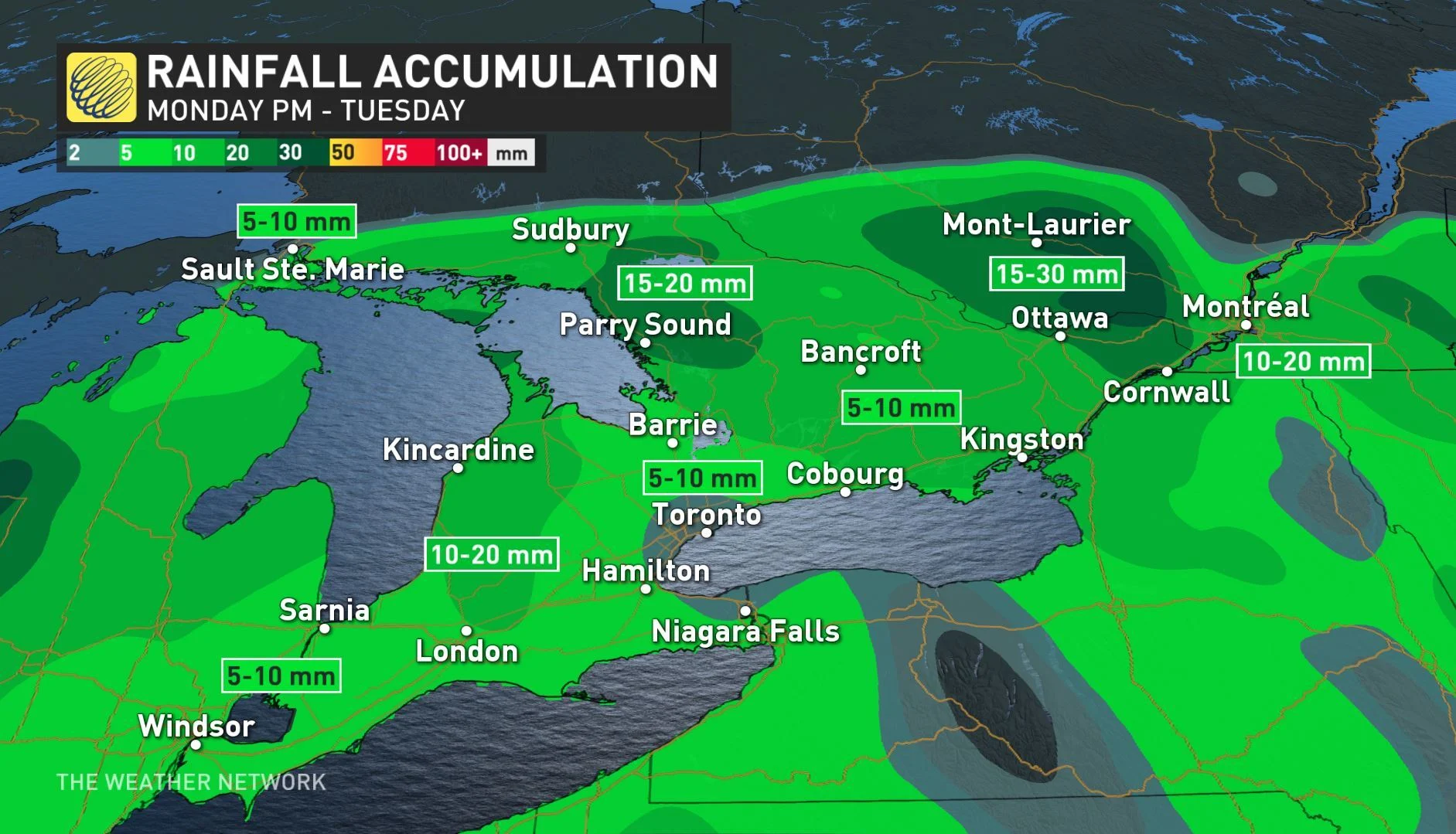
While the start to the week will feature the warmest temperatures of the year so far, the pleasant weather in the south will come to an end by Monday night. An approaching low will bring rain to southern areas in the evening hours through early Tuesday, which will start out warm but temperatures will quickly drop in the afternoon.
Rainfall totals will reach 5-15 mm across the Golden Horseshoe and a general 10-20 mm across other parts of southern Ontario through Tuesday. The same low will bring 10-20 cm of snow to parts of northeastern Ontario and a risk for freezing rain and ice pellets in the Nickel Belt region.
All of next week will feature daytime highs near or above zero, but there is the threat for more wet snow on Wednesday.
"Changeable temperatures are expected for the end of next week and weekend. However, it looks like the following week (March Break for many) will be a rather mild week across southern Ontario," says Weather Network meteorologist Dr. Doug Gillham.