Epic snowstorm set to slam B.C. coasts with up to 30 cm

Winter warnings span B.C. for the next potent system that threatens up to 30 cm of snow over parts of the South Coast.
People in British Columbia will be waking up to the impacts of a powerful winter storm, bringing substantial amounts of snow even down to sea level, far out of character for the region. It'll be even heavier in the mountains, with travel not at all recommended and avalanche risk on the rise. Even when the snow stops falling by late Thursday, strong winds will ramp up as it departs, making for blowing snow and power outages Friday. What we know, below.
THURSDAY INTO FRIDAY: WARNINGS WIDESPREAD AS HIGH IMPACT STORM SLAMS B.C.
This is a very moisture-laden system, and it's encountering air cold enough to make for heavy snow at coastal areas, enough to stick in the memory for some time to come.
Over the last 24 hours, forecasters have gradually revised their estimates upward, such that the Sunshine Coast, Fraser Valley, Metro Vancouver and coastal Vancouver Island could be in the 15-30 cm of range right through Thursday – uncommonly high for what is normally one of the most tepid parts of the country in January.
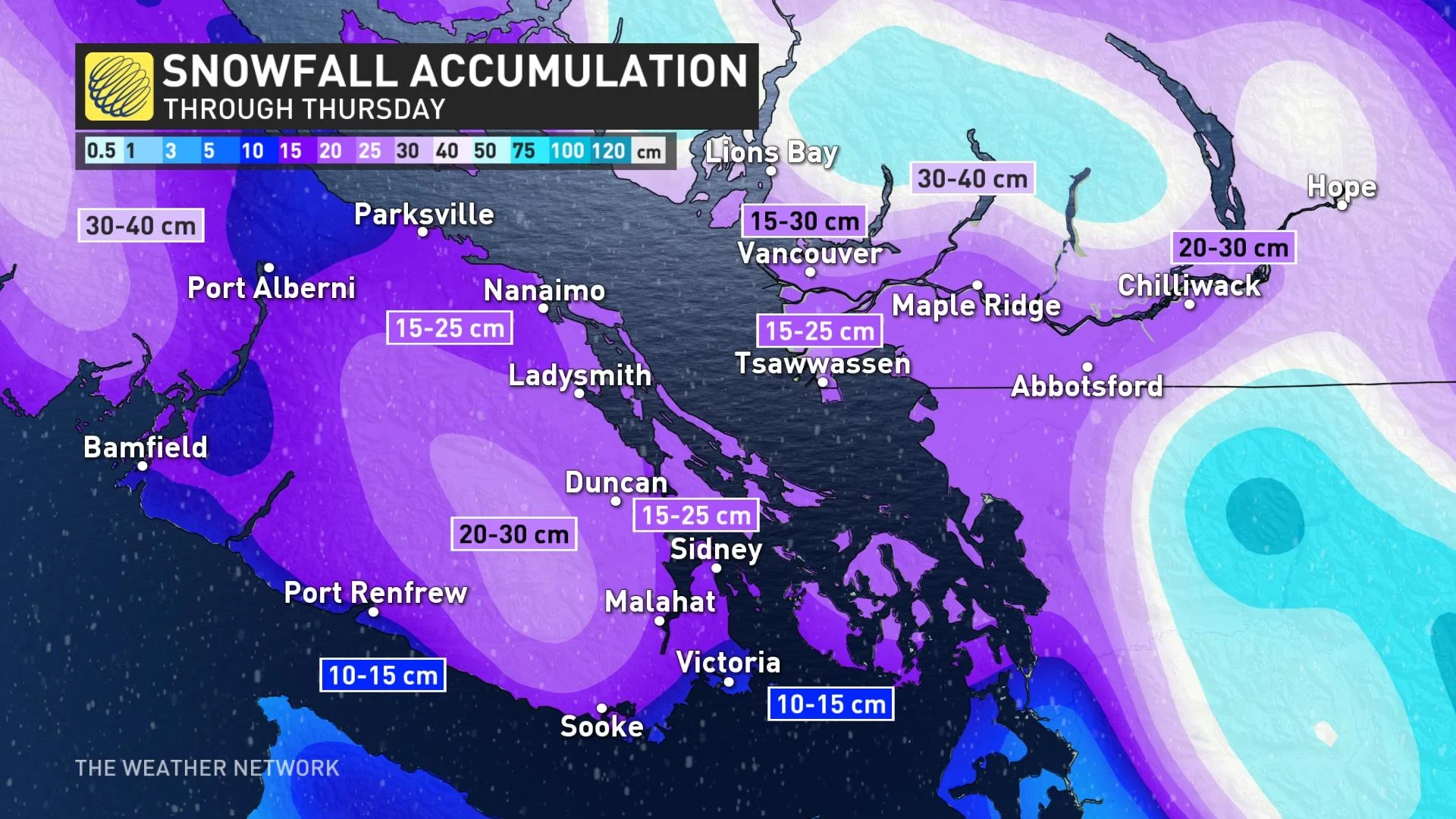
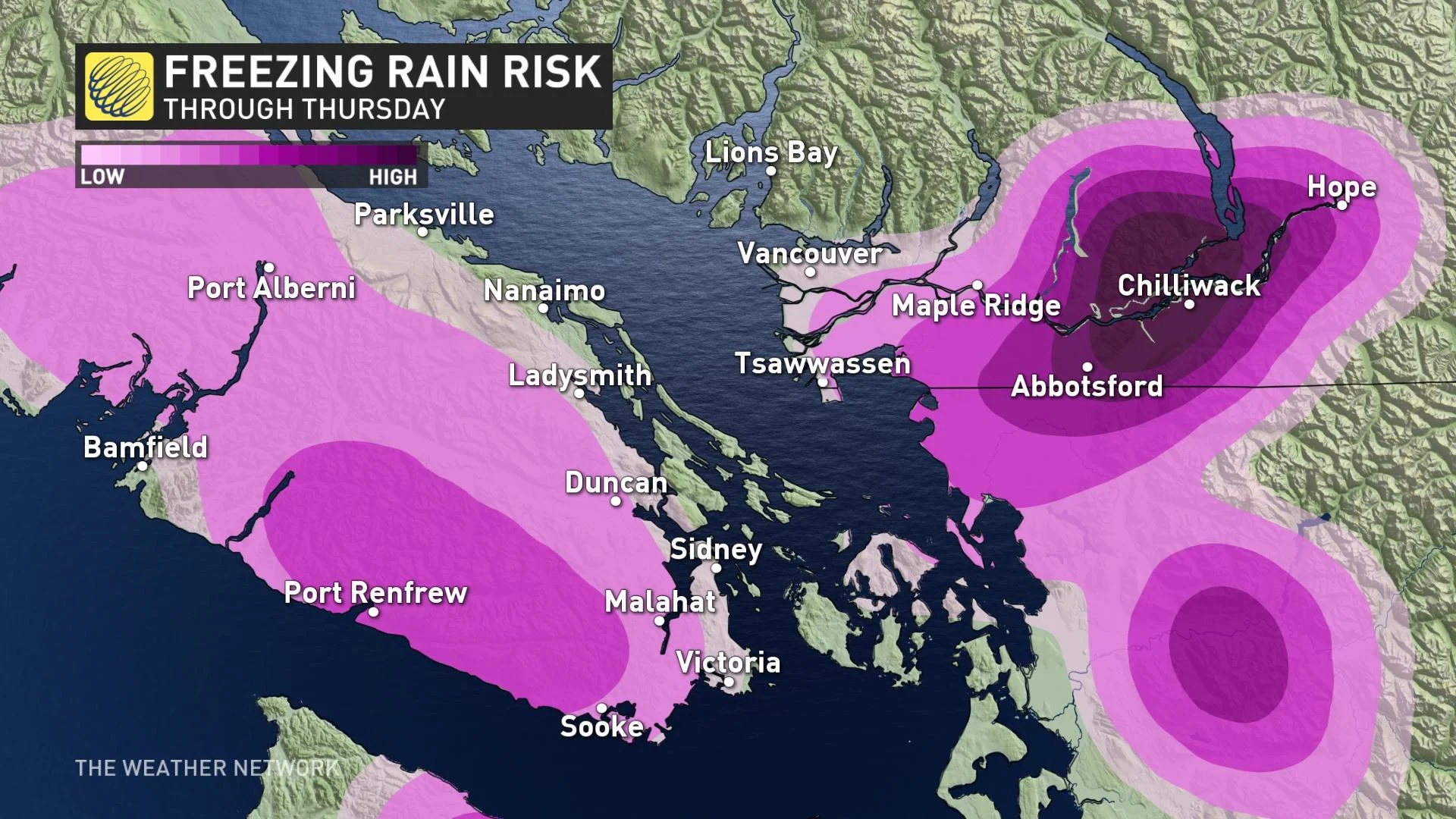
As temperatures rise, we now expect a period of freezing rain before a switchover to rain over the same regions.
There's a particularly high risk of freezing rain in the upper reaches of the Fraser Valley as well, another headache for drivers.
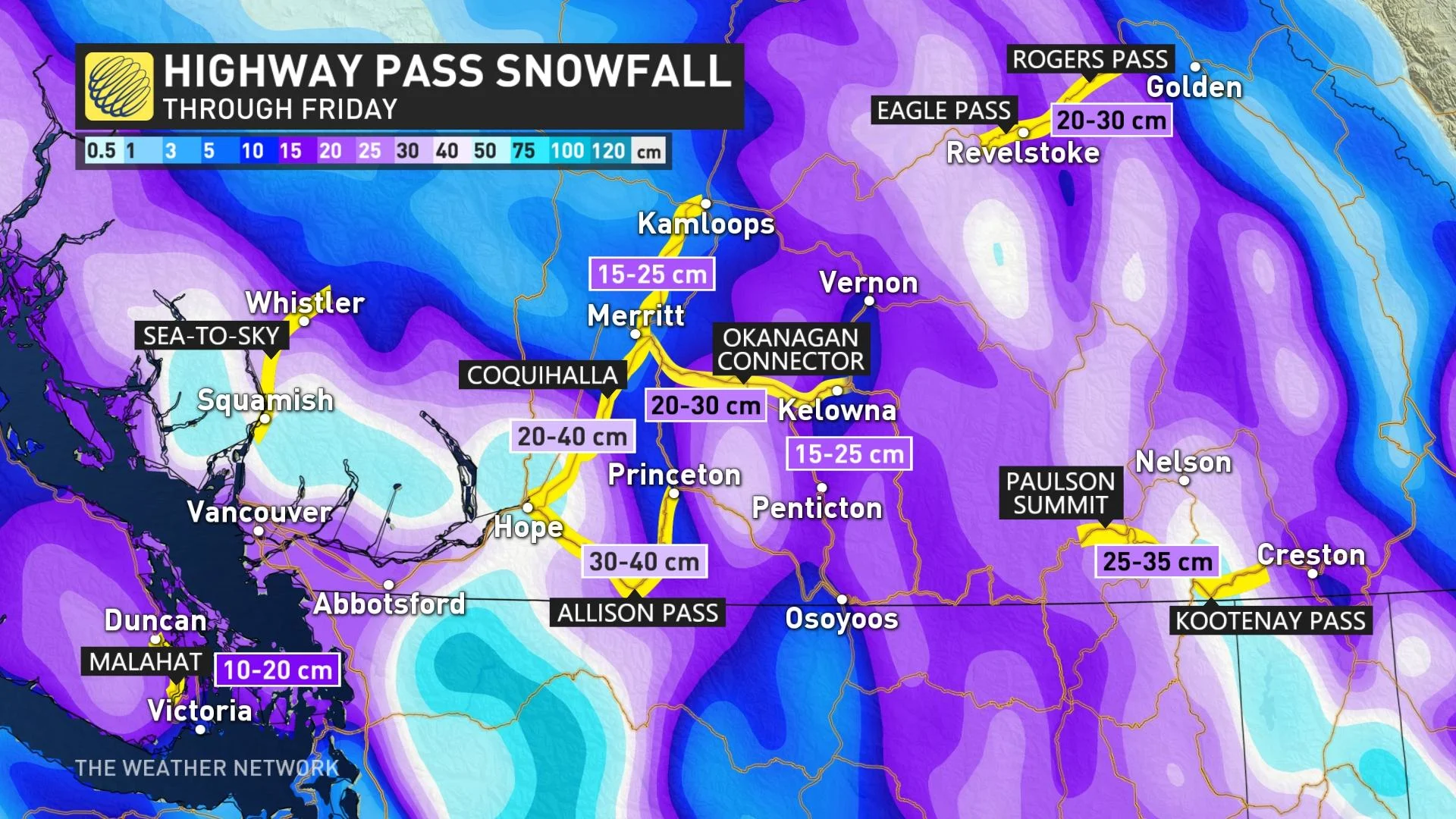
Significant accumulations are anticipated for the southern Interior, as well. Cumulative totals for some of the mountain passes could reach 50 cm, and last through much of Thursday before ending overnight.
Given the fresh snowfall on the ground and what's to come, there’s a considerable-to-high risk for avalanches for several of the coastal mountain ranges according to Avalanche Canada.
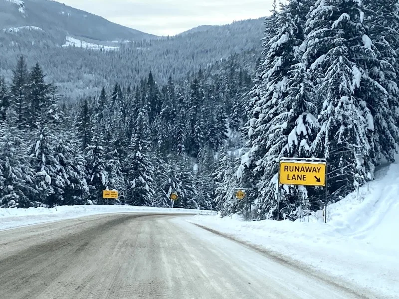
Given this huge impact, travel is not recommended during this storm, and some provincial bridges and highways are likely to be closed at its height.
"Consider postponing non-essential travel until conditions improve. Rapidly accumulating snow could make travel difficult over some locations. Surfaces such as highways, roads, walkways and parking lots will become icy, slippery and hazardous," Environment and Climate Change Canada (ECCC) says in the winter storm warning that's in effect for the region.
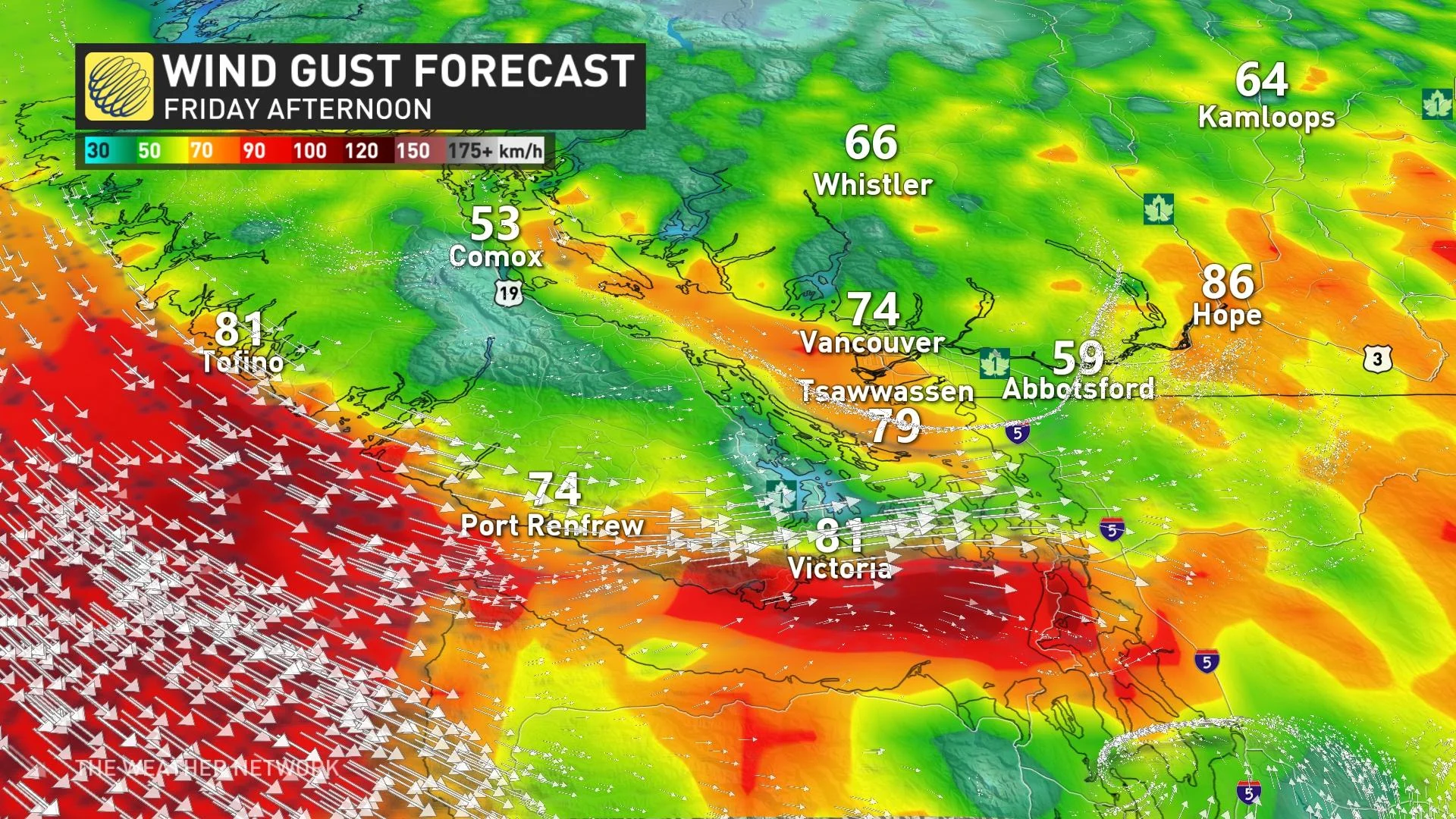
On top of all this, as the storm departs, the winds will be ramping up in its wake, reaching 70-80 km/h by Friday afternoon – expect power outages as these strong gusts slam the region.
Beyond the impacts of the next storm, the frigid pattern finally breaks down this weekend with much milder weather expected for next week. Conditions will remain unsettled at times through next week, but no major storms are expected and coastal areas won’t see any snow for the next couple of weeks.
SOME CITIES HAVE ALREADY RECEIVED MORE THAN THEIR YEARLY SNOWFALL AVERAGE
According to The Weather Network meteorologist Tyler Hamilton, Campbell River has already recorded 130 per cent of its typical annual snowfall (1980-2010) in just 29 days, “with more on the way.”
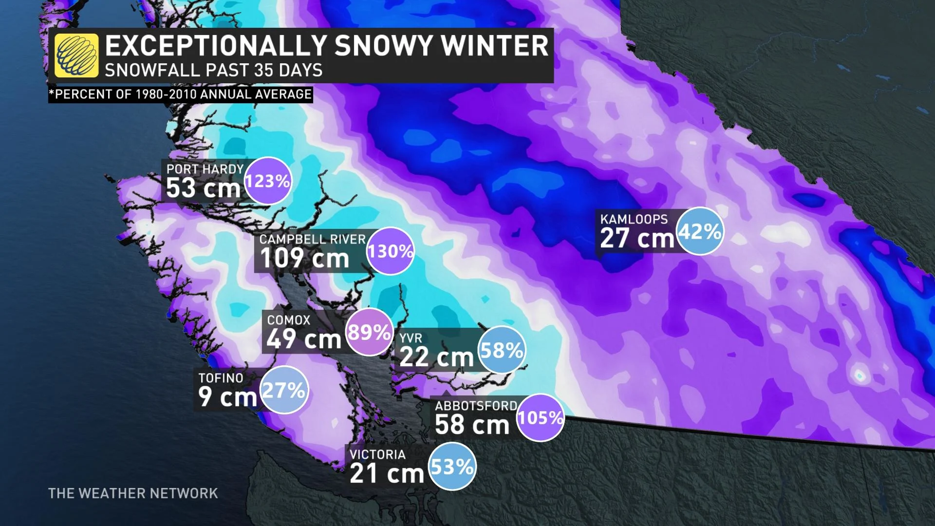
Port Hardy and Abbotsford, meanwhile, have already picked up 123 and 105 per cent of their annual snowfall average, respectively.
MUST SEE: LIGHTNING MAY HAVE EXPLODED THIS TREE IN PACIFIC RIM NATIONAL PARK
Thumbnail image courtesy: Michelle Valancius/Vancouver
Stay tuned to The Weather Network for the latest updates across British Columbia.