Dangerous cold and snowfall sweeps across B.C. with Arctic outflow

November in B.C. is shaping up to be the complete opposite of the record heat that was set in October. Snowfall and frigid temperatures will be the concern across the province this week
The big weather story for B.C. will be the unseasonable chill descending on the region.
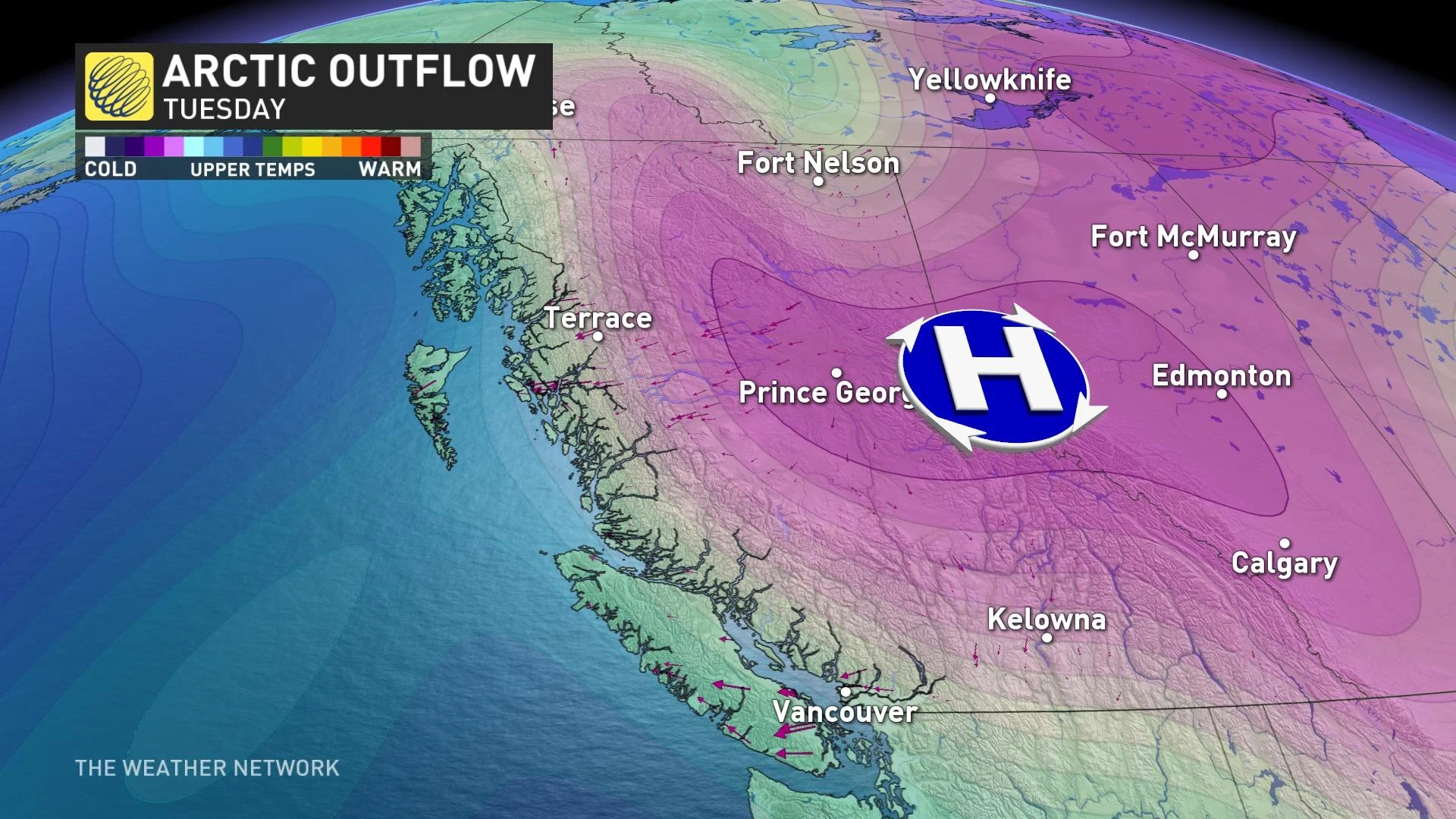
It’s not just the snow that will be a concern for parts of B.C., but a classic Arctic outflow setup will allow cold air to spill south and keep much of southwestern areas much cooler than normal for early November.
RELATED: Windstorm causes 330,000 households to lose power in southwest B.C.
In terms of precipitation, a stacked low off the Washington coast will bring more accumulating snowfall to southern parts of the province.
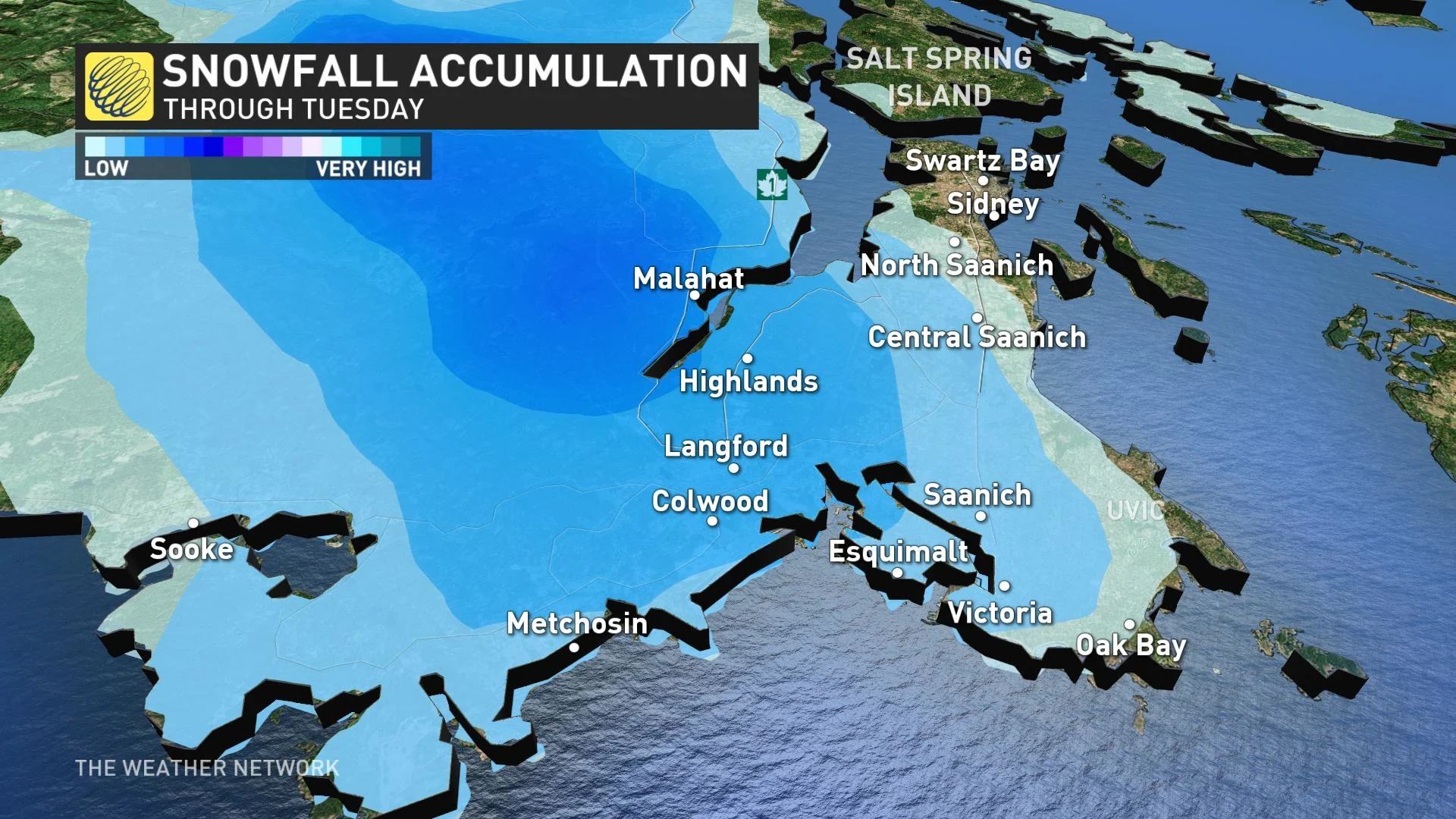
Snow will continue to pile up across the southern Interior and Okanagan through Monday overnight before it eases into Tuesday morning. Schools were cancelled in parts of the latter due to the snowfall and dangerous road conditions on Monday.
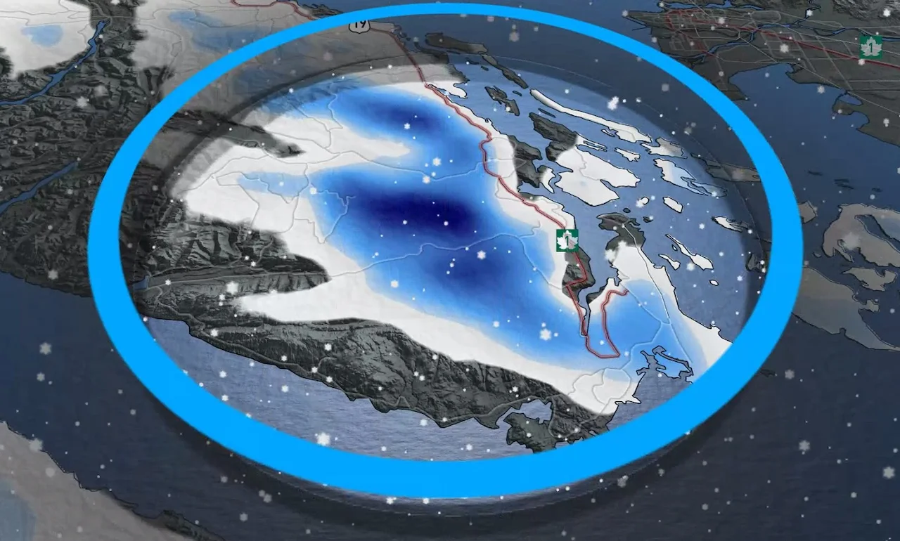
Snow is also expected across southern portions of Vancouver Island, including along the Malahat and possibly into the Greater Victoria area through Monday overnight.
WATCH: January-like cold and snow blasts into the B.C. Interior
What happens on the Malahat might not stay on the Malahat. An upper trough drives some Pacific moisture onshore through Tuesday morning, colliding with the Fraser River outflow. Looking like Victoria's first snowfall of the season.
The Lower Mainland is too dry for any significant snowfall, but there could be just enough moisture for flurries to develop across pockets of the region through early Tuesday morning.
Greater snowfall accumulations will be likely limited to the higher elevations but we can't rule out low-elevation accumulations if rates intensify through Monday overnight.
Arctic outflow drives temperatures down significantly
The trough responsible for dropping temperatures below -20°C in Alberta has left a fragment behind sitting over Vancouver Island. This lingering low will act as a vacuum to start the week, drawing the frigid air through the Interior and to the coast.
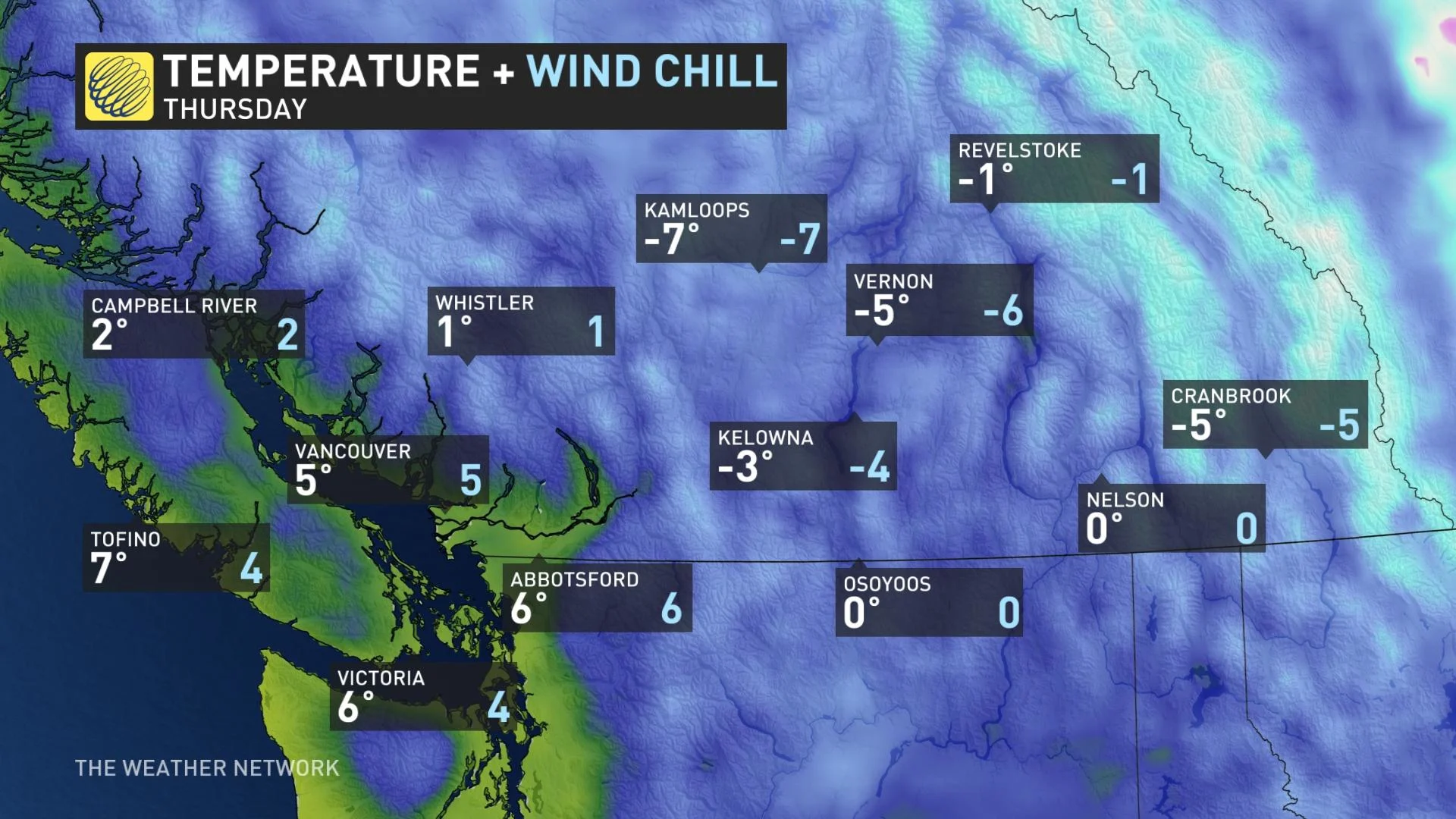
Temperatures have fallen 5-7°C below seasonal and will persist straight into this weekend. Vancouver will struggle to climb out of the lower single digits by the middle of the week and overnight lows could dip below freezing every night through at least Saturday.
Minimize exposed skin with hats, scarves and mittens or gloves. Anyone who is not dressed warmly is at risk of frostbite and hypothermia in cold weather. Be prepared for unusually cold temperatures and strong winds. Be aware of the potential for falling branches or power lines.
Environment and Climate Change Canada has issued Arctic outflow warnings for coastal and inland sections of the Central Coast and states that winds could gust up to 110 km/h with wind chills near -20. The frigid conditions are expected to continue through Wednesday. On Monday, Cathedral Point, west of Bella Coola, gusted to 135 km/h, recording a wind chill of -16.
Conditions will change later on in the week when a ridge brings a return to the onshore flow. However, temperatures will remain well below seasonal into at least the third week of November.
Stay with The Weather Network for the latest on conditions across British Columbia.