
Summer warmth continues for the East Coast, but risk of damaging winds

The East Coast continues to enjoy some summer temperatures, but a system looks to bring damaging winds to parts of the Maritimes. A weekend storm should bring the region back down to more seasonal conditions. A closer look, below.
WEATHER HIGHLIGHTS
Very strong winds for much of New Brunswick Wednesday
Above-seasonal temperatures continue through the end of the week
Messy system takes aim for Friday night into Saturday, cooldown beyond
WEDNESDAY: HOWLING WINDS FOR PARTS OF THE MARITIMES
The good news is that this week's above-seasonal warmth will linger nicely into most of the rest of the week, with Newfoundland possibly seeing record-breaking warmth amid a string of 20+°C days for St. John's.
However, the effects of a low-pressure system will have a serious impact on parts of the region Wednesday, particularly northern New Brunswick, which is likely to see wind gusts of 80-100 km/h, peaking Wednesday -- easily rivalling the strongest winds of Hurricane Teddy, which generally had minimal effect on that part of the province compared to elsewhere.
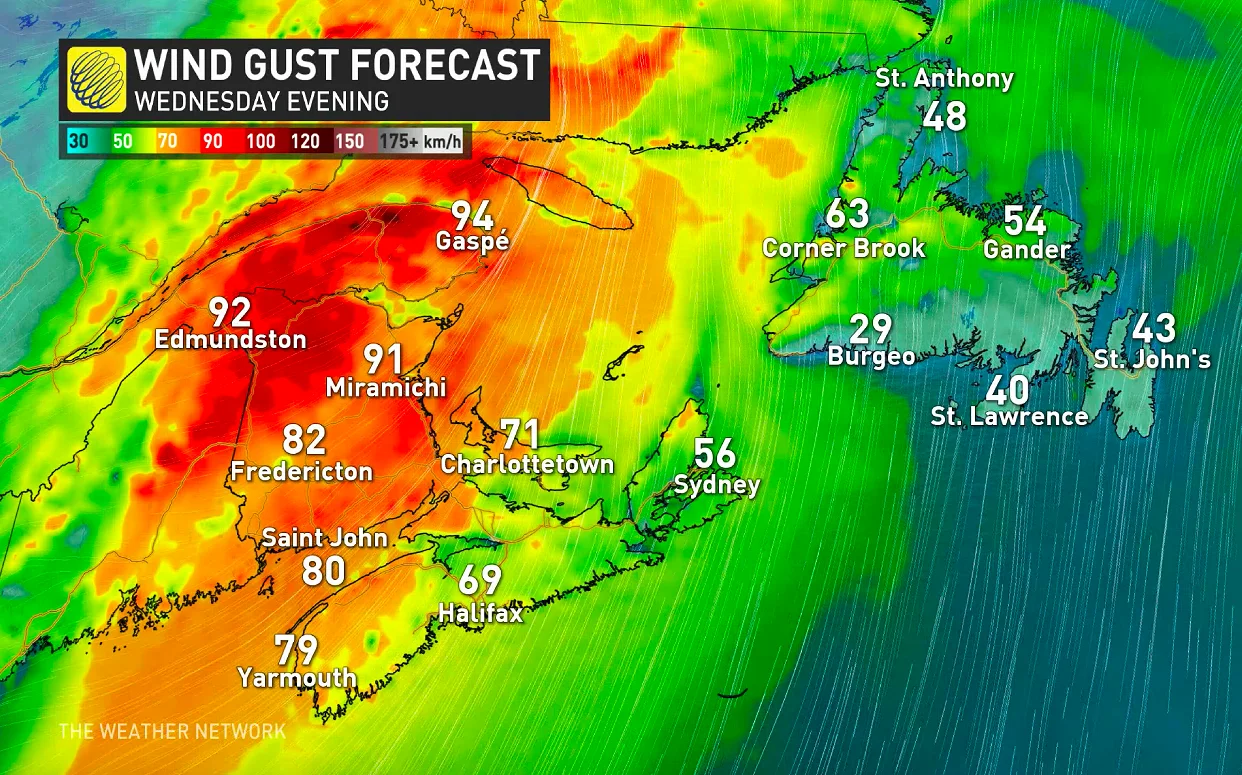
Winds will be gusty for most of the rest of the Maritimes, with some overflow into western Newfoundland, though that province will be mostly spared the worst.
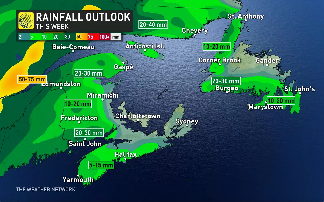
There's also a fair bit of rain to expect from this system, heaviest in northern and western New Brunswick. The latter zone also sees some isolated thunderstorm risk, as does some of southwestern Nova Scotia and the Minas Basin.
THURSDAY AND BEYOND: MORE RAIN, AND COOLER TEMPERATURES AHEAD
Though an upper low in northern Ontario and Quebec is set to send temperatures tumbling in those two provinces, offshore high pressure will slow a similar return to Earth for the East Coast, with above-seasonal conditions dominating through the end of the week.
It will be somewhat unsettled, however: rain will develop across the region Thursday, and a brewing low-pressure system off the U.S. East Coast looks to track into Atlantic Canada late Friday and Saturday with gusty winds and a soaking rain.
"Cooler weather will spread into the region behind this system for early next week, with a somewhat active pattern next week – including the potential for a couple of systems to track across the region," Weather Network meteorologist Dr. Doug Gillham says.
Check back as we continue to monitor the forecast.


