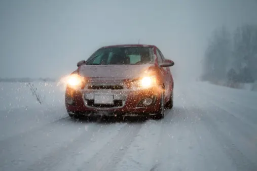
Brace for dicey travel in Ontario as storm set to pack a wintry punch

Rain, ice and snow will make for a tricky couple days of travelling across much of southern Ontario, with Thursday afternoon and evening likely to be the worst time for commuters.
After a windy and mild Wednesday, the next phase of a potent storm is unfolding across southern Ontario. Rainfall will become heavy through Thursday morning in most of the south, while central and southwestern areas see a transition to ice pellets and snow, making for tricky commutes then. The worst of the snow or other wintry precipitation will be occurring over a six-hour period -- from 3-9 p.m., so it's recommendeded to avoid travelling during this time if possible. Compounding the situation will be slippery roads as standing water and snow freezes over from temperatures falling sharply during the day and on Friday, as well. When all is said and done, a good portion of the south may see 10-25 cm of snow. More on what to expect over the next couple of days, and the warming temperatures set to rise for the Family Day long weekend, below.
DON’T MISS: Here's how to stock your vehicle's emergency kit, BEFORE you get stranded
THURSDAY INTO FRIDAY: DIFFICULT TRAVEL AS PRECIPITATION TURNS TO SNOW WITH AN ICY MIX IN BETWEEN
As the boundary continues to sink south, light to moderate rain will fill in across southern Ontario Wednesday overnight.
By Thursday morning, with rain now falling at heavy rates in southern Ontario including the Greater Toronto Area, much of cottage country and the shores of Lake Huron will see a switch to ice pellets and snow, as the colder air begins sinking south. Extreme southwestern Ontario may also start off with freezing rain during this time, meaning lesser snowfall totals for the region.
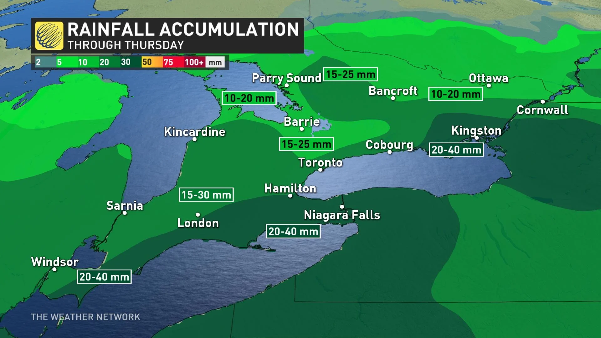
A widespread 15-30 mm of rain is expected in the region, with up to 40 mm for areas along the shores of lakes Erie and Ontario, which could lead to some localized flooding as the ground still remains cold and largely frozen.
Through the afternoon and into the evening, as well, colder air will continue to push farther south, transitioning the rest of the rain to to a brief period of ice pellets and/or freezing rain before shifting to snow on the backside of the system.
If people are travelling on the major 400 routes, and it's possible, it's recommended to leave work early, as to avoid the worst of the impacts on the roads. Anywhere from 3-9 p.m. will see the heaviest snowfall, so travel will be hazardous during this timeframe, especially.
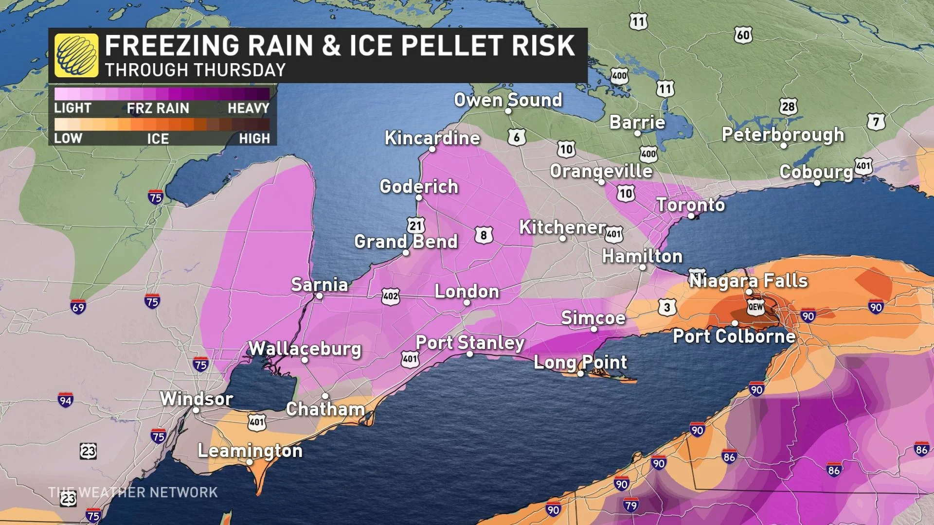
"The greatest concerns for ice would be from Windsor and along the 401, towards Hamilton and Niagara into Thursday evening," says Kelly Sonnenburg, a meteorologist at The Weather Network. "And any of the snow that falls will start out slushy and wet, so keep in mind when looking at the snowfall accumulations, that some will melt initially."
Snowfall rates will then increase Thursday evening, continuing through the overnight before easing off to flurries on Friday morning. Some snow will linger longer across eastern Ontario.
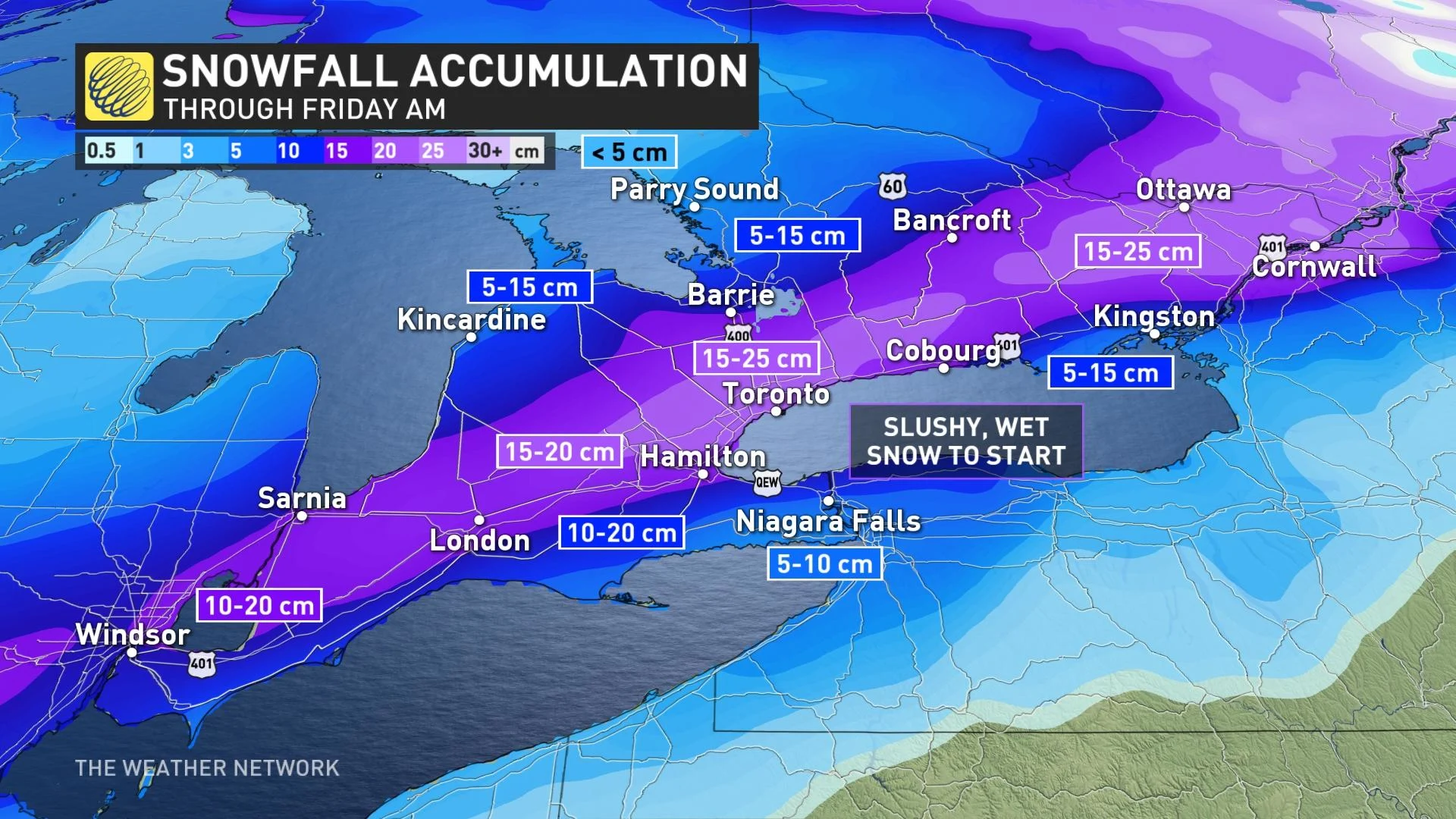
In all, a large swath of 10-25 cm is expected from southwestern to eastern Ontario, with lesser amounts in Niagara region and along Erie shores where they can expect to see a longer period of freezing rain or ice pellets.
Much colder air is expected by Friday morning, with temperatures dropping into the minus double digits and a frigid northwest wind developing. There will be a threat of a rapid freeze of any standing water, which will make for extremely slick surfaces such as sidewalks and roads.
PREPARATIONS BEGIN FOR IMPACTFUL STORM:
WARMER FINISH TO THE FAMILY DAY LONG WEEKEND
While conditions remain well below seasonal on Friday, a warming trend is expected throughout the weekend and into next week, possibly bringing multiple days of very mild, even spring-like weather.
Looking ahead further, we're watching the potential for a taste of early spring at the end of February and into the beginning of March for southern Ontario and Quebec. However, keep in mind it is highly unlikely we are completely finished with the winter weather just yet.
Subscribe to 'This Day in Weather History': Apple Podcasts | Amazon Alexa | Google Assistant | Spotify | Google Podcasts | iHeartRadio | Overcast'
Check back for the latest forecast across Ontario.