COVID-19 could impact weather forecast accuracy

The COVID-19 pandemic has caused a decline in air travel, and that could have an impact on weather forecast accuracy
As heightened travel restrictions come into play, to reduce or slow the spread of the COVID-19 pandemic, the number of airline flights taking to the skies around the world is in sharp decline. While these restrictions are a necessary part of 'flattening the curve', they are setting up an unfortunate side effect. The accuracy of weather forecasts is likely to decline as well.
Every day, tens of thousands of flights travel around the world, ferrying people and cargo to new destinations. As it turns out, these flights are also an essential part of maintaining accurate weather forecasts.
Since weather is a very complex, chaotic system, forecasters use computer models to assist them in their day-to-day work. These computer models, in turn, rely on ingesting specific sources of information to produce their views of what the weather will be in the hours or days ahead. Readings taken by ground stations, ocean buoys and ships cover the surface conditions. Data from satellites tell what is going on in the upper levels of the atmosphere. To cover what is happening at the altitudes in between, scientists launch weather balloons from specific locations, a couple of times each day. More importantly, though, aircraft provide tens of thousands of reports based on the weather conditions they fly through while they are in the air.
Go HERE for our complete coverage of the COVID-19 pandemic
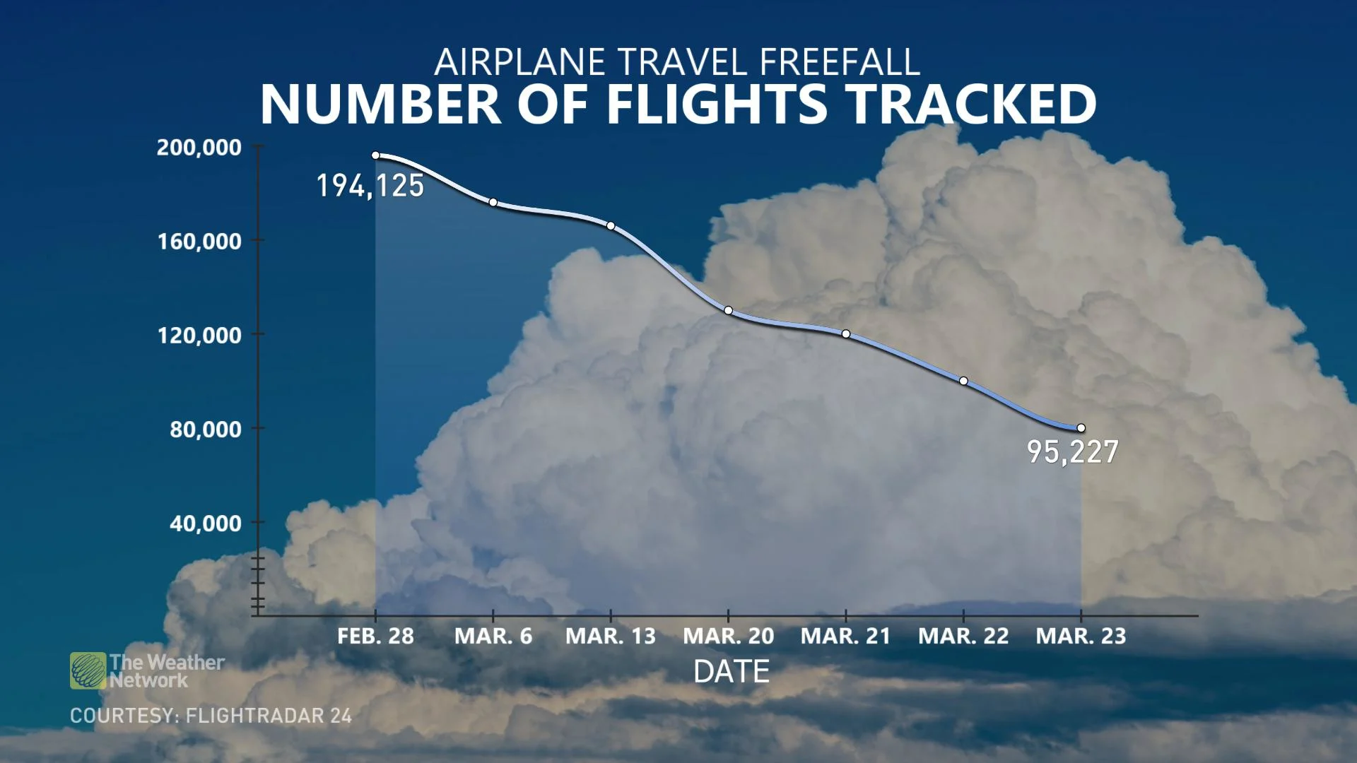
Currently, with the COVID-19 pandemic, the number of flights taking off has been dramatically reduced, as shown in the graph below.
Seeing the reduction in the number of flights in the air, as shown on the map, is even more dramatic, though.
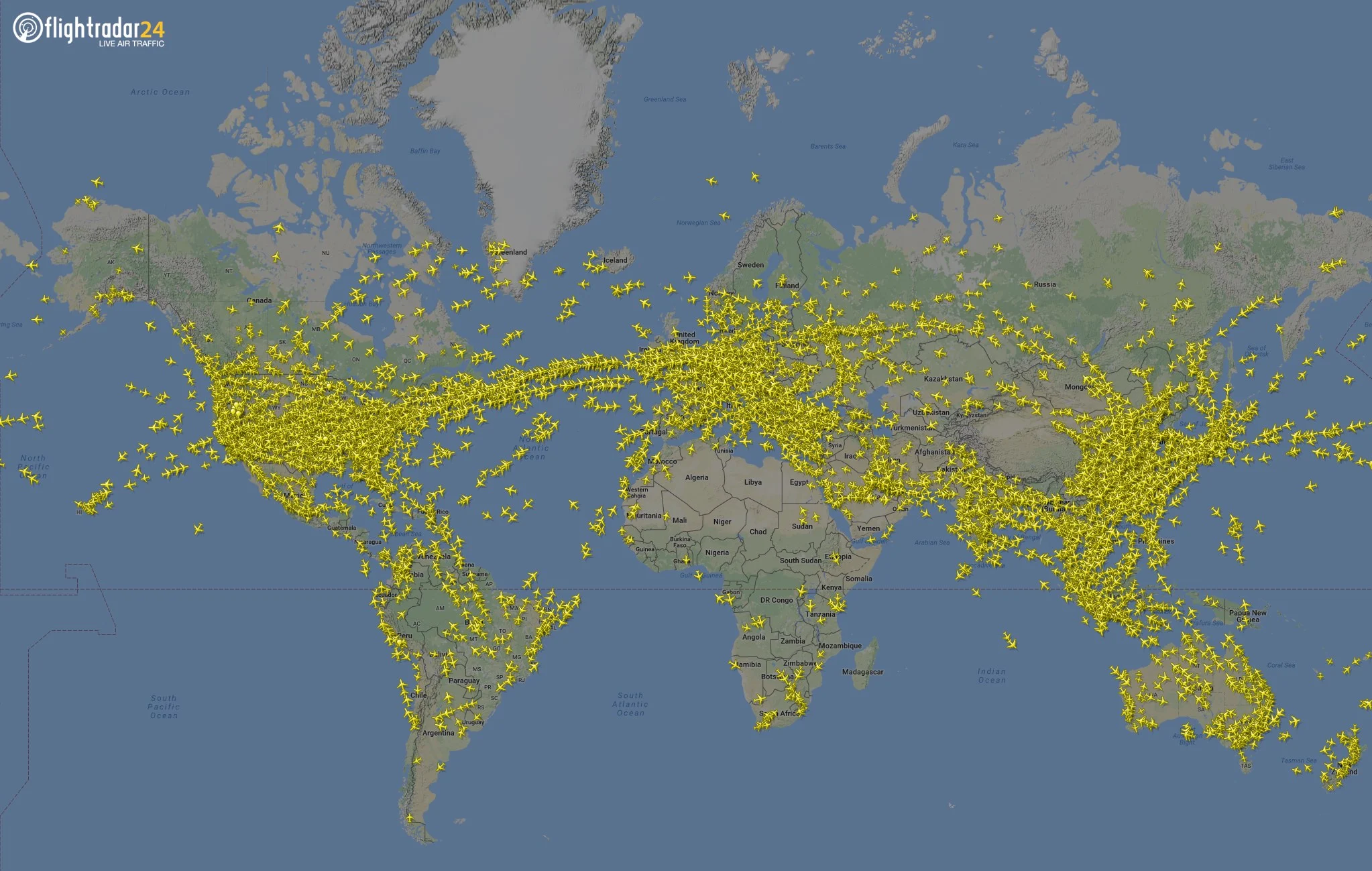
Typical global flight traffic, pre-pandemic. Credit: Flightradar24.com
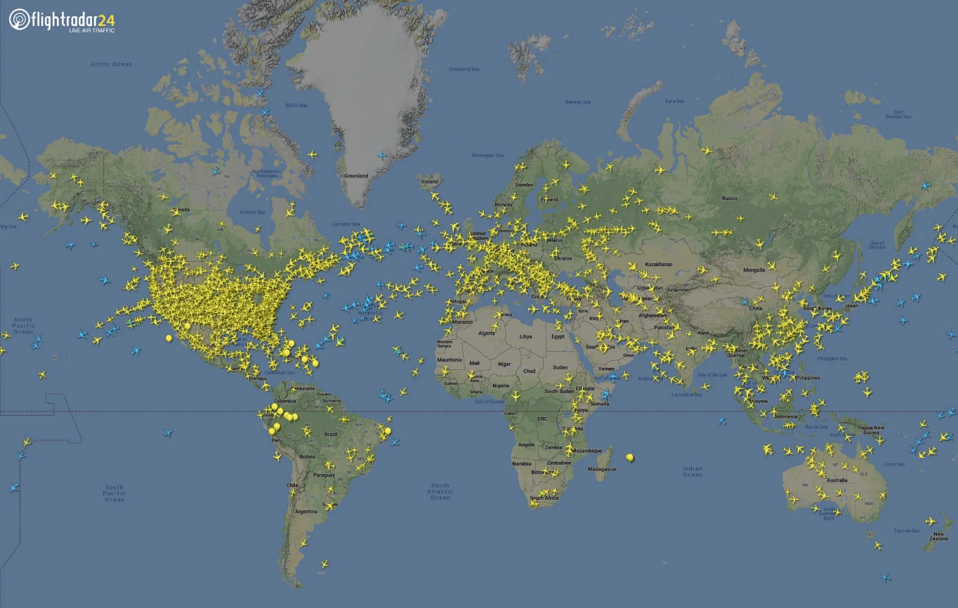
Global flight traffic at 12:30 p.m. EDT, on March 25, 2020. Credit: Flightradar24.com
This reduction in the number of flights is likely to have a significant impact on weather forecasts.
As reported by the European Centre for Medium-Range Weather Forecasts (ECMWF), "aircraft reports are second only to satellite data in their impact on forecasts."
According to ECMWF, the number of daily reports used from flights over Europe dropped from roughly 40,000 per day on March 3, to around 14,000 per day on March 23. That's a 65 per cent reduction.
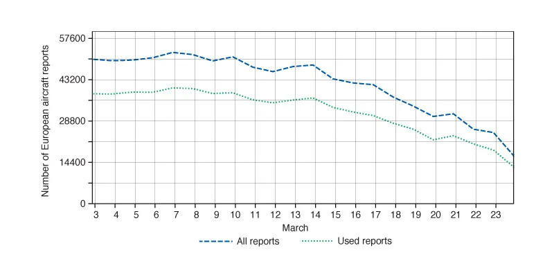
Number of aircraft reports over Europe received and used at ECMWF per day. The number of "used reports" is less than the total because some reports are near-duplicates, and a small proportion is rejected as poor quality. Credit: ECMWF
"Globally," they said, "the reduction was about 42%."
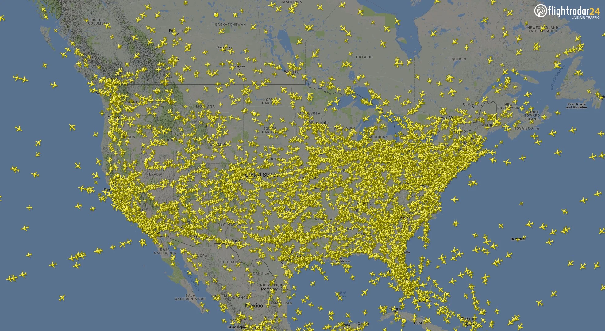
Typical flight traffic over North America, pre-pandemic. Credit: Flightradar24.com
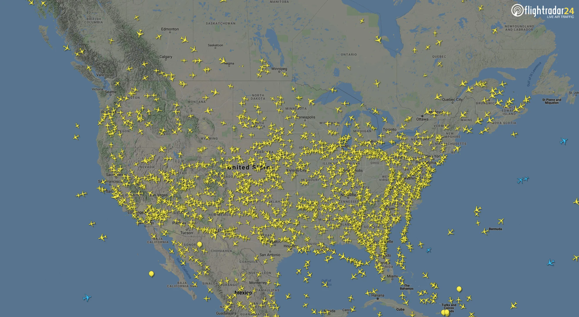
Flight traffic over North America from March 25, 2020. Credit: Flightradar24.com
With more reductions in air traffic expected by the end of the month, the number of aircraft reports being ingested into weather models is going to fall even further.
The main impact of the loss of so many aircraft reports is expected in the forecasts for altitudes that these aircraft fly at, namely temperature and wind conditions at an altitude of 10–12 kilometres. The most significant impacts seen are in the first 24 hours of the forecast, with lesser impacts seen out to 7 days.
In of itself, this greater uncertainty in the forecast could have a direct impact on those flights that are still making trips, including those carrying goods and cargo between nations and continents. Another important aspect of our weather forecasts that is found at that altitude, however, is the jet stream.
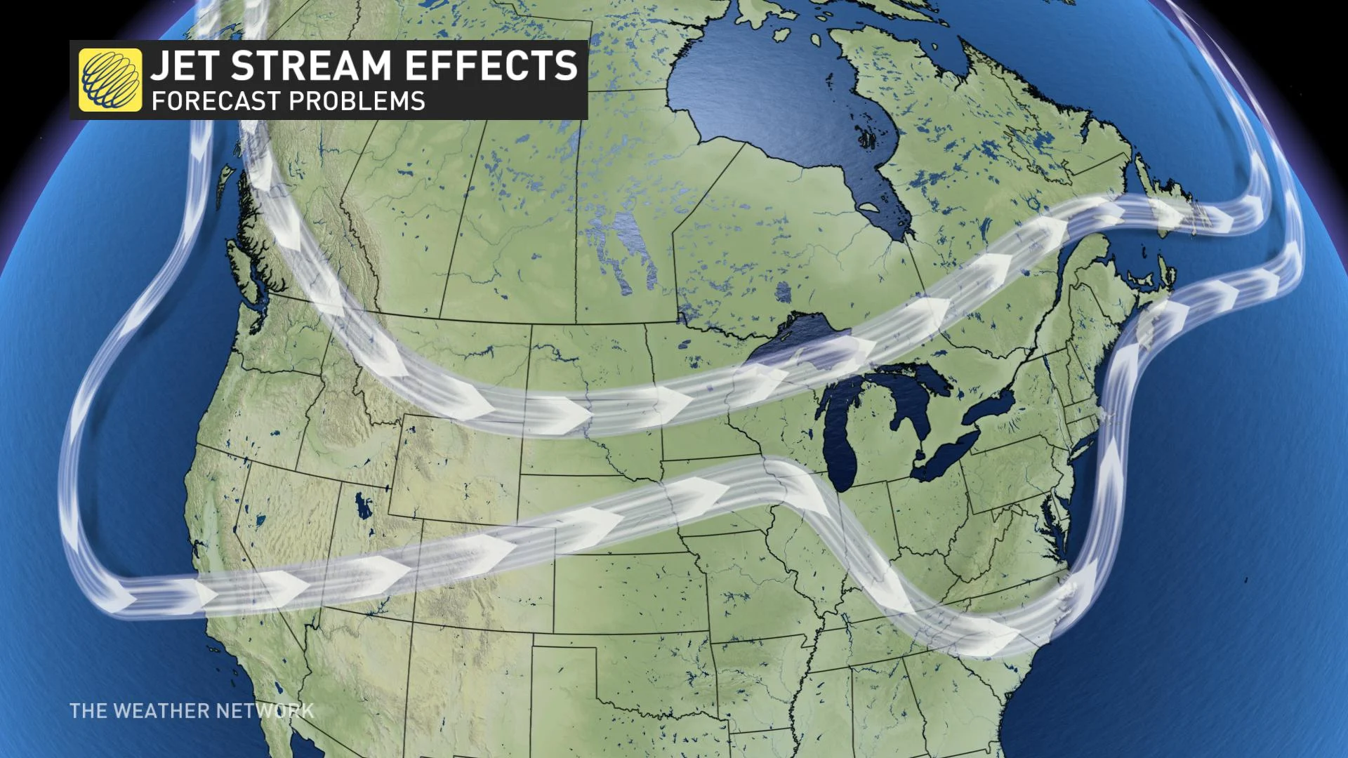
The flow of the jet stream is concentrated at 10-12 kilometres above the ground, but it can still have a considerable influence on the weather we see here at the surface. This is because it acts as a major steering force for large-scale weather systems.
Imagine if there was a major ice storm approaching the Windsor to Montreal corridor. Due to uncertainties in the jet stream's position, however, there's no way to lock down the position of the freezing line until the storm arrives. Will the line be well to the north, affecting less populated regions? Or, will the line fall directly across the Greater Toronto Area and stretch all the way to Montreal, with heavy freezing rain encasing everything in ice and severely impacting the lives of millions of people?
So, the ability to accurately forecast the position of the jet stream is of great importance when it comes to even our local forecasts.
According to the ECMWF, there are ways to compensate somewhat for the loss of aircraft data. More weather balloons can be launched to sample the upper atmospheric conditions. As well, newer satellite data can fill some of the gaps from above, such as from the European Space Agency's Aeolus satellite, which ECMWF began ingesting data from in January.
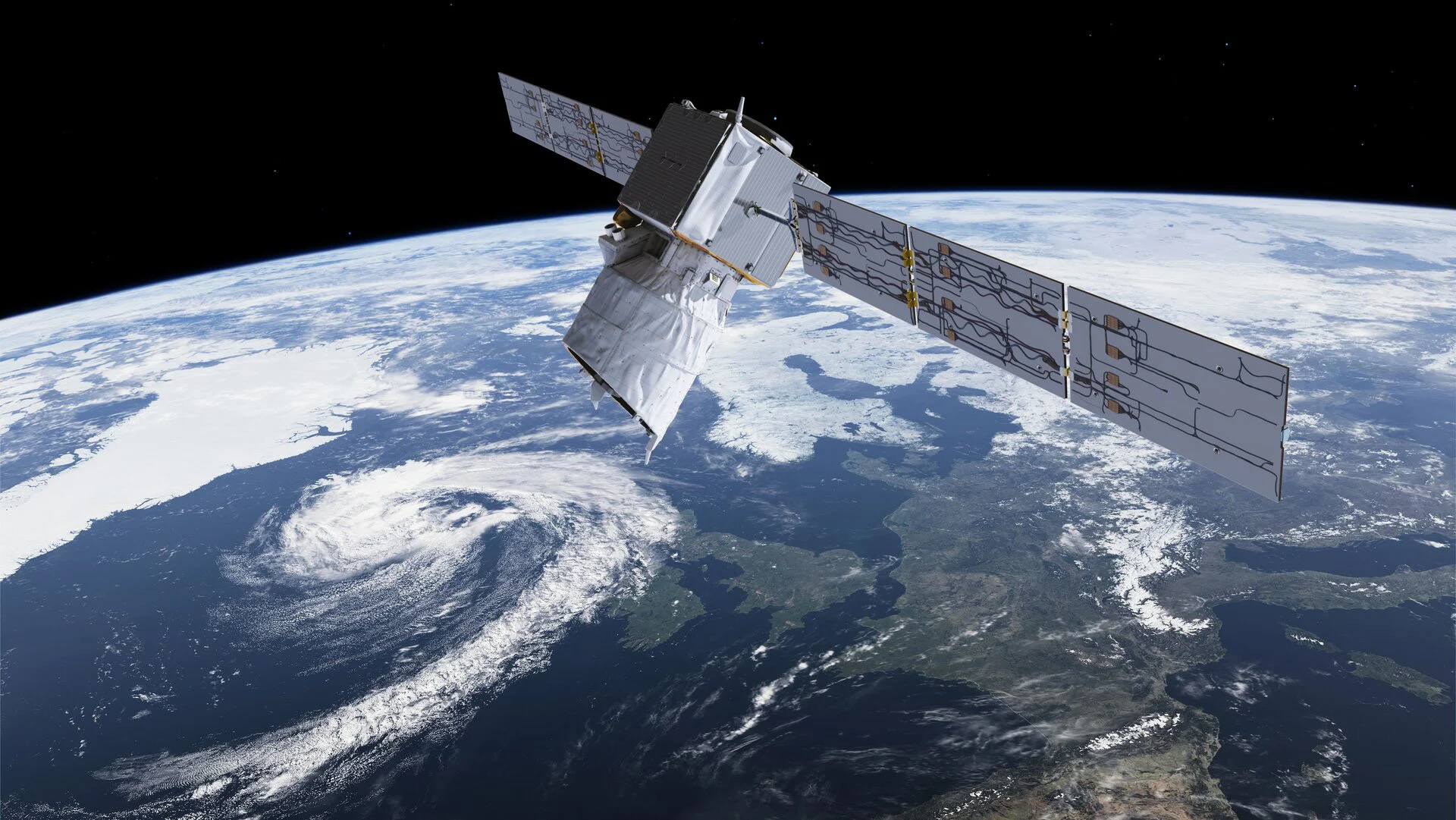
This artist's impression shows the Aeolus satellite orbiting Earth above Europe. Credit: ESA
"The Aeolus results demonstrate that there is still plenty of room to improve wind initial conditions," Lars Isaksen, the Head of the Actively Sensed Observations Group at ECMWF, said in a press release. "The Aeolus data will partly fill the gap due to fewer aircraft reports."
Sources: ECMWF | Flightradar24.com