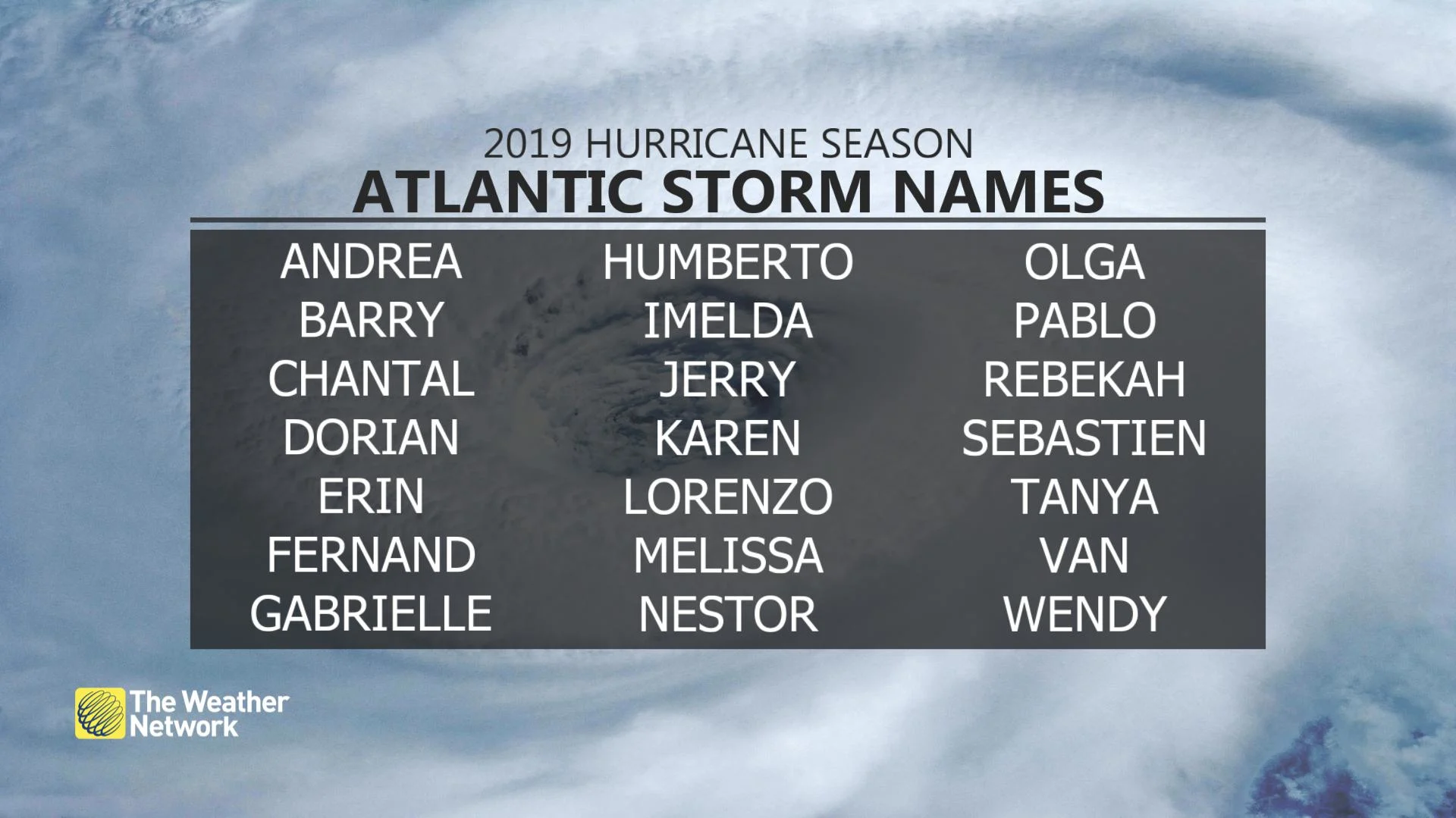
Could July's tropical activity be a hint of what's to come?

We've seen an uptick in tropical activity throughout July, but could this mean more storms for the rest of the season?
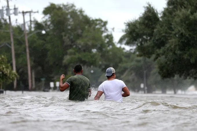
The Atlantic Basin in 2019 has so far had one hurricane -- Category 1 Barry -- that made landfall along the Gulf coast on Marsh Island, Louisiana back on July 13. Hurricane Barry weakened to a tropical storm as it made landfall and its westward shift helped to spare the low-lying areas of New Orleans from the massive flooding that was initially feared.
The storm still brought dangerous storm surge and heavy rains, with several roads and businesses flooded north of New Orleans.

People wade through a flooded street after Hurricane Barry in Mandeville, Louisiana, U.S. July 13, 2019. REUTERS/Jonathan Bachman
The season has also featured sub-tropical storm Andrea, which was a weak and short-lived storm that mostly meandered over the western Atlantic.
Now, as we enter into the more active part of the hurricane season, we are closely watching for another potential tropical system to develop in the Atlantic over the next seven days.
The MDR (main development region) is an area between about 10-20 degrees north and south latitude in the Atlantic Ocean and it stretches from Africa's western coast almost into the Caribbean. This area is where we see most of the tropical systems develop during the peak of the hurricane season from August through October. That is, providing it is warm enough with ideal temperatures around 26°C. This year however, the waters are cooler than normal, and this could hinder tropical development in this area.
COULD THIS BE A SIGN OF WHAT'S TO COME?
Early activity in the Atlantic's MDR might suggest that factors like wind shear and dry air are not hindering tropical development when they emerge off the west coast of Africa. Although we are monitoring a disturbance over the next seven days that is moving across this region, that doesn't necessarily mean we will continue to see more develop.
Overall, the activity in June and July has little effect on what happens in the remaining months of the Atlantic hurricane season, so we can't rely on the current activity to detemine how the fall season will pan out.
WHERE WE DO NEED TO WATCH IS CLOSER TO HOME
The ocean temperatures are more than sufficient to sustain tropical activity in the Atlantic along the Southeast U.S. Coast as well as the Gulf of Mexico. This is where we really need to pay attention to any close-to-home systems that develop, just like Hurricane Barry did in July.
Remember, it only takes one storm to devastate the coast and a good example of this was Hurricane Michael that made landfall as a Category 5 storm, the strongest storm of the season, in the Florida Panhandle last October. More than 70 deaths were reported with the storm, and Michael is said to have caused an estimated $25.1 billion in damage.
WATCH BELOW: HIGHLIGHTS FOR THE 2019 HURRICANE SEASON
With files from Reuters.


