Could a warmup in B.C. raise or lower the risk of flooding?

B.C.'s winter featured plenty of mountain snow and moisture spilling onto the coast, but is the spring flooding risk higher as a result?
Storm after storm has brought an abundance of moisture to the coast and mountain snow to the higher terrain this past winter season, extending right into spring across B.C. For that, you can thank La Niña.
La Niña is a weather pattern that occurs when sea surface temperatures across the eastern equatorial part of the central Pacific Ocean are cooler than normal. This can affect global weather patterns, and in B.C.’s case, it means a rainy and snowy winter season. Winter sports enthusiasts must be thrilled so far this season, but the downside is an elevated risk of spring flooding.
HOW MUCH SNOW DO WE HAVE AS OF APRIL?
If you are a skier or snowboarder, then you know that it’s been a fabulous year for powder on the mountains in B.C. The average of all snow measurements across the province has come down by a mere two per cent since our March update.
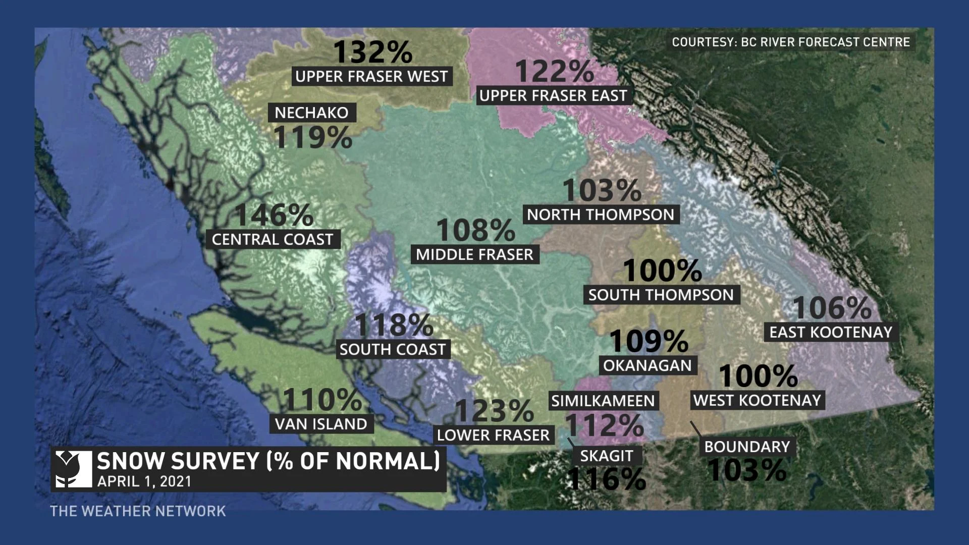
The current snow measurement average is currently at 112 per cent of normal, according to the B.C. River Forecast Centre’s snow survey and water bulletin posted on April 1. The following information was posted in the report:
Overall, the province has above normal snowpack for April 1, 2021, with the average of all snow measurements across B.C. decreasing slightly to 112 per cent (March 1: 114 per cent). The East Kootenay is the only region below 100 per cent of normal. Regions with normal to slightly above normal snowpack (100-110 per cent) include the Middle Fraser, North Thompson, South Thompson, Upper Columbia, West Kootenay, Okanagan, Nicola and Boundary. Above normal snowpack (110-125 per cent) is present in the Upper Fraser East, Nechako, Lower Fraser, Similkameen, South Coast, Vancouver Island, Skagit, Peace, Skeena-Nass and Liard.
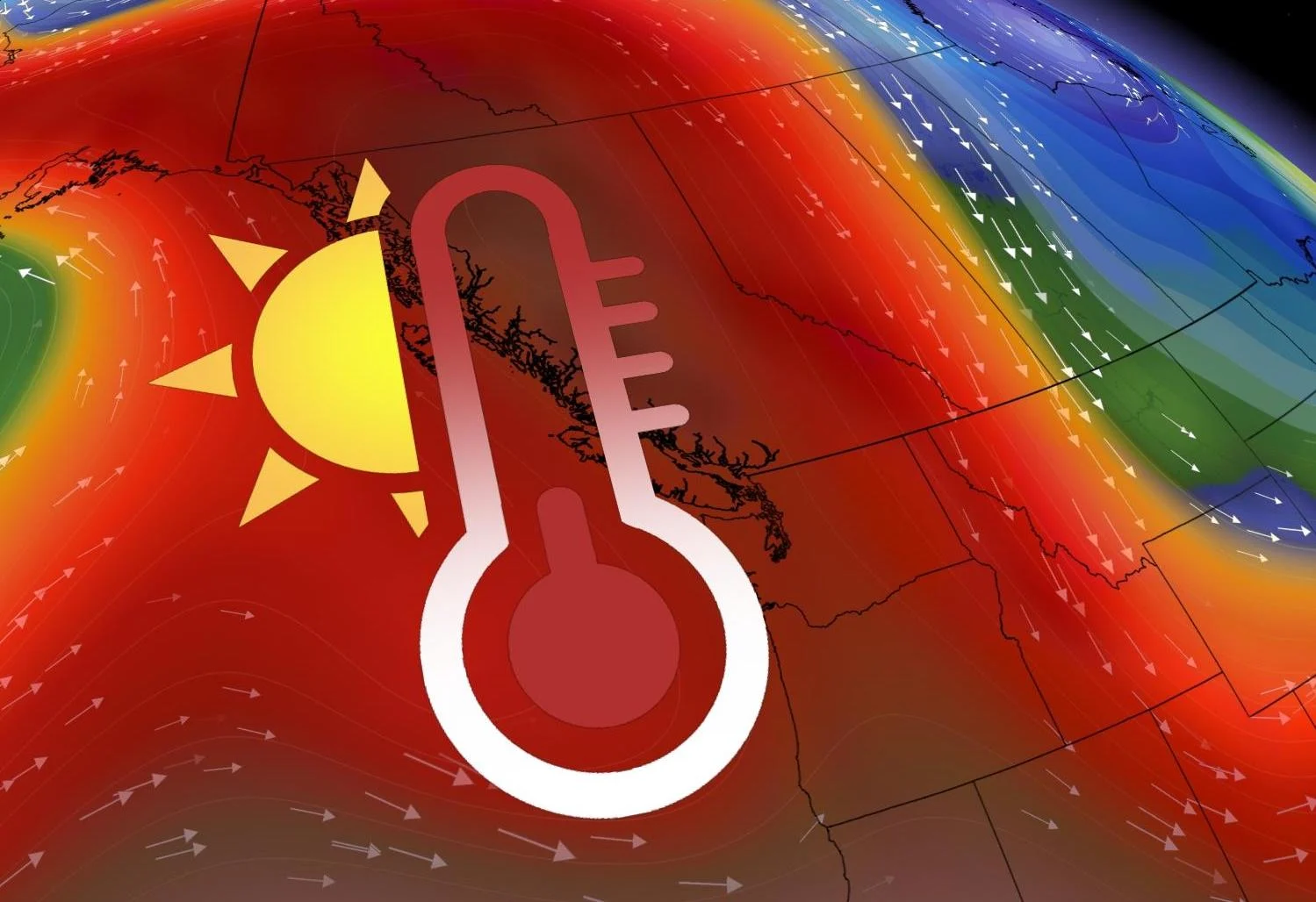
A WARM PATTERN HAS PEOPLE SMILING, WHAT ABOUT FLOODING RISK?
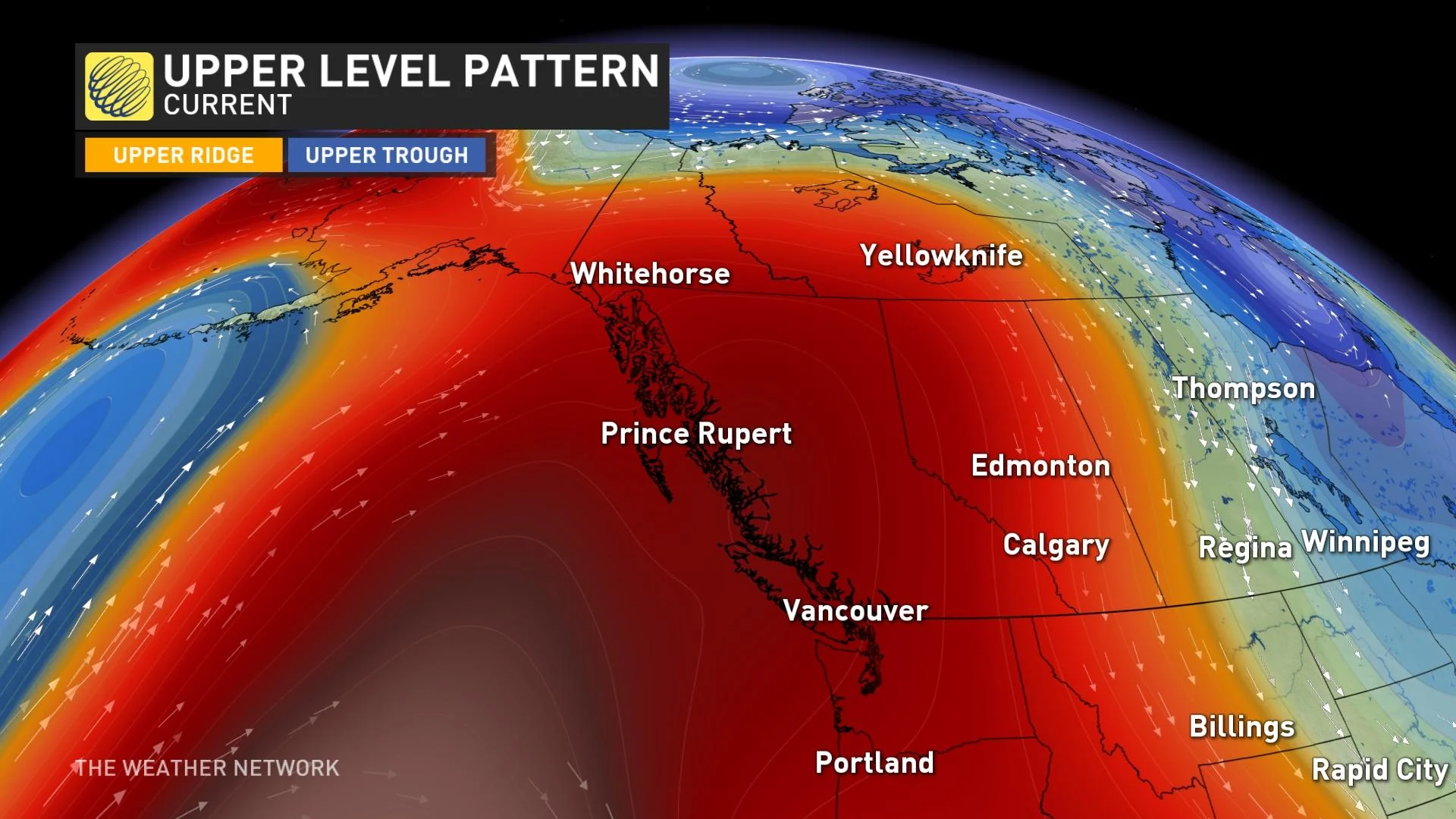
The pattern brought abundant snow and rain to the coast in early April, and a lack of precipitation to the Interior. Now, the pattern has flipped and a ridge of high pressure has been parked over B.C. for the last week, and a significant warmup has occurred across the province.
Many record-breaking days of heat and tons of sunshine had me concerned about early melting and the risk of flooding. However, this pattern I learned from B.C. River Forecast Centre hydrologist Jonathan Boyd is exactly what we need right now.
“It may be a major benefit. Especially because it's happening in the middle of April, not in the middle of May. Because it's the middle of April, the days are shorter, the temperatures are not as warm (and) the sun angle isn't as intense. So the snow hasn't really even started melting very much at the high-elevation sites," said Boyd.
This will allow for a more gradual melt to begin, rather than an abrupt melt to happen if it occurred later in the spring.
WHAT ARE THE VARIABLES THAT GO INTO PREDICTING FLOODING
La Niña years have resulted in significant flooding in B.C., including in 2017, 2012 and 2011. Although those years had similar characteristics, this doesn’t mean flooding is guaranteed.
Boyd told me he believed there would be “some versions” of flooding somewhere in the province. He goes on to say: "One region's best-case scenario for weather conditions might be another region's worst-case scenario. That being said, it starts with the snowpack but then it becomes more about the weather conditions.”
I’ve learned that it is really all about balance. A slow melt with short warmups, followed by cooler conditions, is really ideal, according to Boyd. This allows the snowpack to gradually melt. Precipitation that is not extreme is important to have in order to reduce the risk of flooding.
If we experience heavy rain and snow events, this could lead to the risk of flooding. We will watch the pattern closely into the month of May here at The Weather Network and hope for no extremes, both temperatures and precipitation.