Ice accretion from freezing rain could cause travel issues in Ontario

A complex storm heading toward the Great Lakes this weekend will lead to dynamic weather across Ontario through the first week of January.
The promise of an exceptionally warm start to the first week of January in Ontario won't pan out as exactly planned, thanks to an unforeseen stalling of a stateside warm front. Not only will it be colder than previously thought, but multiple systems trekking across Central Canada over the next several days will bring numerous shots of messy, winter weather.
Talk about a dramatic reversal in fortunes.
A few days ago, weather models strongly suggested the chance for record-setting warmth bathing much of southern Ontario. Unfortunately for those among us who long for a taste of a faraway spring, that doesn’t appear to be in the cards anymore.
SEE ALSO: Will winter stage a comeback this month? Find out in our official January Outlook
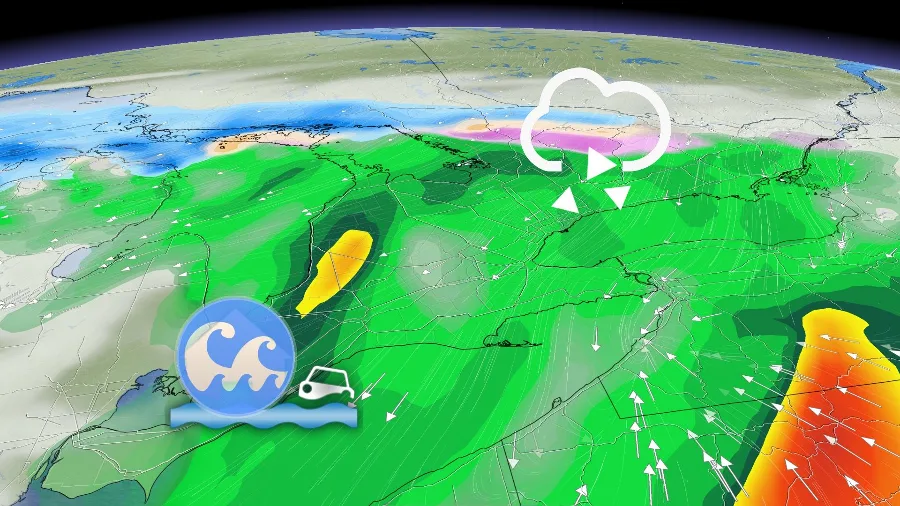
A low-pressure system moving into the Great Lakes is dragging a warm front across the U.S. Midwest. This front will start to push into southern Ontario early Tuesday morning, bringing heavy rain from Windsor to Niagara. There is even the chance of a rumble of thunder and some lightning. The system will stall out not far from the northern shores of Lake Erie.
A difference of just a hundred kilometres in the location of this stalling front meant the difference between unusual January warmth and a chilly, dreary day.
Since the front will come to a halt, the day’s warmest temperatures will remain confined to far southwestern Ontario, where areas southeast of Windsor sitting just the double-digits at 9°C. North of the warm front, temperatures will remain in the low single digits.
CHECK IT OUT: How Colorado lows affect your weather in Canada
Steady rainfall will accompany the warm front as it pushes into southern Ontario. The heaviest rain is likely along the Erie shores, where rainfall warnings are in effect through Tuesday.
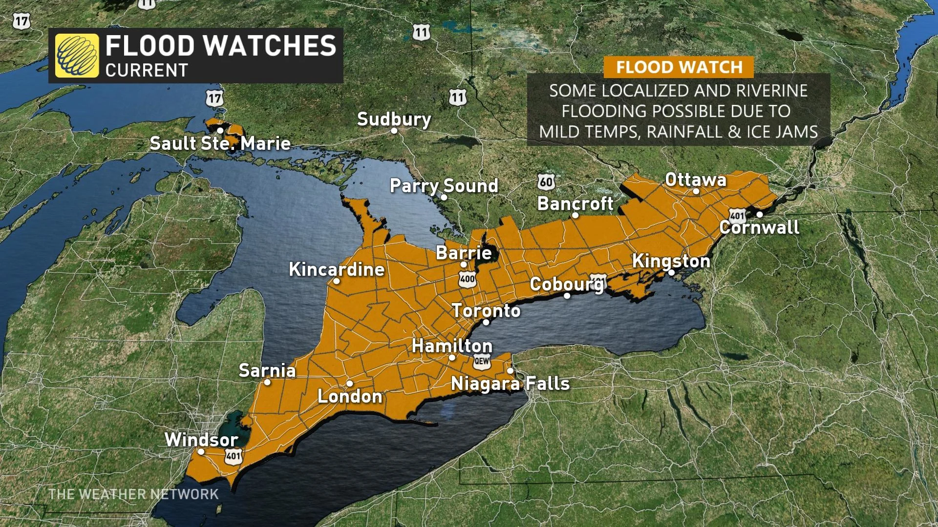
“Localized flooding in low-lying areas is possible. Keep children and pets away from creeks and river banks,” Environment and Climate Change Canada (ECCC) said in its rainfall warning.
The rain will continue for several hours before tapering to showers from west to east Tuesday afternoon. Rain moves into the Greater Toronto Area (GTA) by the late morning into the early afternoon.
MUST SEE: Shop our best of 2022 list and be ready for any weather condition
Dense fog is also possible as the warmer, more humid air tries to scour away the cooler air at the surface.
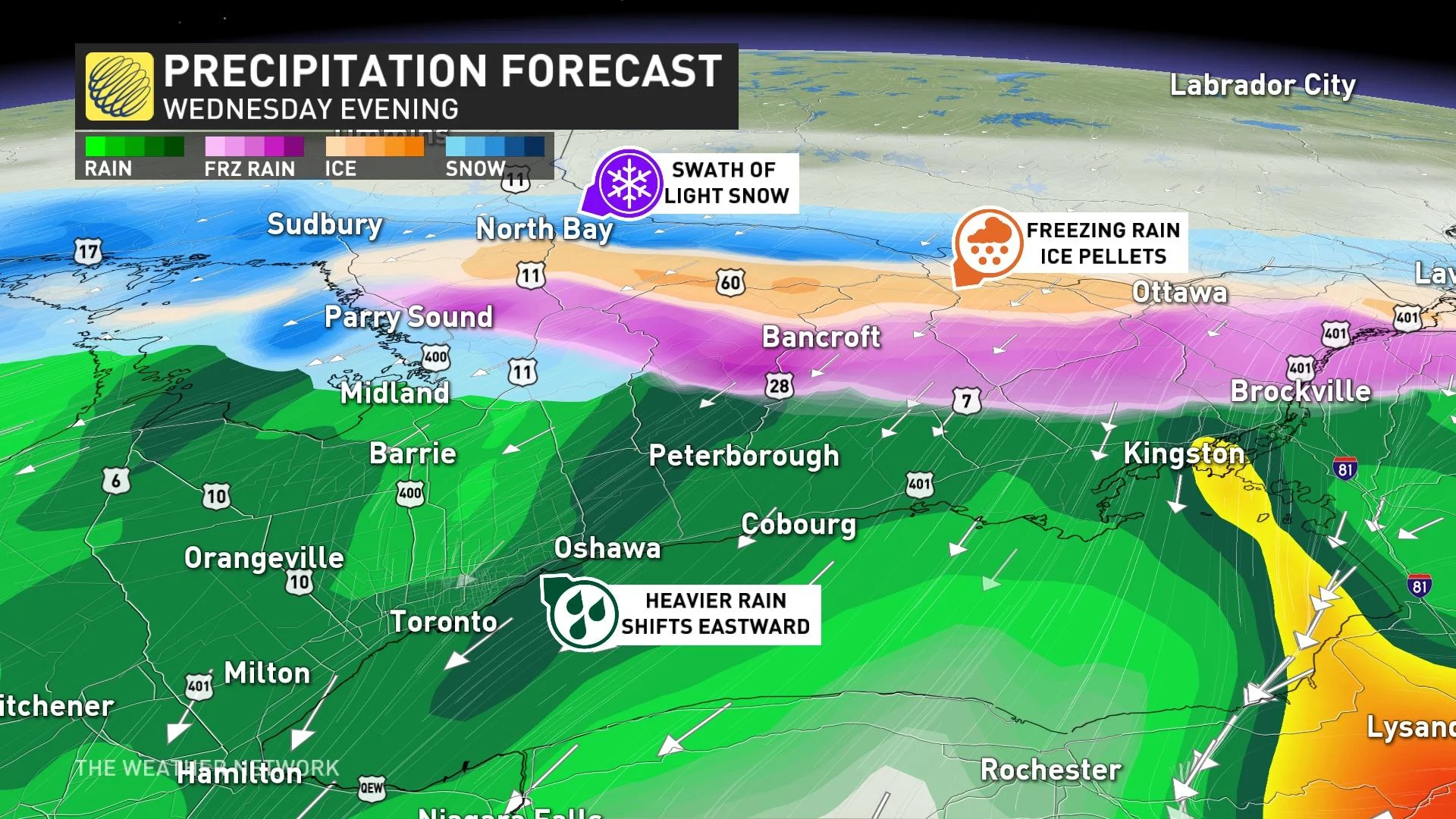
A renewed batch of precipitation will push deeper into Ontario on Wednesday afternoon and evening. Colder air sliding in from the north will undercut the warmer air over eastern Ontario and cottage country, forcing this precipitation to fall as a wintry mix, or as freezing rain and/or ice pellets.
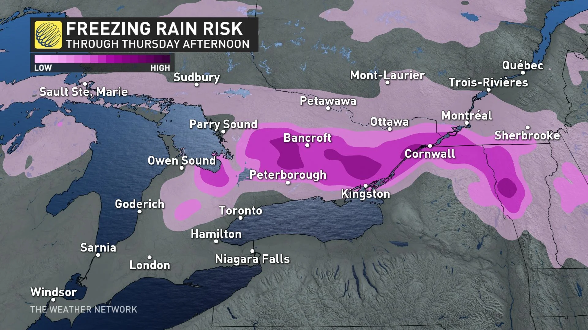
Freezing rain and ice pellets are possible for much of eastern Ontario, parts of cottage country, the northern shores of Lake Ontario and portions of southern Quebec starting Wednesday evening and lasting into Thursday morning.
Thursday morning will see colder air filtering in, transitioning the precipitation to snow for the GTA, Grey-Bruce region and eastern Ontario.
The ice accretion from freezing rain could cause travel issues, and possible damage to trees and power lines in the hardest-hit areas. Stay tuned for details as we get closer to the event.
Temperatures will start to fall back toward seasonal behind this system, with daytime highs around the freezing mark expected for much of the region by next weekend.
Check back for the latest on conditions across Ontario and Quebec.