
Colorado low set to speed into the record books
As at least one user on Twitter said, it might be time to get out of Dodge.
The U.S. National Weather Service has issued a wide swath of watches and warnings associated with the Colorado low currently taking shape over the U.S. Plains, but this storm looks to be something more unusual than your run-of-the-mill spring storm. In fact, model guidance and observed pressure trends suggest this low might do something pretty unusual, at least for storms over land: It might become a weather bomb.
Visit our Complete Guide to Spring 2019 for an in depth look at the Spring Forecast, tips to plan for it and much more
A 'bomb cyclone' is a storm system wherein the central pressure drops by at least 24 millibars in 24 hours. In Canada, we're probably most familiar with them in the form of some of the more intense nor'easters that roar into the Maritimes, but they're not entirely unheard of over the continent; the so-called 'Cleveland Superbomb' was such a storm, back in January 1978.
This current low has the potential to become just as powerful as its Cleveland counterpart, packing wind gusts near 100 mph (160 km/h) and dumping more than a foot of snow on parts of the Plains, while also giving rise to the threat for severe weather in the South.
Another possible feather in its cap? The all-time record low pressure recorded in Dodge City, Kansas.
So what's giving this storm its potent punch? It's mostly just being in the right place at the right time. In this case, it's the collision of a very winter-like feature moving down from British Columbia and a very spring-like feature over the southern Plains; the best (or worst) of both worlds when it comes to our shoulder seasons.
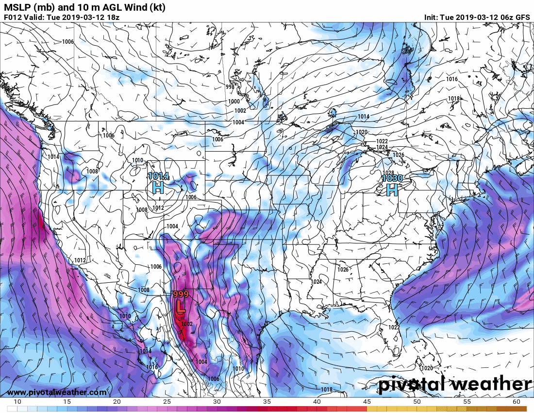
You can see these two features merging (or 'phasing') in the image below. The centre of rotation over Baja California is providing the dyanmic setup for the storm, and the one swooping down from near British Columbia is bringing a shot of colder air to help it strengthen rapidly.
The main thing that distinguishes this low from others isn't so much the setup as the location.
Lows of this type frequently form over Colorado -- that's how the term 'Colorado low' became a household name -- but they don't usually sit around in the Central Plains while they intensify. Instead, they generally speed along with the jet stream toward the Great Lakes or the U.S. Northeast, with the central pressure deepening as they go. The fact this system will spin up to hurricane-like intensity (at least, when it comes to the central pressure) without even making it out of Kansas is rare, to say the least.
The centre of circulation is expected to coalesce over New Mexico Tuesday night, and reach its deepest pressure by late Wednesday night.


