Ontario: Widespread rain, snow as potent system tracks through

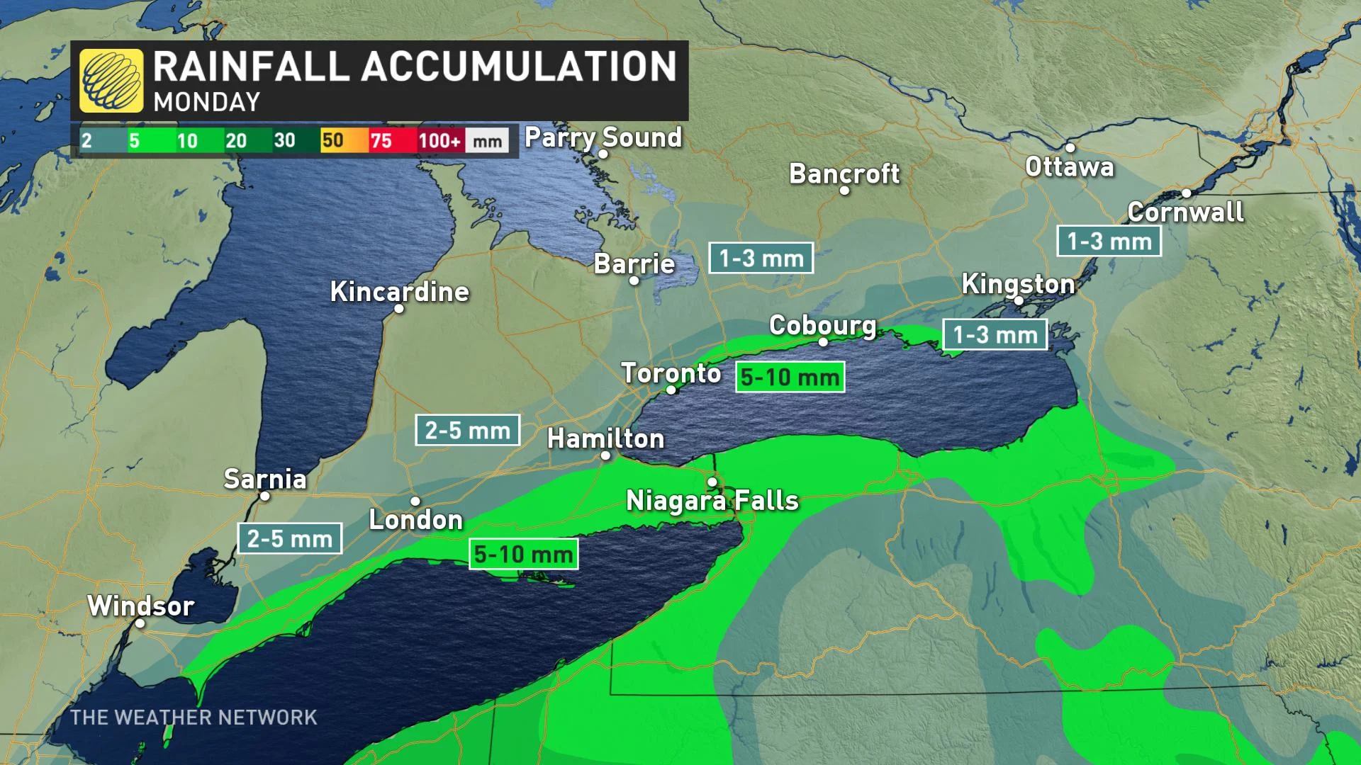
A system that will track through southern Ontario will bring rain for the Niagara region and the GTA while eastern regions will see higher snowfall accumulations between 5 and 10 cm. The wet snow will begin in the morning and will transition to rain in the GTA during the early afternoon hours, while eastern Ontario will see snow into the evening. Details and timing, below.
WEATHER HIGHLIGHTS
Snow transitions to rain by early afternoon on Monday for southwestern regions
Snow continues into evening for eastern Ontario, around 5 to 10 cm possible
Stay up-to-date on the weather ALERTS in your area
MONDAY: SNOW, RAIN TRACK THROUGH
The precipitation that began on Sunday evening will continue as snow for southwestern regions until it shifts to a rain/snow mix in the morning hours on Monday.
This rain/snow mix will occur along the Highway 401 corridor from Hamilton to Belleville while rain falls in the Niagara area and south of the 401 along Lake Erie to Chatham-Kent.
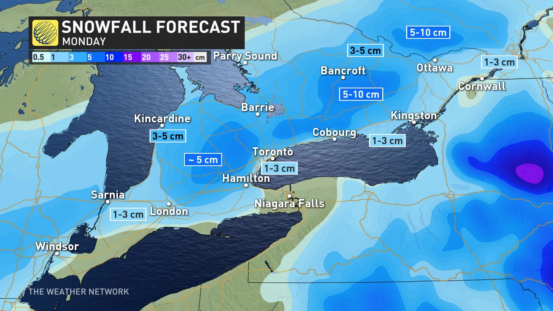
By noon the switchover to rain will have already occurred in the GTA and will have moved out of the southwest, though snow or a rain/snow mix will continue a bit longer for areas east. The precipitation will be over for the GTA by the afternoon and will end in the east through the evening hours.
Accumulations will depend on elevation and distance to the shores of the Great Lakes. Currently, less than 2 cm will fall for the southwest and most of the GTA, with some 3-5 cm at higher elevations for most of the rest of the province. The heaviest amounts are likeliest for parts of eastern, central Ontario away from Lake Ontario and the Ottawa River, where 5 to 10 cm could occur.
High pressure will settle over southern Ontario on Tuesday and will give the region a break from precipitation.
Stay tuned to The Weather Network as we continue to update the forecast details.


