20+ cm possible in southern Ontario under prolonged snow squalls

Prolonged snow squalls are in the forecast for parts of southern Ontario through the weekend as cold winds blow over the relatively warm lakes. Some areas could wind up with 20+ cm of snow over the next few days, an abrupt and rather rude end to the warmth we’ve seen this week.
This will be the first significant multi-day snow squall event of the season, so drivers are urged to prepare for rapidly changing conditions.
DON'T MISS: Why snow squalls are one of the hardest events to forecast
This weekend: Swing in seasons as mild rain gives way to cold and snow
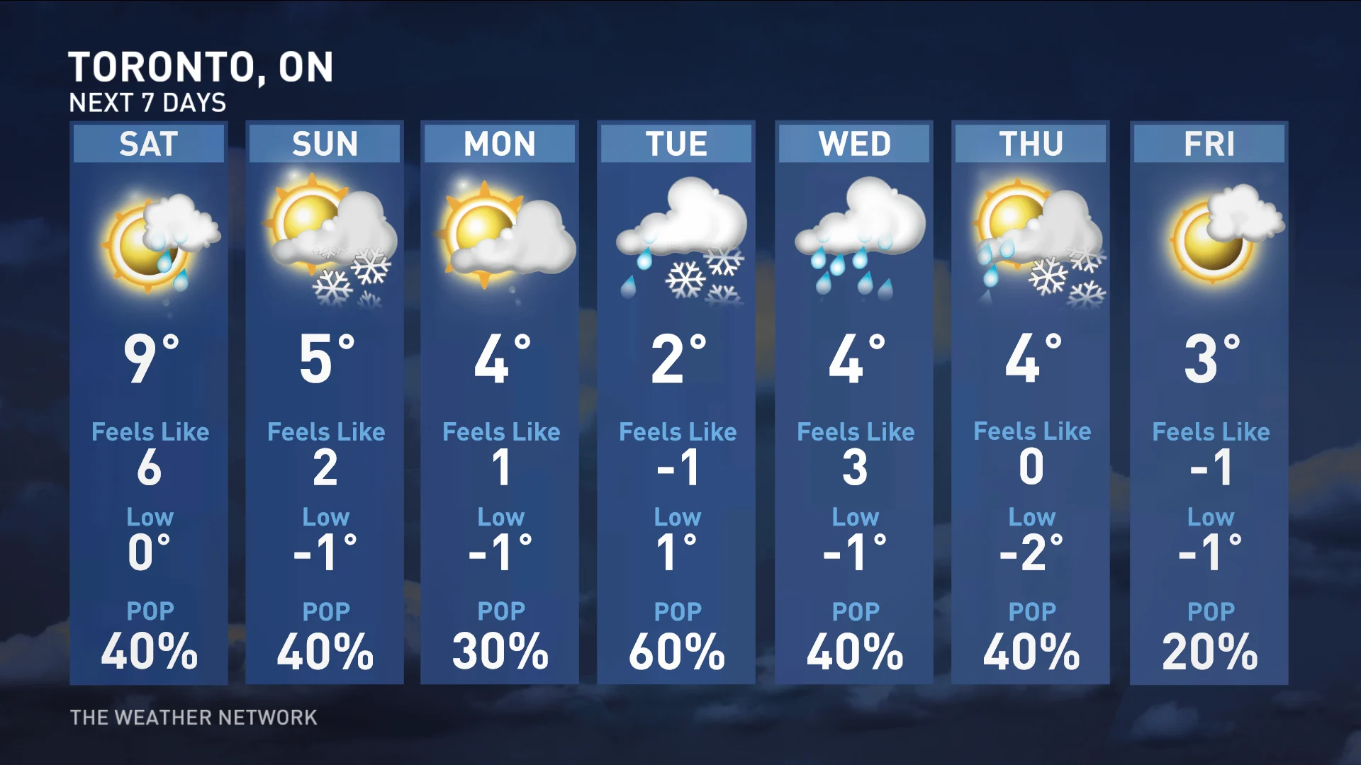
Most folks across southern Ontario will wake up in a different weather world than the one they saw off to sleep on Friday night. A cold front pushing through the eastern Great Lakes will sweep away the tropical influence of former Hurricane Nicole and allow much colder air to take its place.
WATCH: Heavy snow targets the GTA this weekend, where to expect it
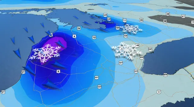
Conditions will also turn blustery and much colder behind the front, with snow flurries and lake-effect snow squalls expected to develop southeast of Lake Huron and Georgian Bay late Saturday and Sunday. This will be the first multi-day snow squall event of the season.
SEE ALSO: Could a hurricane’s remnants give Canada its last 20C temperature?
The hardest hit areas could locally see 10-20 cm of snow. Conditions will change rapidly over short distances beneath snow squalls, potentially catching drivers by surprise when visibility drops to near-zero in spots. It never hurts to take it slow and consider changing non-essential plans in areas expecting heavy snow this weekend.
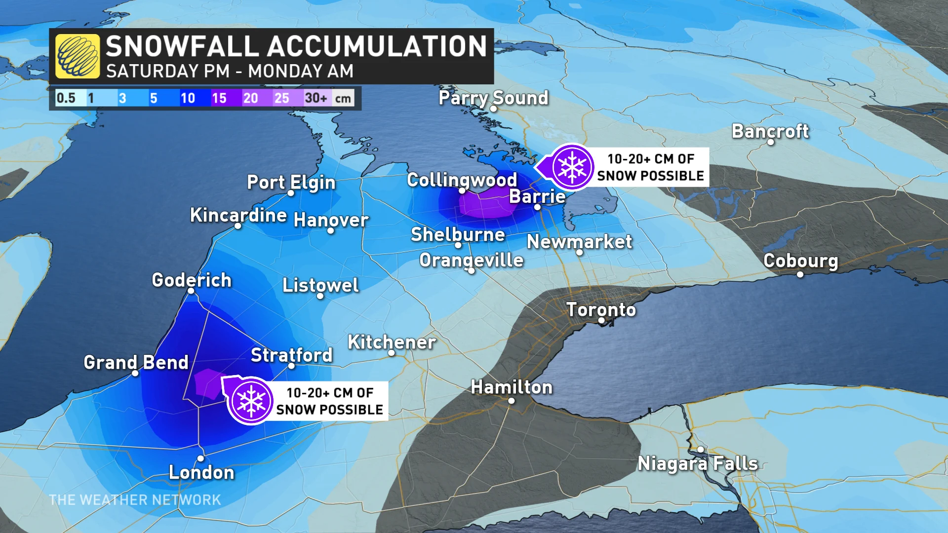
Meandering bands of lake-effect snow could drop 10-20 cm of accumulation in some areas, with gusty winds blowing around any snow that begins to pile up. Blowing snow will reduce visibility even in areas where snow isn’t falling at the time.
Some of the squalls could grow potent enough that we might see snow poke into the Greater Toronto Area and 400-series highways. While no accumulations are expected here because the ground is still warm, it'll serve as a reminder that winter is indeed on its way.
Widespread colder than seasonal conditions are set to dominate next week and beyond, with another reinforcing shot of Arctic air and temperatures more typical of early December at times.
This should bring additional lake-effect snow to the traditional snowbelt areas east and southeast of the Great Lakes.
DON'T MISS: Icy weather is inevitable. Here's what you need to prepare
Heavy snow and ice spread across northern Ontario, dangerous travel continues through Friday
Meanwhile, much of northern Ontario has already been dealing with a fair bit of impactful wintry weather this week, with heavy snow, ice and freezing rain continuing for many communities through the day on Friday.
The combination of snow, gusty winds, and ice accretion on exposed surfaces could lead to dangerous travel across the region during the storm.
By the time all is said and done into Saturday morning, some of the hardest hit areas may end up with 40 cm of snow, or ice accretion of 5 to 10+ mm.
"Consider postponing non-essential travel until conditions improve," said Environment and Climate Change Canada (ECCC) in some of the winter warnings posted for the region. "Surfaces such as highways, roads, walkways and parking lots may become difficult to navigate due to accumulating snow. Visibility may be suddenly reduced at times in heavy snow."
Be sure to check back for the latest weather updates across Ontario.