Chasing ‘the most elusive weather’: Whimsical waterspouts

Meteorologist and longtime storm chaser, Mark Robinson, recounts what it was like to witness a ‘water tornado’ for the first time in his career
The raindrops collected in small rivulets that drained down the windshield of The Weather Network vehicle, the grey skies above pretty much matching my mood. It was October 3rd, and I was sitting at the beach on Long Point (north shore of Lake Erie) waiting for the clouds to clear even a little so I could maybe, just maybe, see something I’d never seen; a waterspout on the Great Lakes. Even after so many years of chasing storms across the world, I’d never managed to even see the barest glimpse of one.
The atmosphere was absolutely primed to produce waterspouts on Lake Erie, and in fact, at least one chaser had watched over 30 of them the morning before. I’d be running around like a madman, trying to be in the right place at the right time, but somehow, even amidst one of the largest outbreaks we’d ever seen, they’d remained maddeningly elusive for me.
What I didn’t know at the time was how random they are. They’re not a well studied phenomenon like tornadoes, but they do share some basic characteristics. I talked to my friend Dr. Dave Sills, a Canadian tornado expert, about what it takes to produce one.
RELATED: GREAT LAKES SEE RECORD-BREAKING WATERSPOUTS
“There’s a lot of luck involved with this because the process is more or less, random,” he told me. “You’ve got wind along a boundary at different speeds, and that causes wind shear along the boundary. The shear then creates spin-ups on the water surface, and if you’ve got a rapidly building cumulus above, you can have a sort of vortex stretching – kind of like a figure skater pulling in their arms to speed up a spin.”
WATCH BELOW: SCIENCE BEHIND WATERSPOUTS
So, to get my first waterspout I needed to have a few things fall into place; a warm lake, cold air aloft to allow for the rapid build of a cumulus cloud, and that needed to be along a boundary on the water to create enough sheer to get the air spinning at the surface.
No problem, that should be simple (ha!).
Luckily for me, fall in the Great Lakes region of North America is the prime time for all the dynamics needed for ‘spout formation to be present. All of the big lakes, Erie included, retain their summer heat for a long time into the colder months thanks to the vast amount of water they contain. Given their relative proximity to the Arctic, cold air can easily move south and sweep over them, creating the unstable conditions that can lead to rapid cumulus development (warm air at the surface rising into cold air aloft). Add in a stalled boundary over the lake, and the conditions for waterspouts were just perfect.
So, as I sat in the car watching the grey cloud deck slowly give way to broken blue sky -- then I looked at the radar, hoping to see a line of showers beginning over the lake. Instead, what I saw was a bunch of showers heading right towards me. If they were to produce a waterspout, would they come onshore?
While had a moment of panic, I recalled Dave’s words, “Anything that causes enough rotation that causes the water to spray up in the air, where you get a spray vortex at the surface, can cause damage to a boat and when it comes on shore, it might take out some trees before it dissipates.”
So, waterspouts can be dangerous, but generally, the wind speed doesn’t get much beyond 120 km/h, and the average speed is about 80 km/h. While you might get knocked over in a boat (or even worse, sunk if the boat were to be flipped), any shelter onshore would likely keep you safe. So, I was probably going to be ok in the car.
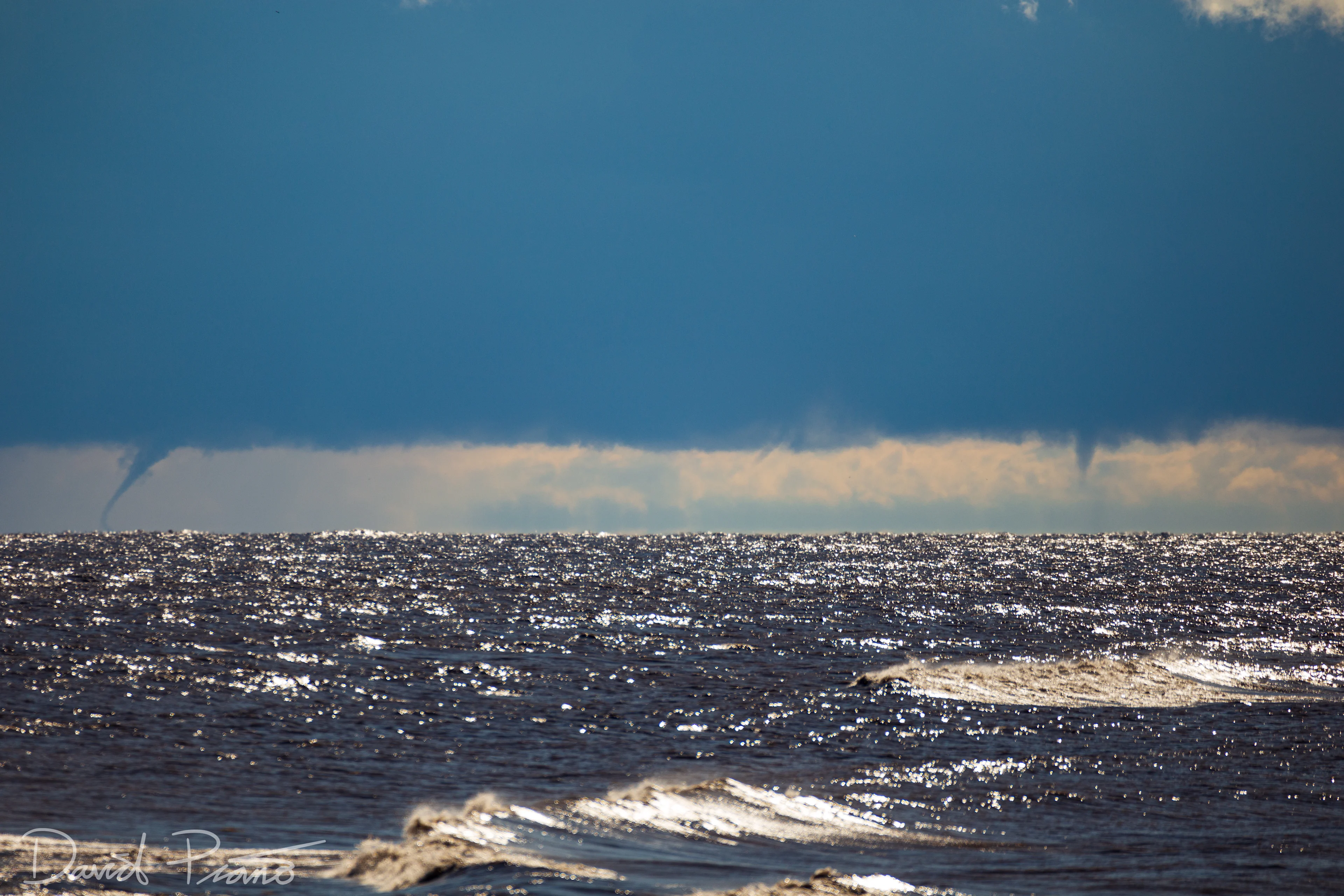
Still, even as the rain began to slow and stop, I wanted to chance a quick run over to the beach where I’d be able to see to the south (leave this to the professionals!). A line of showers was evident on radar south of the cells that were making their way towards me. If I were able to see the southern showers, the first thing I’d likely be able to pick out would be a spray ring which forms as the rapidly spinning vortex begins to build up from the water’s surface.
Next, the most obvious sign would be a funnel shaped cloud dipping down from a flat cold base beneath a rapidly building cumulus cloud. Finally, if the waterspout was close enough, a tubular funnel would connect the spray ring and the cloud base.
As I trudged up and over the massive dunes that separated the parking lot from the beach, I pulled my rain jacket around me, hoping that I’d finally get my waterspout. The cold air mass that had spread over the Great Lakes was moving away, and this was the last chance I’d have until the next storm moved through. As I wiped water away from my face and turned the corner to the beach, the line of storms to the south came into view.
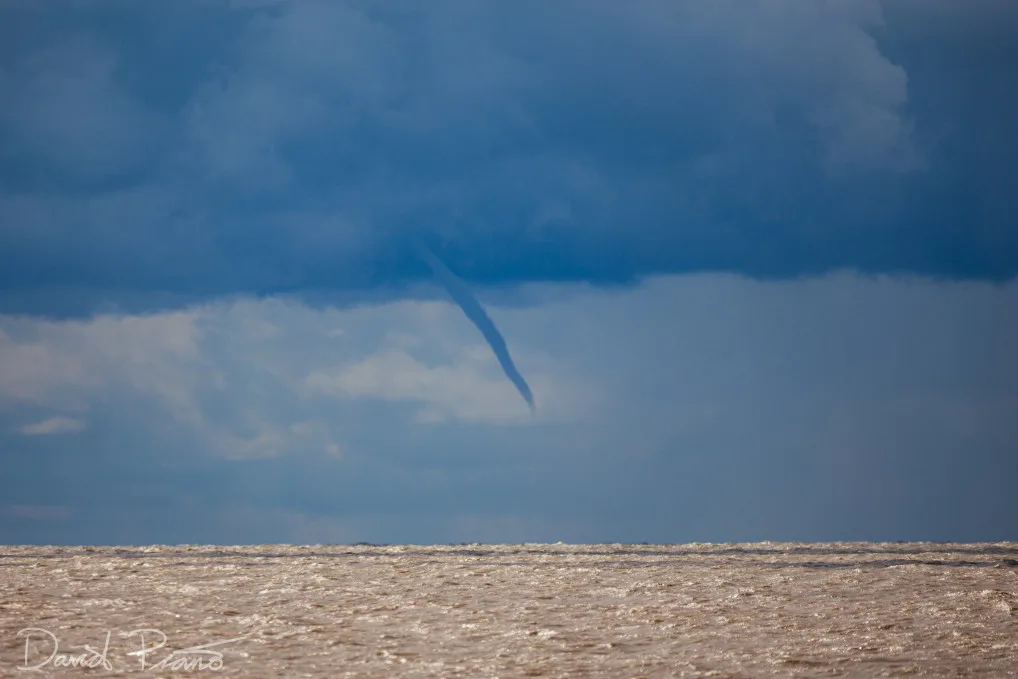
And there it was.
Waterspout captured on Lake Erie, October 3, 2020. Courtesy: David Piano/@ONwxchaser
A big funnel, big enough to not be anything, yet, but the start of a waterspout hung below the line of the showers and building cumulus.
Waterspout.
An actual waterspout!
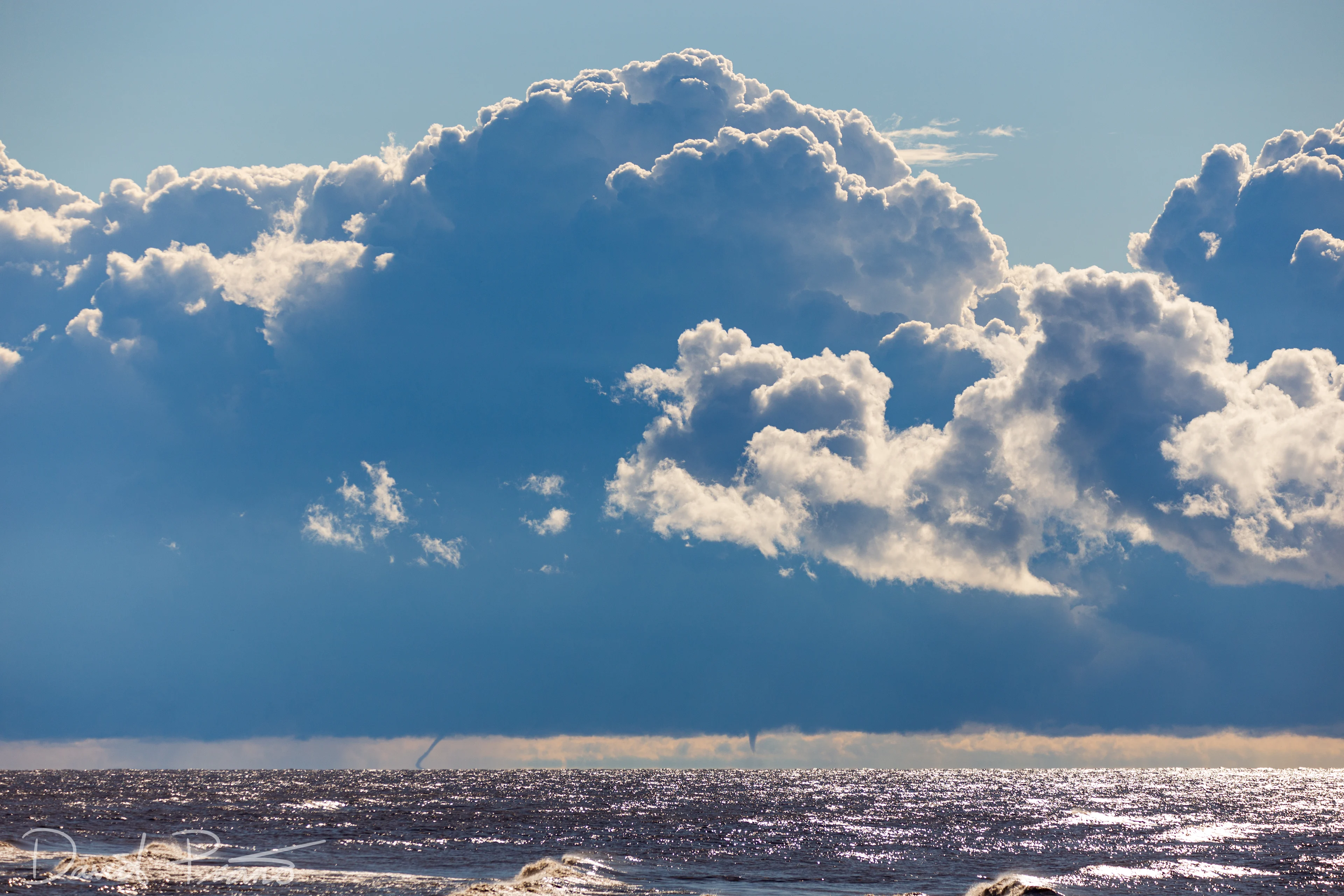
Though it didn’t last long, it still counted towards the massive outbreak between September 28th 2020 and October 4th. A total count of 232 waterspouts made it one of the biggest outbreaks on the Lakes ever seen.
And the season is still ongoing.
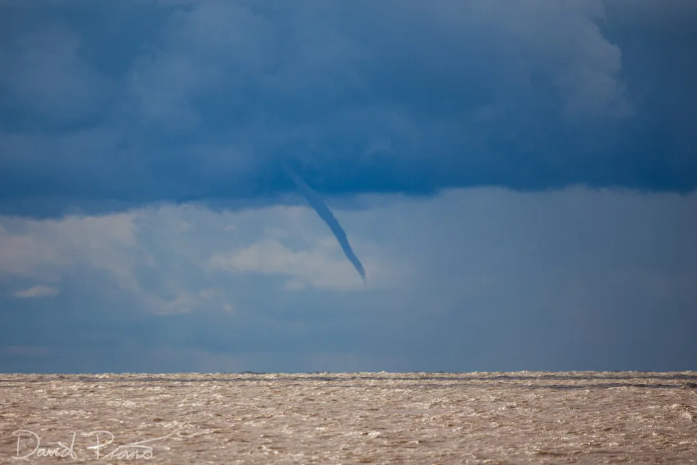
Waterspout captured on Lake Erie, October 3, 2020. Courtesy: David Piano/@ONwxchaser
Waterspout captured on Lake Erie, October 3, 2020. Courtesy: David Piano/@ONwxchaser
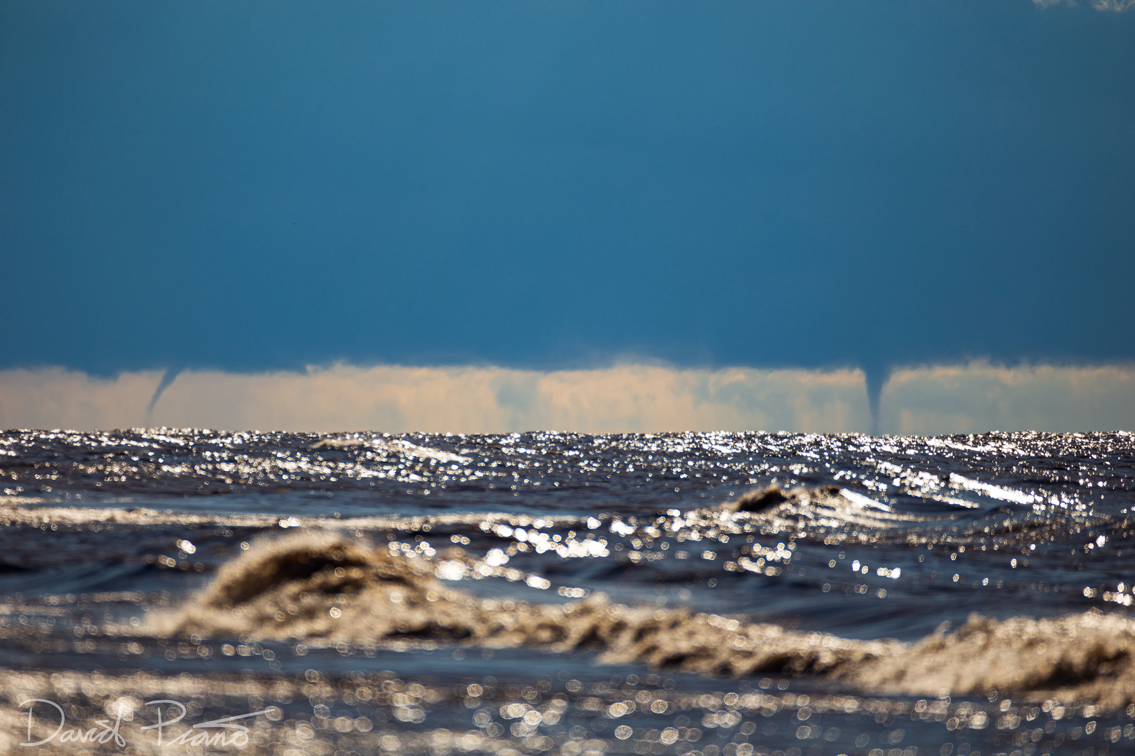
Waterspout captured on Lake Erie, October 3, 2020. Courtesy: David Piano/@ONwxchaser