B.C.'s 'stormy' pattern won't flip the switch on the current drought

While B.C. is finally undergoing a pattern change that is bringing it some sorely needed rainfall, it won't immediately eradicate the months' worth of drought it has endured, so negative effects will be seen for some time still
British Columbia's weather pattern may have quickly flipped the switch from mid-summer-like conditions right into the heart of fall and a storm parade last week, but that doesn't necessarily mean we will see fast relief from the dire drought situation across the province.
"Drought conditions are tough to snap out of right away," tweeted Tyler Hamilton, a meteorologist at The Weather Network, "and it often takes several systems to tip the balance towards a more traditionally wet pattern."
Where is the rain from the recent storm parade falling?
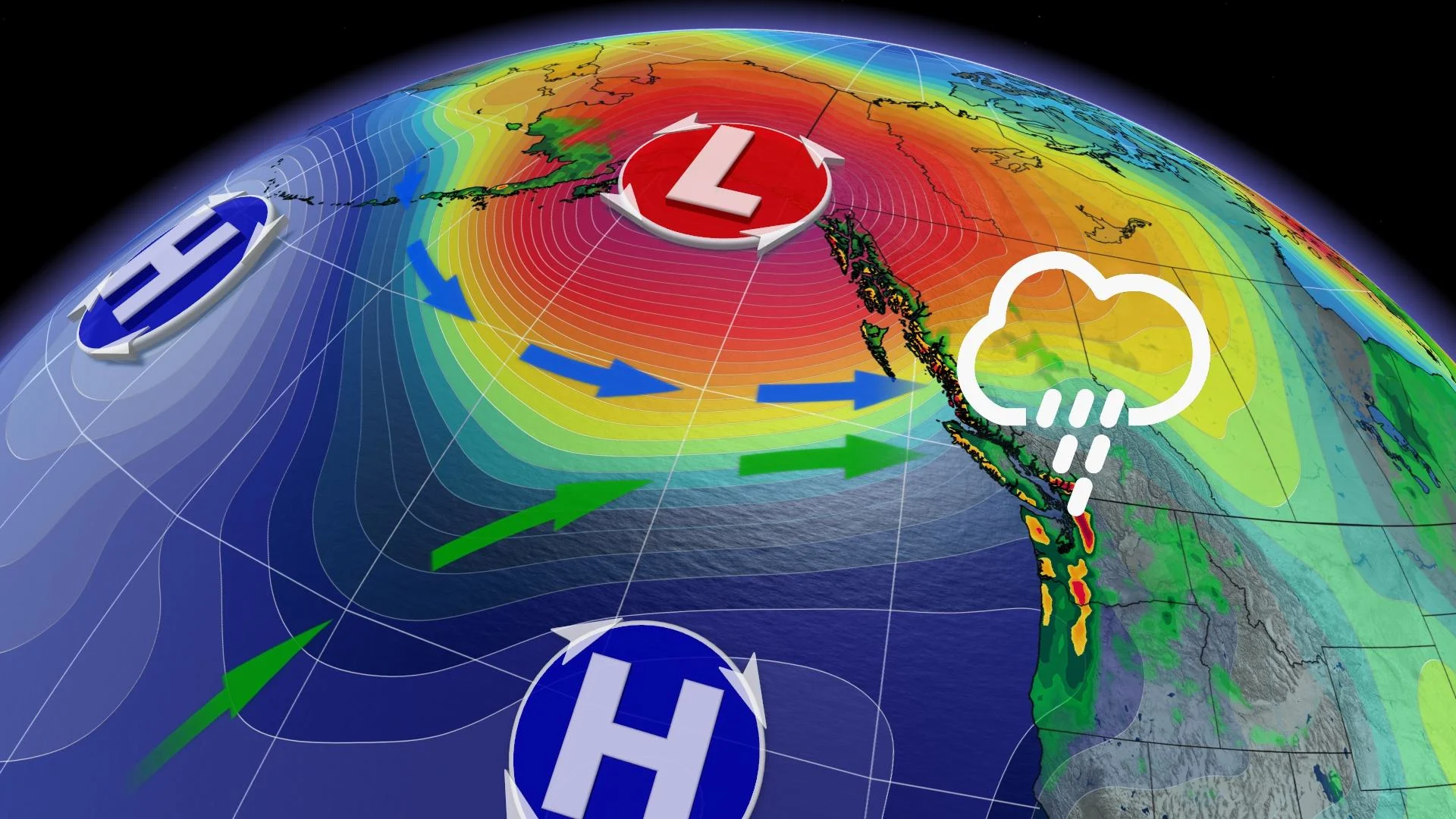
With the jet stream's focus into the B.C. coast, a parade of systems from the Pacific have begun their trek into the province, delivering much more fall-like weather and precipitation. But this doesn't necessarily mean everyone is receiving significant rainfall.

"The focus of the systems have taken more of a central or northern track into the coast, delivering higher rainfall totals to northern communities along the coast and into southern Alaska," explains Kelly Sonnenburg, another meteorologist at The Weather Network. "As the fronts slide south, precipitation totals lessen."
Topography and rain shadows also play a significant role in how much rain communities and locations receive.
You can clearly see the difference with the total rainfall amounts so far this month.

Juneau airport - 220 mm
Prince Rupert - 134 mm
Terrace - 50 mm
Bella Bella - 53 mm
Versus:
Vancouver (YVR) - 1.6 mm
Kelowna - 6 mm
Victoria - 2 mm
Squamish - 2 mm
Port Alberni - 4 mm

Now, as we head through the end of October, the pattern will remain unsettled and more fall-like for the province, with chances for more measurable rainfall to the South Coast.
A slow ease into a wettern pattern isn't a bad thing, either, especially after conditions have been so dry. Storms often travel in packs in B.C., with the wettest months of the year being October to March. How the rain falls, especially in those initial storms when the ground is at its driest, but also throughout the rainy season, could spell the difference between beneficial and costly impacts for the region.

RELATED: Wanted: Several 'gentle' storms for B.C.
It also takes much more than a few weather systems to break a long-range drought.
WATCH: A return to normal fall weather, except for part of the South Coast
Stay tuned to The Weather Network for the latest forecast updates for B.C.