B.C.: After rounds of snow and cold, a return to normal beckons

As one storm moves out, another one moves in. Eyes on a weekend system that threatens even more snow.
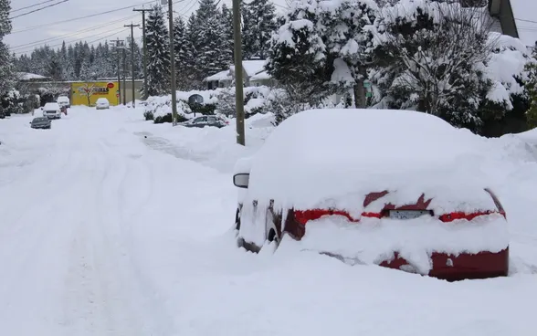
The significant winter storm that has targeted B.C.'s South Coast with heavy snow and powerful winds this week is gradually loosening its grip, though some rounds of snow will persist into Friday morning. Beyond is a return to seasonal temperatures, and the next shot of moisture moving in for the weekend. More on the timing, below.
January outlook: Checking in on winter in Canada with The Weather Network's Dr. Doug Gillham
WEATHER HIGHLIGHTS:
Last lingering snowfall ends early Friday
Temperatures recover to seasonal values into the weekend
Next round of weekend moisture will be mostly rain for the coasts
Stay aware of ALERTS in your area
INTO THE WEEKEND: ACTIVE WINTER PATTERN CONTINUES, SNOW CHANGES TO RAIN
People in B.C. don't need forecasters to tell them how uncommonly cold it's been in recent days, thanks to Arctic outflow that sent cold air right down to the coasts, a big factor in the progressive rounds of snow have afflicted the region.
But the harshest of the cold air was already in retreat Thursday, with temperatures slowly creeping back up to the 0°C mark, and they'll keep rising into the weekend, marking a return to what the province would consider 'normal.'
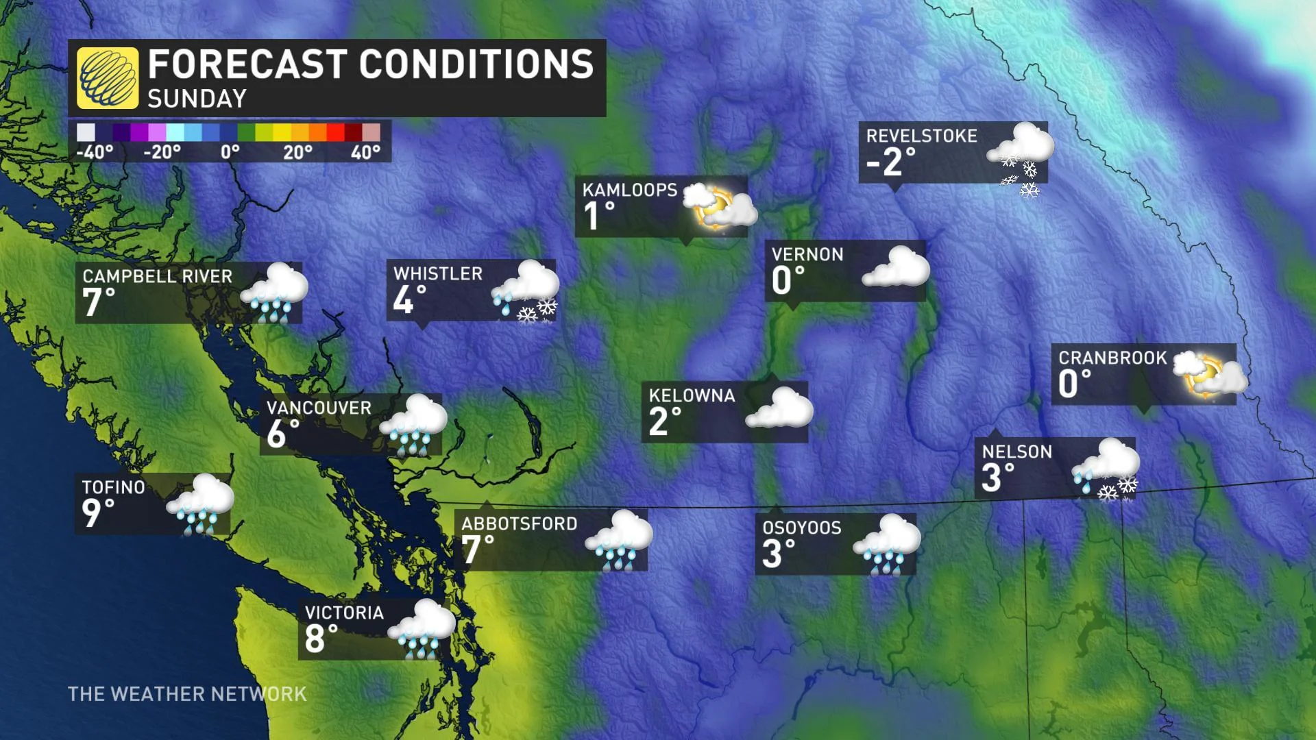
Forecasters are already eyeing the next round of moisture ahead, however, but its impact won't be the same as the one that will shortly exit the region.
As this new weekend system moves in, a shot of widespread snow will push across Vancouver Island and the Lower Mainland once again, but accumulations will be limited thanks to those recovering temperatures, and will soon switch over to all-rain for the coasts, with higher elevations mostly staying as snow.
But though this won't be another snowy experience, the uncommon snowfall in recent days will bring a double sting in the tail.
Heavy rain on top of the snow may lead to rapid melt and localized flooding, while at the higher elevations, rising freezing levels will mean elevated avalanche risk going into the weekend.
Check back as we continue to monitor this setup.