B.C.: Potential for severe thunderstorms, flash flooding in the Interior

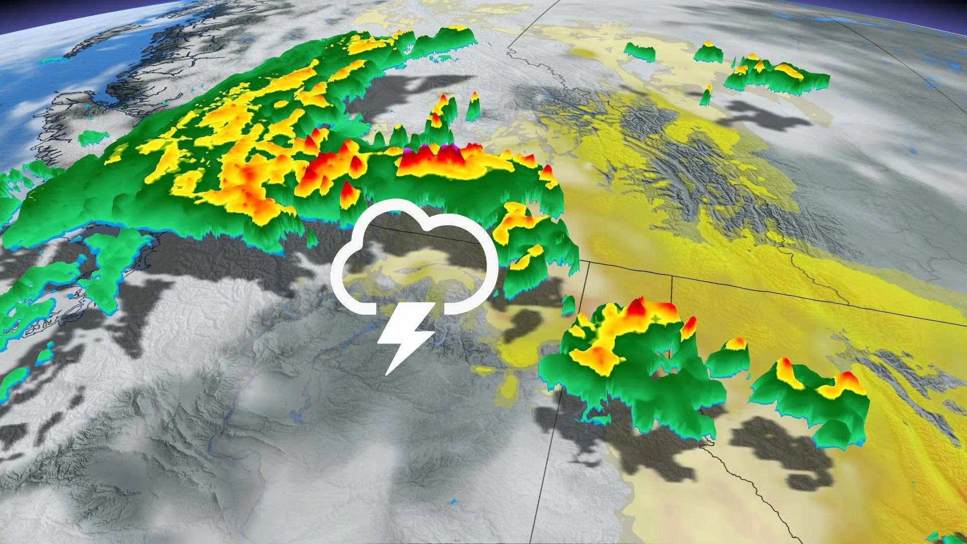
Forecasters are keeping a close eye on the B.C. Interior, as severe thunderstorms may develop in the region late Saturday evening, which has elevated concerns over flash flooding in some areas. Flood watches, high streamflow advisories and a state of emergency are in place over the anticipated rainfall with the storms Saturday. Some of the storms near the U.S. border may become supercells. There are severe thunderstorm watches, special weather statements in effect. Timing, details, below.
WEATHER HIGHLIGHTS
Severe storm risk with second trough in the Interior late Saturday evening, overnight
Chance of supercells; main threats will be flash flooding, strong winds, large hail, heavy rain
Flood watches, high streamflow advisories, state of emergency issued
Keep ahead of ALERTS in your area
SATURDAY: POTENTIALLY SEVERE STORMS IN EVENING, FLOODING RISK
While the first short-wave trough triggered some rain and thunderstorm development through early Saturday afternoon in the south, the main concern is with the one that will follow. An upper-level, southwesterly flow is helping pump in warm, unstable conditions, favourable for thunderstorm development.
After some clearing, the second trough brings the threat of thunderstorm complexes into the southern Interior late evening and overnight that may bring heavy rain, strong winds, hail and flash flooding. Severe thunderstorm watches and special weather statements are in place.
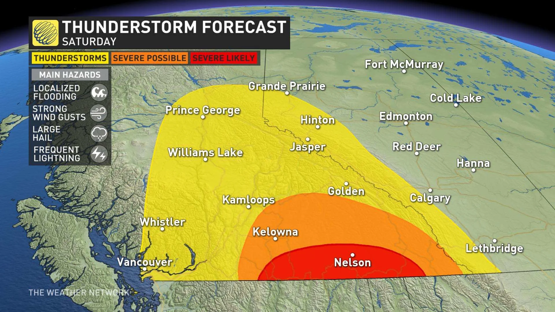
However, the timing may not be as favourable for the greatest severe threat with storms, as daytime heating will start to decrease by 8 p.m. local time. The storms will still be strong and the risk is there for some of the storms near the U.S. border to become supercells.
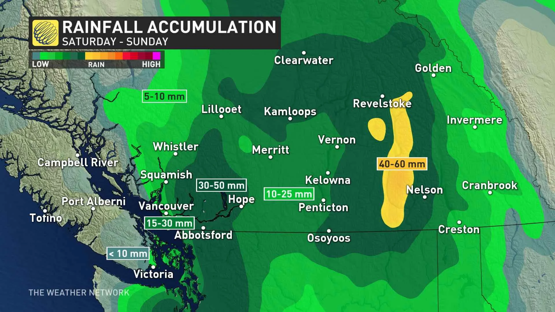
"We are closely monitoring a rare threat for severe thunderstorms across the Interior of southern B.C. The rain will become widespread (heavy at times) across B.C. Saturday night and Sunday with locally heavy rainfall," says Weather Network meteorologist Dr. Doug Gillham says.
FLOOD, STREAMFLOW ALERTS, STATE OF EMERGENCY
The B.C. River Forecast Centre has issued a flood watch for Okanagan and Boundary regions, as well as parts of Salmon River and Bonaparte River in anticipation of the income deluge. As well, high streamflow advisories are in effect for parts of the Thompson, Similkameen, North Okanagan, Quesnel, Horsefly, Cariboo and Nicola rivers.
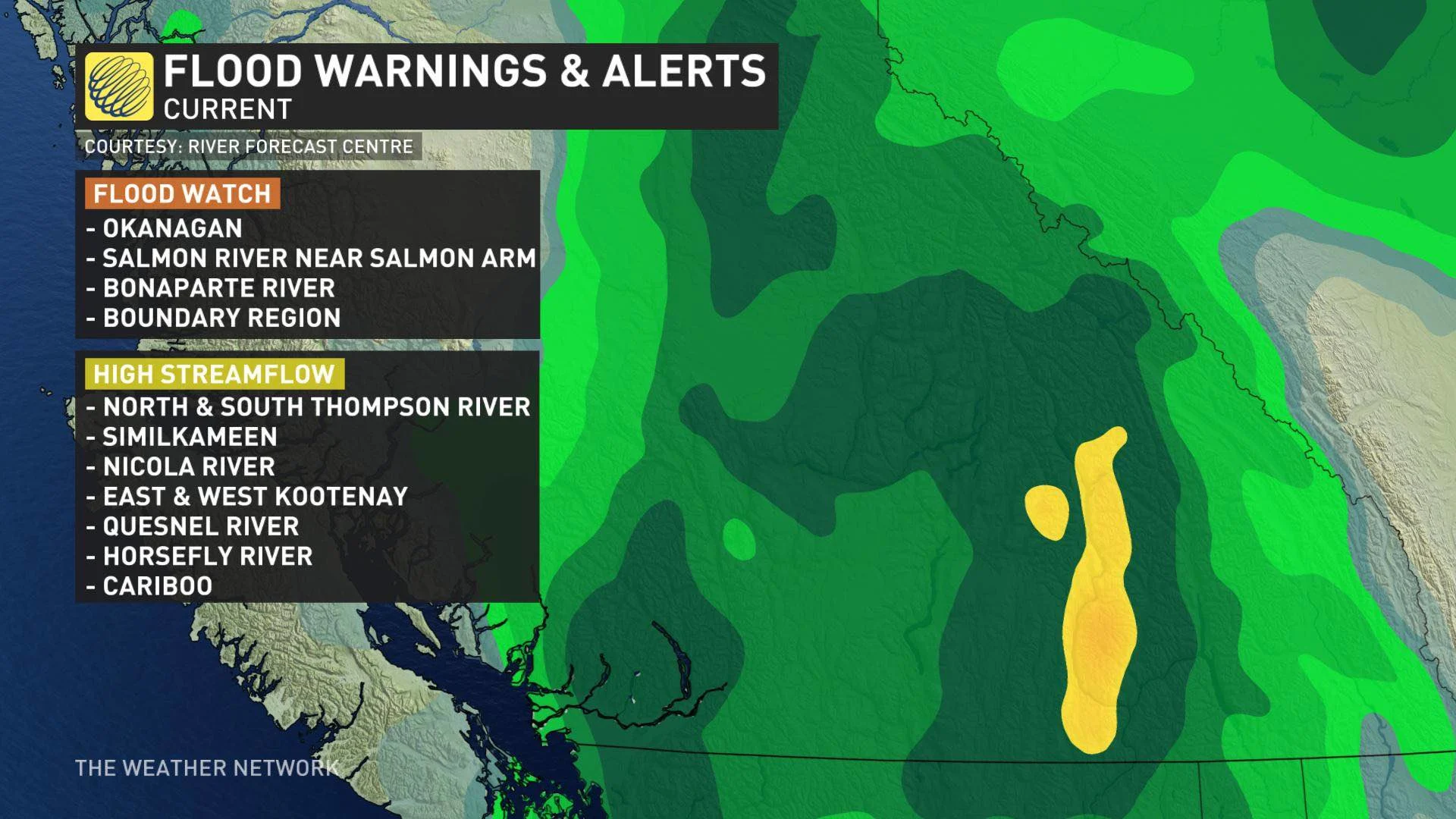
Meanwhile, the Regional District of Kootenay Boundary has declared a state of local emergency for the entire Boundary region, including Christina Lake, rural Grand Forks and West Boundary, as well as the municipalities of Grand Forks, Greenwood and Midway. The district issued evacuation alerts affecting some 2,300 people, indicating residents should prepare to evacuation if ordered to do so.
The rain continues through Sunday across B.C. and then departs Monday.
Beyond the weekend, a drier pattern will arrive for next week, but a couple periods of showers are expected mid-week and temperatures will be near/below seasonal through the week.
Check back as we continue to monitor the forecast.


