Lightning risk as multi-day storms threaten parts of B.C.

The balmy conditions throughout B.C. come with a chance of storms due to the heightened heat and humidity, which have the potential to spark thunderstorms on Wednesday and potentially Thursday. The chance of lightning could raise some concern for regions of the province that have been dealing with abnormally dry conditions since winter ended. More on the timing of the potential thunderstorms, plus a look at who will see 30°C weather, below.
Summer revealed! Visit our Complete Guide to Summer 2019 for an in-depth look at the Summer Forecast, tips to plan for it and much more
WEATHER HIGHLIGHTS:
Conditions ripe for thunderstorms through Wednesday, Thursday
Potential for intense storm activity for South Coast, Vancouver Island
Lightning strikes pose wildfire danger to drought areas
Latest watches and warnings [HERE]
WATCH BELOW: RAIN TIMING
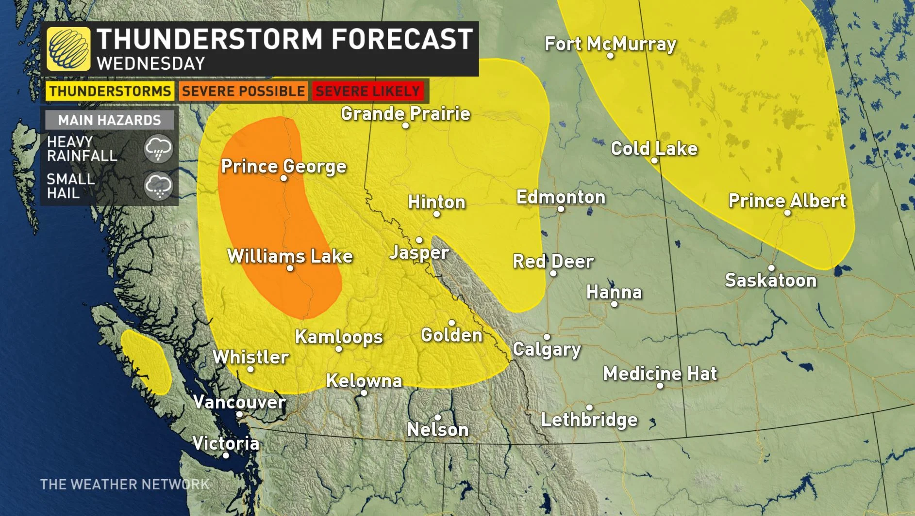
Rising heat and humidity will help to fuel thunderstorms for parts of British Columbia this week, potentially even close to the coast and over Vancouver Island.
While a ridge of high pressure building over the west coast will, by and large, send storm-supporting energy sailing up and around the province, a potent trough of low pressure moves in on Wednesday -- potent enough that it looks to dig into that ridge and potentially kick off a few storms.
With the building heat under the ridge supplying ample fuel, this trigger has the potential to result in some of the strongest storms the region is capable of producing.

The Northern Interior sees the highest chance for severe thunderstorms through Wednesday afternoon, which could involve heavy rainfall and the chance of small hail.
SEE ALSO: Single-use plastic ban could come as soon as 2021
WATER RESTRICTIONS, LIGHTNING, AND FIRE RISKS
Level 3 drought conditions on Vancouver Island have already prompted calls for voluntary water conservation, and with little widespread rain in sight for at least the next week, those conditions are unlikely to improve in the short term.
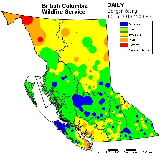
While much of the island remains at low or very low fire danger risk, the south -- including Victoria -- have edged up to moderate to high danger over recent days and the B.C. Wildfire service calls for "extreme caution" for any forest activities.
That makes this week's lightning potential particularly unwelcome. Weather had a major influence on 2018's record-breaking wildfire season in the province amid record heat and major lightning storms. Some 70,000 lightning strikes lit up the province between July 31 and August 1, followed by another extreme lightning event on August 11, resulting in 400 new fires over the course of just two weeks, according to the B.C. Wildfire Service's year-end report.


