A wintry strike interrupts spring in Ontario with hefty snow for some

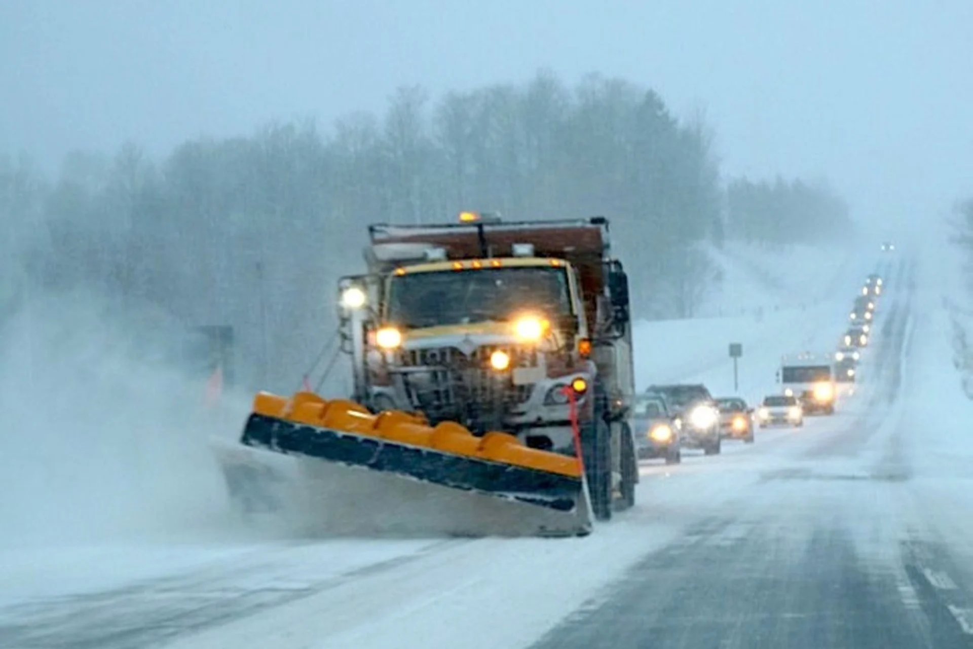
A brief burst of late-season snow could take a toll on travel across parts of southern Ontario this week.
Don't put away the winter clothing and shovels, yet, Ontario. A complex setup is unfolding in the province this week. The end result will see snow in northern and southern Ontario through Wednesday. Some substantial amounts are expected in the northern sections, with 15-30 cm potentially, but the south will see far lesser amounts, though still considerable for this late in the season. Some areas can expect to see 5-10 cm, though Niagara region may potentially see 10+ cm, depending on the final track of the system, which remains uncertain. For more on timing and impacts, read below.
NORTHERN ONTARIO SEES SNOW CONTINUE
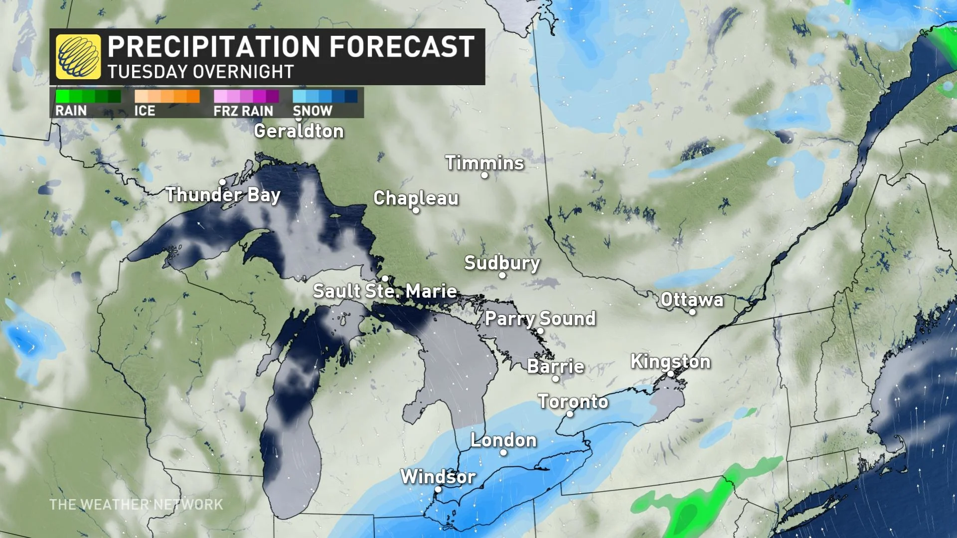
Tuesday morning will see the snow in northern Ontario continue, with the heaviest expected north of Lake Superior. Widespread snowfall and winter warnings in effect. Accumulative totals of 15-25 cm of snow are likely, but areas closer to Hudson Bay may see up to 30 cm.
In addition to the snow, northerly winds gusting up to 50 km/h will result in poor visibility due to blowing snow. Snow will taper off Tuesday evening.
TUESDAY INTO WEDNESDAY: THE 401 CORRIDOR COULD GET 5-10 CM OF SNOW
Meanwhile, in the south, cold Arctic air will pool over the region and send temperatures back below seasonal Tuesday, with single-digit highs expected.
The stateside system will then begin to trek south of the lower Great Lakes overnight Tuesday. With cooler air to work with, the low will bring snow, possibly considerable amounts to parts of southern Ontario, depending on the storm's final track and location.
"But the complex setup will bring forecast challenges, as several pieces will need to fall into place to set the stage for this event," says Michael Carter, a meteorologist at The Weather Network.
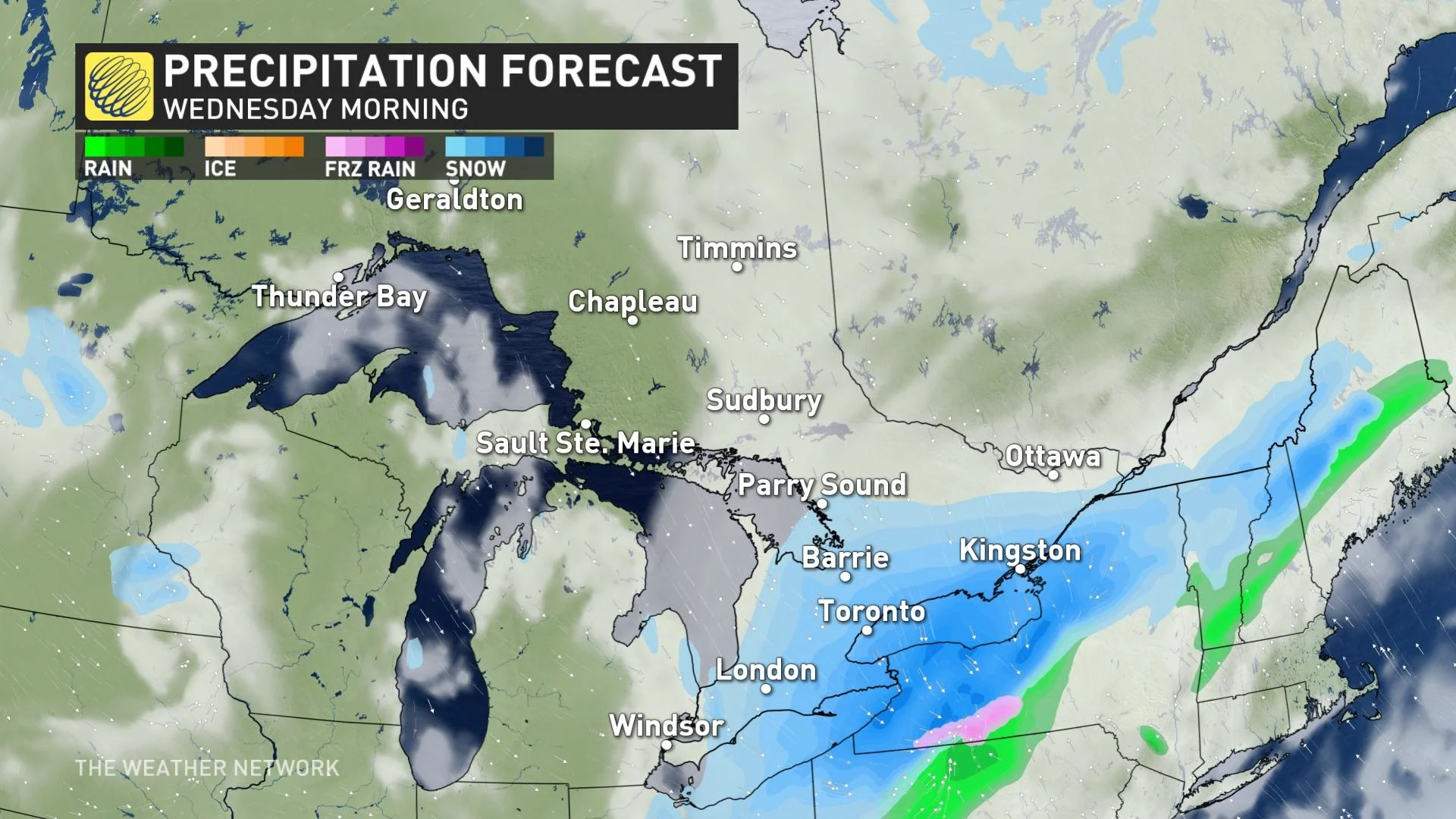
With the potent cold front expected to stall south of the U.S. border on Tuesday, a new wave of low pressure will then form and move eastwards. This new system will absorb some moisture, which will wrap back into the cold air in place. The result is a band of snowfall that will sweep into the Great Lakes Tuesday night though Wednesday, eventually reaching eastern Ontario and southern Quebec.
"The snowfall forecast will depend on exactly where this low pressure develops and tracks, and how far north the moisture spreads," Carter explains. "The precipitation will be pushing into cold but relatively dry arctic air, and so snowfall totals will decrease rapidly north of the low's track."
The forecast will continue to be revised as the event draws closer, as this system does have the potential to bring between 5-10 cm of snow to areas along the 401 corridor, with even locally higher amounts depending on how all of the ingredients come together.
For example, Niagara has the potential to see 10+ cm of snow based on the current track. The situation is similar to Quebec, where amounts will be refined over the coming days as the uncertainty is still there.
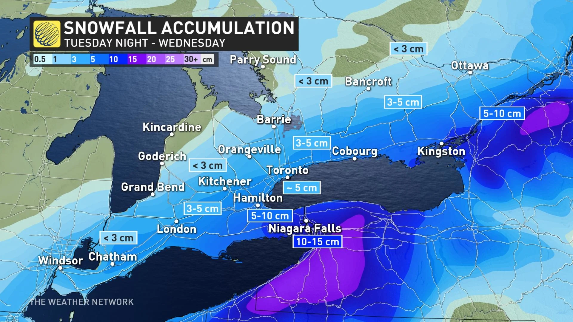
Whatever the final accumulation projections are, conditions and travel will become progressively worse Tuesday overnight, persisting through the day on Wednesday. The focus of snowfall will then shift east towards the Ottawa Valley and Quebec.
LOOK AHEAD: TEMPERATURES RECOVER, SUN RETURNS LATE-WEEK, BUT MORE UNSETTLED WEATHER ON THE WEEKEND
Chilly and below seasonal temperatures will also linger into Thursday in the wake of this system, with the hard freeze of great concern in the Niagara region especially, as blossoms are already out in many orchards.
Abundant sunshine and warmer, near seasonal temperatures return for Friday, as fair conditions start out the weekend.
"So while this week's snowfall is likely to be disruptive considering the time of year, it won't be sticking around for long," Carter adds.
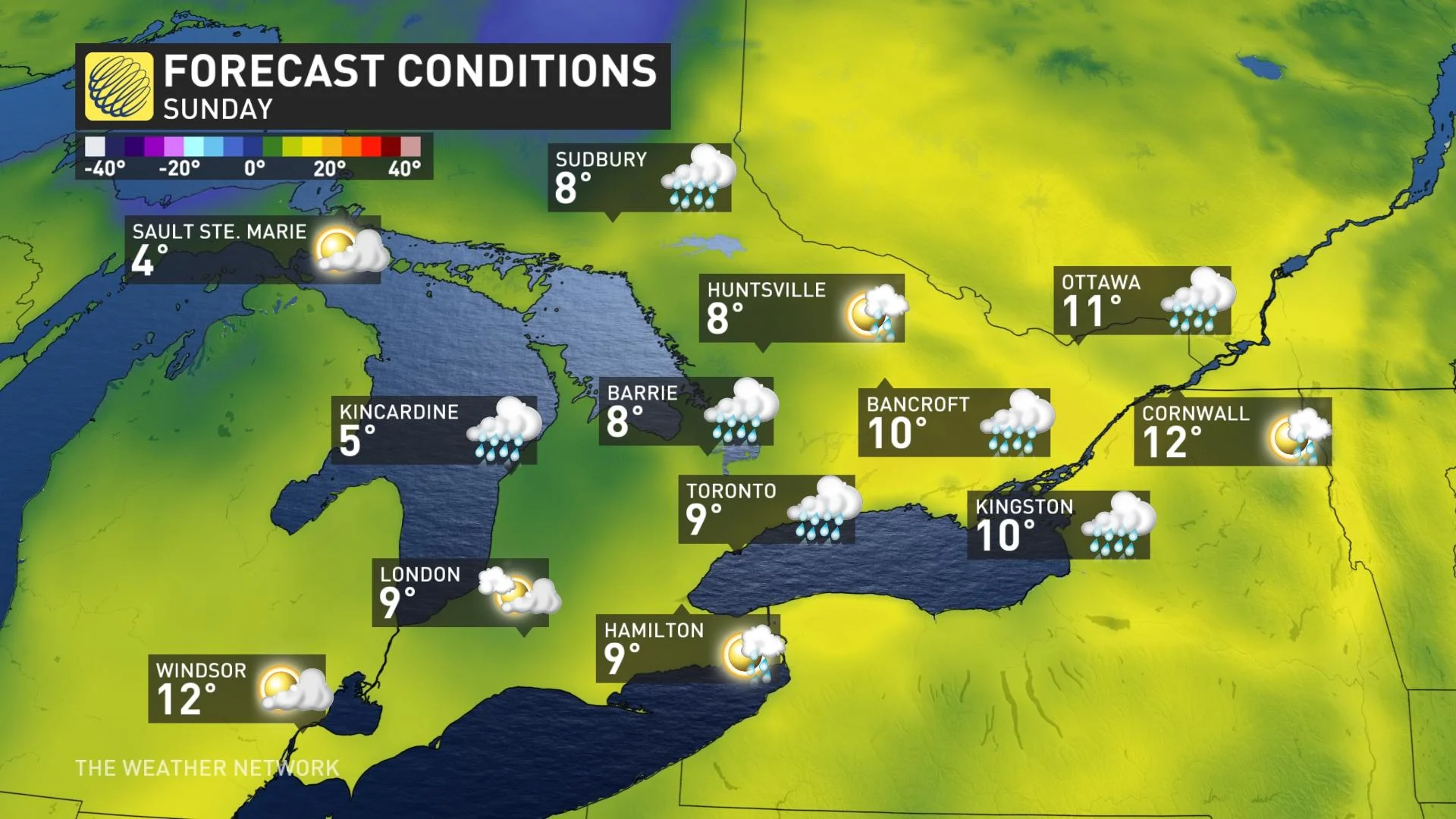
However, a system will track across southern Ontario Saturday night with widespread rain that will linger into Sunday for eastern areas. Temperatures will be cooler than seasonal behind this system.
Forecasters are watching the potential for a couple days of much warmer weather during the first half of next week, but also keeping a close eye on the possibility of another period of colder weather during the second half of the week, the final days in April and the beginning of May.
This will be triggered in part by the track of Typhoon Surigae as it recurves out of the tropics.
We will be keeping a very close watch on this potentially snowy system as it nears. Check back for updates in the meantime.