Messy weekend system shaping up for Ontario after brief return of warmth

Double-digit daytime highs, nicely above zero, beckon once again for Friday, but beyond will be an abrupt reminder of what to expect from the season.
Daytime highs in the mid-teens were commonplace Thursday across southern Ontario Thursday, and there's more of the same in store for Friday to see out the week. It's not uncommon to see rollercoaster conditions in November, and that will be very apparent this weekend, as cooler temperatures and a brewing messy storm are set to fall on the province. More on the weekend rain and wet snow potential, below.
WEATHER HIGHLIGHTS:
Temperatures peak in the double digits once again Friday
Eyes on the next system by Sunday, with the potential for wet snow and widespread rain
Chilly start to next week, trending milder midweek
FRIDAY AND SATURDAY: DOUBLE-DIGIT PEAKS, THEN A RETURN TO NORMAL AHEAD OF THE STORM
Thursday's well above-seasonal daytime highs will continue into Friday, putting even more distance between us and the deep freeze that marked the earlier part of the week.
Once again Friday, temperatures will actually be more typical of early to mid-October, with some places in line to reach the mid-teens.
PHOTOS: Parts of Ontario blinded by whiteouts from heavy snow squalls
But cold air won't be far off, pressing back into the region Saturday to bring temperatures back down to more seasonal levels, ahead of another dip Sunday.
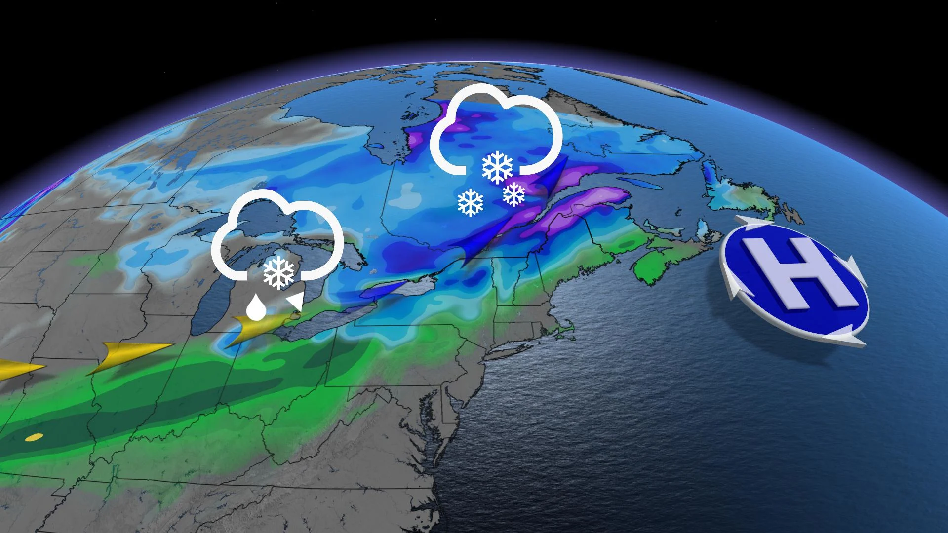
SUNDAY: TIMING THE THREAT FOR WET SNOW, WIDESPREAD RAIN
As the incoming system impacts Ontario, most places begin as wet snow, developing from south to north across the region, becoming widespread by the early afternoon, including along the 401 corridor.

However, as we near the event, model guidance is starting to favour enough cooler air to make for at least a period of rain/snow mixing for areas near the shores of Lake Ontario. For areas further inland and at elevation, however, this system may bring substantial snowfall, in the 10-15 cm for parts of cottage country and pockets of the southwest.

The boundary will press south of the region for early next week, and though Monday will feature a slight recovery in temperatures, Tuesday sees daytime highs not far above zero, and even below for a few communities.
Another warmup looks to take hold for the second half of the week, though not as drastic as the one that will have preceded it the previous week.