Gusty winds, heavy rain to sweep Ontario ahead of a cooldown

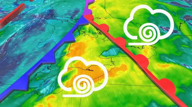
A cold front pushing across Ontario will bring overnight storms to southern sections of the province, while eastern areas are in line for heavy rain on Thursday.
Get ready for a wet and breezy night in southern Ontario.
It’ll be a lovely night if you’re soothed by the sound of wind chimes. But it won’t be so nice for your Halloween decorations, unfortunately, as gusty winds, heavy rain, and even some rumbles of thunder push into southern Ontario with a cold front through the overnight hours.
Fall Forecast revisited: The good, the bad and the ugly
A cold front sweeping across the Great Lakes will arrive in southern Ontario on Wednesday night, pushing east through the overnight into Thursday morning.
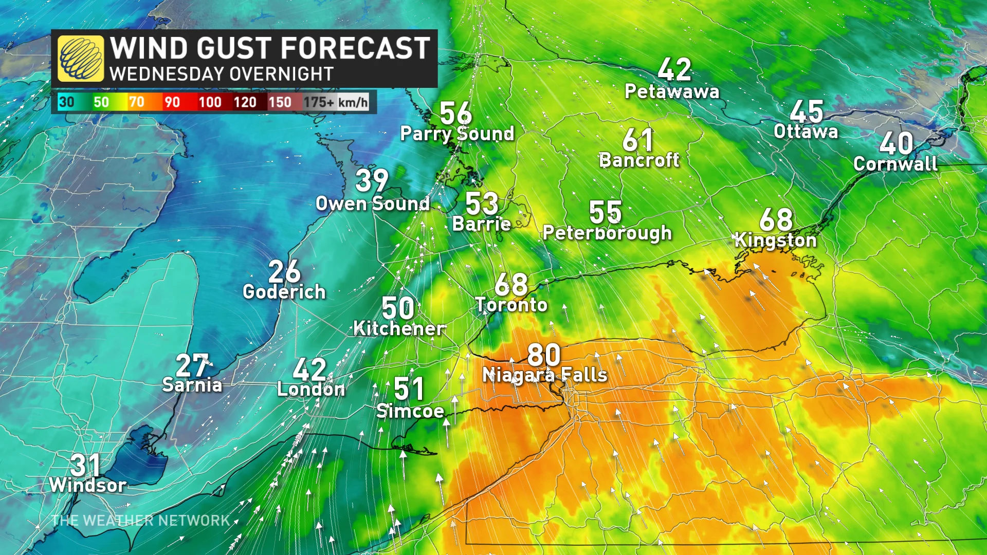
Winds could reach 50-70 km/h as the front moves through, with locally higher gusts to 90 km/h possible. These blustery conditions could lead to fallen tree branches and isolated power outages in spots, so make sure your devices are charged and loose outdoor items are stored properly.
"Gusty winds can damage soft shelters, tents and awnings at outdoor events. Loose objects may be tossed by the wind and cause injury or damage. High winds may result in power outages and fallen tree branches," Environment and Climate Change Canada (ECCC) warns.
If the wind doesn’t wake you up, a clap of thunder might do it—a line of heavy showers and thunderstorms will accompany the boundary as it moves through. This line will be responsible for those higher wind gusts.
DON'T MISS: Keep your furniture from flying around in strong winds with this simple hack
We’ll see the front push into eastern Ontario as the day progresses on Thursday.
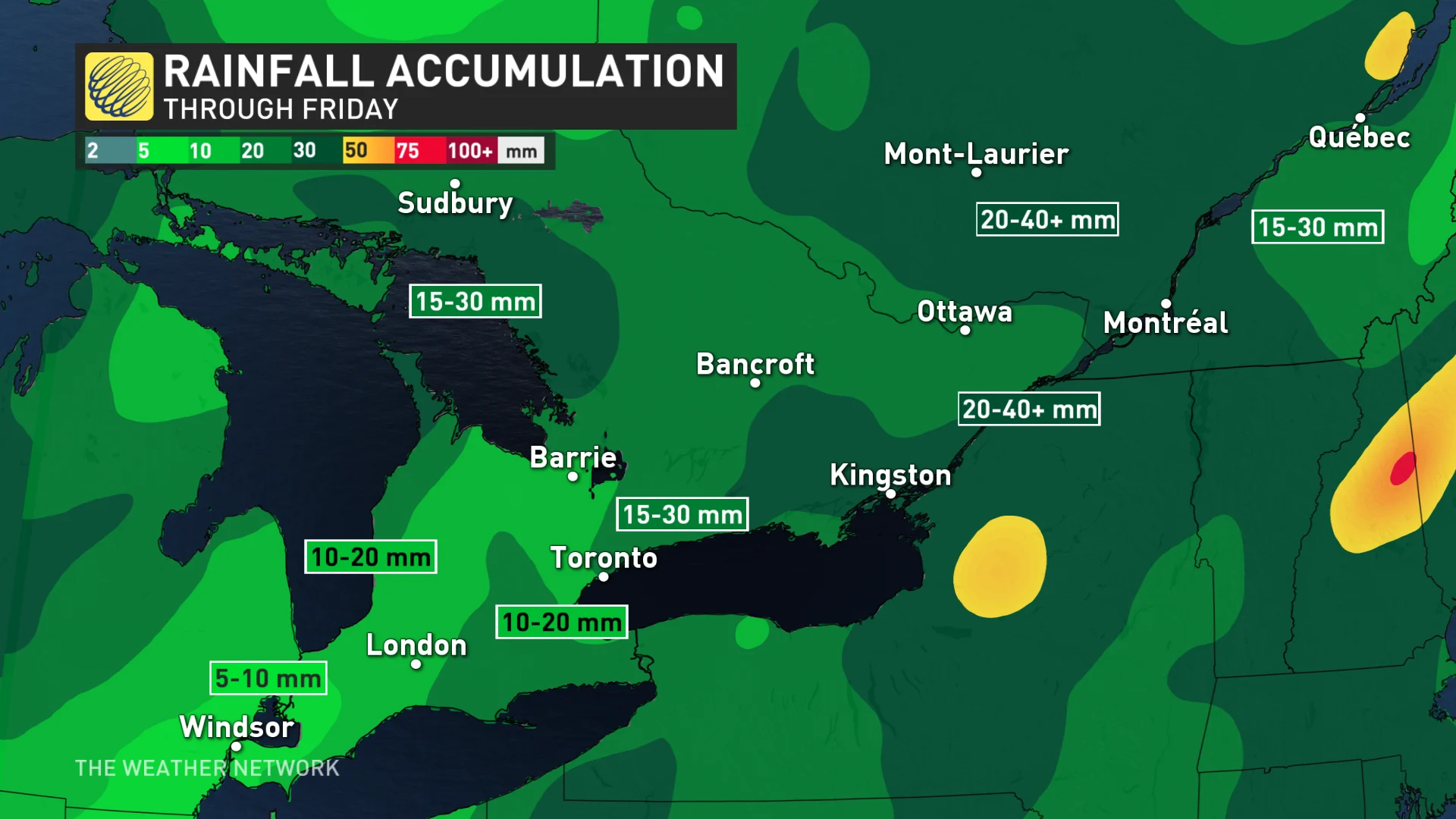
Elevated atmospheric moisture will allow for heavier rainfall totals across eastern Ontario around Kingston, for example, where we could see rainfall totals of 20-40 mm through the end of the week.
Temperature patterns across the southern and eastern sections will be an up-and-down affair heading into the weekend.
Highs will come in slightly below normal for Friday. Warmer temperatures arrive on Saturday, with a steady cooldown beginning Sunday and continuing into next week. We could see high temperatures struggling to climb out of the single digits by the middle of next week.
RELATED: Don't be fooled by Canada's gentle start to fall, storms are on the way
Widespread lake-effect rain and snow showers are likely into next week as the cooler pattern takes hold. The atmospheric setup responsible for that chillier air over the region could lead to decent snowfall totals across far northwestern Ontario through early next week.
WATCH: How recurving typhoons flipped Canada's Fall Forecast
Be sure to check back for the latest weather updates across Ontario and Quebec.