Heavy snow squalls make for dangerous Christmas travel in Ontario

Frigid temperatures and dangerously cold wind chills will continue this holiday weekend. System snow has ended but lake-effect bands will result in very dangerous travel still on Christmas Day.
Heavy snow squalls will make for another day of dangerous travel conditions across parts of southern Ontario as folks head out and about this Christmas. Slick roads and whiteout conditions are possible across some major highways through the day.
There is light at the end of the tunnel, though, and those who had a rough trip to their destination for the long holiday weekend should have a much smoother journey home as we start the final week of December.
PHOTOS: Powerful winter storm disrupts travel, power across Ontario
Strong winds whipping across the Great Lakes will continue fueling bands of heavy lake-effect snow off Lake Huron and Georgian Bay, where snow squall warnings remain in effect through Christmas Day.
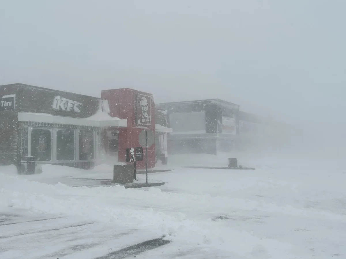
Much like we’ve seen for the past couple of days, communities caught beneath these bands of snow will see near-zero visibility as heavy snowfall rates combine with wind gusts as high as 70 km/h to create whiteout conditions.
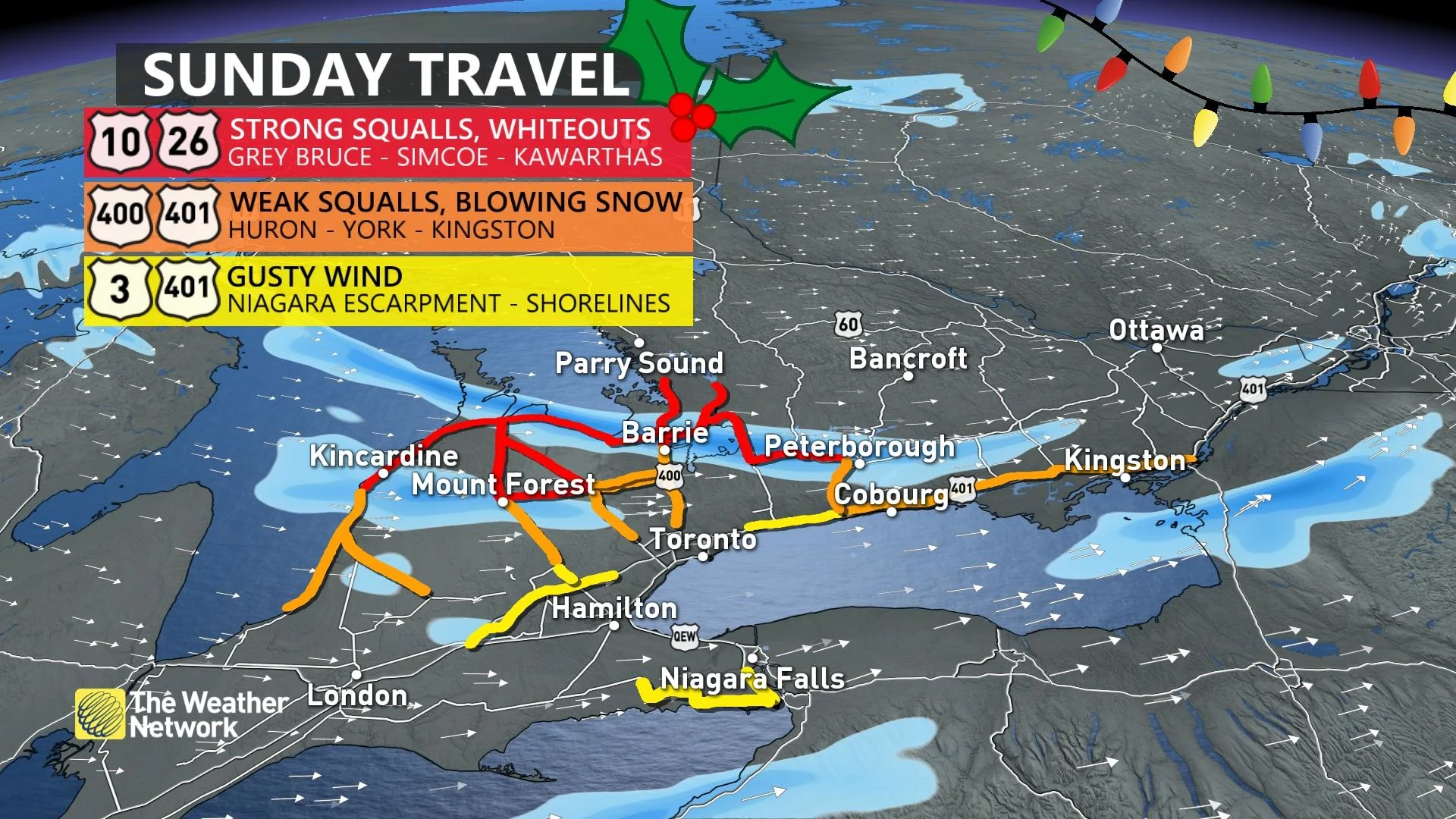
Visibility can change rapidly in and near snow squalls, quickly falling from clear to nil over short distances. “Prepare for quickly changing and deteriorating travel conditions,” Environment and Climate Change Canada (ECCC) said in its snow squall warnings.
Avoid non-essential travel across the affected areas until conditions improve. We’ve seen many motorists stranded on roads—and even spending the night in stores—as a result of the impassable conditions created by the storm’s snow and unrelenting winds.
DON’T MISS: People stranded by storm crashed at Walmarts in Ontario
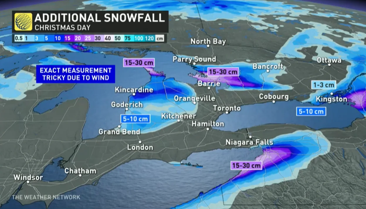
Folks caught beneath the Huron and Georgian Bay snow squalls could see storm totals of 50-75 cm by the end of the weekend, with totals of 20-40 cm possible away from the lakes as the bands wander inland. Exact measurements will be tricky due snow blowing and drifting in the high winds.
While most larger municipalities outside of the snowbelts will see conditions improve overall on Christmas Day, lake-effect snow could meander and push through southern Ontario at times through the day Sunday.
WATCH: Wildest blizzard and whiteout videos from Ontario and Quebec
This has been a tremendously impactful and memorable winter storm for the entire region.
Many roads across southern Ontario were closed Friday and Saturday as a result of the blizzard conditions. Heavy snow and low visibility even forced some townships to pull their plows from the roads. Buffalo, New York, reported blizzard conditions for nearly 36 continuous hours as of Saturday night—an unbelievable feat that speaks to the tenacious force of this storm.
Thankfully, if you’re looking for a bright spot through all these weather woes, this pattern will begin to flip around as we forge through the final week of 2022. A ridge building over eastern North America will bring much warmer conditions next weekend, with parts of southern Ontario possibly finishing out the year with high temperatures approaching the double digits.
Stay with The Weather Network for the latest on conditions across Ontario.