
Blizzards, whiteouts and localized flooding threaten Atlantic Canada

A powerful low pressure system moving through Atlantic Canada has the potential to be one of the more severe storms the region has seen for far this season with significant snowfall, strong winds, blizzard conditions and flooding rains all on the table.
Environment and Climate Change Canada (ECCC) has issued widespread snow and rainfall warnings across the Maritimes, with significant impacts to travel likely through Tuesday.
"Be prepared to adjust your driving with changing road conditions. There may be a significant impact on rush hour traffic in urban areas," says ECCC in the warning.
As a result of the deteriorating conditions, several schools closed their doors first thing Monday morning.
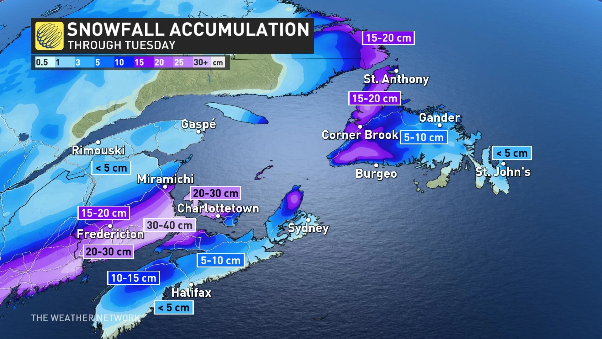
"This storm could drop 20-40 cm of snow and produce blizzard conditions Monday and Tuesday," warns Kelly Sonnenburg, a meteorologist at The Weather Network.
Widespread snow spread across the central Maritimes Monday morning, with a rain/snow mix impacting Nova Scotia. Heavy snow will continue through the day for southern New Brunswick and P.E.I., where areas will also get hit with gusty to strong winds through the afternoon and continuing into Tuesday morning. Blizzard conditions are forecast to develop and widespread whiteouts are possible as well.
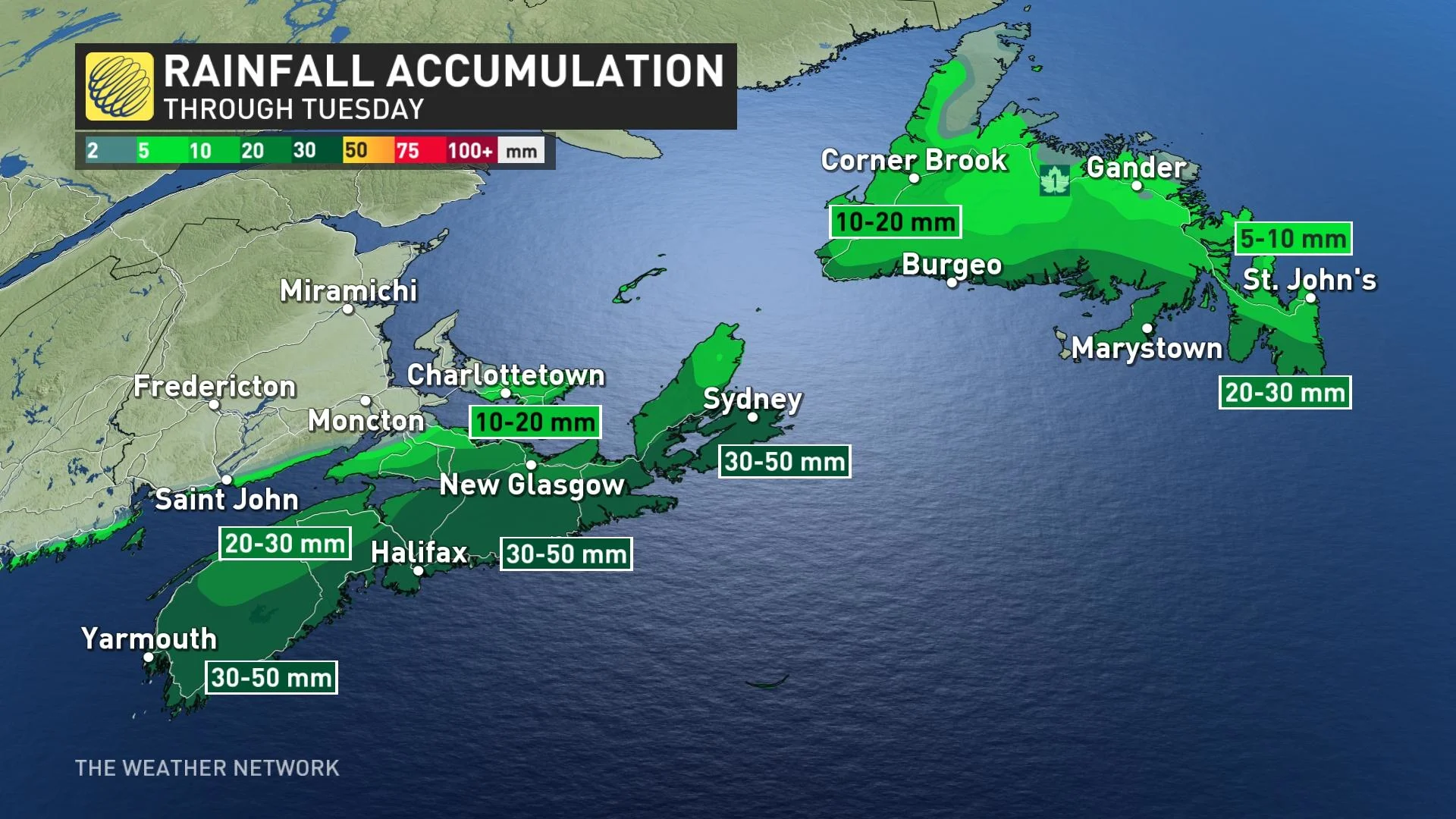
Across Nova Scotia, moderate rainfall is expected through Monday. Any storm drains covered by the recent heavy snow should be cleared to avoid any localized flooding or ponding on roads due to the rain and combined snowmelt.
Rainfall warnings are in effect across the region, with up to 50 mm possible in the hardest hit areas.
"Strong winds are forecast for eastern Newfoundland and the Avalon Peninsula overnight Monday and into Tuesday morning and so any snow left on the ground from the weekend event could lead to blowing and drifting snow," Sonnenburg adds.
The precipitation should be mainly rain across eastern Newfoundland Monday night through Tuesday, chipping away at the snow on the ground from the major snowfall event prior as well.
PHOTOS: St. John's, other N.L. communities buried after winter wallop
Look ahead: Next potent system follows closely for Thursday
Conditions will gradually improve through Tuesday and Wednesday before a Texas low marches towards eastern North America and into Atlantic Canada for Thursday. Another messy mix of heavy snow and rain will threaten the region once again.
Watch below: Birds trapped in ice get chiseled free by good Samaritans
Be sure to check back for the latest weather updates across Atlantic Canada.


