'High confidence' for a major, paralyzing snowstorm on the Prairies

'This storm is expected to completely shut down travel across a large part of the region.'
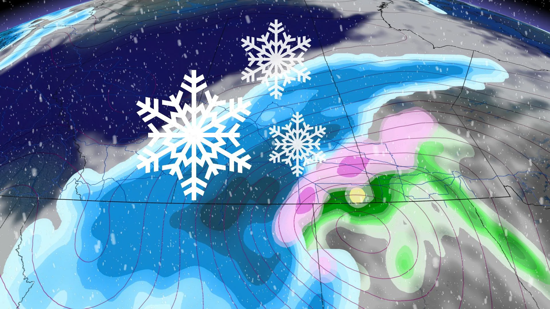
The Prairie provinces have already had plenty of winter-like cold, with more than one shot of snow, but the true power of the coming season will bear down on the region soon, starting at the end of the week. Beginning Friday night, a deepening upper-level trough will bring about a drastic change in temperatures, along with hazardous wintry weather – in fact, there is an increasing likelihood of blizzard conditions due to the heavy snow and strong winds. It's still a couple of days out, but forecasters say there's a non-zero chance for record-breaking November snowfall. More on the timing and impact, and how much snow could fall, below.
WEATHER HIGHLIGHTS:
Potential for record-breaking snowfall, dangerous blizzard on the Prairies
Snow moves in Friday night into early Saturday morning, will be most hazardous Sunday with 60-70 km/h wind gusts, 80-90+ km/h at times
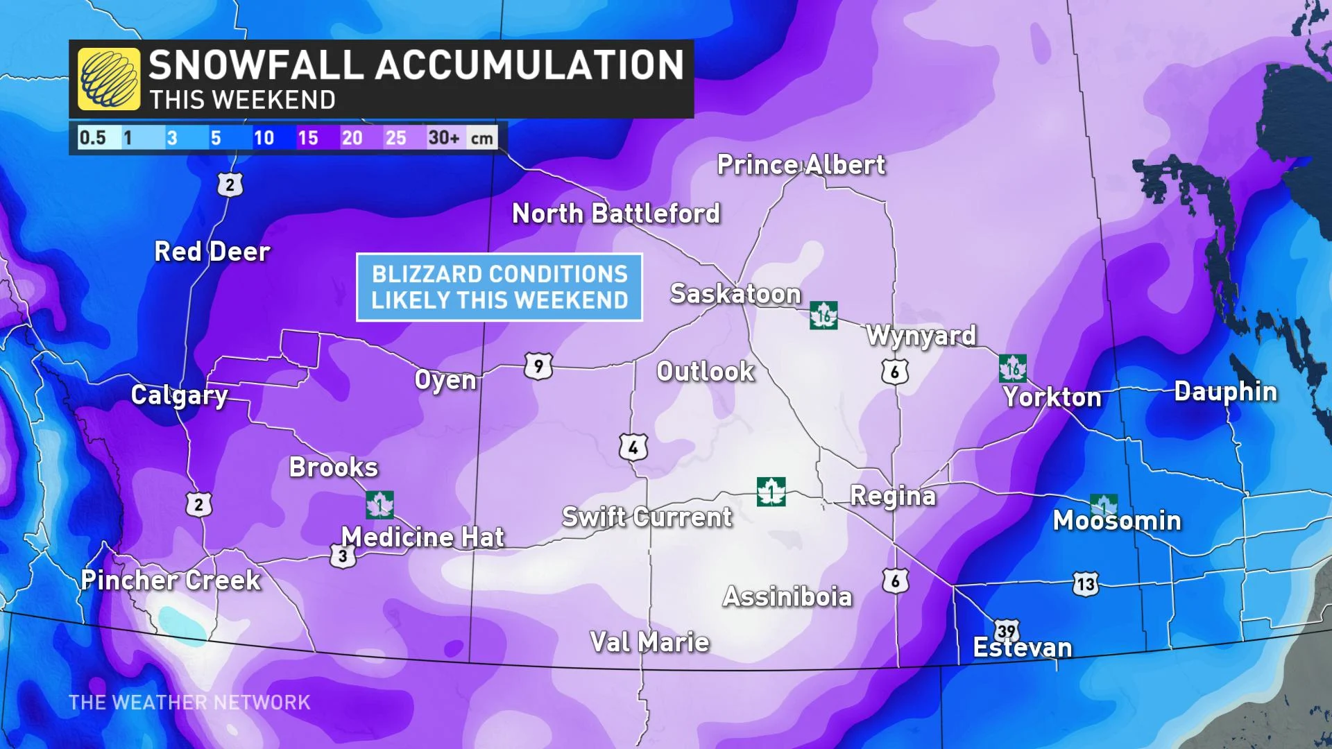
30-60+ cm of snow possible in hardest hit areas through Monday morning
FRIDAY NIGHT/SATURDAY: SNOW PUSHES INTO SOUTHERN ALBERTA, SASKATCHEWAN
Shots of Arctic air will begin to sink south across the Prairies Friday, eventually intensifying through the weekend. Meanwhile, a deepening low-pressure system stateside will begin to track north of the border in the overnight hours into pre-dawn hours Saturday morning. This will push snow into extreme southern Alberta and southwestern Saskatchewan.
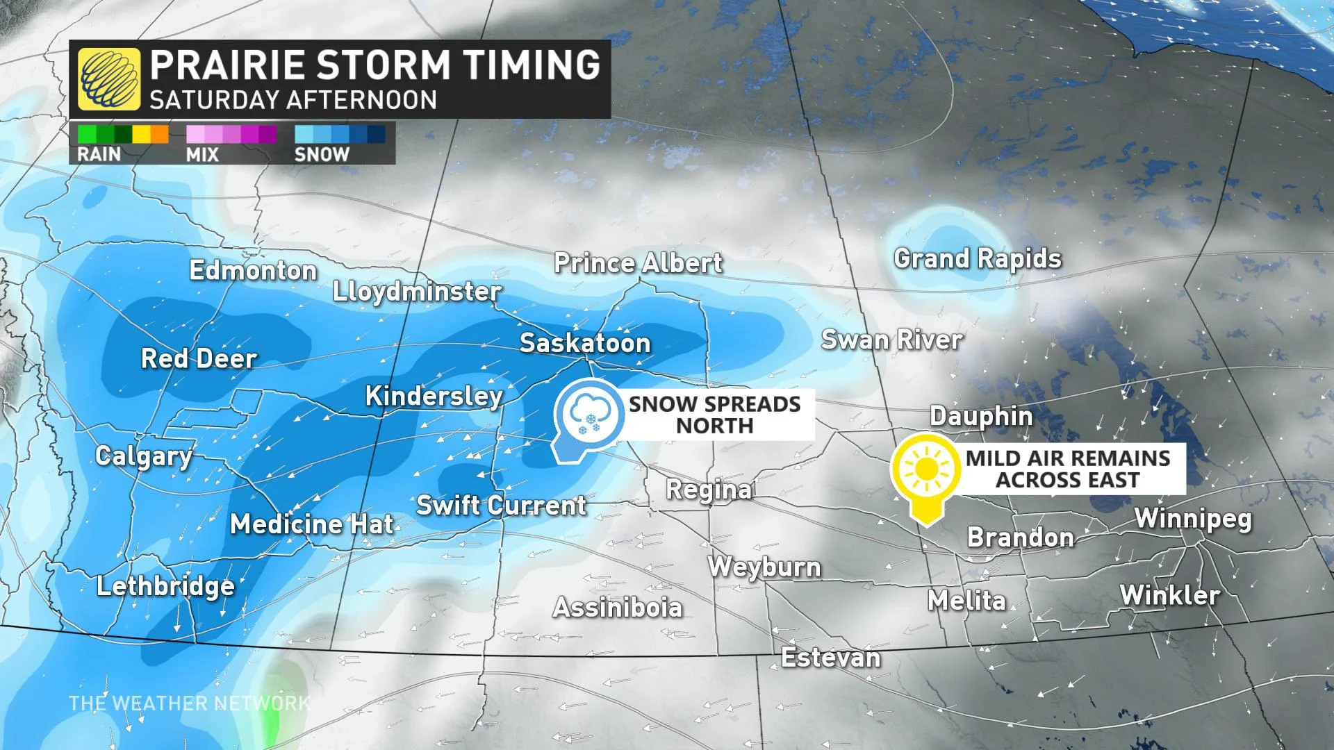
By Saturday morning and afternoon, snowfall rates will start to rapidly intensify across southern areas of Alberta and Saskatchewan. It will likely spread as far north as Calgary, Red Deer and Saskatoon.
The strongest wind gusts are expected north and west of the track of the low, mainly impacting southern Saskatchewan and Manitoba, starting Saturday night and continuing Sunday.
"This storm could completely shut down travel across a large part of the region, including a long stretch of the Trans-Canada Highway," warns Weather Network meteorologist Dr. Doug Gillham.
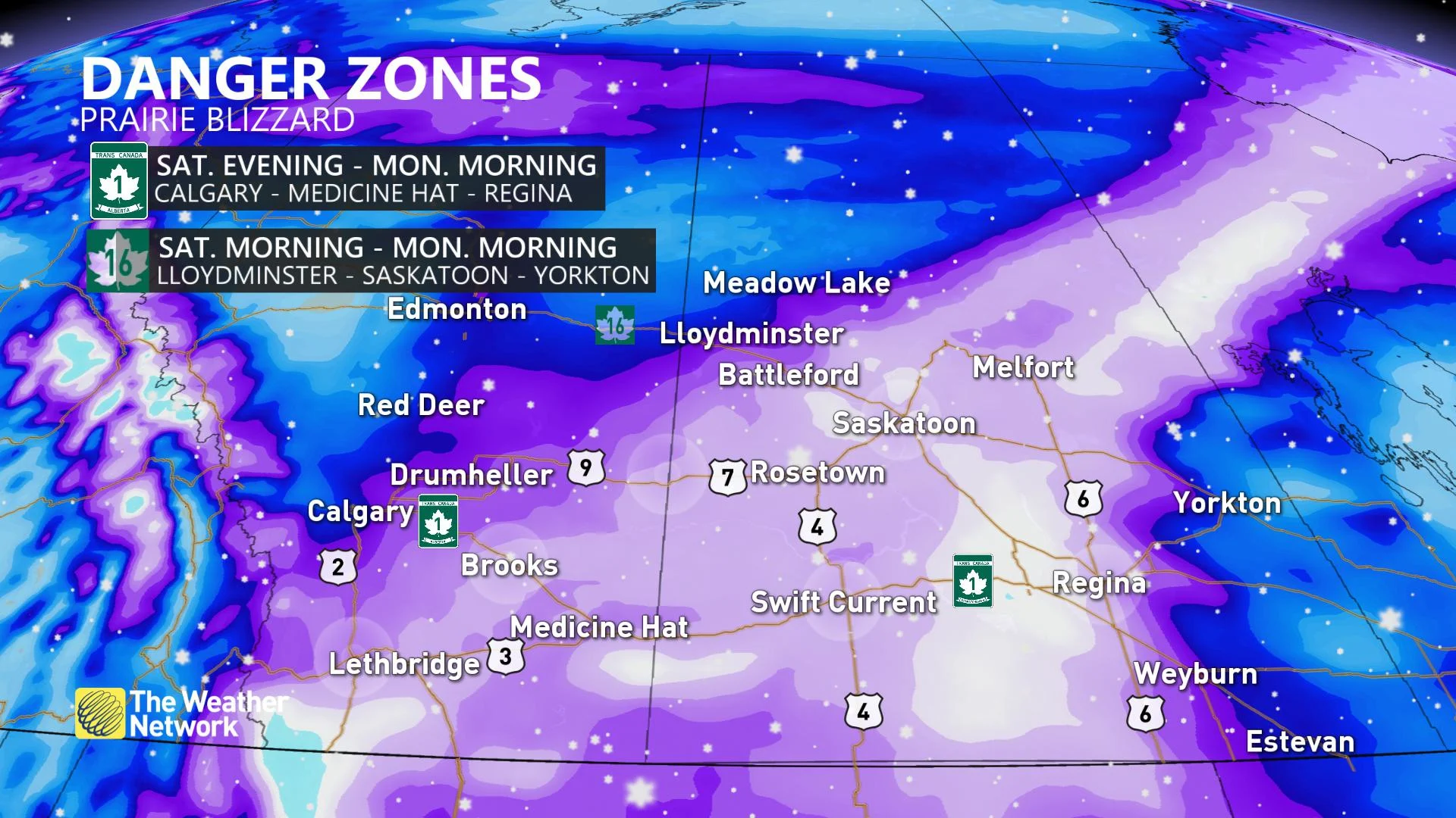
The winds will cause extensive blowing and drifting snow, whiteouts and very dangerous and impossible travel conditions. The height of the storm, with the most dangerous travel, is anticipated to occur through Sunday night.
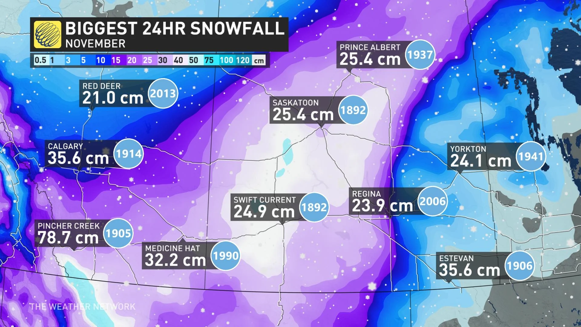
NOVEMBER SNOWFALL RECORDS IN JEOPARDY
The impending, increasing threat of a dangerous blizzard could bring record-breaking November snowfall to the region. The biggest 24-hour snowfall totals in November are in jeopardy.
Some of the current records include 78.7 cm in Pincher Creek, Alberta, set in 1905, 35.6 cm in Calgary, Alberta, set in 1914, 35.6 cm in Estevan, Saskatchewan, set in 1906, and 32.2 cm in Medicine Hat, Alberta, set in 1990.
SUNDAY: DANGEROUS BLIZZARD-LIKE CONDITIONS WITH HAZARDOUS TRAVEL
The storm will continue to strengthen as it tracks into southeastern Saskatchewan and southern Manitoba on Sunday. While the exact track of the storm is still uncertain, very heavy snow is likely to the west of the storm's track. This will likely include parts of southern Alberta, southern and central Saskatchewan and northern Manitoba.
The hardest-hit areas on the Prairies will see snowfall totals of 30-60+ cm. Widespread wind gusts between 60-70 km/h, possibly exceeding 80-90 km/h at times, are expected. Blizzard-like conditions are possible for southern Saskatchewan and Alberta.
PREPARE NOW: HOW TO GET READY FOR THIS DANGEROUS BLIZZARD SET-UP
Daytime highs will be below freezing on Saturday and Sunday in Alberta and Saskatchewan. Most of the two provinces will be 5-10 degrees below seasonal as Arctic air descends across the region. Meanwhile, slightly milder air will be prevalent across southeastern Manitoba, allowing for showers and mixing in the region Sunday.
The system moves out late Sunday night into the pre-dawn hours Monday morning. However, strong winds will continue in the wake of the system, allowing for reduced visibilities and blowing or drifting snow to persist into early next week.
Colder weather will finally spread into the eastern Prairies as the storm departs, as well. Arctic air will dominate across the Prairies early and mid-next week, but temperatures will recover to near or above seasonal late-week and weekend.
Be sure to check back with The Weather Network as we provide updates on the forthcoming, potential blizzard.
--
Subscribe: Apple Podcasts | Amazon Alexa | Google Assistant | Spotify | Google Podcasts | iHeartRadio | Overcast