Whiteouts, dangerous travel expected as major storm hits southern Ontario

Conditions will rapidly deteriorate across southern Ontario overnight as the heart of a vigorous winter storm pushes over the region.
This storm will create dangerous travel conditions and a risk for power outages as high winds and heavy snowfall blanket the region into Saturday morning.
Visit our Complete Guide to Spring 2023 for an in-depth look at the Spring Forecast, tips to plan for it and much more!
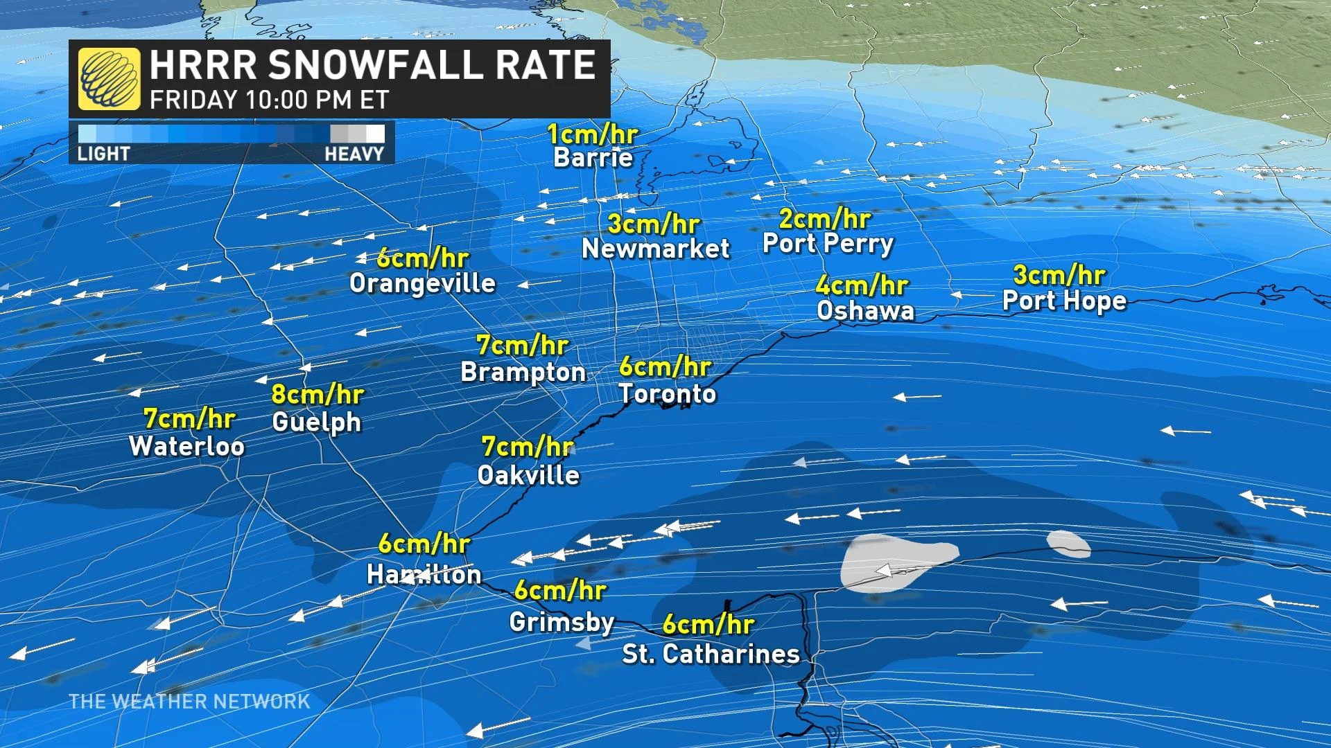
Snowfall rates of 5-8 centimetres per hour are possible at the height of the storm, which will combine with wind gusts of 60-70+ km/h to create blizzard conditions at times. The risk for blizzard conditions is heightened near the west end of Lake Ontario, including in the city of Toronto.
Blizzard conditions, power outage risk through the overnight
The heaviest snowfall and gustiest winds will arrive tonight and last through the early morning hours on Saturday. During the height of the storm, snowfall rates of 5-8 centimetres per hour and wind gusts of 60-70+ km/h are possible. This will lead to blizzard conditions for some communities. Thundersnow is also possible.
DON'T MISS: Be aware of your heart while shovelling heavy snow
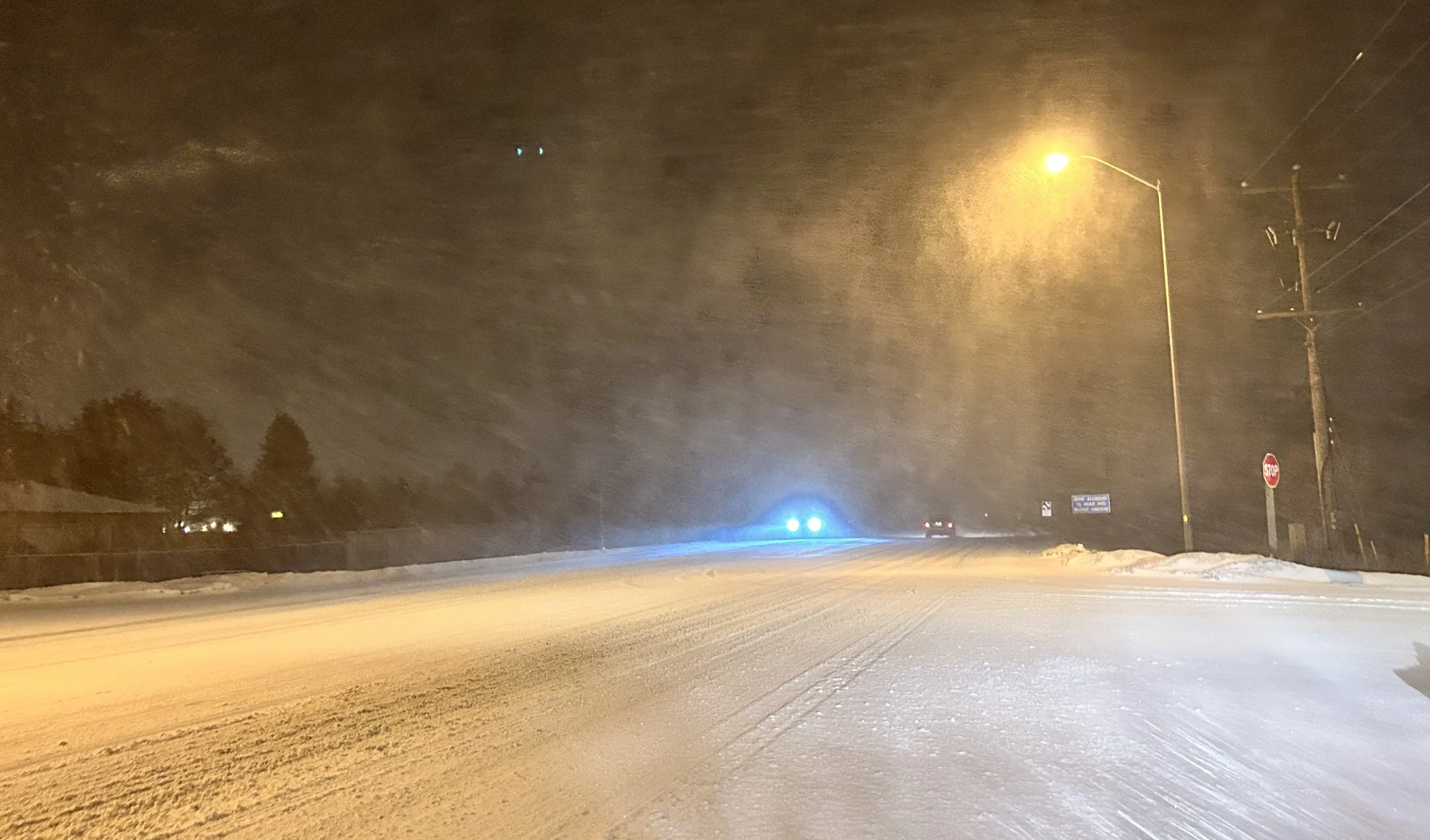
Residents are advised to avoid travel whenever possible overnight Friday into Saturday morning. Heavy snowfall rates and gusty winds will create near-zero visibility at times, making road conditions extremely dangerous at the height of the storm. Unnecessary travel can risk the safety of motorists, first responders, and plow drivers trying to keep major thoroughfares clear.
WATCH: Thundersnow captured across Ontario during blizzard-like storm
"Prepare for quickly changing and deteriorating travel conditions," Environment and Climate Change Canada (ECCC) says in its winter storm warning for the area. "Visibility will be suddenly reduced to near zero at times in heavy snow and blowing snow."
RELATED: How the City of Toronto is preparing for the big storm
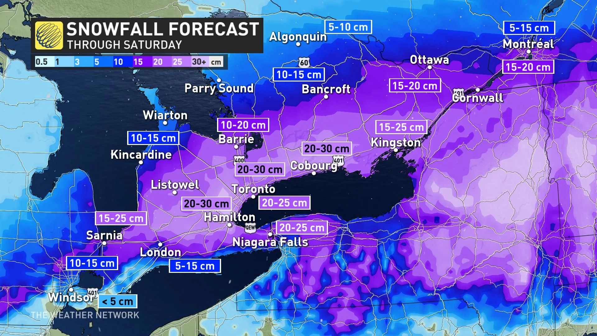
By the end of the storm on Saturday morning, we’ll likely see a blanket of 20-30 cm of snow across much of southern Ontario. Lower totals are likely in the southwestern corners of the province where mixing and marginal temperatures help to somewhat limit accumulations.
MUST WATCH: As blizzard-like conditions target GTA roads, here's what to do
Making a bad situation worse, temperatures hovering near the freezing mark will make this a heavy, wet snowfall.
Gusty winds and the weight of this wet snow on trees and power lines could lead to an increased risk for power outages throughout the area. Remain mindful of trees and tree branches that could fall during the storm.
BE PREPARED: Staying safe during a power outage
Shovelling up to 30 cm of snow is also a chore on its own, but the sheer weight of the snow will increase the challenge of the post-storm cleanup. Pay extra mind to the physical stress of shovelling heavy snow, taking care to stretch beforehand, shovel with safety in mind, and stop for frequent breaks.
Folks heading out to clean up on Saturday will encounter light snow lingering through the first half of Saturday as the system pushes east into New England.
Beyond this storm, temperatures will warm up a touch heading into the first weekend of March. Daytime highs approaching the mid-single digits will aid with cleanup efforts, though black ice will be a concern each night as lows drop below freezing.
WATCH: Do you know about the 4-4-4 rule regarding blizzards?
Prime ski conditions for March Break
Below-seasonal temperatures will return for the second half of next week and through the following week, which is March Break for most schools. At this point, we don't expect frigid weather, but not very spring-like either, with temperatures a few degrees colder than seasonal.
Southern Ontario ski areas should be in great shape for March Break.
Stay tuned to The Weather Network for the latest on this major storm hitting southern Ontario.


