Major pattern change offers some very sharp reversals of fortune

A major pattern change is set to sweep much of the country, with some very sharp reversals of fortune in some cases.
The atmosphere just pressed shuffle, and this pattern change playlist is coming to a city near you.
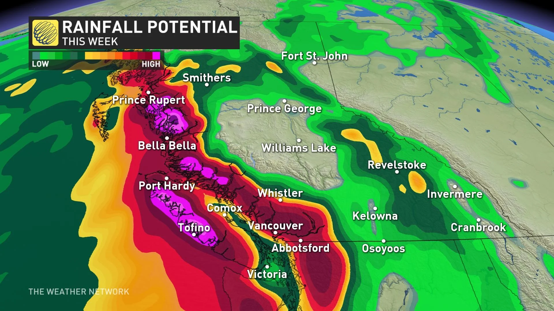
1) SEPTEMBER FIREHOSE, EYEING RECORD RAINFALL
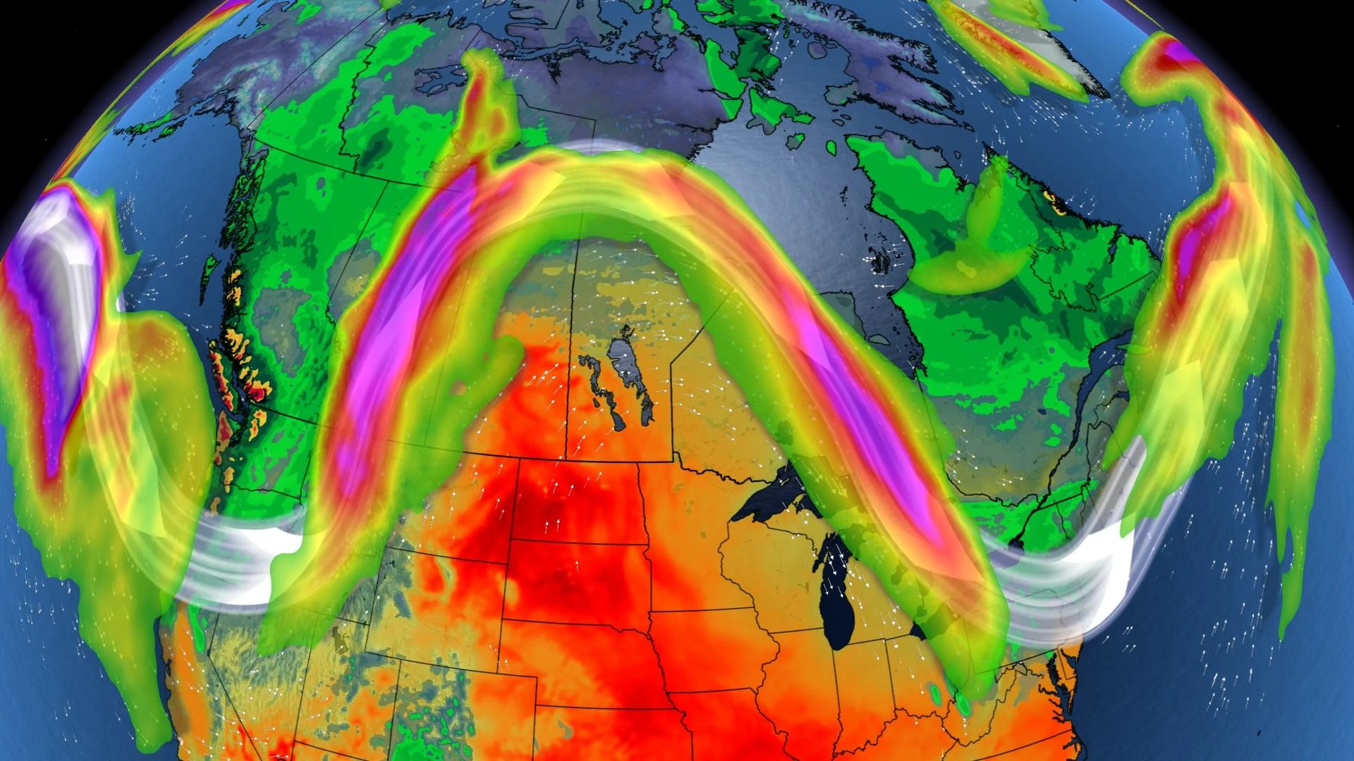
Not one but two troughs will steer low-pressure systems towards British Columbia. The first trough sticks around until early Tuesday, then a potentially more powerful one migrates in on Wednesday. Here, we'll highlight rainfall projections for the next seven days. Several stations in British Columbia are careening towards record rainfall; these systems might be the difference makers.
2) PRAIRIE FALL SIZZLER, ENCORE 30°C PERFORMANCE
All that storm momentum barreling into British Columbia – well, that's helping amplify the high pressure across the Prairies, and it'll be a September scorcher. Cities in extreme southern Saskatchewan have the highest odds to see temperatures in the low 30's.
If the mercury goes over 33.3°C in Estevan (like on October 1st, 1992), then it's never been this warm this late in the year. Regina, Yorkton, and even Winnipeg look to challenge all-time record warmth for this time of year. The overnight low temperatures will likely stay above 20°C in southwest Manitoba. Keep in mind, normal is about 15°C for daytime highs.
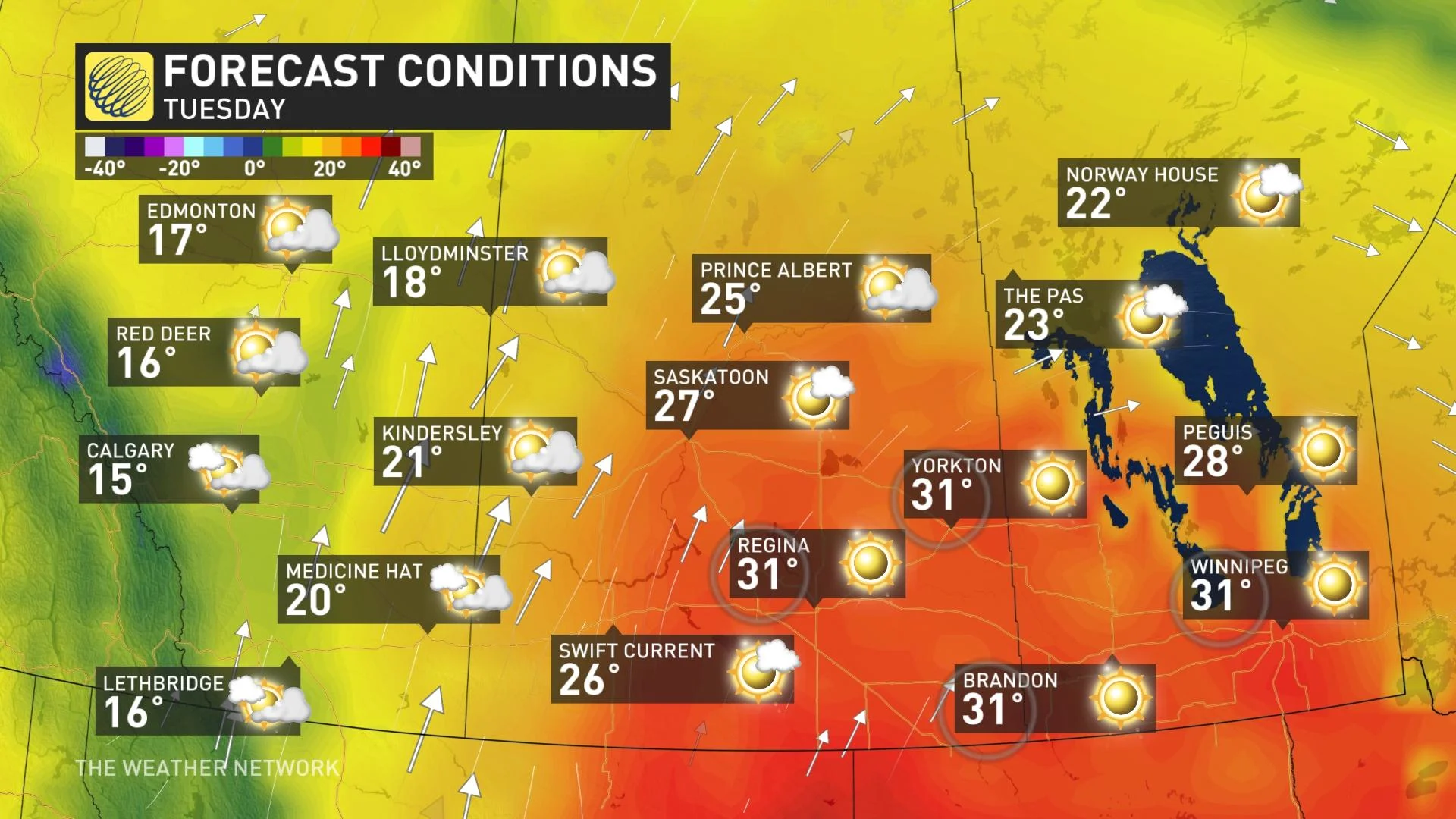
It'll be ideal harvesting conditions, but that's for crops that survived the severe drought conditions that were especially hard on farmers this summer.
3) HUDSON BAY BLOCK, YOU SHALL NOT PASS
In the final few days of September, there's a signal to build a high-pressure fortress from Hudson Bay, extending downwards to the United States and western Great Lakes.
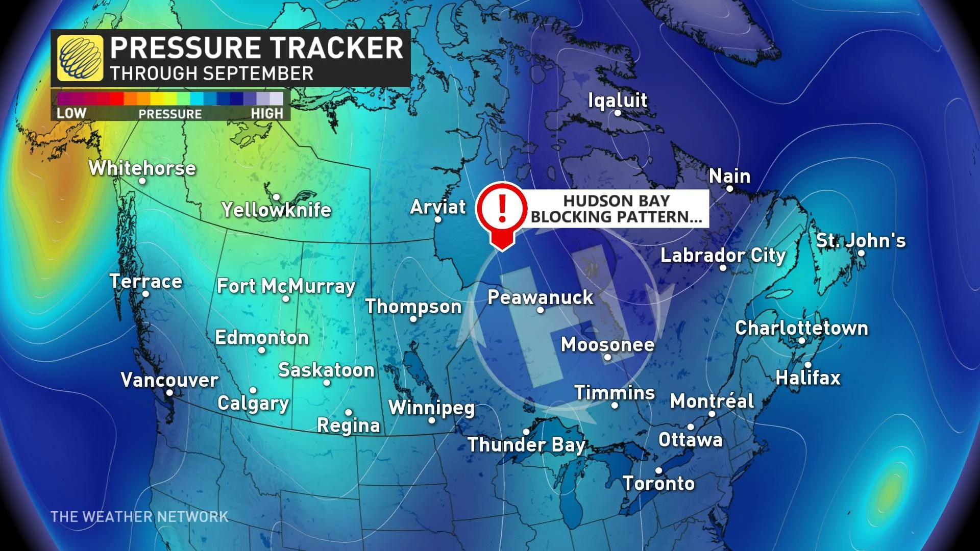
Warm air will attempt to press into Ontario as we creep towards October, but it's possible in a pattern like this – the further north you go, the warmer it gets.
4) THE INVISIBLE TROUGH, TROPICAL TROUBLE BUILDS
Things on the east side of the blocking pattern are arguably the most interesting and have the highest stakes over the next couple of weeks, but this story has become a little bit more clear as of late.
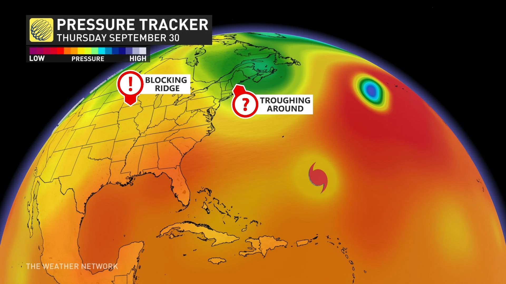
There's a signal to hold the trough in place longer, potentially reinforced with some energy from northern Canada, and confidence has increased in this feature.
As we flip the calendar into October, there'll be a formidable major Hurricane Sam moving north of Puerto Rico, eventually coming close to Bermuda by next weekend. With the forecast trough further east, it will likely pull the hurricane around the base of the trough, and probably out to sea. Still much too early to rule out other indirect impacts, such as large surf, and it’s far too early to give the all-clear for Newfoundland.
You'll want to check back on this one.