B.C.: This unexpected city out-snowed Canada's winter heavyweights
Remember back at the start of November, when we were talking about record-long stretches with no rain in Vancouver and water restrictions on Vancouver Island?
What a difference a couple of months makes.
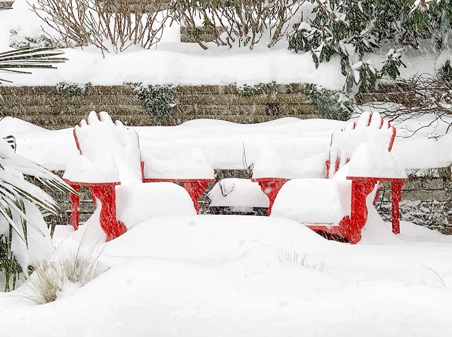
While we went into the cold season with much of British Columbia approaching drought conditions, January has made up for that lack of moisture in a big way, with some parts of the Lower Mainland and Vancouver Island actually out-snowing some Canadian winter heavyweights.
Vancouver itself chalked up more than 300 per cent of its average January snowfall, with 34.6 cm putting it ahead of Toronto (which will finish up right around average for the month -- at least, in terms of snow.)
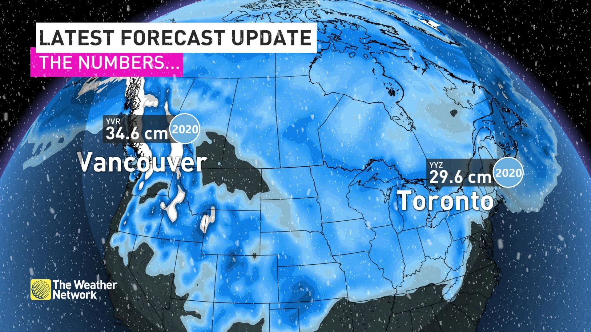
That's not to say Toronto's been dry, however. With 105.6 mm of rain recorded, January 2020 will be the second rainiest on record at Pearson International.
This switcheroo comes courtesy of the prevailing temperature pattern across the country for much of the month, which saw British Columbia shivering in Arctic outflow winds and record-breaking cold. Meanwhile, an active storm track across the Great Lakes drove many storms north across the region and dumped tropical-source rainfall on southern Ontario rather than snow.
If you're in search of the 'missing snow,' you'll find it by looking back to B.C. Nanaimo is the sleeper snow champ when it comes to reported snowfall in January, second only to St. John's and its historic blizzard.
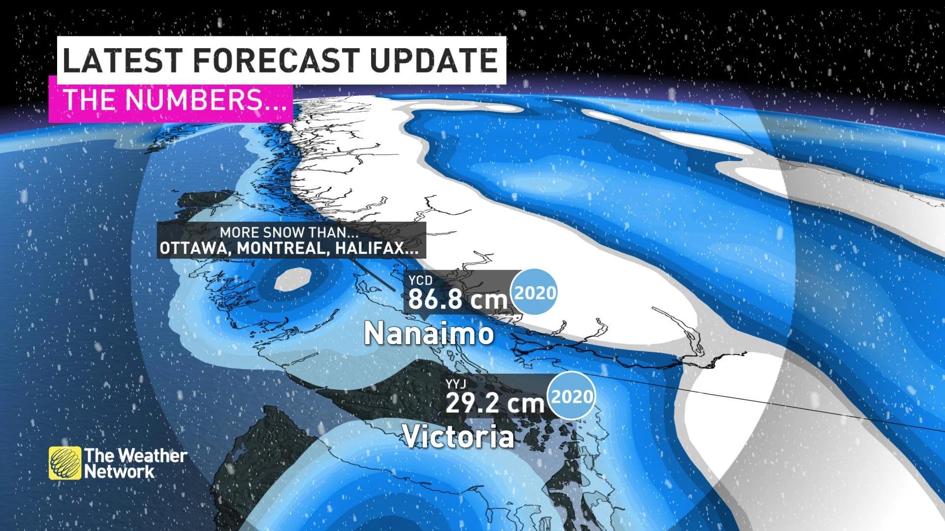
Again, Arctic outflow is to blame for this stat, which saw the Vancouver Island city rack up at least 242 per cent of its average January snowfall ('at least' because there are a couple of days missing from the Environment Canada data available.) The unusually cold air in place over much of the South Coast and Strait of Georgia helped to spur 'strait-effect snow' -- bands of snow that set up thanks to converging air over the water. Those bands hammered Nanaimo and Van Island's east coast with blizzard conditions around the middle of the month. 40 cm of the city's snow was recorded on January 17th alone.
MORE OF THE SAME TO CLOSE OUT THE MONTH
While the cold has eased, the wet pattern continues for the B.C. Coast, with no prolonged periods of dry weather in sight through at least the first week of February.
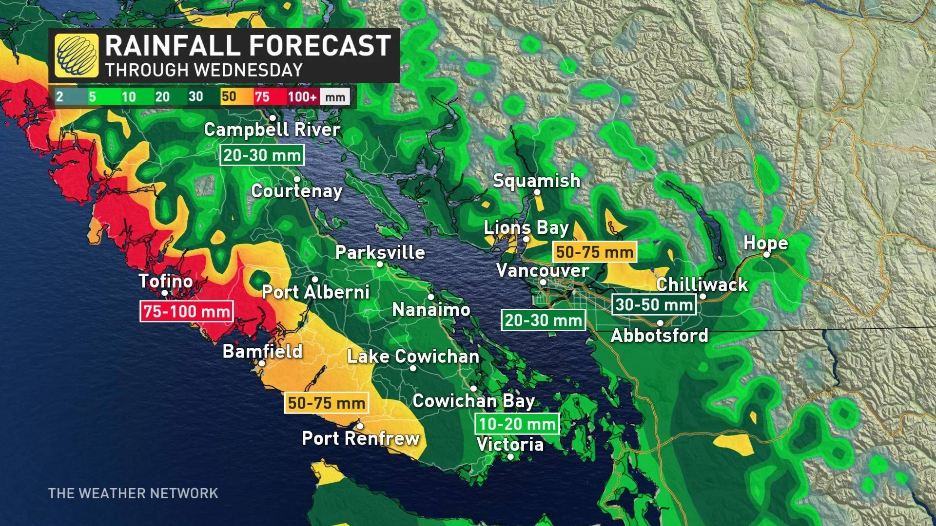
There has been a shift in the source regoin of the moisture, at least. Tropical-sourced moisture will round out the month for the west coast, keeping snow levels on the higher side. That means, while we're looking at a few more hundred millimetres of rain for parts of the region, snow should stay comfortably above sea level.