Winds subside on the Prairies, but snow may complicate travel Tuesday

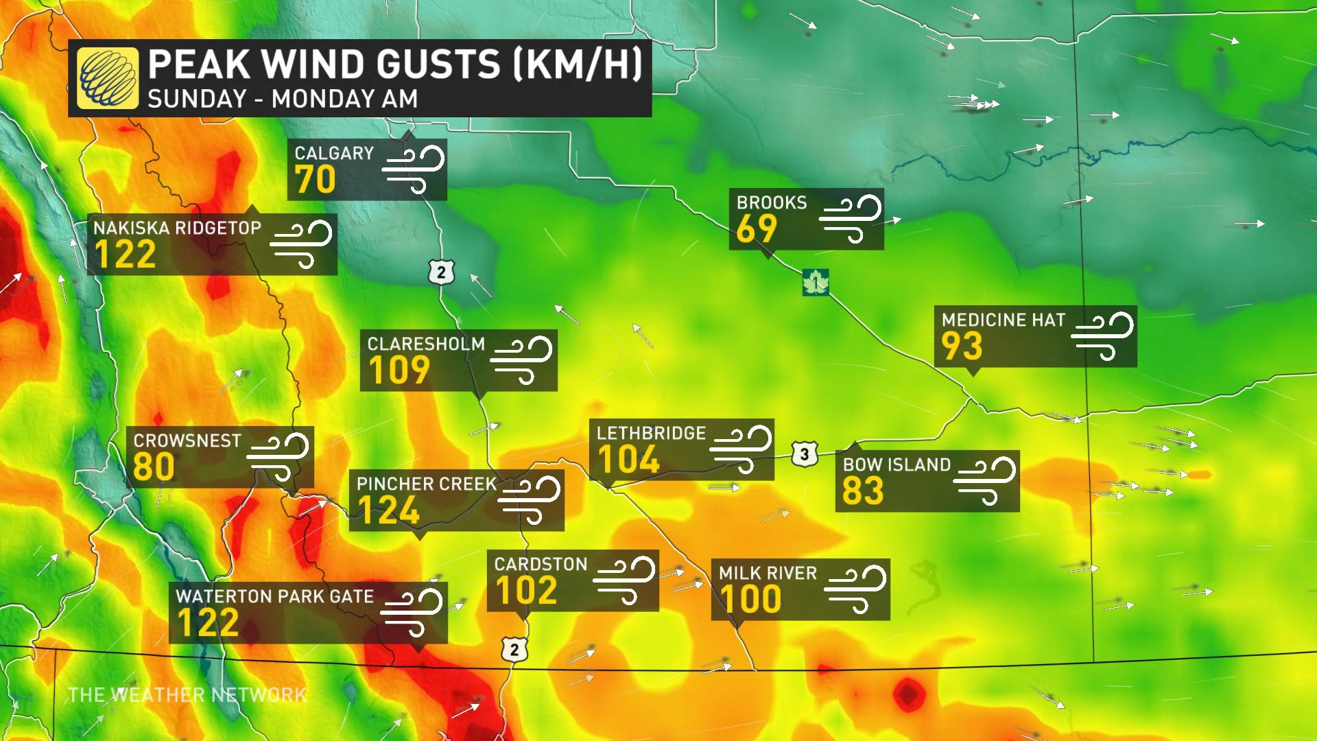
After an extended period of record, bitter cold, Western Canada is being treated to much warmer weather in comparison this week. Along with the surge in daytime highs to start the week, Chinook winds developed and moved along the foothills of Alberta, bringing powerful wind gusts exceeding 120 km/h in several areas, with Nakiska Ridgetop recording a wind gust of 169 km/h. The good news is the winds are subsiding, but a cold front expected to sweep through Monday overnight will bring a brief blast of snow Tuesday morning, along with cooler temperatures. While the amounts will be modest, the rapid pace of it assembling will likely lead to reduced visibilities and difficult travel. More on the timing and impact, below.
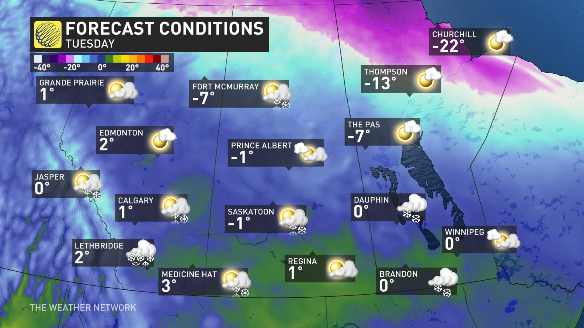
TUESDAY: COOL AIR SWEEPS IN, BURST OF ACCUMULATING SNOW MAY COMPLICATE TRAVEL
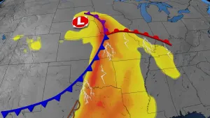
With intense winds diminishing Monday, the next weather-maker will be a cold front moving in through the overnight hours, expected to bring a quick shot of accumulating snow by the pre-dawn hours Tuesday morning.
This will bring a swath of snow stretching through Alberta and Saskatchewan. Areas around Calgary, southeastern Alberta, and southern parts of Saskatchewan could see around 5 cm or less with a few pockets of 5-10 cm of snow.
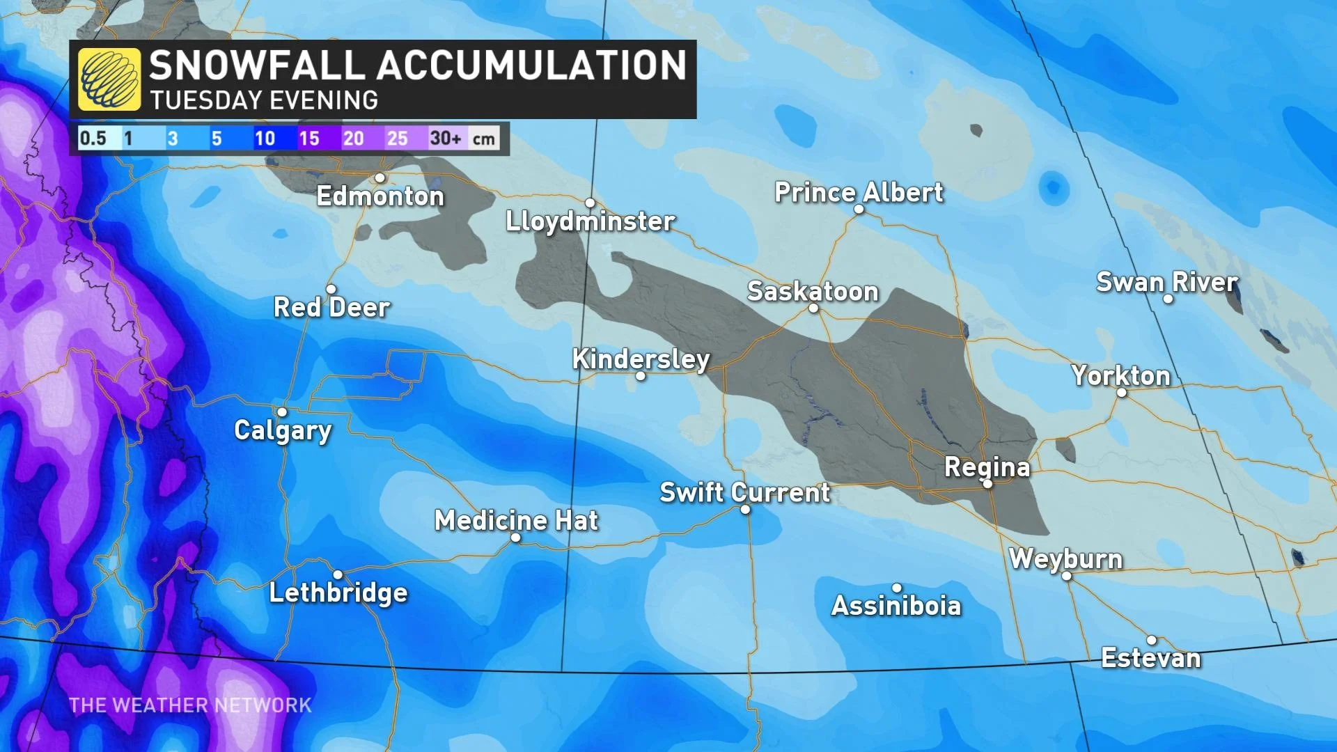
While amounts aren't excessive, the snowfall will accumulate quickly, likely leading to poor visibilities and difficult travel due to the changing conditions on the roads.
"Though accumulations won't be exceptional, snow could come in the form of intense bursts that could lead to localized drops in visibility and dangerous travel conditions," warns Weather Network meteorologist Michael Carter.
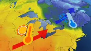
The influx of milder air that brought near or at double-digit temperatures to parts of southern Alberta Monday will subside a bit for Tuesday, thanks to the cold front, with temperatures dropping a few degrees. However, they will still tip the mild side.
POWERFUL WINDS RECORDED
A strong westerly flow off the Pacific has brought powerful winds onto parts of the Prairies from Sunday to Monday morning, with the strongest gusts being reported in southern Alberta. Wind gusts reached 169 km/h in Nakiska Ridgetop, 156 km/h in Vulture Peak, with several more areas reporting gusts exceeding 120 km/h including 124 km/h in Pincher Creek.
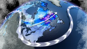
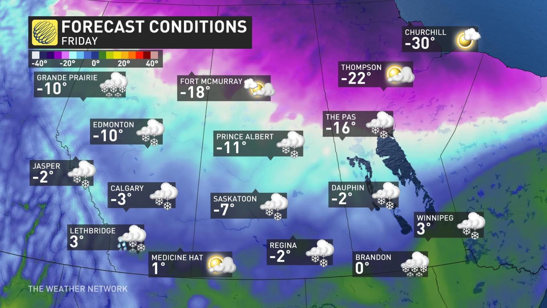
LOOK AHEAD: ARCTIC AIR RETURNS BRIEFLY, BUT MILDER TEMPERATURES WILL RETURN
Beyond Tuesday's snow, the milder pattern will continue to dominate this week. However, there will be a quick blast of arctic air late week and into the weekend as the region makes an abrupt transition from early spring-like weather back to mid-winter, with well below seasonal temperatures. Winnipeg will go from a high of 3°C on Friday to a high of -15°C on Saturday.
"However, it will not get anywhere near as cold as it was a couple weeks ago, and the shot of cold weather will only last a couple of days as mild Pacific air quickly returns for next week," says Weather Network meteorologist Dr. Doug Gillham.
No major storms are in sight, but a potent system will track from northern Alberta Thursday morning to central Manitoba Thursday night with several centimetres of snow for Fort McMurray. A burst of snow also possible with the Arctic front late in the week.
Be sure to check back for updates on the latest weather conditions impacting the Prairies.