Warnings span B.C. as an atmospheric river takes aim with a high flood threat

Heavy rainfall is on its way once again for B.C. this week, thanks to a potent atmospheric river threatening to unleash significant storm totals that could create widespread flooding.
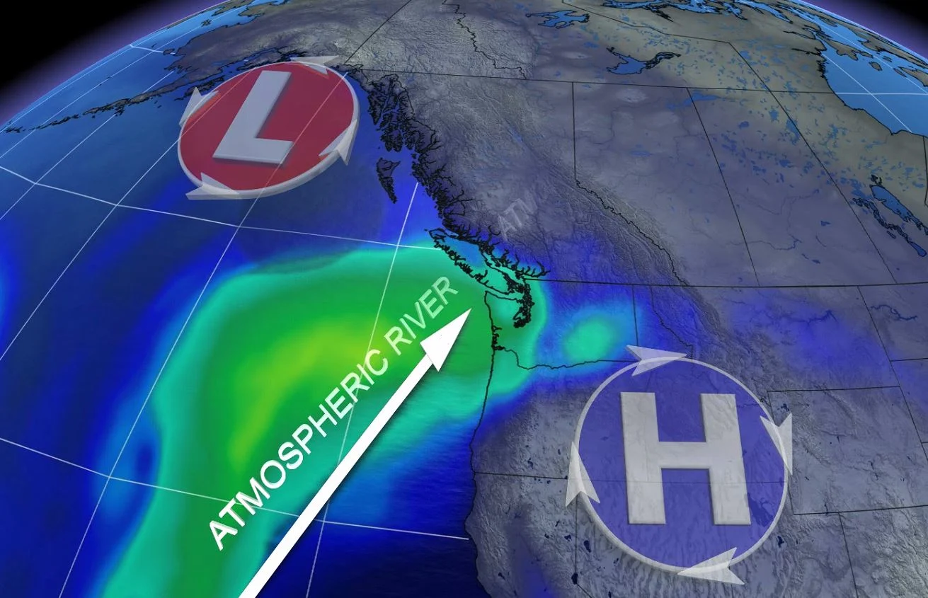
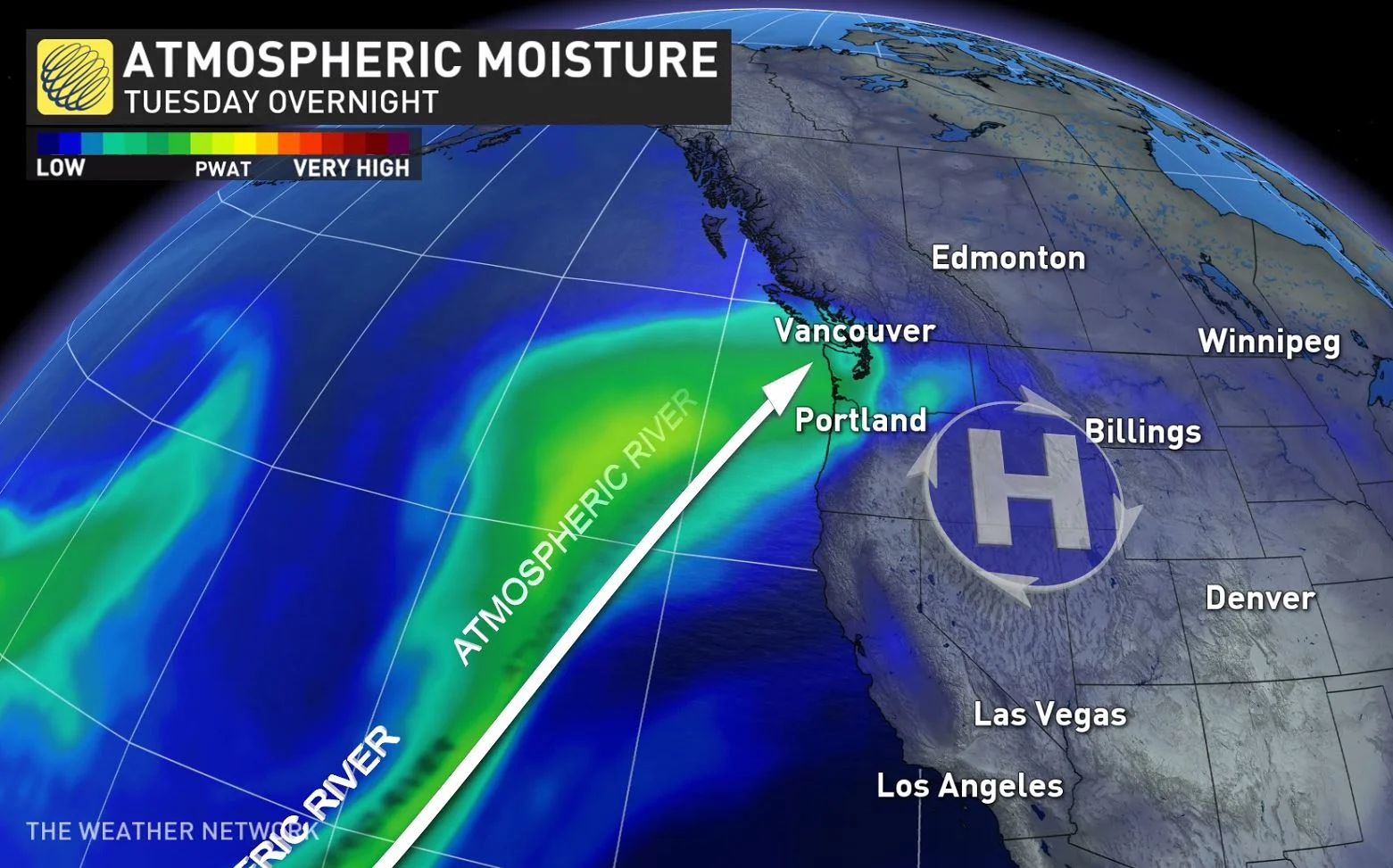
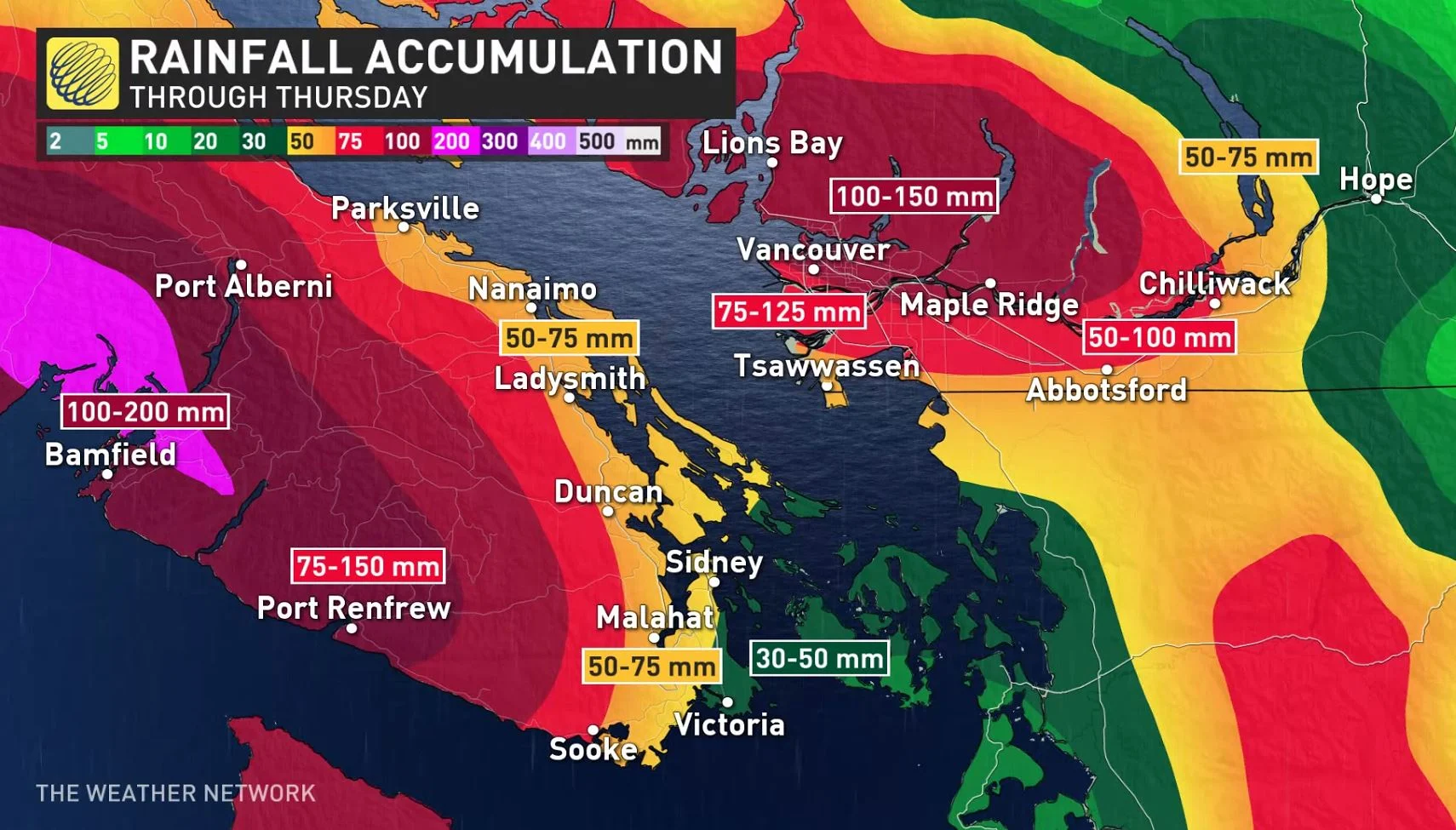
As the frigid air and snowy conditions finally break across the South Coast of British Columbia this week, the warming conditions and familiar Pacific air will come at its own costs. Another mighty atmospheric river is set to usher in multiple rounds of deluges through Thursday, prompting widespread warnings. The melting snowpack, rising freezing levels and weakened infrastructure from the destructive November atmospheric rivers, will all make for a serious flood threat across the region once again. Some areas could see 100-200 mm of rainfall by the time this atmospheric river subsides late week. Rainfall warnings and special weather statements are in place, as well as a high streamflow advisory. More on the timing and impacts to keep an eye on, below.
THIS WEEK: ROUNDS OF RAIN, WARMER TEMPERATURES HEIGHTEN FLOOD THREAT ACROSS THE LOWER MAINLAND
Rainfall warnings and special weather statements already span B.C.'s Lower Mainland, including Metro Vancouver and Vancouver Island, Howe Sound and the Sunshine Coast, with multiple rounds of rainfall amid a rise in temperatures with Pacific air returning to the region. Localized flooding and high stream levels are of major concern.
The B.C. River Forecast Centre has also issued a high streamflow advisory and says areas that experienced flooding in November may be more vulnerable for flooding once again, due to erosion and higher baseflow conditions.
"The public is advised to stay clear of the fast‐flowing rivers and potentially unstable riverbanks during the high‐streamflow period," the advisory reads.
According to officials with Emergency Management B.C., sandbafs will be made available across the region.
A strong southwest flow will develop on Tuesday and result in an atmospheric river impacting the South Coast. Heavy rain from the first system will continue through Tuesday morning, then easing off into the afternoon. Heavy rain will redevelop at times through Tuesday night and Wednesday as other systems arrive.
The heaviest rainfall is expected to fall near the Coast Mountains in favourable, upslope locations. The heaviest rains will occur Wednesday afternoon and evening, lingering well into Thursday morning as well. This particular atmospheric river could be as strong as a Category 3.
Through Thursday, 100-200 mm of rainfall expected for western Vancouver Island and Metro Vancouver and 75-125 mm for the Lower Mainland.
This last and strongest system will be the one to keep a close eye on, bringing the heaviest amount of rain to the region.
"It's going to rain for 72 straight hours across the Lower Mainland," warns Tyler Hamilton, a meteorologist at The Weather Network.
While the amount of rain over this period of time is not unpredecented, other factors at play could cause some "havoc," Hamilton says.
Rivers are expected to start rising on Tuesday and will likely peak Wednesday or Thursday. As well, freezing levels will rise to between 1500-2000 metres, causing rapid snowmelt and flooding.
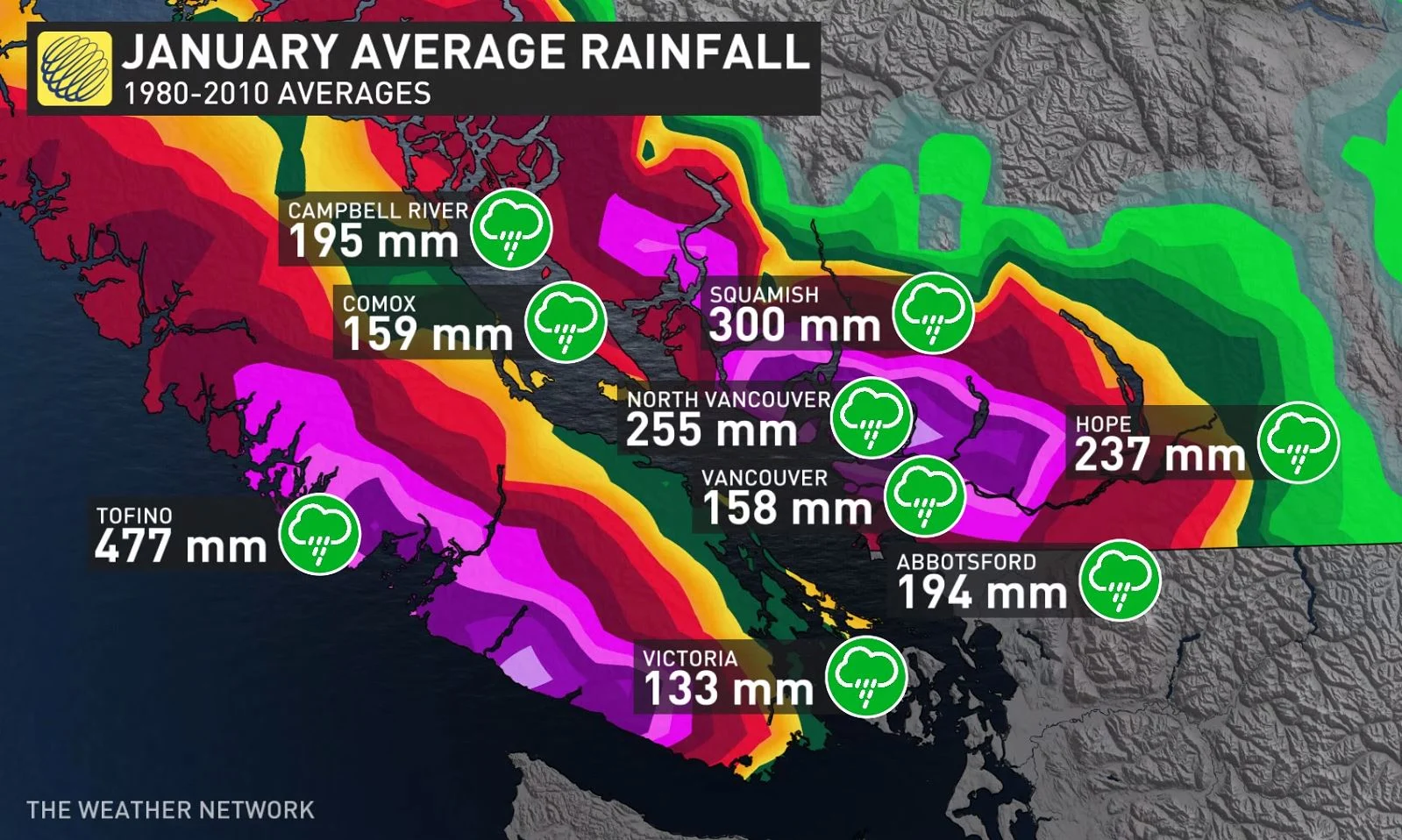
While January is typically known as a wet month in Vancouver with an average of 160 mm of rain, just this week alone could bring as much as 100 mm to the area.
Residents are being urged to clear catch basis from snow, and to make sure appropriate emergency supplies are on hand.
Beyond, an extended break from significant snow and ice is expected for the next couple of weeks. However, winter is not over – colder than seasonal temperatures are expected to return late in the month and dominate during February.
Stay tuned to The Weather Network for the latest forecast updates on B.C.