
B.C.: Few breaks ahead as West Coast drenching continues

No sign of rain and snow slowing down anytime soon.
There just isn't any letup from the snow and rain as the week comes to a close. Freezing levels will rise drastically Friday such that the heaviest snows will be confined to the peaks into Saturday, while the rain will continue for the coasts without respite. The active weather will continue into the weekend and into next week. More details, below.
WEATHER HIGHLIGHTS
Downpours continue into Friday, though freezing levels rise to 2,000 metres, keeping snow to the peaks
Winds pick up, becoming strong through Friday evening
More rain, snow for the weekend
Stay up-to-date on the ALERTS in your area
FRIDAY: RAIN, SNOW CONTINUES, WINDS GET GUSTY
We'll start with the snow, which would have made for difficult travel Thursday into the overnight, and the early morning hours will still see some snow falling.
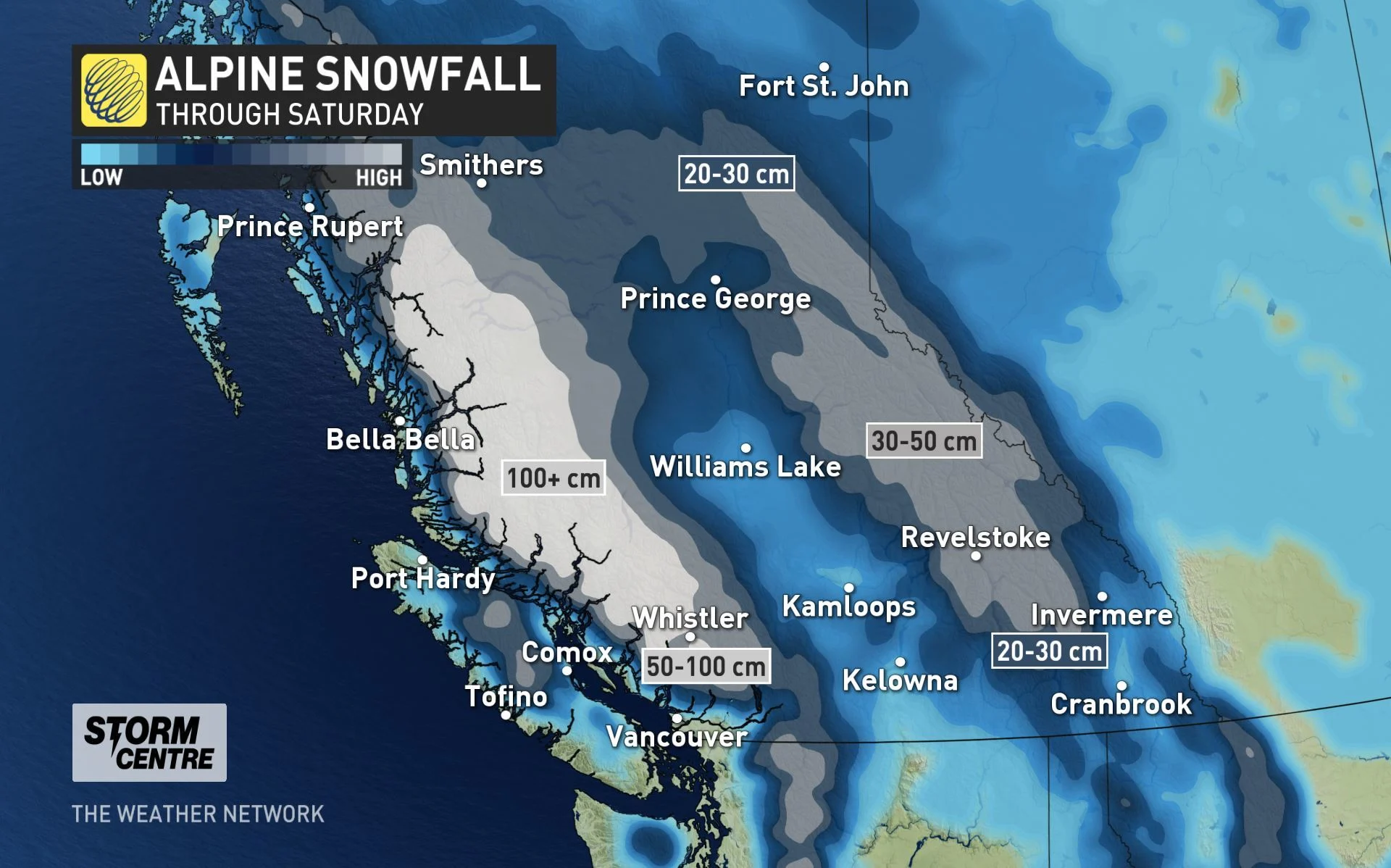
However, things improve drastically as the morning wears on, as freezing levels will soar to heights of approximately 2000 m, generating heavy snow in the alpine regions. There will be many spots that could receive totals exceeding 100 cm, up and down the coastal mountains, through Saturday.
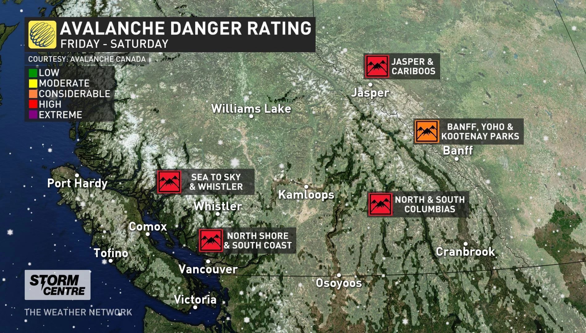
The avalanche threat that has been persistent all week remains at a high level for most areas. This is not expected to change for the next three days. The danger level on the Sea to Sky mountain could be raised to extreme by Friday, as more snow falls on the unstable snowpack.
INTO THE WEEKEND: PULSE AFTER PULSE
There's just not much letup ahead for B.C. into the weekend, with rain at the coasts and snow at the higher elevations into Saturday.
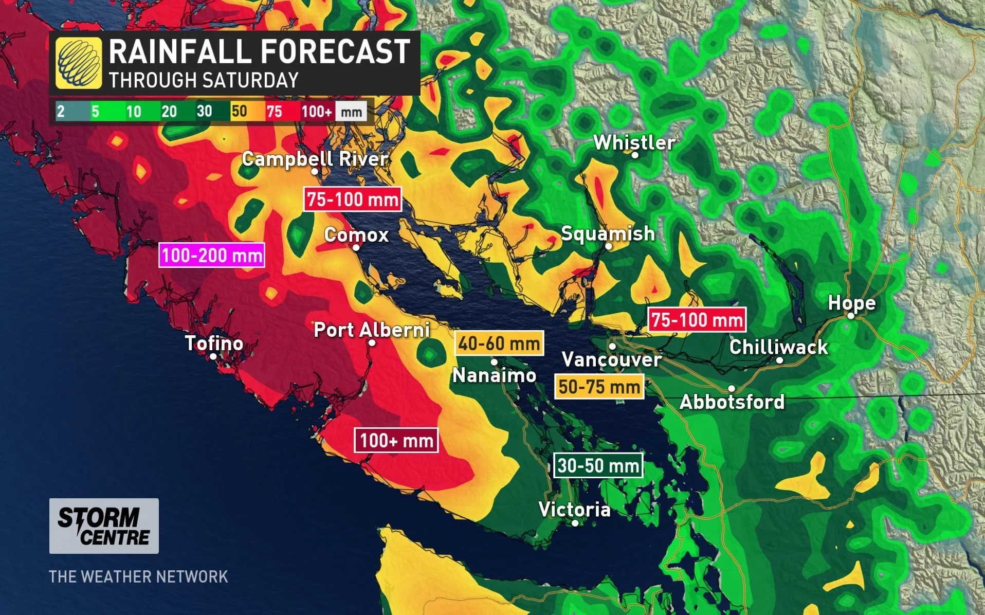
Snow levels above 1500m on Friday will drop well below 1000m for the weekend, while parts of Vancouver Island could blow past the 100 mm mark through Saturday, with even Metro Vancouver possibly reaching the 50-75 mm range.
Behind Saturday's precipitation, the next pulse beckons for Sunday.
ACTIVE WEATHER CONTINUES INTO NEXT WEEK; POSSIBLE SNOW FOR LOWER MAINLAND?
There won't be much of a break in the rain and snow for B.C., as the active weather pattern that has dominated through the week and into this weekend will continue into next week. A parade of systems will bring heavy rainfall to coastal areas and 1-2 metres of snow for the alpine regions.
There will be variable snow levels, but will be low enough most of the time so the north shore ski areas should see it primarily, but we will keep a close eye on whether snow levels will get low enough to bring the white stuff to higher elevations of the Lower Mainland later next week.
Stay tuned to The Weather Network for the latest forecast updates.