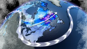
Atlantic: Lingering snow, strong gusts for Newfoundland

Though it's cleared out from the Maritimes, parts of Newfoundland are waking to some very snowy conditions, worsened by strong winds that will make for blowing snow through the morning. Beyond, we're already keeping an eye on the next system's approach. What we know, below.
RELATED: Right on cue, Sheila and her brush take aim on Newfoundland
WEATHER HIGHLIGHTS:
Snow tapers off through the morning in Newfoundland
Strong winds make for blowing snow, poor visibility
Next system looks late Thursday into Friday for the region
Stay up-to-date on the weather ALERTS in your area
WEDNESDAY: SNOW LINGERS, STRONG WINDS RAMP UP
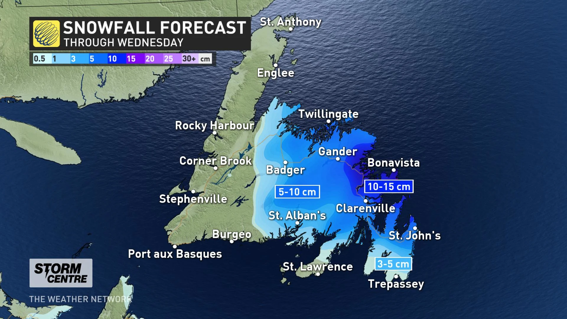
After a strong start overnight, and a brief period of freezing rain in the early morning, parts of the island are set for an additional 5-15 cm through the morning, lasting into the early afternoon before coming to an end.
However, even after the last flakes have fallen, travel will be difficult, due to strong winds, gusting in the 70-90 km/h range.
"Snow and strengthening northerly winds will combine to cause poor visibilities in blowing snow for much of today. Conditions are expected to improve late this afternoon," Environment Canada says.
LATE WEEK AND BEYOND: ANOTHER STORM TO BRING MESSY WEATHER
The active pattern isn't done with Atlantic Canada yet; we are looking at another storm for late Thursday through Friday, tracking north from the Atlantic into the Gulf of St. Lawrence with widespread strong winds and a messy mix of precipitation.
Presently, the heaviest snow looks to be across eastern Nova Scotia and western Newfoundland, with 15-30 cm possible. 5-10 cm is also possible for Halifax and areas east of Charlottetown. In Newfoundland, the precipitation looks to start as snow, changing to rain for central and eastern Newfoundland.
Beyond, another messy system is possible for the Maritimes late Sunday through Monday.
"Models disagree on how quickly system weakens as it tracks into the region, so there is uncertainty in precipitation totals, but much of the region will see a period of snow that could change to rain across southern areas," Weather Network meteorologist Dr. Doug Gillham says.
Check back for more updates and details as we continue to monitor the forecast.