
Atlantic: Unsettled pattern lingers before weekend warmth

Well below seasonal temperatures are acting as the perfect primer for more spring snow in Newfoundland this week
A range of precipitation will fall across Atlantic Canada on Friday - Nova Scotia and New Brunswick are set to see rain while light snow will fall in Newfoundland. The cold, windy, and unsettled conditions are finally set for a pattern change as clear, sunny weather with many seeing temperatures warm up into double digits. More on the rainfall timing and how warm it will get this weekend, below.
Fire up the barbecue - the countdown to our official 2019 #SummerForecast is on! See our full report on TV and online June 27
WEATHER HIGHLIGHTS:
Light snow across Newfoundland Friday morning
Rebound to more seasonal, pleasant spring conditions by Saturday
Stay up-to-date on the latest ALERTS in your area
LIGHT DUSTING OF SNOW ON FRIDAY MORNING
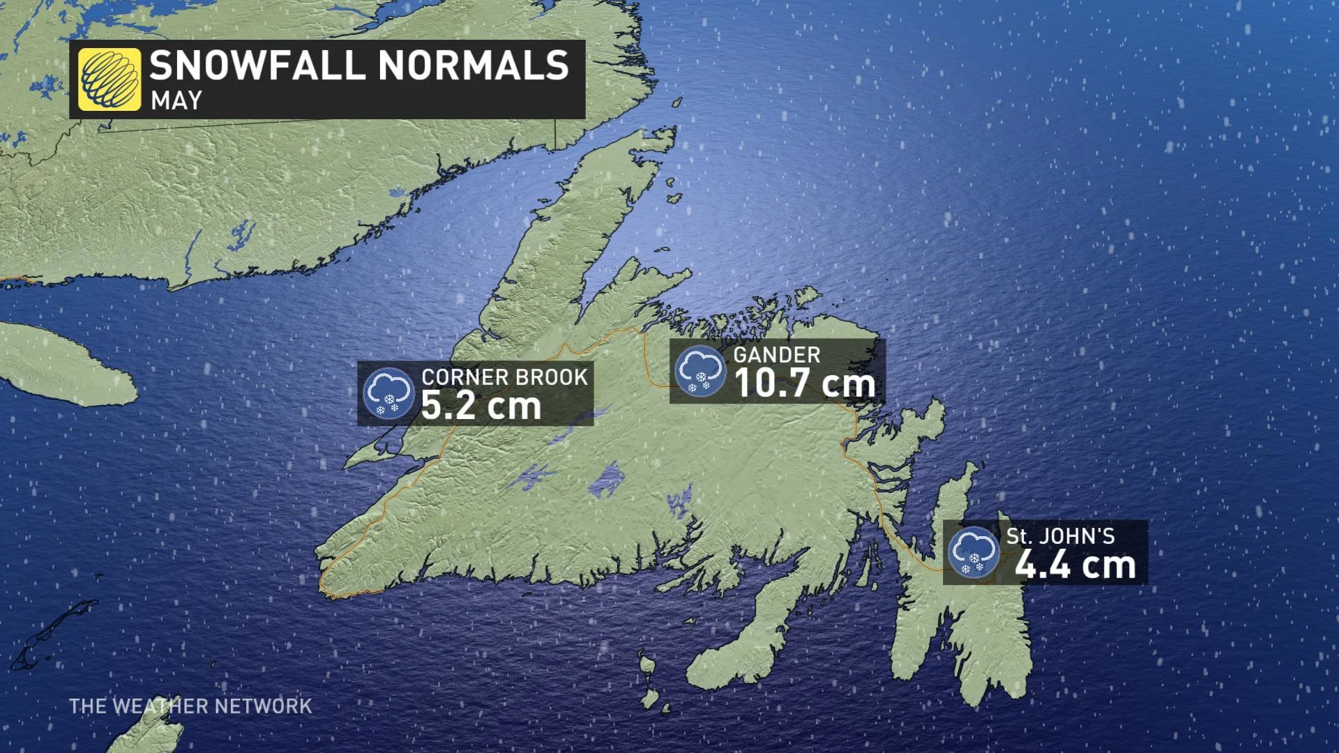
It's not out of the question for Newfoundland to get snow this late in May, but even by the East Coast standard, Wednesday's snowfall seemed a bit inappropriate.
In the city of St. John's, 6 cm of snow was reported at the airport, with the monthly average for May snow typically sitting closer to 4 cm. So far this month, about 8 cm has already fallen in the city.
Some regions of Newfoundland will wake up to a light dusting of snow due to a wintry mix that tracked over the region.
"A northwesterly flow will be bringing in some scattered flurries to the western portions of the island and along the Trans Canada Highway," says Weather Network meteorologist Kelly Sonnenburg. "Parts of the Avalon could also be waking up to some wet snow Friday morning."
For parts of the western Maritimes the precipitation will fall as mostly rain with at times heavy downpours through Friday and showers largely clearing out by the evening.
WATCH BELOW: RAINFALL TIMING
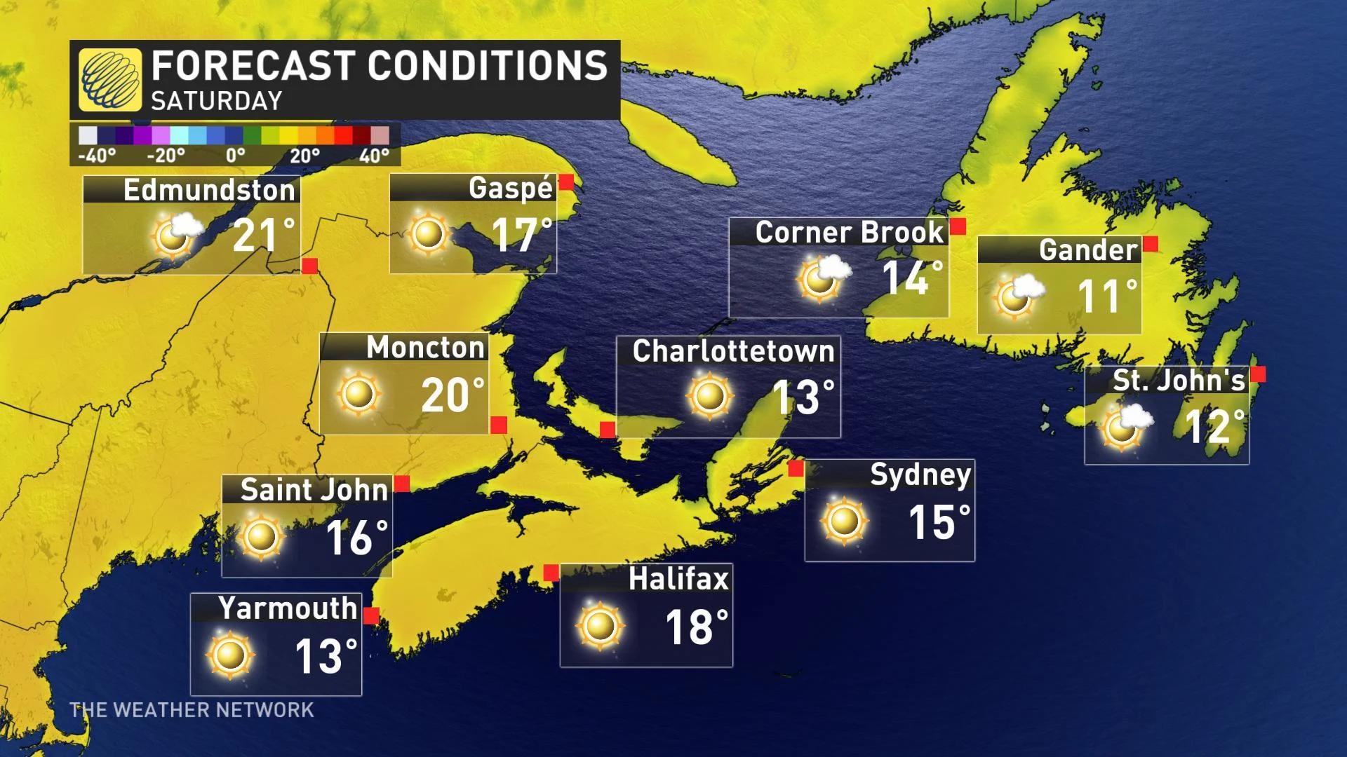
Temperature-wise, the chilly trend throughout the week will linger into Friday, but a pleasant warm up is set to move in for the weekend. Much warmer temperatures, as well as sunshine bursting through clearing skies will welcome everyone outdoors to enjoy the spring weather.
"This will be a nice recovery for the Avalon in particular, going from wet snow on Wednesday to the mid to upper teens for Saturday," says Weather Network meteorologist Dr. Doug Gillham.
The threat for rain showers and thunderstorms returns to the Maritimes through Saturday night and into Sunday, although staying mostly dry for Newfoundland.
Be sure to check back as we continue to track this unsettled spring pattern.