
Scattered storms across Atlantic Canada, changeable pattern continues

A cold front pushing through the region will bring the potential for isolated thunderstorms across Atlantic Canada on Thursday, but many will see dry conditions. The heat will ease as the weekend approaches, but meteorologists warn that the unsettled trend will continue. Scattered showers are expected on Friday and will continue into the weekend, but could miss regions that are in need of a heavy rain. Details and timing, below.
WEATHER HIGHLIGHTS
Lingering non-severe thunderstorm potential on Thursday
Relief from heat Friday, remaining unsettled on the weekend
Keep on top of active weather ALERTS in your area.
THURSDAY: SLIGHT STORM RISK, LAST DAY OF HEAT
A cold front will track eastward across Atlantic Canada on Thursday, bringing the risk for thunderstorms to parts of Nova Scotia and Newfoundland and Labrador. They could fire up in the afternoon and while heavy rainfall is possible, the storms are expected to remain non-severe in nature.
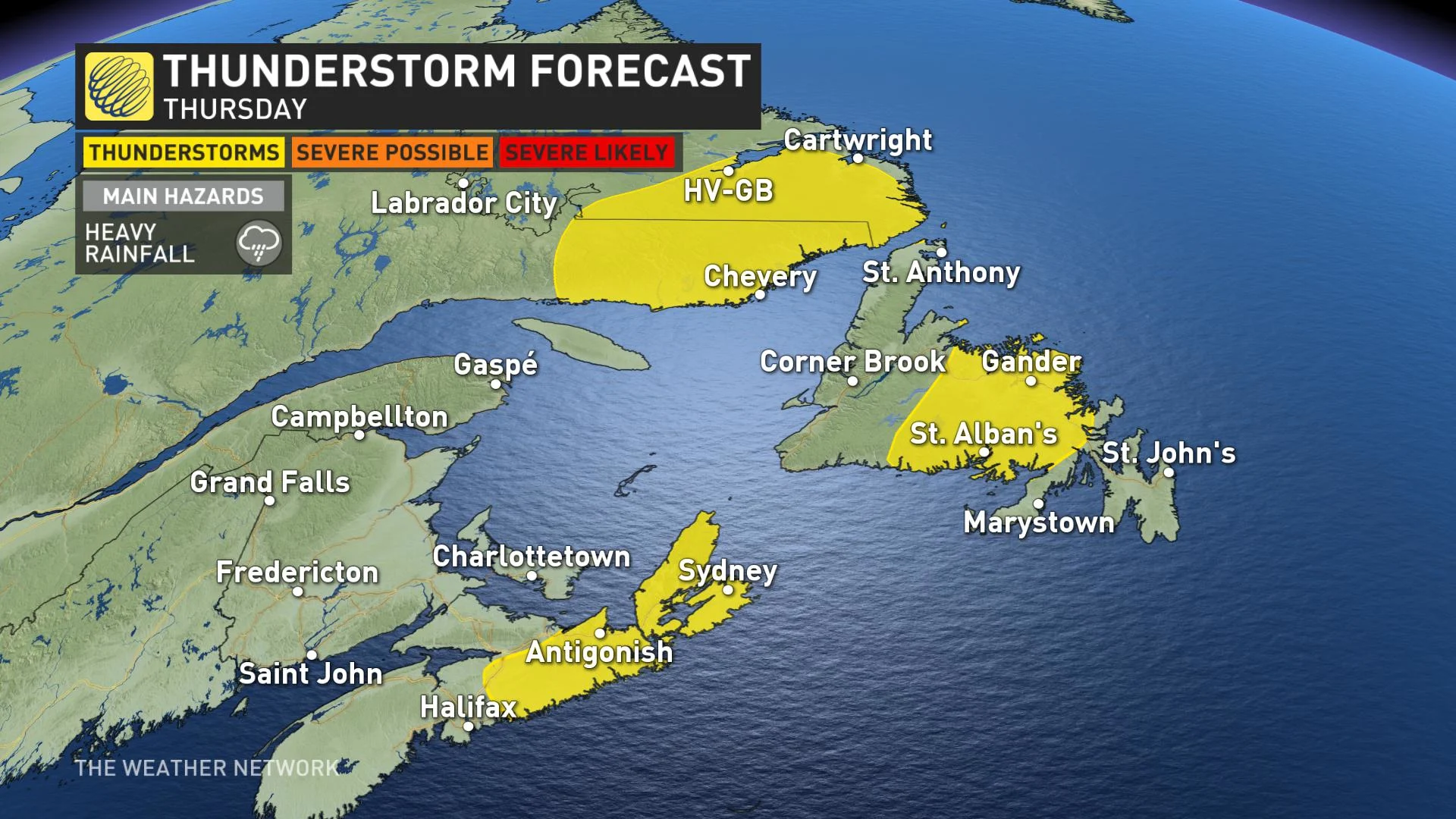
Meanwhile, the intense heat and humidity will continue in the Maritimes, with daytime highs again approaching or reaching the 30-degree mark across the region, as well as parts of Newfoundland. Humidex values will be into the 30s and may reach the upper end of the digits in parts of Nova Scotia.
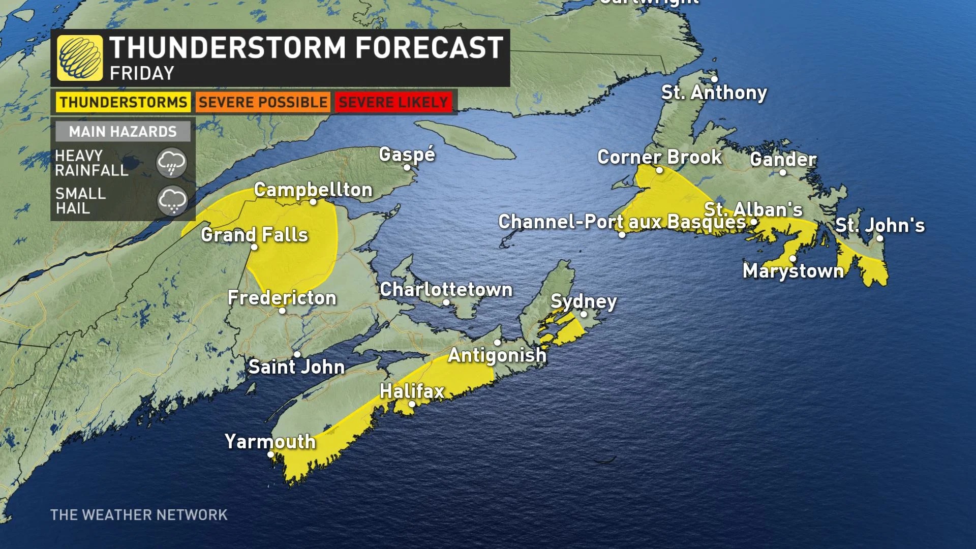
FRIDAY: HEAT RELAXES, LINGERING STORM RISK IN NOVA SCOTIA
On Friday, the heat will subside in New Brunswick and temperatures across the Atlantic will be seasonal. Another system moving in could spark non-severe thunderstorms in Newfoundland.
LOOK AHEAD: COOLING DOWN ACROSS THE REGION, POSSIBLE SYSTEM
Meanwhile, cooler weather is expected to continue on the weekend, as well as the possibility of more unsettled weather.
WATCH BELOW: NOTABLE PATTERN CHANGE AHEAD
Latest models indicate a system will just stay offshore of Nova Scotia. It may shift toward the province, with moderate rainfall, but the rest of Atlantic will be dry on the weekend.


