Atlantic: Heavy, blowing snow threatens treacherous travel into Thursday

Snowfall warnings span New Brunswick as the province looks to bear the brunt of the next major storm.
A strong low-pressure system will be lashing the Maritimes by Thursday morning, reaching Newfoundland by the evening. A wintry mix of rain, freezing rain and heavy snow, as well as strong winds, are all on the table for the region, depending on location. The latest on timing and impact, below.
Visit our Complete Guide to Spring 2020 for an in-depth look at the Spring Forecast, tips to plan for it and much more
WEATHER HIGHLIGHTS:
Texas low pushes into the Maritimes Thursday morning, spreading rain, possible freezing rain and snow as day progresses
Heaviest snow expected over Cape Breton, northeastern New Brunswick and northwestern Newfoundland
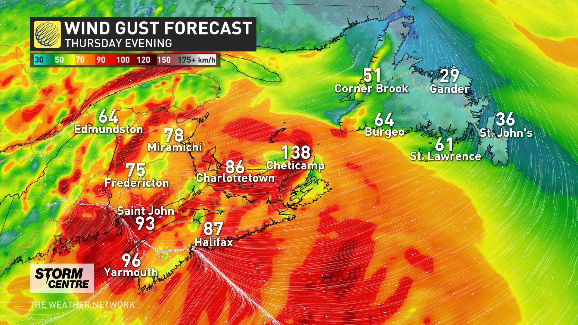
Strong winds will accompany this system, in the 70-80 km/h range for most of the Maritimes and as high as 140 km/h in Cape Breton
Stay up-to-date on the ALERTS in your area
THURSDAY: FULL STRENGTH IN THE MARITIMES
The system will be ramping up its effects in the Maritimes by the early part of the morning, going through most of the day before exiting Thursday night.
Though its effects won't be uniform across the region, this will be a very potent system for the Maritimes, particularly in New Brunswick, where parts of the north are in line for 30-40 cm, with lesser but still significant amounts over much of the rest of the province. In Nova Scotia, the heaviest will be in the Cape Breton area, but the rest of the province will largely escape significant amounts.
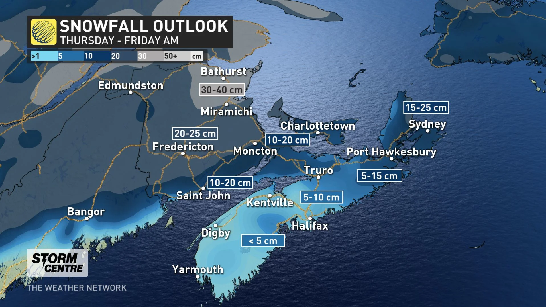
NEW BRUNSWICK TO BEAR THE BRUNT OF THE SNOW WITH THIS NEXT STORM
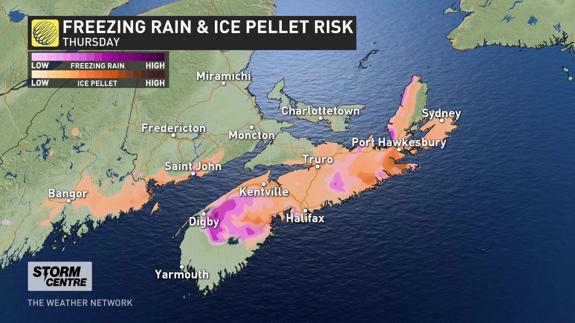
That will in large part be because the temperature differential will trigger a switchover first to ice pellets and freezing rain, then to rain for most of the province, limiting snowfall totals outside of Cape Breton.
The forecast is still being finalized, but New Brunswick's Fundy Shore is also in line for some ice pellets, as well as a few drops of rain in the province's extreme southeast.
Making things worse for travellers will be the winds, which will be peaking by the afternoon in the Maritimes and still be strong into the overnight.
Gusts across much of the region will be in the 70-80 km/h range, except Cape Breton, where those Les Suetes winds will be near 140 km/h.
FRIDAY AND THE WEEKEND: TURNING MUCH COLDER, EYES ON NEXT SNOW MAKER
In Newfoundland, the snow will have begun Thursday night, and will make the Friday morning drive a difficult one for people across the province.
Unlike Nova Scotia, in Newfoundland this system will be an all-snow event, with moderately heavy amounts across the province, except the northwest, where as much as 30 cm is possible.
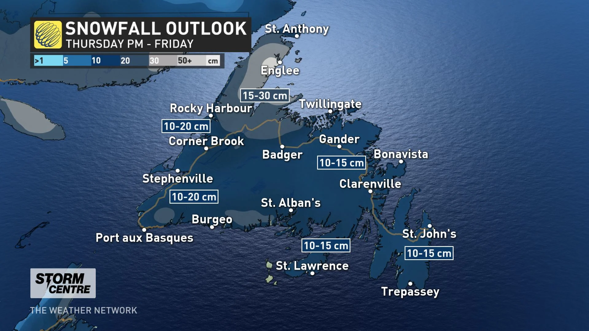
As for the winds, they'll have peaked overnight, but will still be somewhat stiff in the morning, making for blowing snow for several hours.
Conditions will turn much colder behind the system for the weekend, and eyes are already on the next looming storm that could bring significant snow to southeastern Newfoundland Sunday night and into Monday.
Check back for updates as we continue to monitor these next round of storms.