
Atlantic: Early winter storm spreads heavy rain, wind and snow

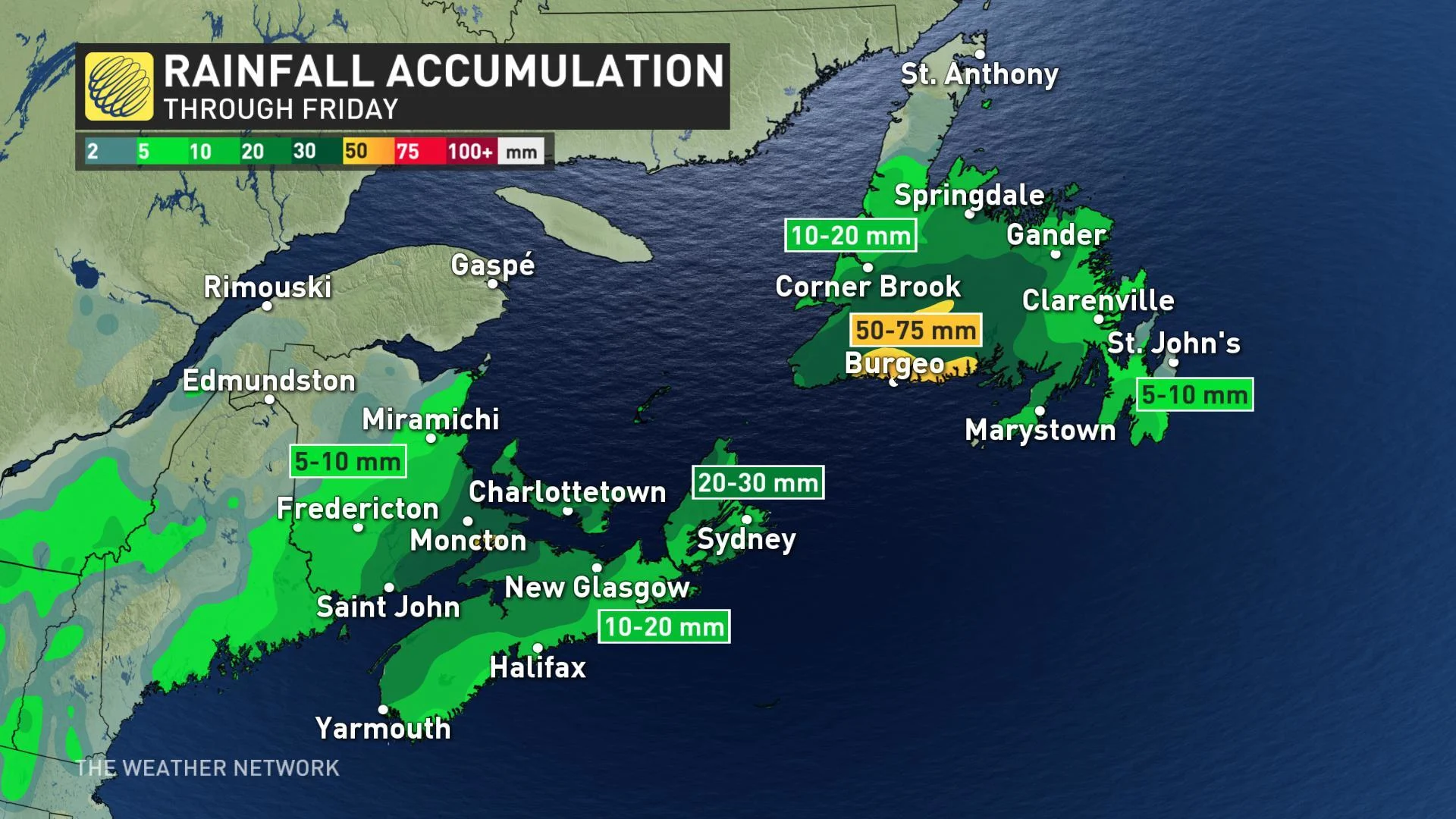
The latest system in Atlantic Canada will bring lots of rain and the first taste of snow for some over the next few days. Behind this system the cooler air will drop temperatures and will be responsible for the transition from rain to snow, and could bring accumulations between 10 to 20 cm by Friday evening. Details and timing, below.
WEATHER HIGHLIGHTS:
Transition from rain to snow across the region on Friday as temperatures drop
Special weather statements warn of wintry weather, snowfall
Stay on top of ALERTS in your area
WATCH BELOW: TIMING THE SNOW AND RAIN THROUGH SATURDAY
As the nasty November cold pattern begins to make its mark on much of the country, an active storm track takes aim at eastern Canada with falling temperatures and a wintry mix of snow and rain.
Though initial computer models that suggested a heavy shot of snow have backed off a bit, this will still be the most significant snow of the season so far, especially over central and northern sections of New Brunswick.
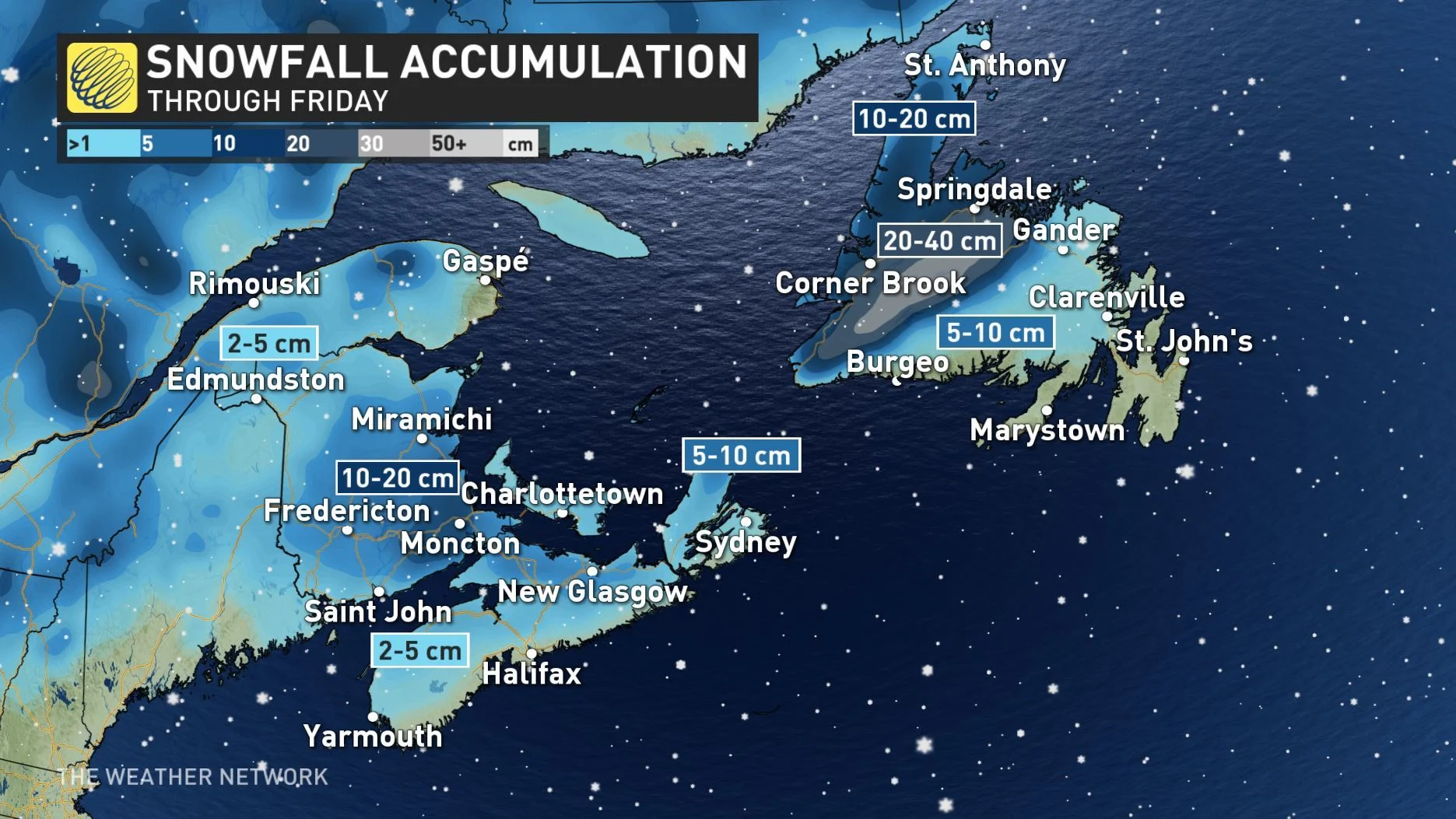
Between 5-10 cm of snow is possible by Friday morning, with some additional snow flurries expected as colder air moves in from the north.
"Reduction to visibility could create potentially hazardous driving conditions Friday afternoon and evening," Environment Canada warns.
For Nova Scotia, this will largely remain a rain event, except for when the system exits the Maritimes Friday evening, when the province will transition from rain to snow, with a period of mixing in between. Some local snowfall accumulations are expected, especially for the Annapolis Valley, northern Nova Scotia and parts of Cape Breton Island.
HEAVY RAIN, WIND SPREADS ACROSS NEWFOUNDLAND
Across the Gulf, Newfoundland will see mostly rain, except the higher elevations near the western shores, where some communities could see as much as 20-30 cm for the system, and then on-and-off sea-effect snow through Saturday.
The heaviest rain, meanwhile, will be for the province's southwestern shore, with the Avalon presently on track for less than 10 mm.
Strong winds will also accompany the storm Friday and into Saturday with widespread coastal gusts of 70-100 km/h expected. Sea-effect snow will pick up on Saturday for western Newfoundland thanks to these gusty winds.
Be sure to check back as we continue to monitor this storm closely.


