
Atlantic: Up to 12 hours of ice, snow on Sunday with winter storm

The Maritimes remains blanketed in winter weather warnings on Sunday, thanks to a potent storm moving into the area. Up to 40 cm of snow is on the way for parts of the region, but the main impact may well be from the ice -- as much as 12 hours of freezing rain and ice pellets are ahead for some. We break down what you need to know below.
WEATHER HIGHLIGHTS
Heavy ice pellet accumulation expected central New Brunswick, P.E.I.
Heavy snow in northern New Brunswick, southwestern Newfoundland
Stay up-to-date on the ALERTS in your area
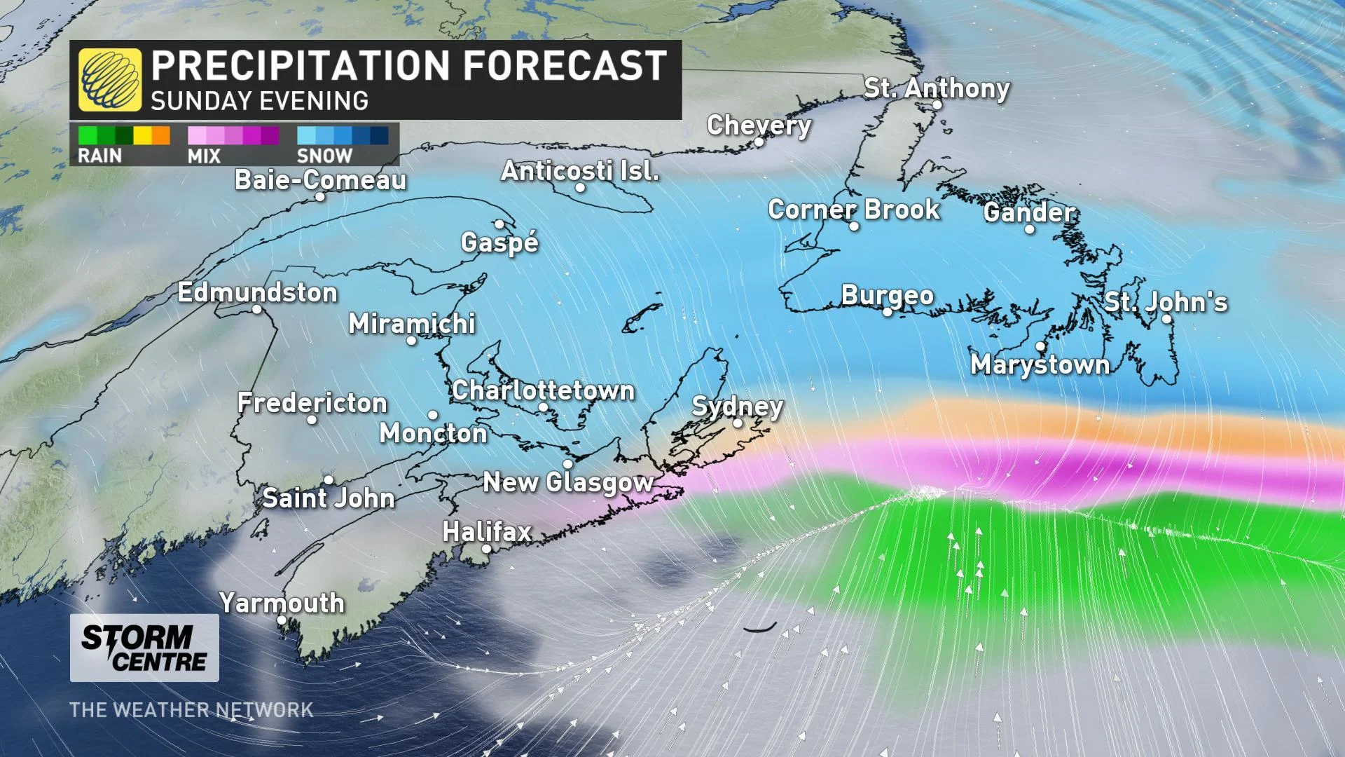
SUNDAY EVENING/NIGHT: LINGERING SNOW, ICE PELLETS
The active weather will be winding down for most of the Maritimes by Sunday evening, with ice pellets and snow lingering the longest over P.E.I. and Cape Breton.
Snowfall will continue longest across southern Newfoundland, with the highest accumulations expected in the southwest. Between 15 to 25 cm is possible there by early Monday.
Fortunately for those regions that do see prolonged freezing rain, strong wind gusts are not expected in the wake of the low, though ice-laden branches and power lines may still lead to power outages across the region.
LOOK AHEAD: RAIN, SNOW WITH MIDWEEK SYSTEM
The active storm track over eastern Canada continues this week, with the next system on the horizon for midweek. Unlike the weekend storm, this system looks to take a more northerly track, and that should help usher milder air back into the southern Maritimes.
BELOW: TRACKING THE NEXT ROUND OF WINTRY WEATHER
Since this next storm will have less moisture to work with than the previous system, this storm is unlikely to produce significant rain or snowfall totals as it sweeps through late Tuesday and Wednesday. However, gusty onshore winds should help boost accumulations for exposed coastal areas.
Stay tuned to The Weather Network for your latest forecast updates.


