Atlantic: Temperatures to rebound Sunday following record cold

After bitter, record-breaking cold Saturday, temperatures will begin their rebound on Sunday, even creeping above zero for some people, but accompanied by another shot of light snow. We have more details on that warmup, along with a look at the next system moving in, below.
WEATHER HIGHLIGHTS:
Temperatures warm up to more seasonal temperatures Sunday
Next system moves in Sunday morning, with light snow in New Brunswick and possible rain/snow mix in southwestern Nova Scotia
Another messy mid-week system threatens heavy snow, freezing rain before weekend warmup
Stay up-to-date on the ALERTS in your area
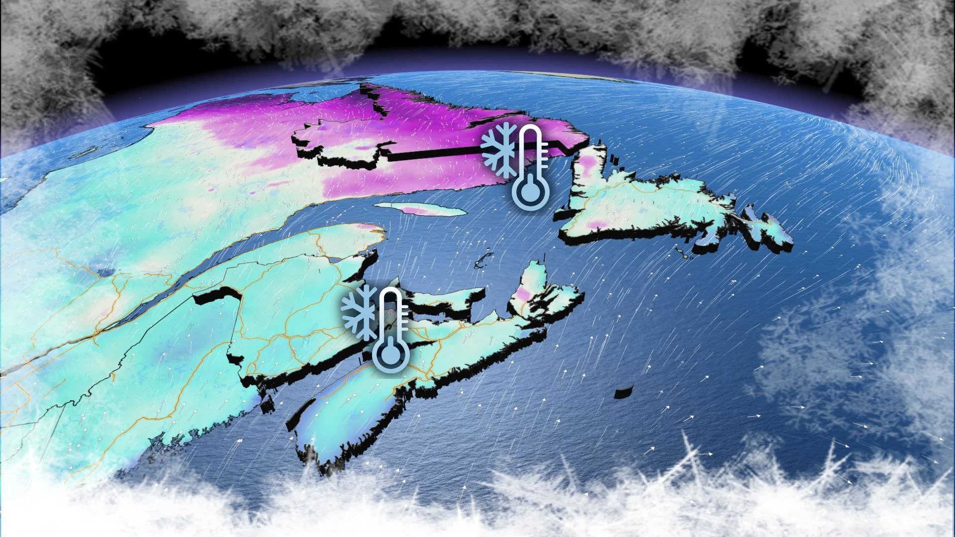
SATURDAY: FAIR SKIES, BUT TEMPERATURES REMAIN CHILLY
The cold will finally ease off Sunday with milder air ushering into the region, bringing daytime highs above zero in southern areas of Nova Scotia and New Brunswick and near or slightly below the freezing mark elsewhere.
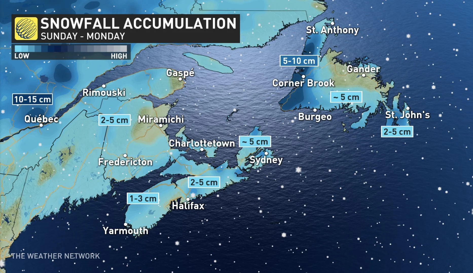
However, messier weather returns, courtesy of a weak frontal boundary that will move into the Atlantic Sunday morning, bringing light snow to New Brunswick and Nova Scotia, with possible mixing in southwestern areas of the latter province. Snow will move into Newfoundland's Avalon Peninsula through the evening hours.
Accumulations will remain light across the region, with totals staying below 5 cm, through Monday morning. The likeliest exception will be the western shores of Newfoundland, where totals will be enhanced by sea-effect snow.
BEEN THERE? THE CLASSIC DRIVE-THRU WINDOW FREEZE
LOOK AHEAD: NEXT SIGNIFICANT SYSTEM
Beyond Sunday's light dusting of snow, forecasters are keeping an eye on the potential for more messy weather during the mid-week mark.
"At this point it looks like most of the region will start off with snow with some significant totals possible, followed by a changeover to rain across southern and central areas and a risk for freezing rain," says Weather Network meteorologist Dr. Doug Gillham, adding a brief shot of Arctic air will return for the end of next week, but temperatures will trend milder by the weekend.
Check back in the coming days as we continue to monitor the forecast.