
Ontario: Some storm impacts linger into Sunday

Lingering messy weather in southern Ontario will make for tricky travelling conditions through Sunday
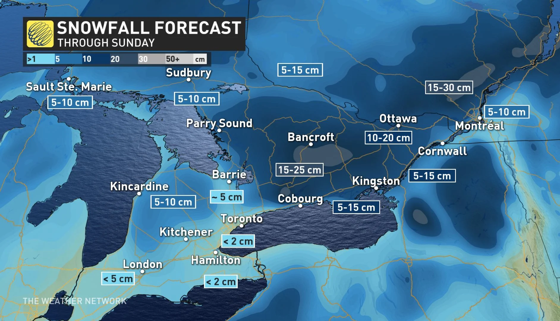
Saturday's storm saw at-times heavy snow for parts of eastern Ontario and the Dundalk Highlands, some travel impacts expected to linger through Sunday. Winds could also be gusty in areas along Lake Ontario. More on the impacts of this weekend storm and amounts expected, below.
WEATHER HIGHLIGHTS:
Up to 25 cm of snow for parts of central areas, 10-20 cm for eastern portions through Sunday
Fair conditions, milder pattern for early next week
Stay up-to-date on the ALERTS in your area
WRAPAROUND SNOW INTO SUNDAY
Though the system will have largely departed the province overnight, some wraparound snow will be possible for much of the south, particularly the southwest, though there will be little in the way of accumulations.
By Sunday morning, eastern parts of the province are expected to have picked up an additional 5 cm, with the GTA in the trace to 5 cm range.
At this time, the possibility of tree damage and power outages is less likely than previously thought.
FAIR WEATHER RETURNS NEXT WEEK; MILDER AIR TO START
Dry conditions are expected to return for early and the middle of next week. Overall, there will be a mild pattern, but temperatures will trend closer to seasonal for Tuesday through Thursday, with daytime highs near or just above the freezing mark.
"We are keeping our eye on a couple of systems that could impact our region late next week and weekend, but it is too early to have confidence in the tracks of these systems and how they will impact the Golden Horseshoe," says Weather Network meteorologist Dr. Doug Gillham, adding there are indications of a return to more typical winter temperatures beyond Feb. 5, but confidence is low as to whether there will be an extended period of cold weather.
Stay tuned to The Weather Network for the latest forecast updates.