Multiple shots of snow to blanket the Prairies this week amid October chill

Temperatures continue to be quite cold across the Prairies this week, with an Arctic chill keeping temperatures winter-like for the rest of the week. Accompanying the cold will be the snow, with multiple shots expected, with the latest round occurring Tuesday as a result of a trough pushing through. Wednesday will see a more potent system track in, with the potential for isolated snowfall amounts up to 15 cm by Thursday. By late week, southern Manitoba could be in the crosshairs of a stateside snowy system. Details and timing, below.
WEATHER HIGHLIGHTS:
Temperatures stay close to freezing throughout the week
Scattered rounds of snow in Alberta, southern Saskatchewan, Manitoba
Potential for stateside system to impact the eastern Prairies late-week
TUESDAY: LIGHT SNOW BECOMES MORE WIDESPREAD, OCTOBER CHILL CONTINUES
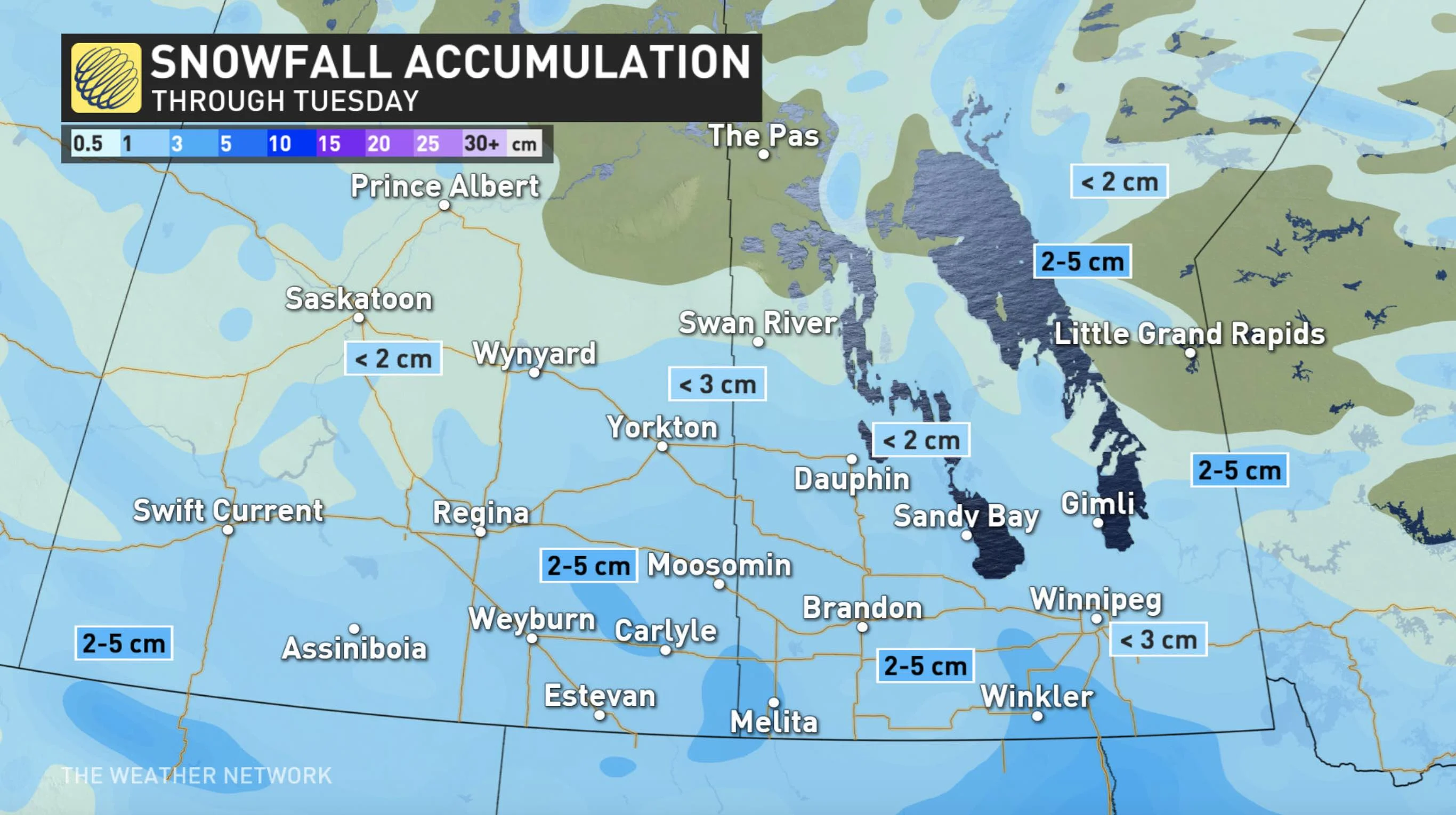
The trough will continue to spread snow in Alberta in the pre-dawn hours Tuesday, lingering until the afternoon. As the morning wears on, the snow becomes more organized in southern Saskatchewan and Manitoba.
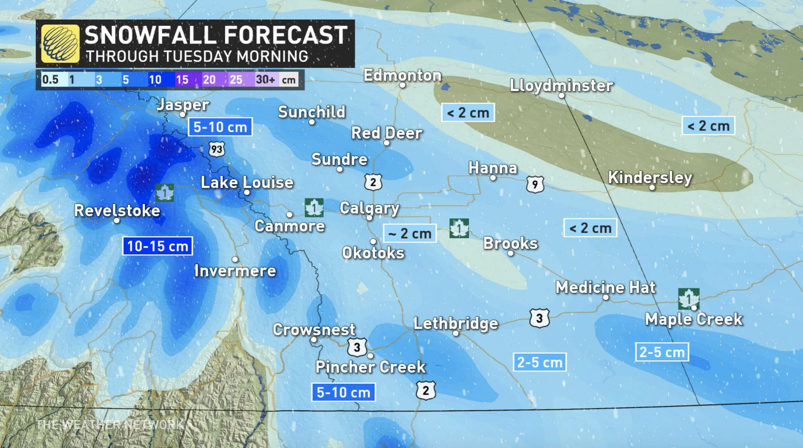
Amounts will be limited, with less than 5 cm expected during the day for most of the southern Prairies, with 5-10 cm for areas near Pincher Creek, Alberta. The heaviest totals will remain in higher elevations of the northern foothills.
Snow will also taper off across the rest of the Prairies in the afternoon, but the break will be short-lived, as yet another round is set to push in Wednesday morning.
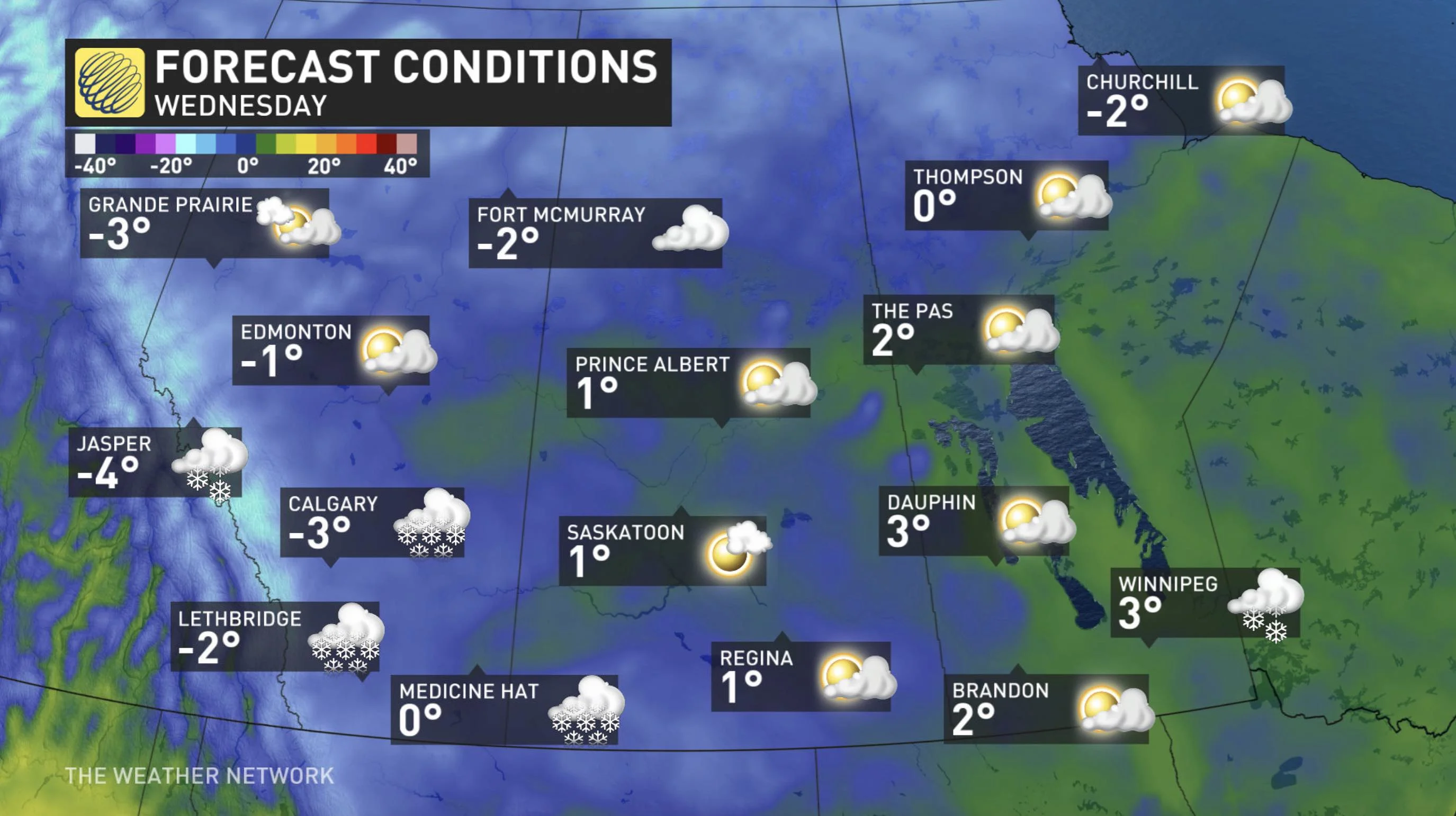
Alberta will see a very slight temperature bump to just above the freezing mark Tuesday, expected to be the warmest day of the week. Daytime highs Prairies-wide will still be well below seasonal for this time of the year, thanks to Arctic air situated over the region.
WEDNESDAY: HEAVIER SNOWFALL AMOUNTS WITH UPSLOPE FLOW
Forecasters are keeping a close eye on a more significant low-pressure system that could impact southern Alberta Wednesday with locally heavy snowfall amounts.
A cold front is expected to sweep south with accumulating snow, beginning in the morning and continuing through the day.
"An upslope flow in southwestern Alberta will likely enhance some snowfall totals to locally 15 cm by Thursday morning," says Weather Network meteorologist Tyler Hamilton. "Gusty northeast winds will create some locally reduced visibility in the region as well."
Hamilton notes that there is also the potential for a stateside system to track into southern Manitoba Thursday morning. However, there is considerable uncertainty with the system’s track and whether it trends far enough north.
REINFORCING SHOT OF COOLER AIR
One thing is for certain to close out the week, and that's another reinforcing shot of cooler air.
By Friday, the widespread cold conditions return as the cold air pivots in from northern British Columbia and sends temperatures tumbling into the weekend.
Just this past weekend, several areas in Alberta wrote a new page in the record book as temperatures dropped about 15 degrees below normal.
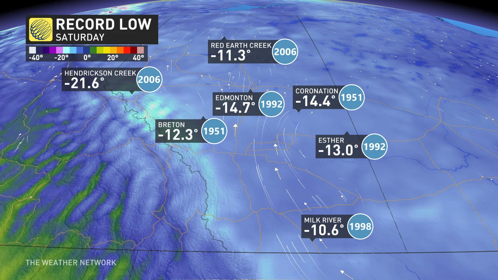
According to Weather Network meteorologist Dr. Doug Gillham, this is unusually early in the season to have such an extended stretch of sub-freezing temperatures. It's all part of a strong blocking pattern that is much more characteristic of winter.
"Blocking patterns in the Arctic are the key to dislodging Arctic air and sending frigid temperatures plunging south, and that is what we will see during the next two weeks," Gillham says, adding that several rounds of Arctic air will descend upon western and central Canada during the next 10 to 14 days.
The city of Calgary especially stands out again later this week with more below seasonal temperatures, even by January standards.
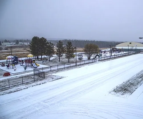
Thumbnail credit: David Fitzpatrick/Swan Hills, Alta.
Be sure to check back as we provide updates on this extended period of winter-like weather.


