Another round of snow threatens southern B.C. to end the week

A new system scooting down the B.C. coast will bring more wintry precipitation on Friday to areas that saw plenty of it earlier this week.
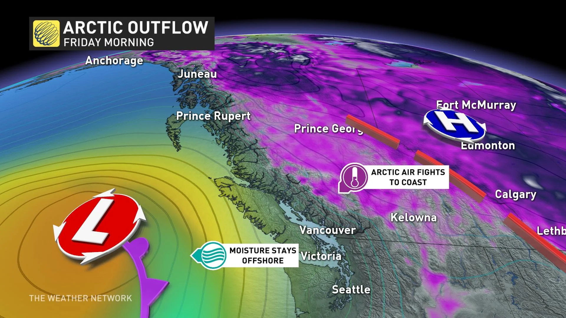
History doesn’t repeat, but it sure does rhyme from time to time. Just a few days after the region got walloped by a significant early-season storm, a new low-pressure system scooting down the West Coast will bring another round of wintry weather to portions of British Columbia to end the week.
Visit our Complete Guide to Winter 2022/23 for an in-depth look at the Winter Forecast, tips to plan for it, and much more!
Our upcoming storm won’t produce nearly as much snow as the early-season system that blanketed southern B.C. earlier this week, but it could be enough to hamper travel in some areas.
The erstwhile snowfall brought 10 cm of powder to Vancouver International Airport, 25 cm in North Courtenay, and 15 cm up in Pitt Meadows. That midweek storm left nearly one hundred thousand customers without electricity and snarled traffic throughout the region.
Thankfully for the winter-averse among us, this upcoming system won’t be nearly as productive as the storm before it. Although we won’t see similar snowfall totals, even a tiny amount of wintry precipitation on the roads can cause major safety issues for commuters and travelers.
PHOTOS: Hefty snow unleashed on B.C. South Coast, travel hindered
A broad low swirling off the B.C. coast will slide south into the day on Friday, sparking some precipitation across Vancouver Island and Lower Mainland overnight Friday and into Saturday morning.
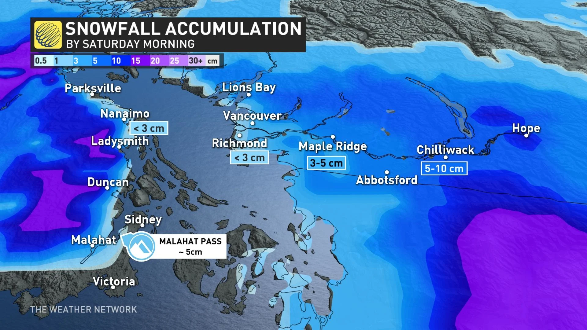
The greatest totals will fall across eastern Vancouver Island, where some areas could see 10+ cm of snow by Saturday morning. A light dusting is possible in and around Vancouver, with the best chance for accumulation falling north and east of the metro area.
Environment and Climate Change Canada (ECCC) issued snowfall warnings for eastern Vancouver Island, as well as special weather statements for the Lower Mainland, ahead of this end-of-the-week encore presentation.
DON’T MISS: Why road salt isn't the best solution for removing snow and ice
Slick roadways due to wintry precipitation may affect the evening commute, ECCC said in its special weather statement for the Fraser Valley.
WATCH: Timing out B.C.’s next bout of wintry weather
Conditions—both in the sky and on the roads—will improve as the system moves on its merry way and sunny skies prevail.
Temperatures will remain on the brisk side of seasonal heading into the first full week of December, with daytime highs in the lower single digits likely for much of southern B.C. through the foreseeable future.
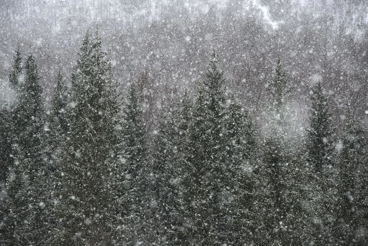
Thumbnail image courtesy of Unsplash.
Stay tuned for the latest information on this renewed snow threat in B.C.