No end in sight for rain in B.C. this week as Pacific systems move through

Some areas in B.C. could see more than 100 mm of rain by the end of the work week
It's the same story this week in British Columbia -- rain, rain and more rain -- thanks to a series of low-pressure systems moving in from the Gulf of Alaska. This will lead to multiple days of heavy rain for coastal British Columbia, while snow will fall in the highest elevations through the week. We have more details of the weather-makers for the week, below.
Visit our Complete Guide to Fall 2019 for an in-depth look at the Fall Forecast, tips to plan for it and a sneak peek at the winter ahead
WEATHER HIGHLIGHTS:
Soggy expected along B.C. coast
Snow for the highest elevations this week
Significant rain accumulation expected along coast; rainfall warnings in effect for North Coast
Stay aware of weather ALERTS in your area
WATCH BELOW: WAVE AFTER WAVE OF MOISTURE HITS B.C.
A winter-like Aleutian low -- so named for its origins off the Alaska coast -- is behind this parade of systems, and though it is
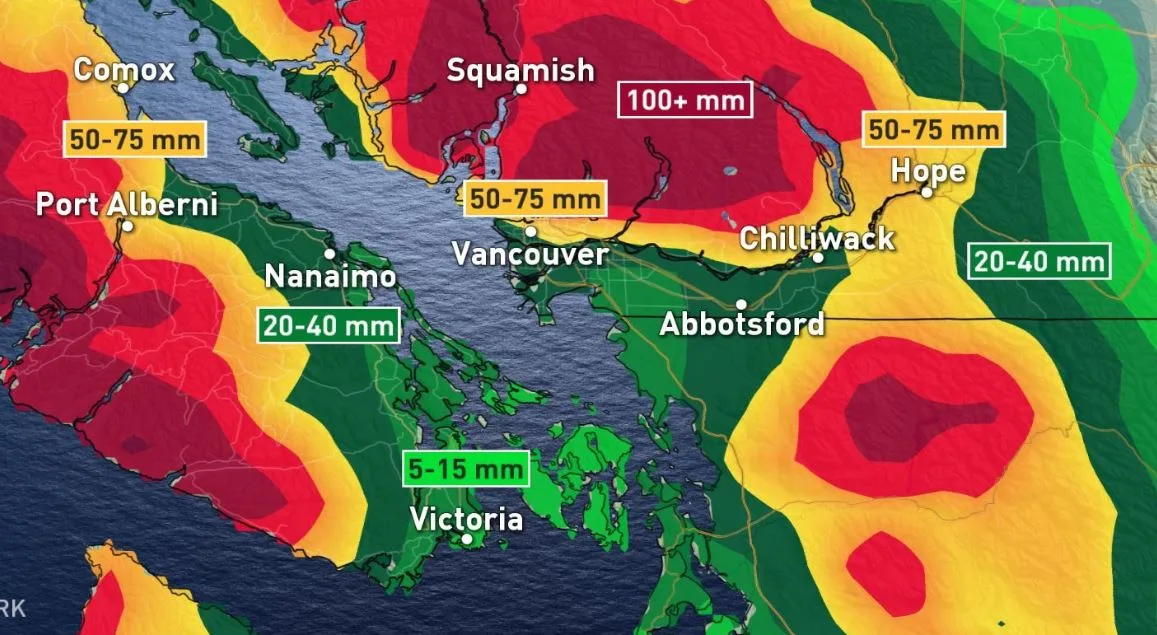
Gusty winds tapering off later this afternoon for coastal BC however, heavy rain continues throughout the evening and sweeps across the lower mainland. Unsettled conditions persist right through the end of the week with coastal sections receiving over 100 mm by Friday.
An active/unsettled fall pattern for the south coast of B.C. continues through the weekend and early next week. Substantial rainfall totals likely across the region. Snow levels dip to 1100-1500 metres, impacting travel through mountain passes. Milder & drier pattern for the final week of October and early November.
A winter-like Aleutian low is responsible for this parade of systems, though it's stationed farther north than you'd typically expect to see in December and January. That should direct the bulk of the moisture into the central and north coasts, rather than Vancouver Island and the Lower Mainland.
Heaviest rain is expected for central coastal sections of B.C. Even so, western Vancouver Island can expect 50 to 75 mm of rain through mid-week, with as much as 100 mm or more in store for some. Wednesday will feature gusty winds as the strongest of the lows push southward. At this point, however, these seem unlikely to be strong enough to cause widespread damage.
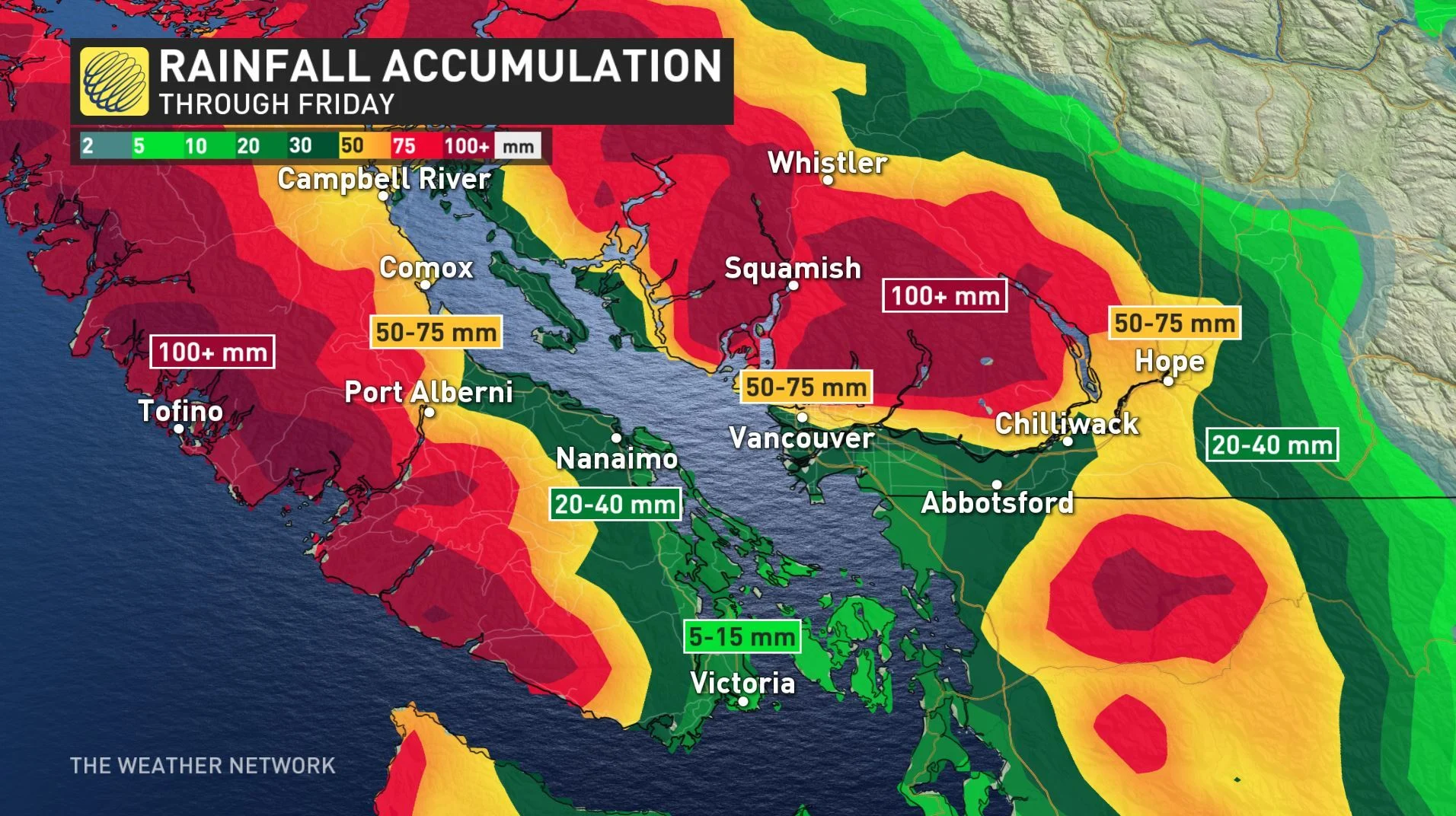
An upper trough will remain locked in place over the Gulf of Alaska for Thursday and Friday, bringing persistent showers along the B.C. coast to end the work week. The Lower Mainland will receive 20 to 40 mm of rain by Friday evening.
Snow will be restricted to the highest elevations this week.
At this point in time, there won't be a break from the rain until Saturday for coastal areas, but the reprieve will be brief -- rain will return to the region Sunday.